
I am going to save a little bit of time on web site work this year, and lump the chase season entries into a tour-by-tour basis for the most part. The high-end days will receive preferential treatment. Maybe.
So let’s get to Tempest Tours Tour One of 2024 out of Oklahoma City, the 8 days from April 18 to 25.
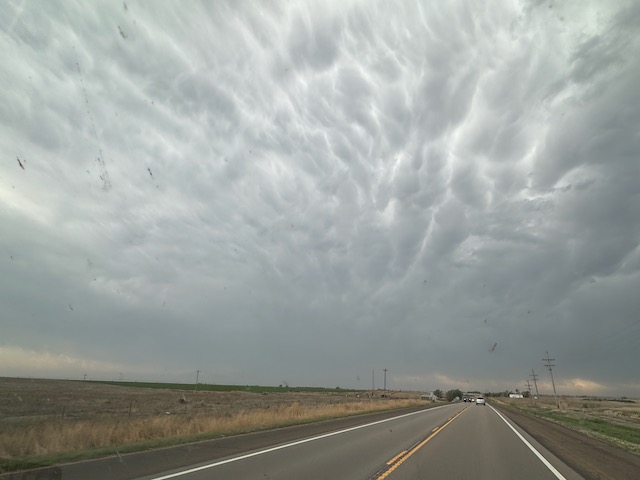
April 18/Antlers Supercell
Start OKC/lunch Braums in Antlers, OK/End Commerce, TX/399 miles
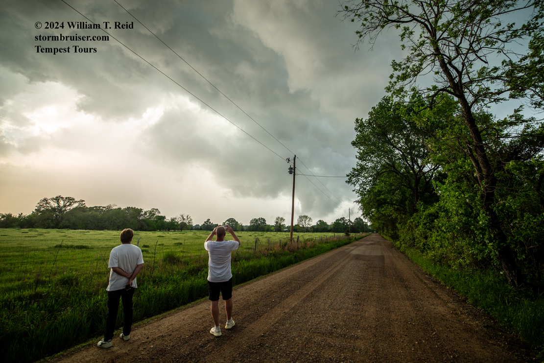
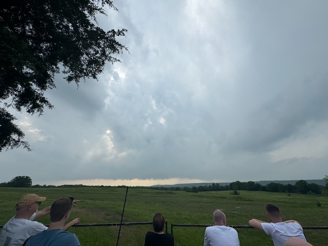
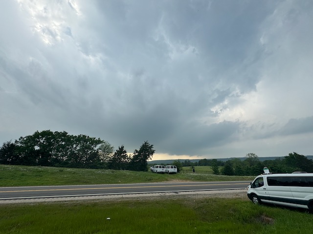
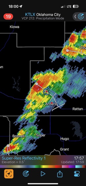
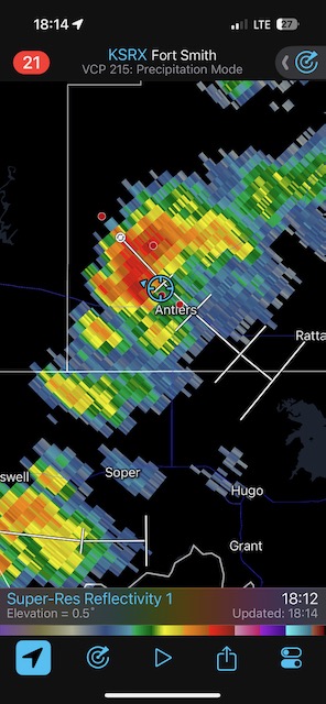
The better chance for high-end severe this day was up towards St. Louis. Since we were beginning a tour out of OKC, we tried our luck along a cold front that was moving into a warm and unstable airmass over southeastern OK. A storm or two became marginally severe NW of Antlers, which is north of Hugo. There seemed to be brief attempts at a funnel or a tornado, but for the most part these storms seemed to struggle.
April 19/Reposition Day
Start Commerce, TX/lunch Billy’s BBQ in Cisco, TX/End Sanderson, TX/461 miles
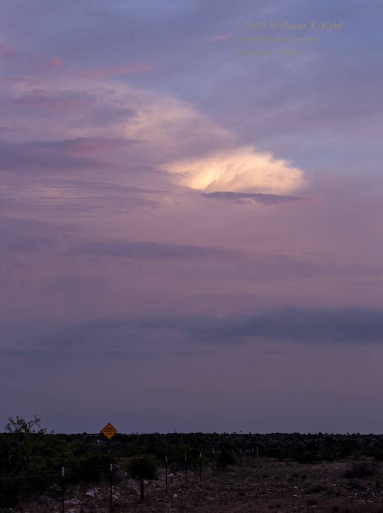
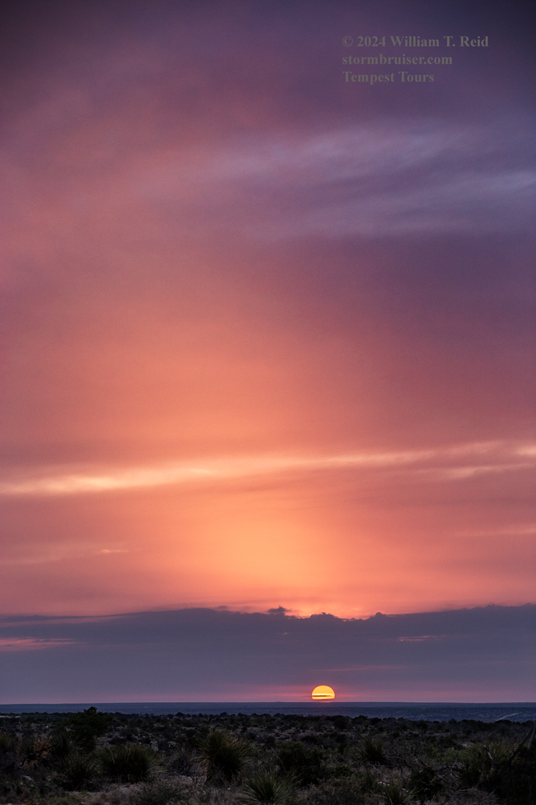
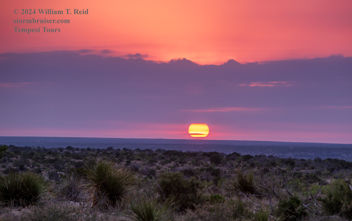
We had to dive south if we were to see any convection on the 19th and 20th. A cold front was making its way through Texas. We headed southwest from Commerce to Cisco and Sanderson, and all we had to show for it was a somewhat scenic drive and a semi-pretty sunset. At least expectations were very low. This left us in decent position for the chase on the 20th.
April 20/South Texas Storms
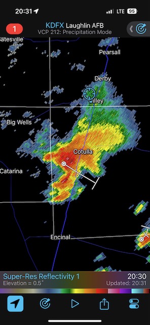
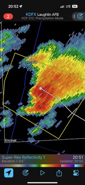
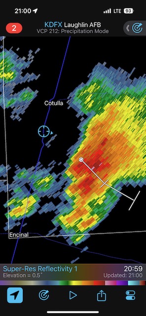
Start Sanderson, TX/lunch Chick Fila in Del Rio/End Pearsall, TX/468 miles
We had a “Marginal” risk of severe today in south Texas, along and near a cold front that was slowly sagging to the south. The instability was decent, but the overall shear was rather lame. We played with some storms that looked kind of okay early on, but then became messy. Also, the road network and storm motions were not working in our favor. We wound up behind this storm near Cotulla at sunset. The chase was so uninspiring that I never picked up my Canon camera.
April 21/Down Day
Start Pearsall, TX/End San Angelo, TX/274 miles
Down day/Reposition north day
We took the guests to the Sonora Caverns

April 22/Down Day
Start San Angelo, TX/End Turkey, TX/240 miles
One more down day as we wait for moisture to return to the middle of Texas…
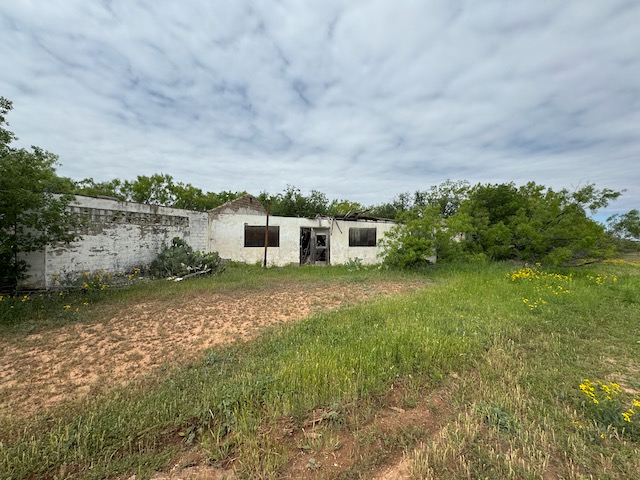
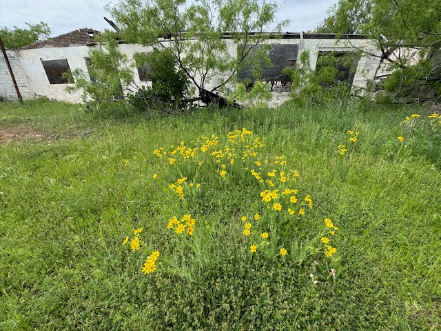
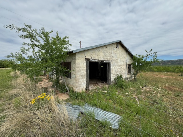
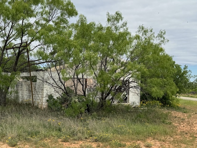
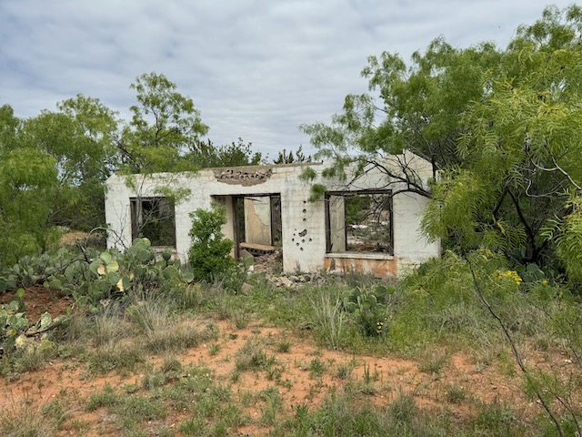
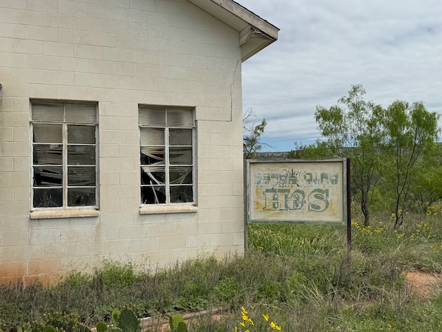
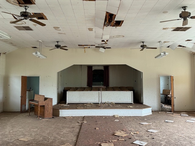
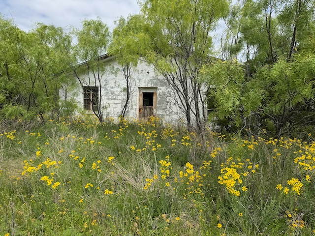
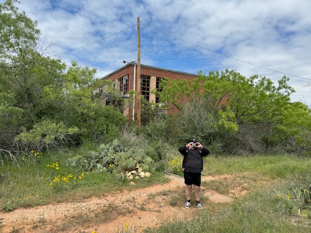
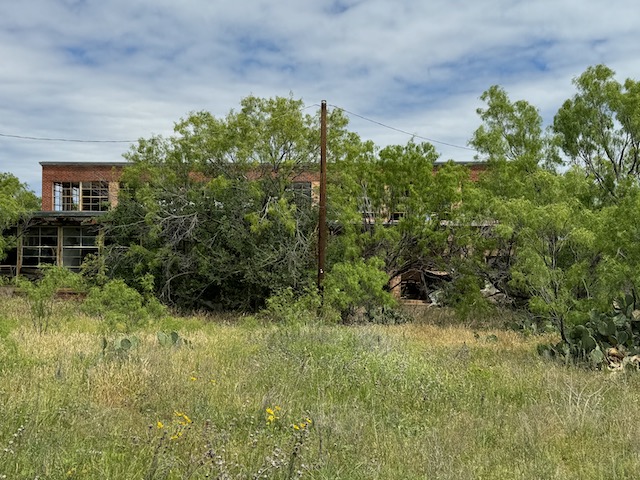
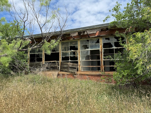
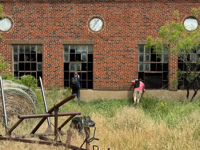
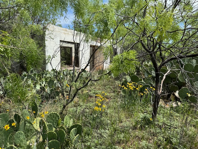
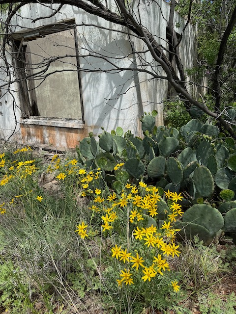
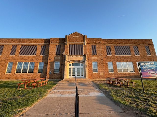
We stopped at the ghost town of Silver and explored the abandoned buildings and homes. Below are iPhone shots of Silver. (A large tornado occurred near Silver on May 3rd, during Tour 2 this year.) The final two pics are from Turkey.
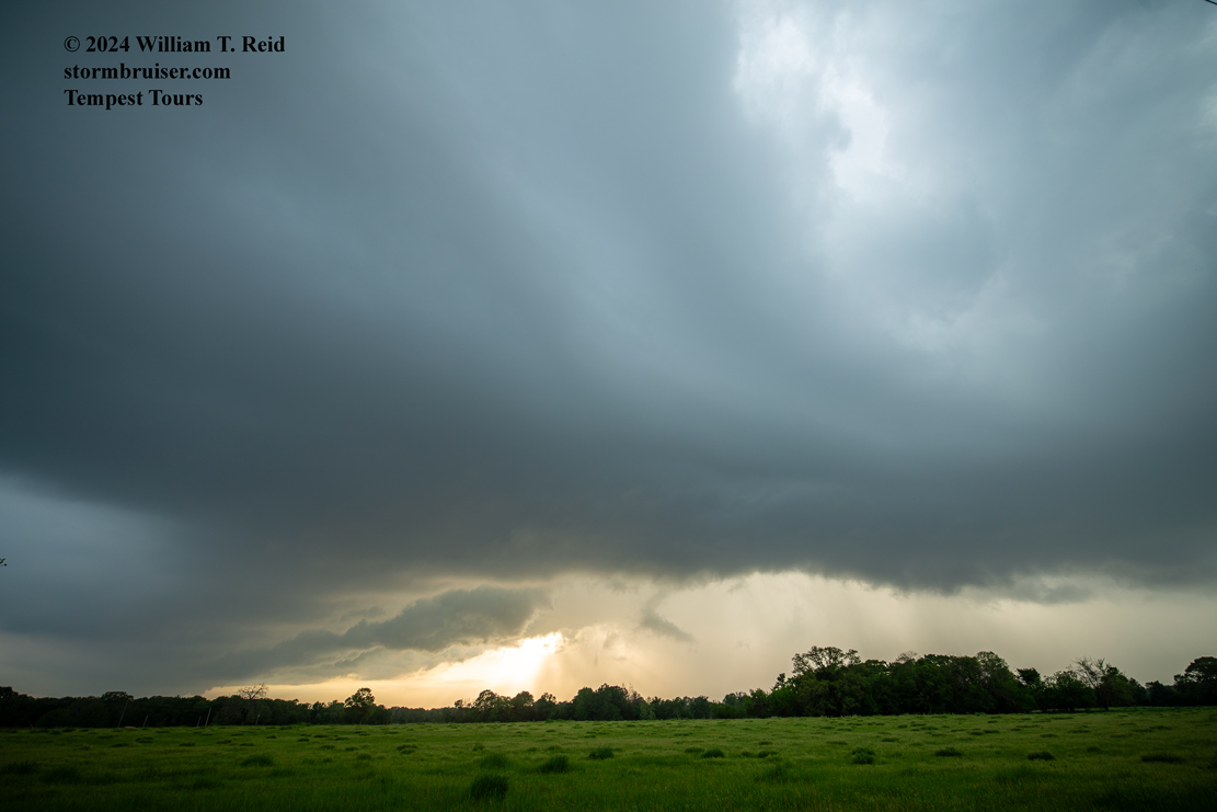
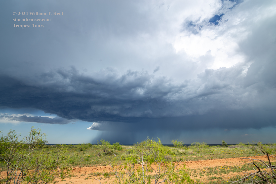
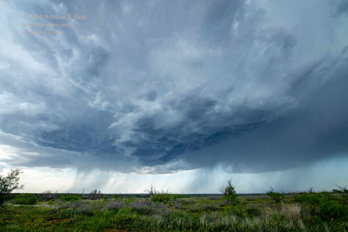
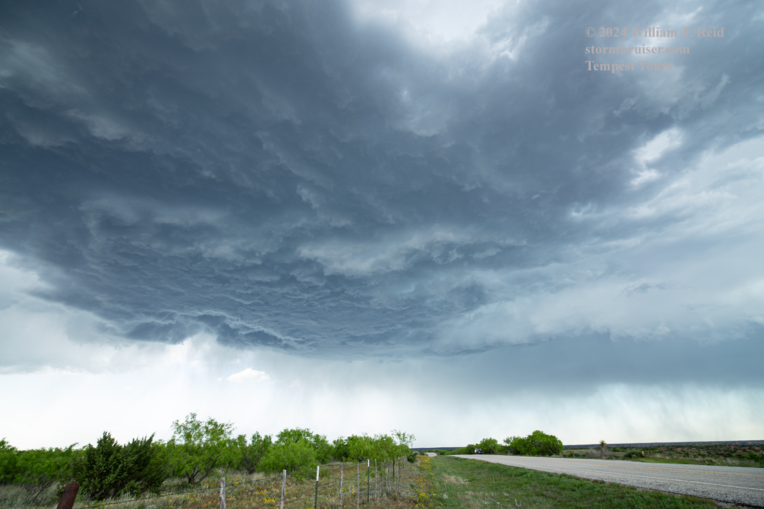
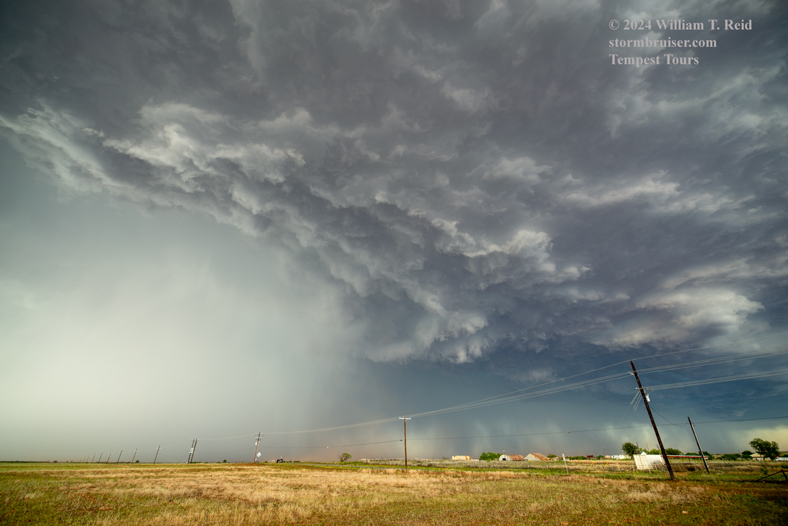
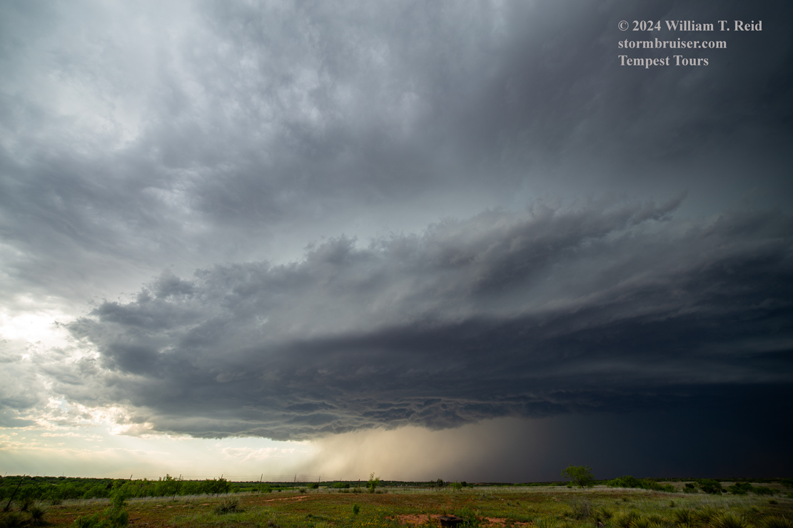
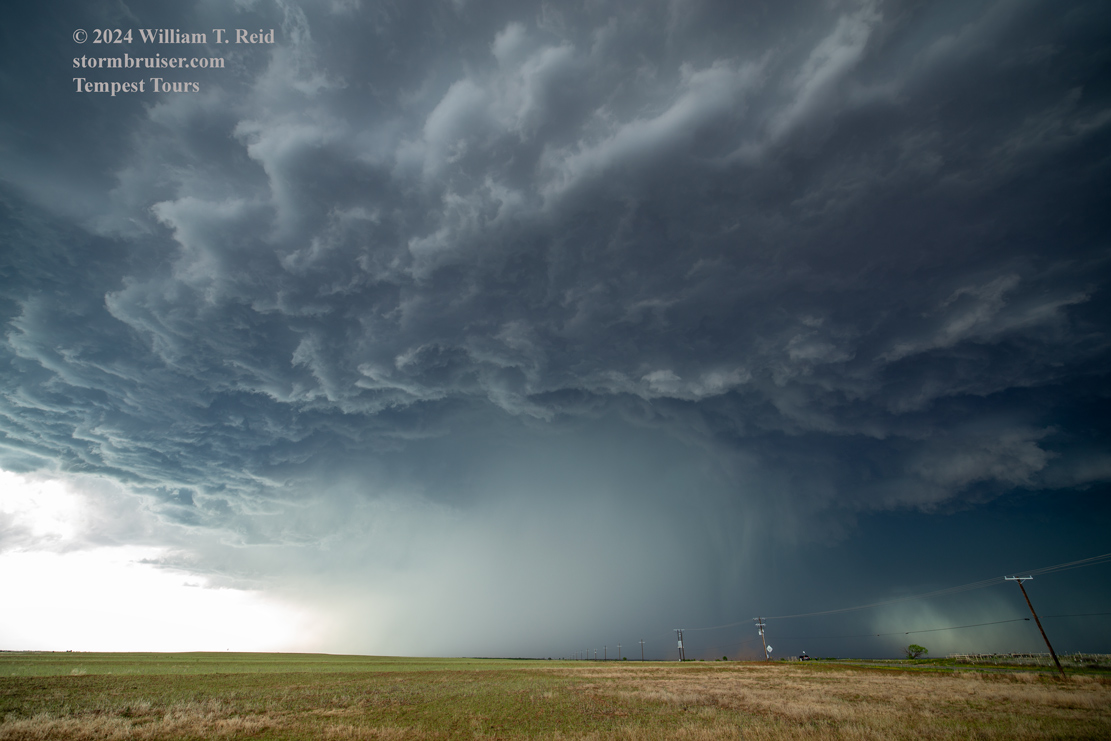
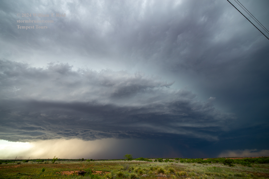
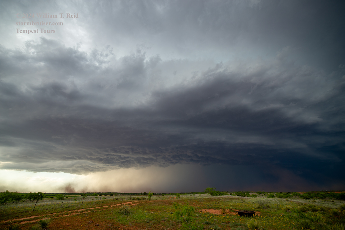
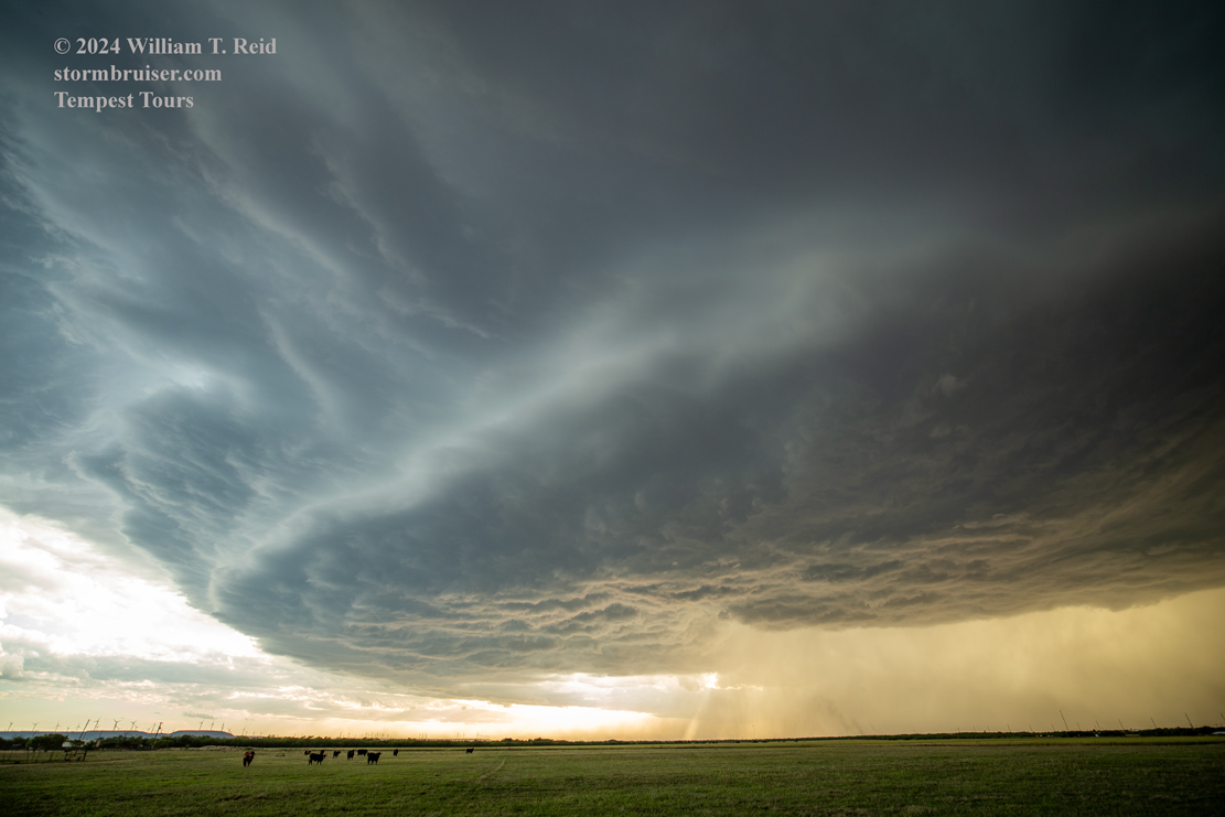
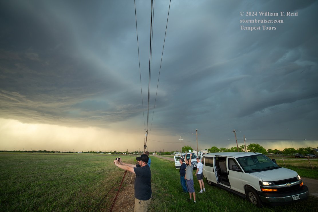
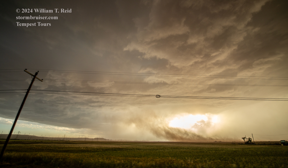
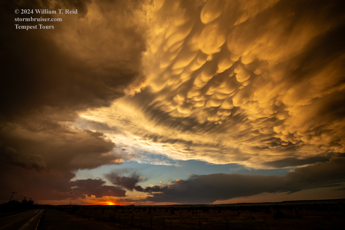
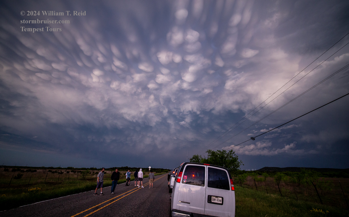
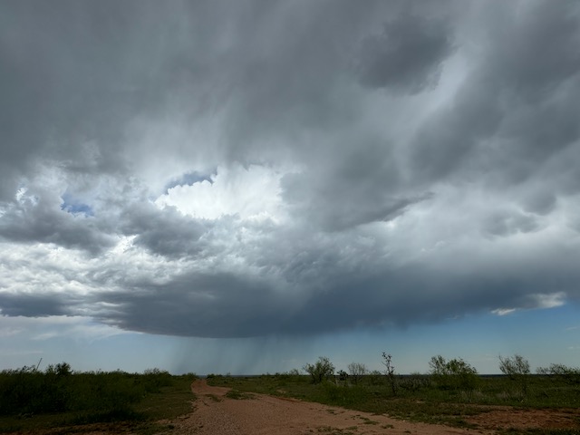
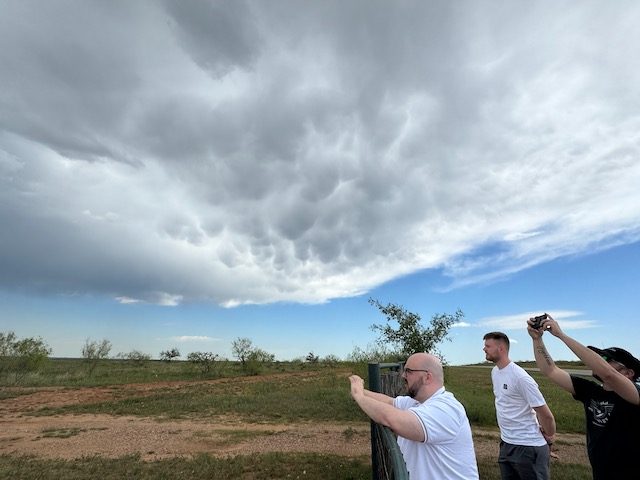
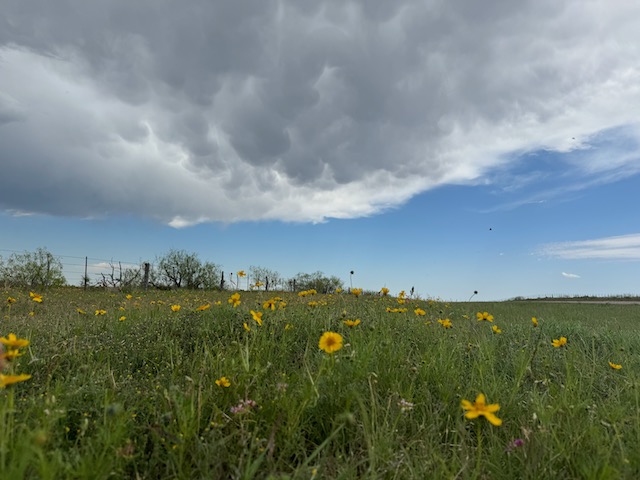
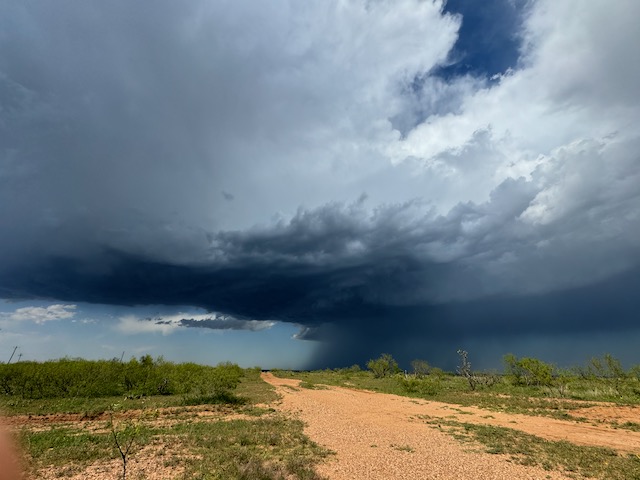
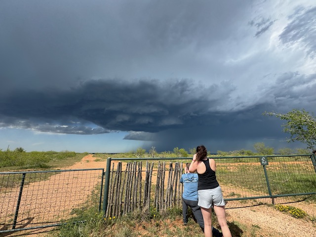
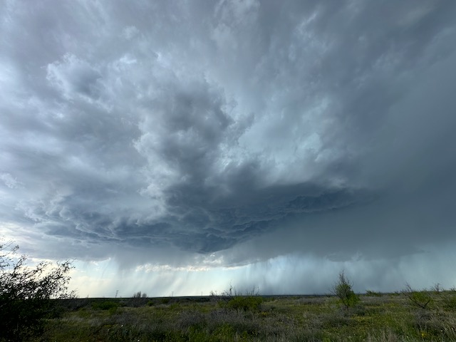
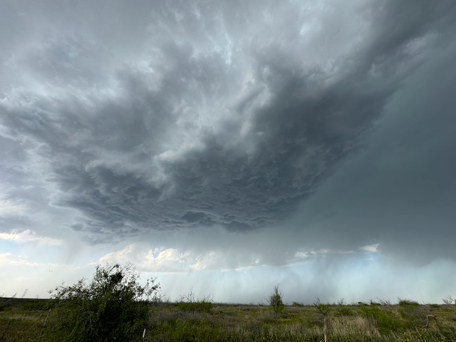
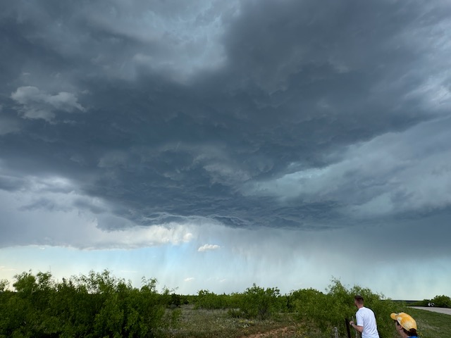
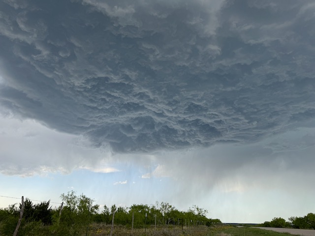
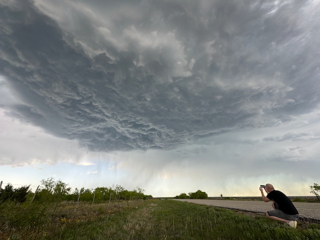
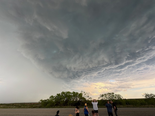
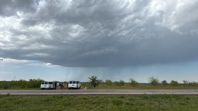
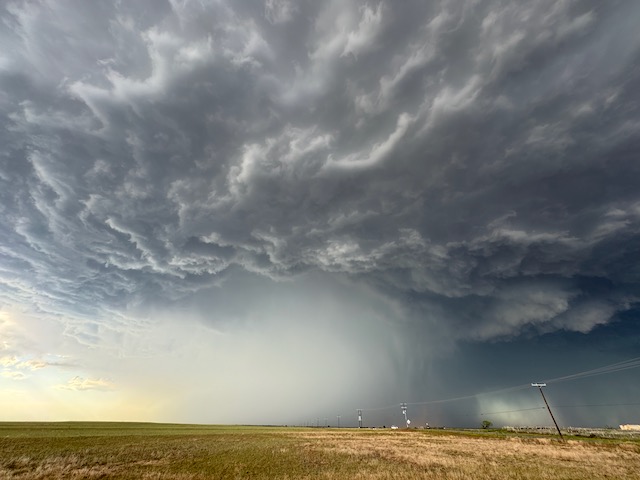
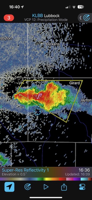
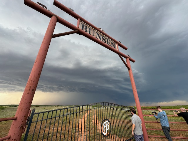
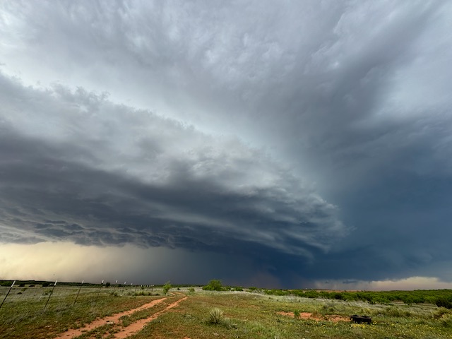
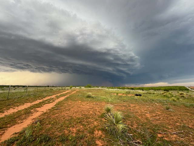
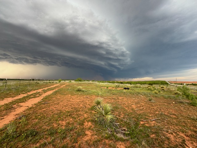
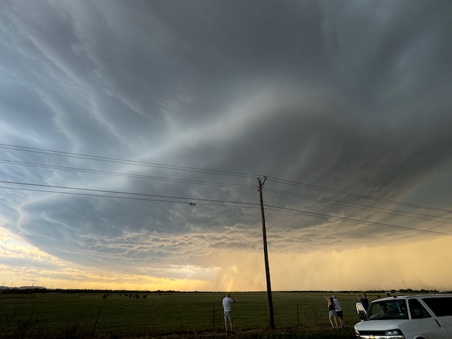
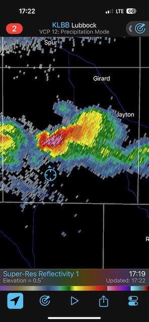
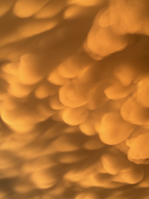
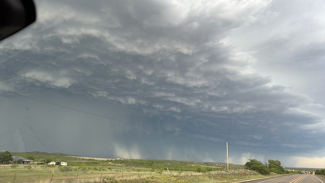
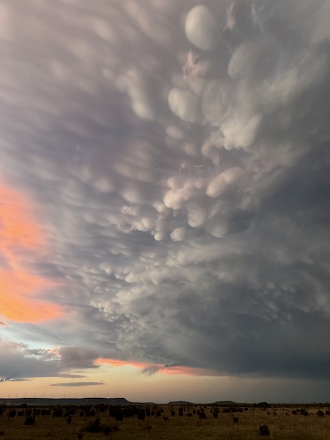
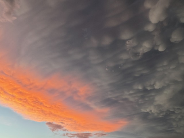
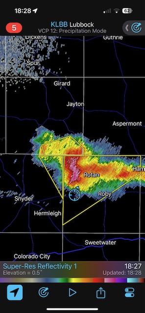
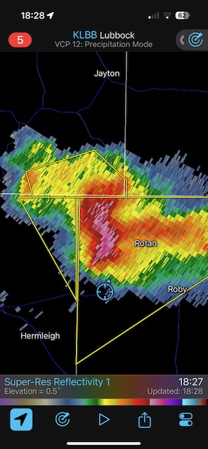
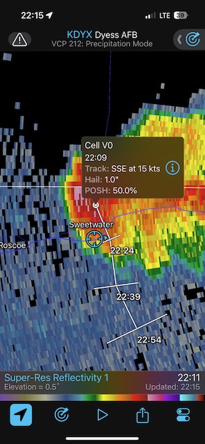
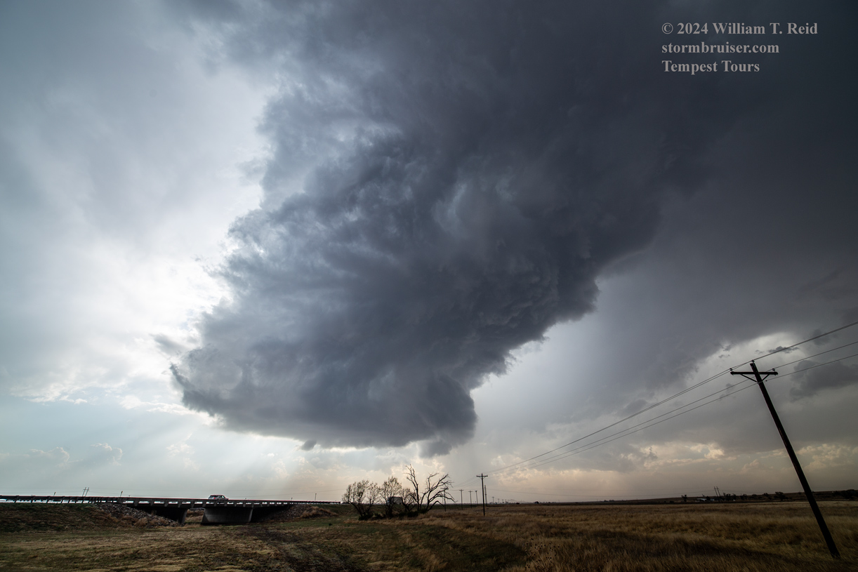
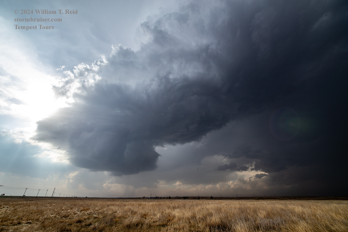
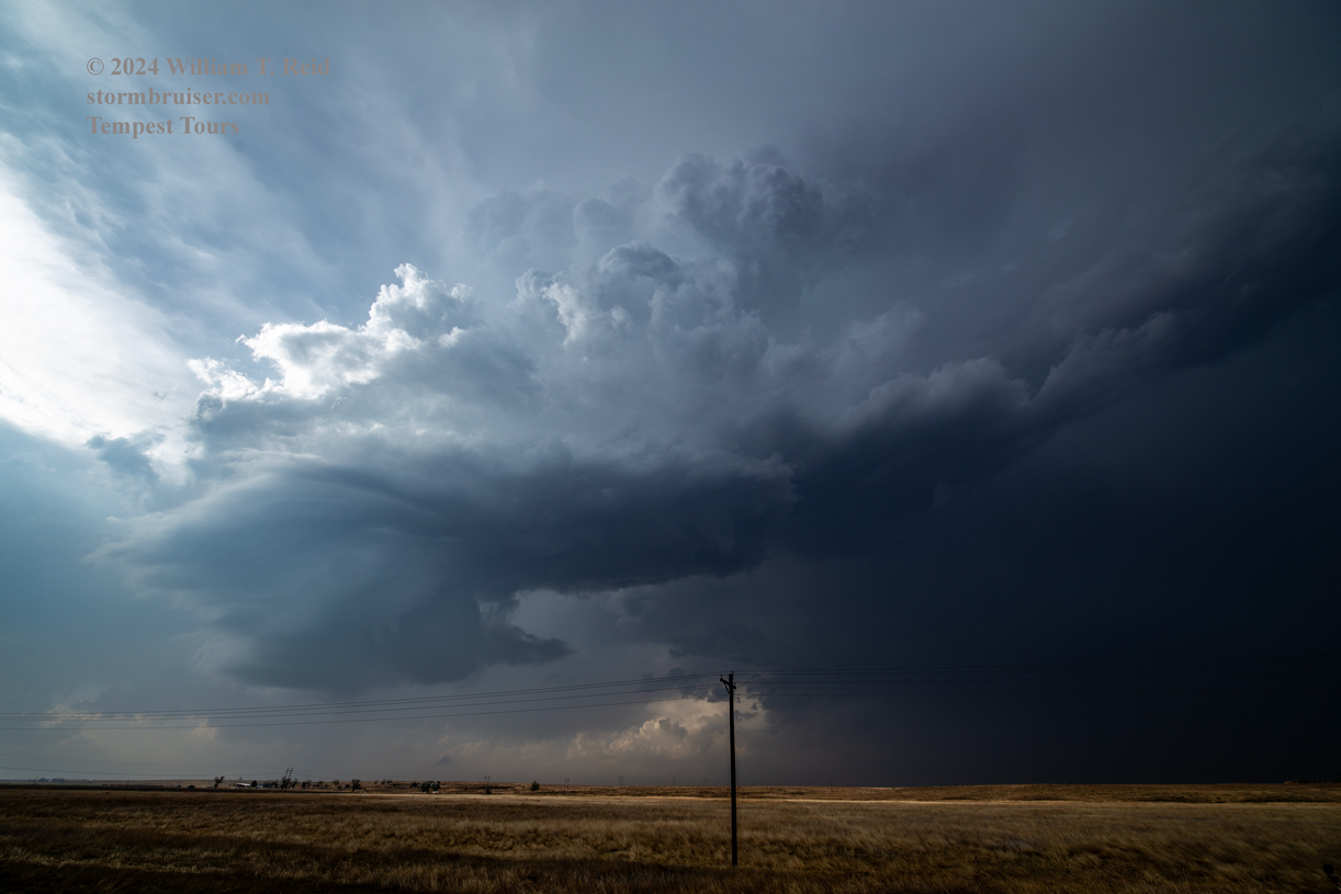
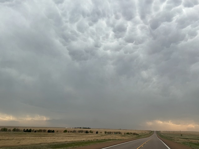
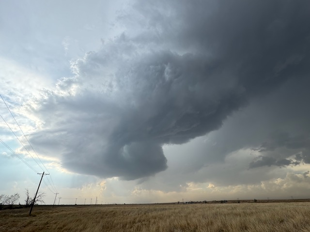
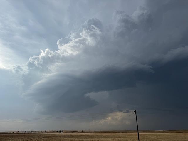
April 23/Trent, TX Supercell
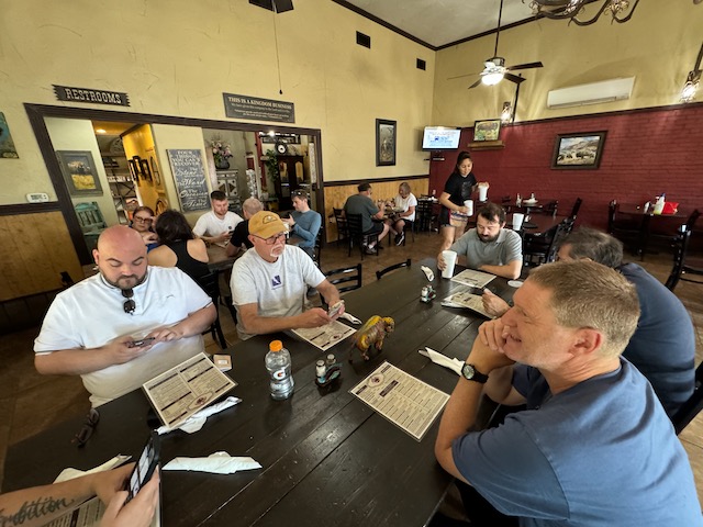
Start Turkey, TX/lunch Bison Cafe in Quitaque/End Sweetwater, TX/274 miles
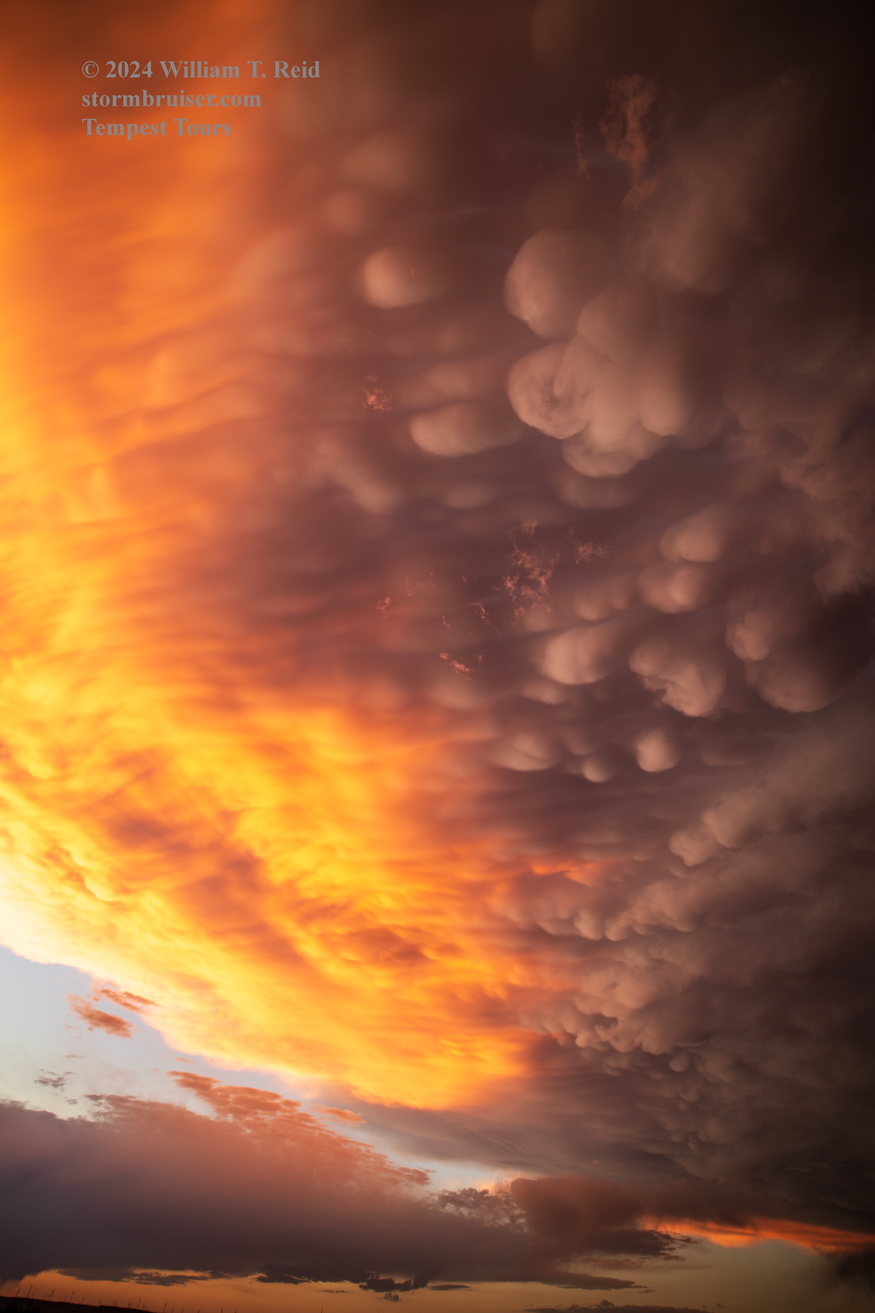
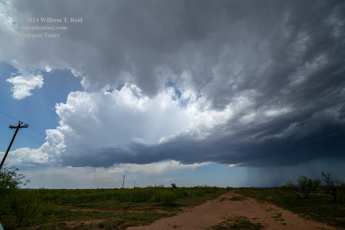
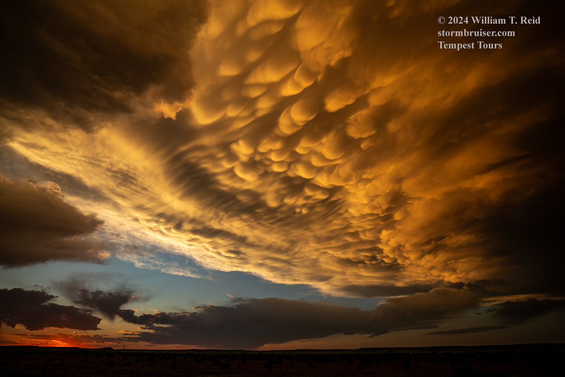
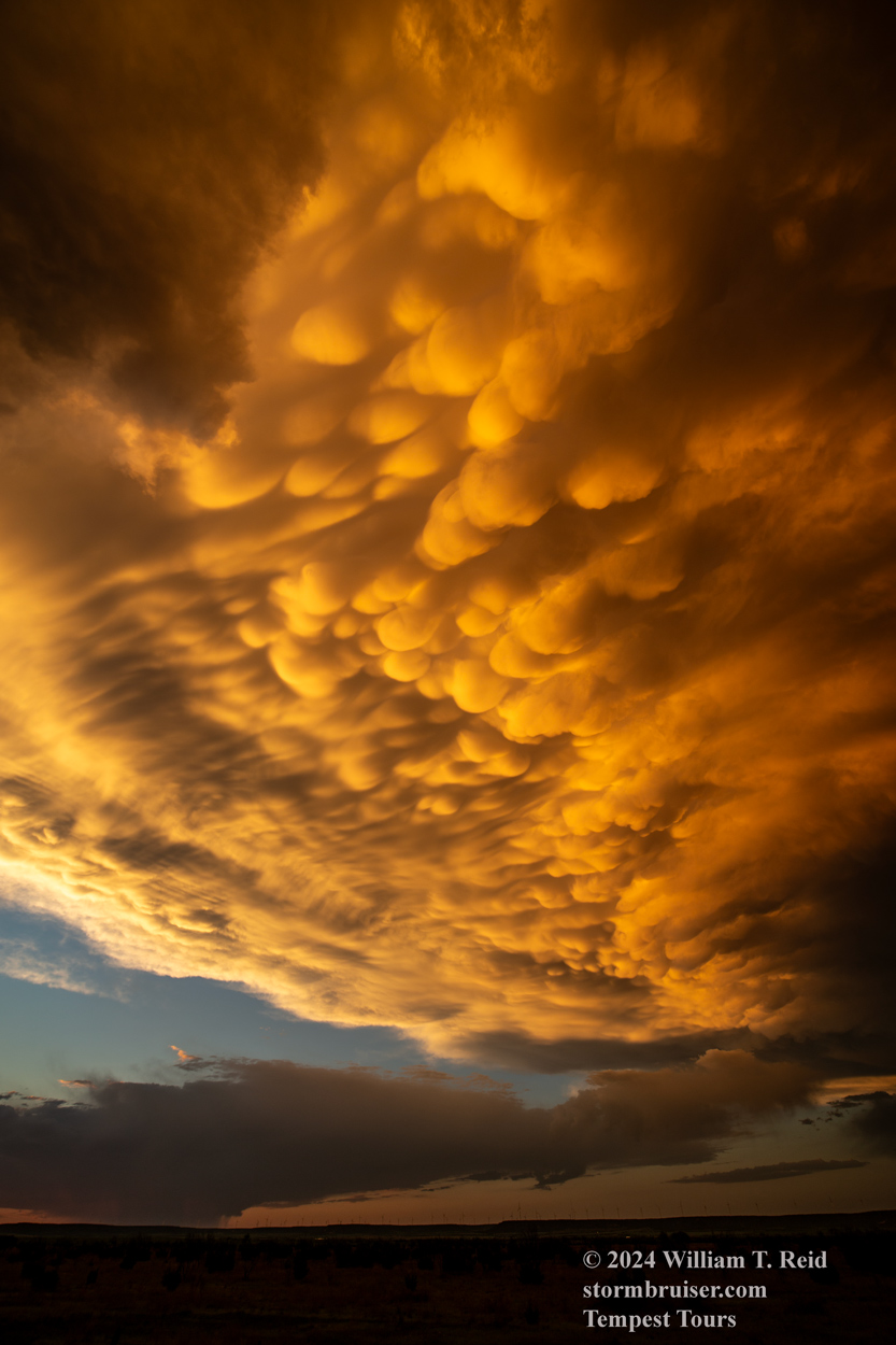
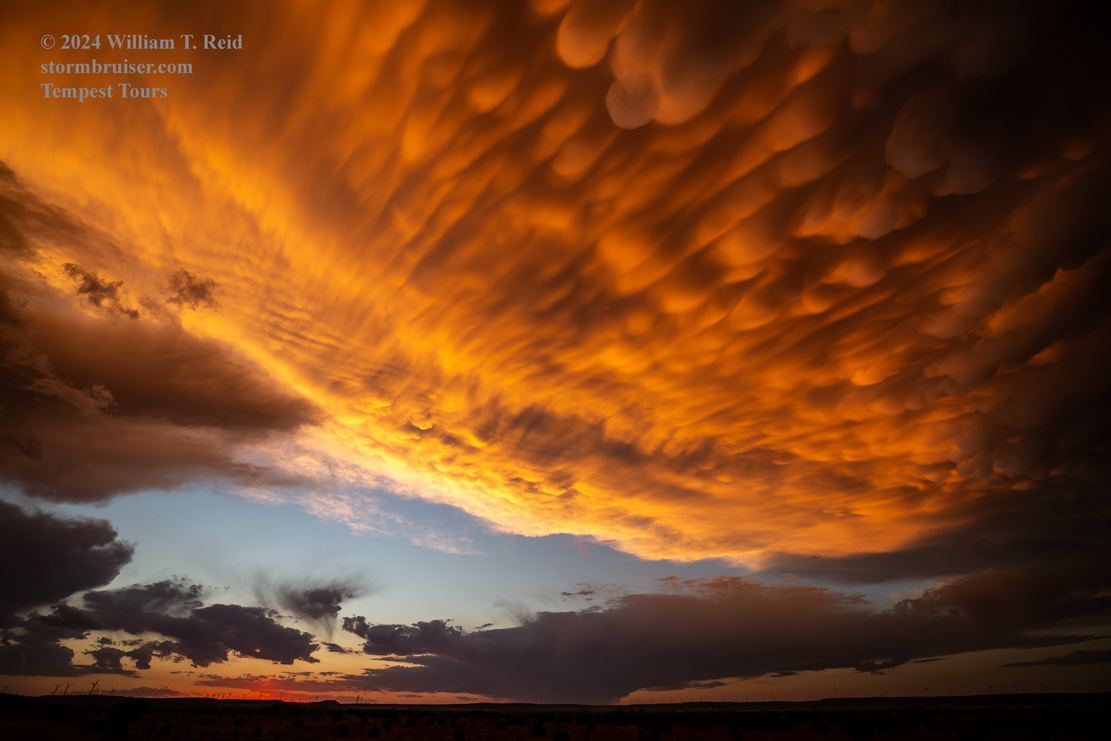
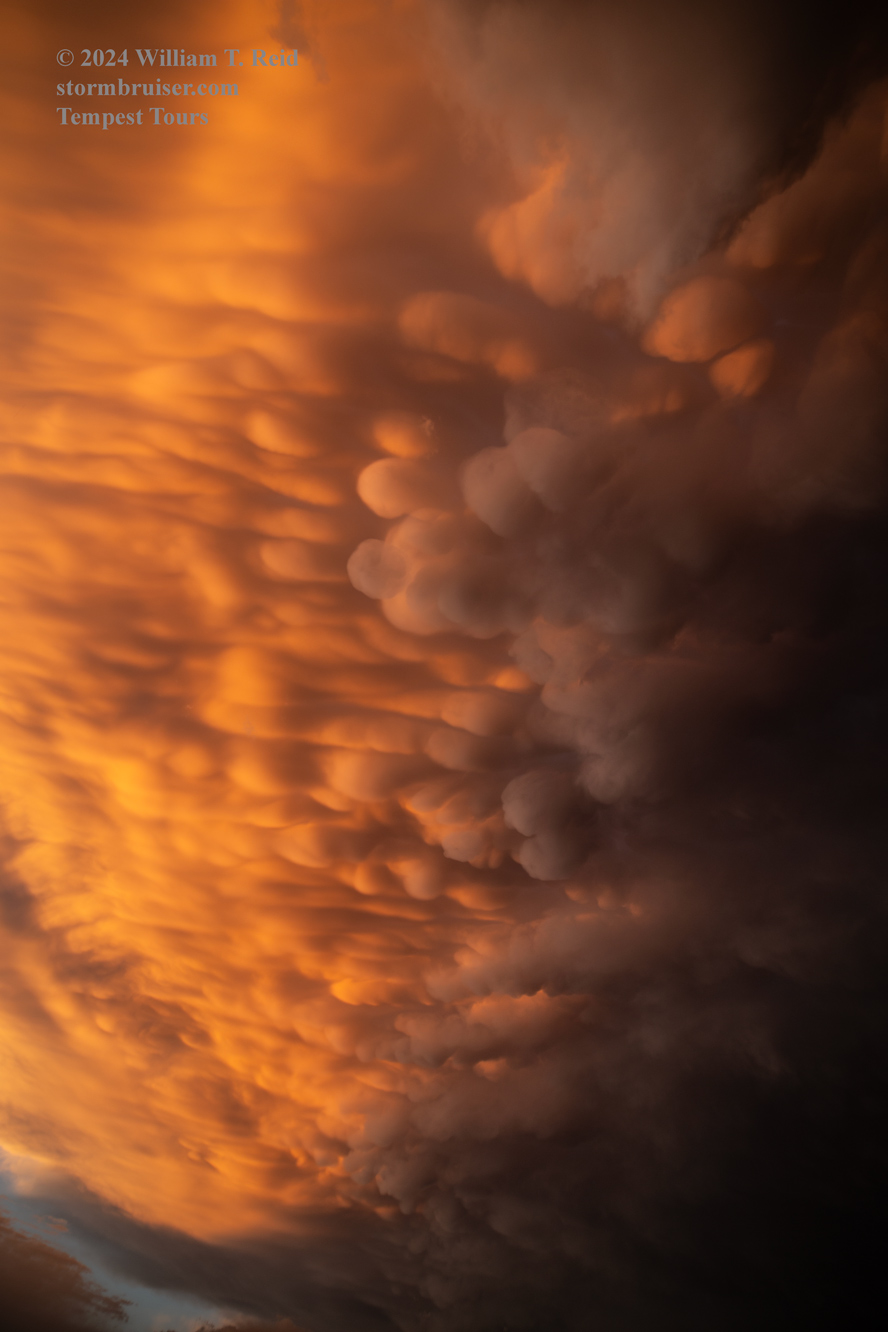
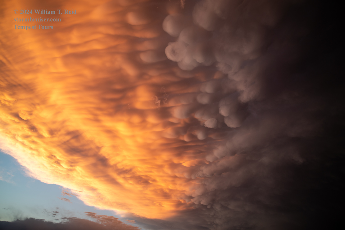
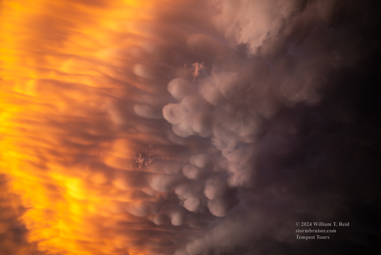
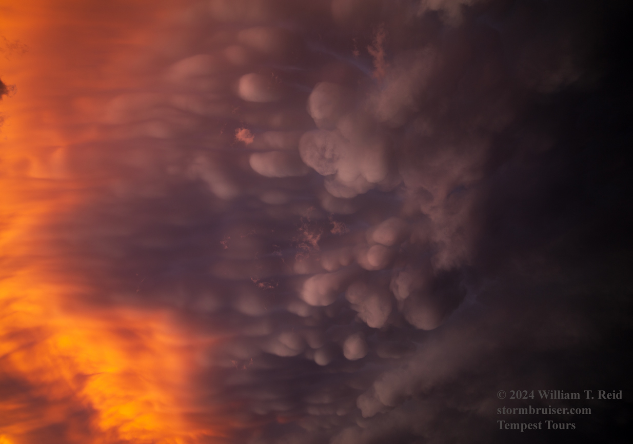
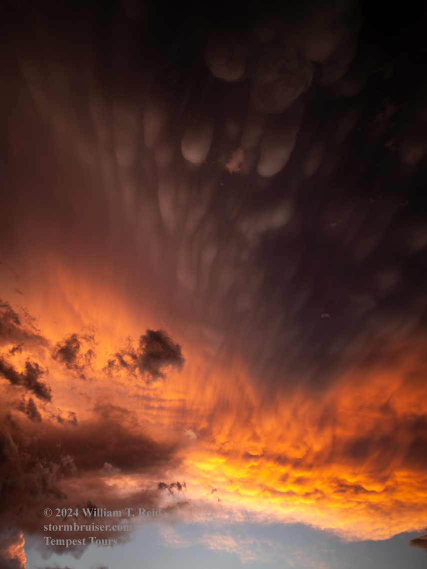
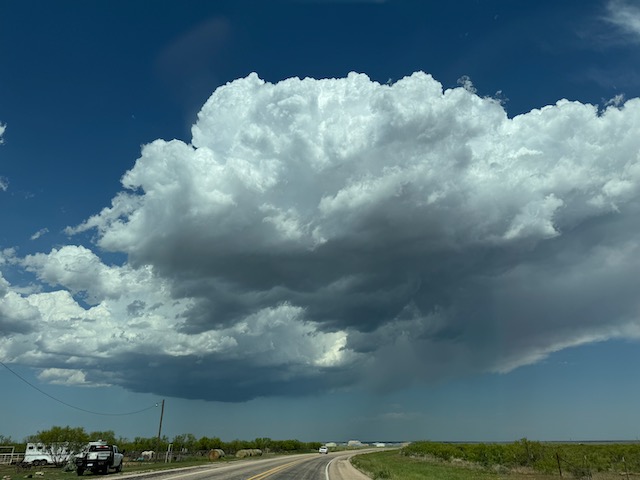
We finally had a decent setup for severe weather again on the 23rd. We got south of development that went up northeast of Post, TX, and followed it southeastward some. There was supercell structure and some RFD cuts, but dews were a little too low and cloud bases were a little too high for a decent tornado chance. The mammatus display behind the cells near Trent (in Taylor County on I-20) was top notch.
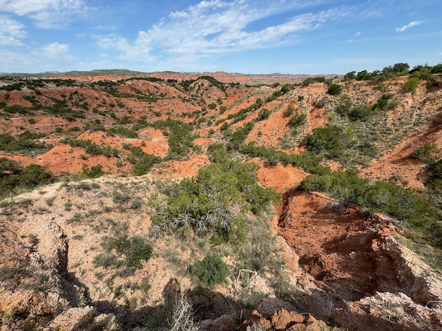
Prior to the chase we killed some time with a tour of Caprock Canyons.

iPhone pics and radar screenshots below
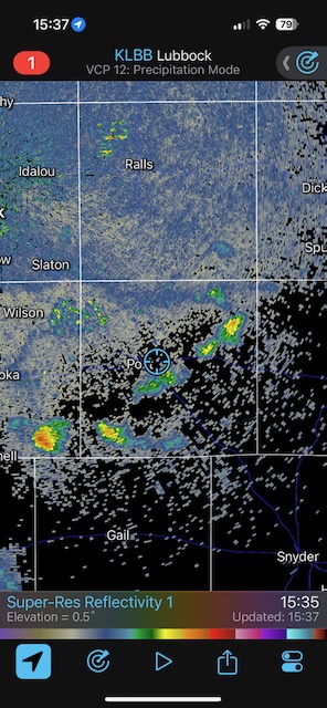
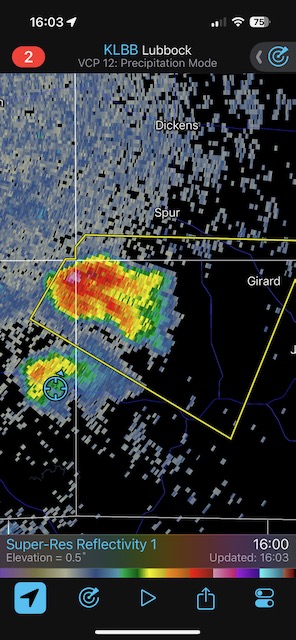
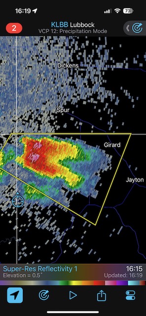
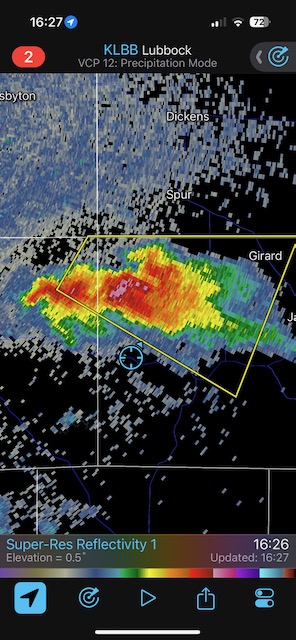
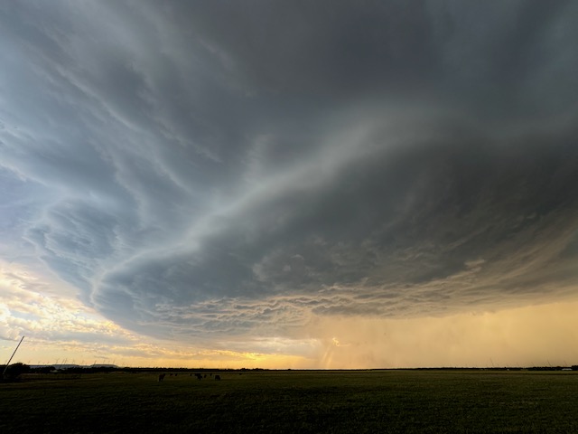
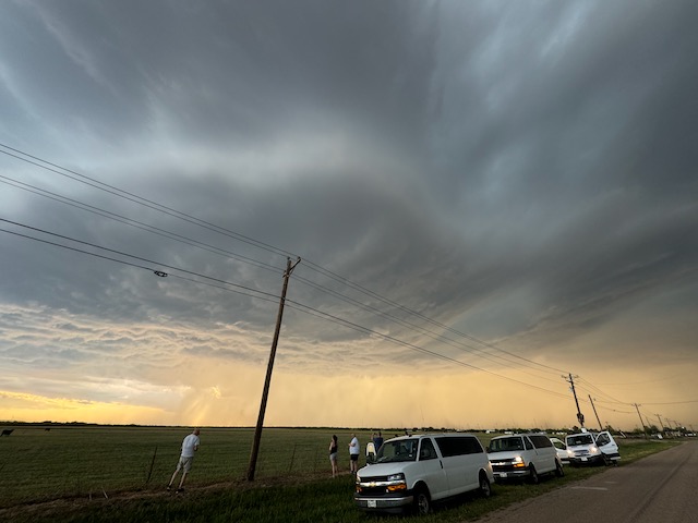
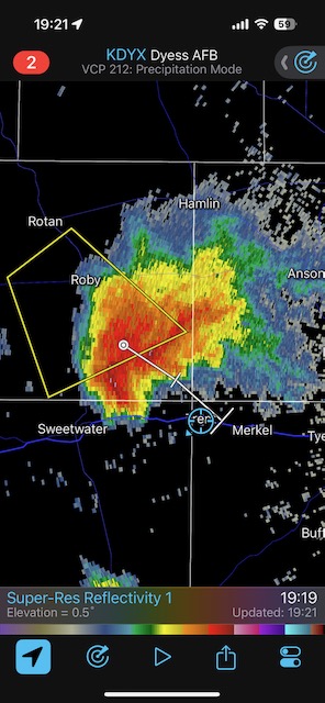
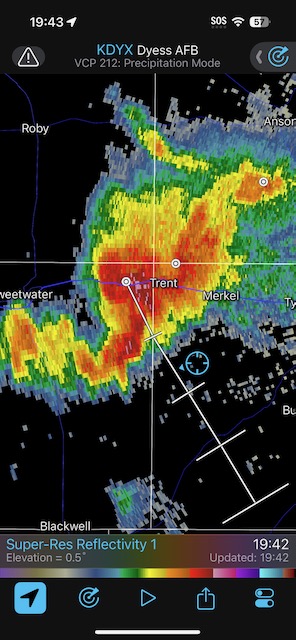
Round Two came through at our hotel in Sweetwater mid-evening.
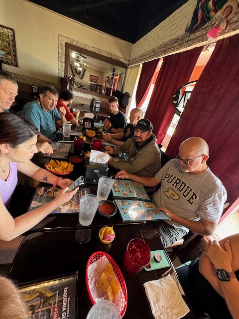
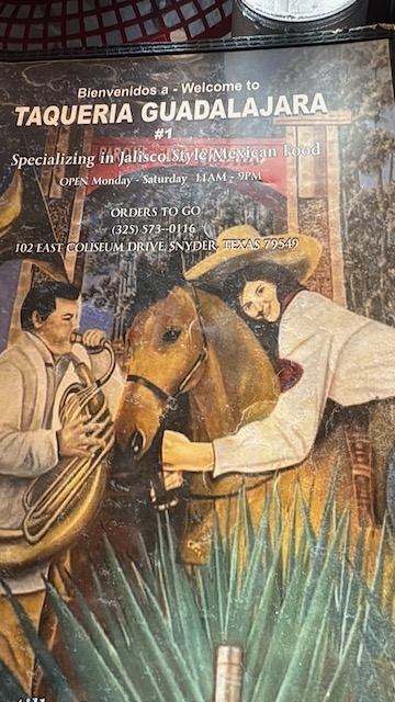
April 24/Cap Bust near Brownfield
Start Sweetwater, TX/lunch Guadalajara Mexican in Snyder/End Pampa, TX/318 miles
I don’t recall this chase day. In my notebook I wrote that we busted near La Mesa and Brownfield, and that high clouds and minimal surface convergence were problematic. There were no storms. SPC had a slight risk, with 2% tornado and hatched hail risk areas centered near La Mesa. But it was a bust. The number of Storms Reports in the USA this day: zero.
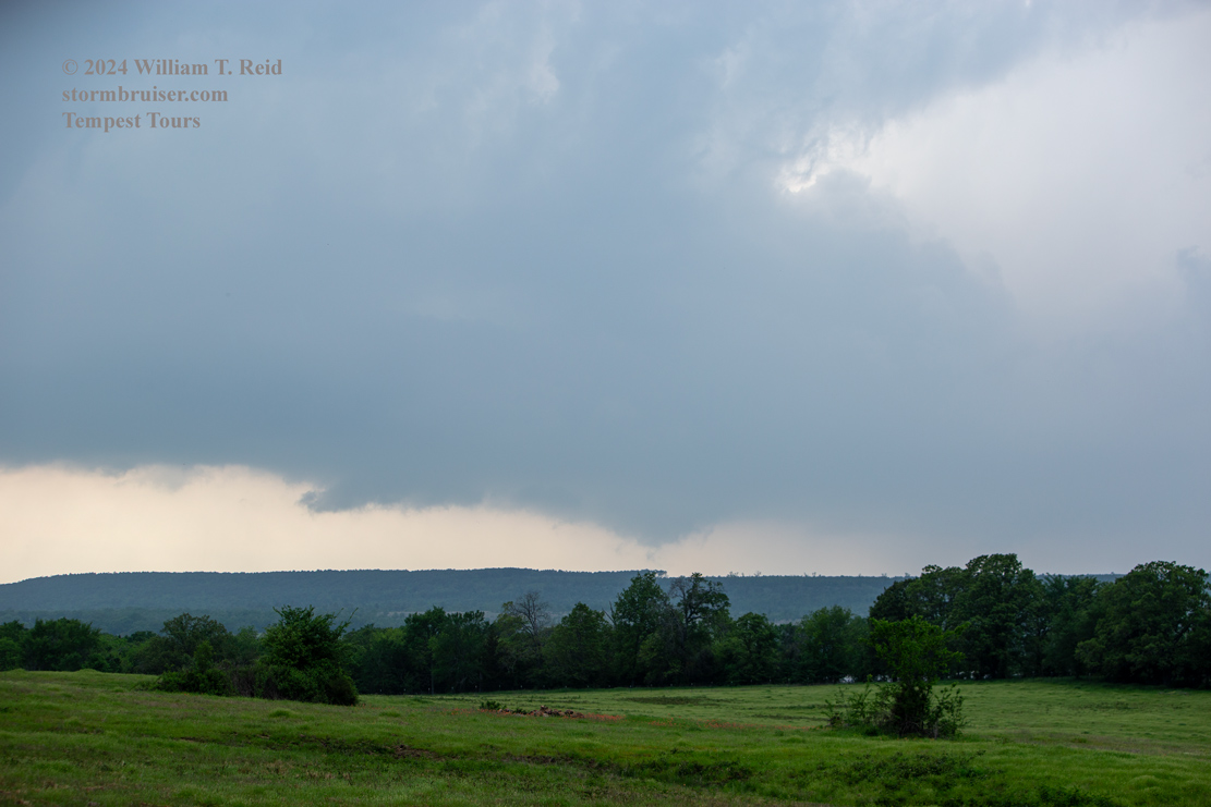
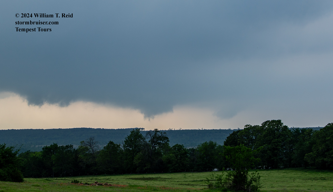
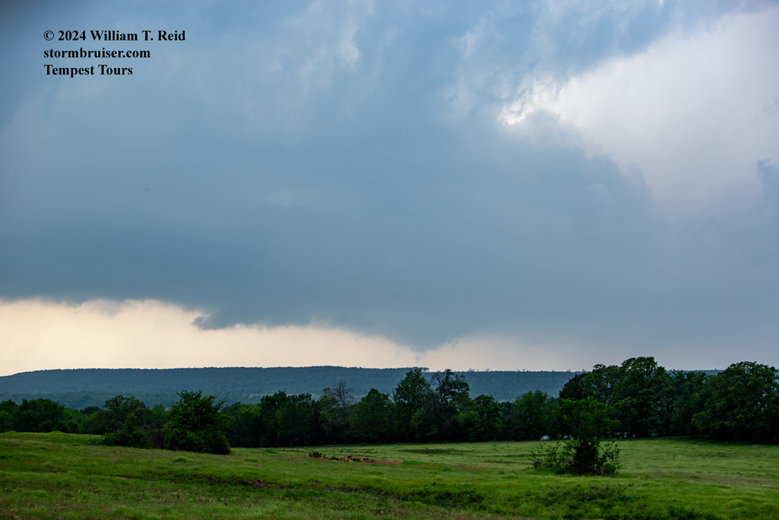
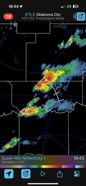
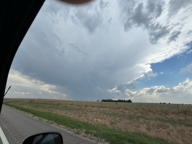
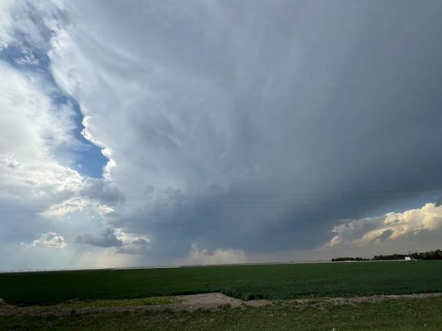
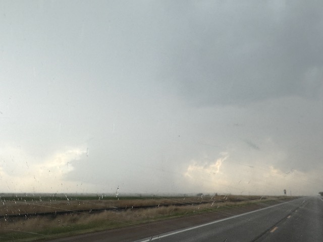
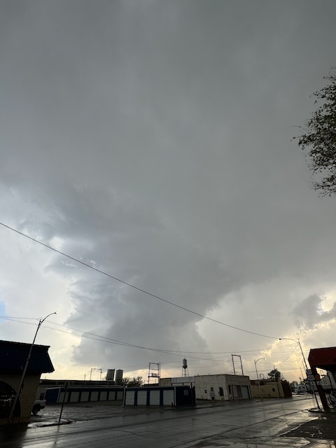
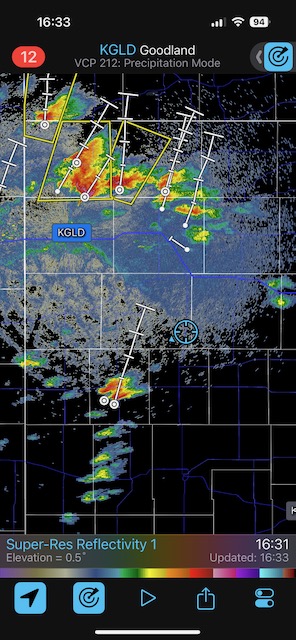
April 25/Undercut Garbage in Tornado Watch in NW KS
Start Pampa, TX/lunch Subway at Sublette, KS/End Liberal, KS/550 miles
NW KS: 10 percent enhanced tornado risk! 30 percent hatched hail risk!
This day blew chunks from a storm-chasing perspective.
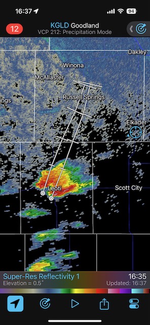
There were the obligatory weak tornadoes and landspouts in northeastern Colorado and near Goodland. But the area which appeared to be well-suited for the BIG-TIME stuff wound up junky. Here is the 20Z SPC discussion:
..20Z Update...
   The Enhanced Risk across western KS has been expanded to include
   more of northwest KS, far northeast CO, and far southwest NE. Based
   on recent visible satellite trends, convective initiation appears
   imminent across east-central CO along/near a surface dryline.
   Additional robust thunderstorm development will likely occur this
   afternoon across northeast CO into northwest KS and vicinity as an
   upper trough continues ejecting eastward over the central High
   Plains. Given moderate buoyancy and strong deep-layer shear, very
   large hail (possibly up to around 3 inches) should be the main
   threat with initial supercells. By early this evening, strengthening
   low-level shear should encourage a greater tornado threat with any
   supercells that can persist, especially as this activity interacts
   with a warm front across northwest KS. A strong tornado or two
   remains a possibility across this area. See Mesoscale Discussion 513
   and recently issued Tornado Watch 133 for more details on the severe
   threat for this region.
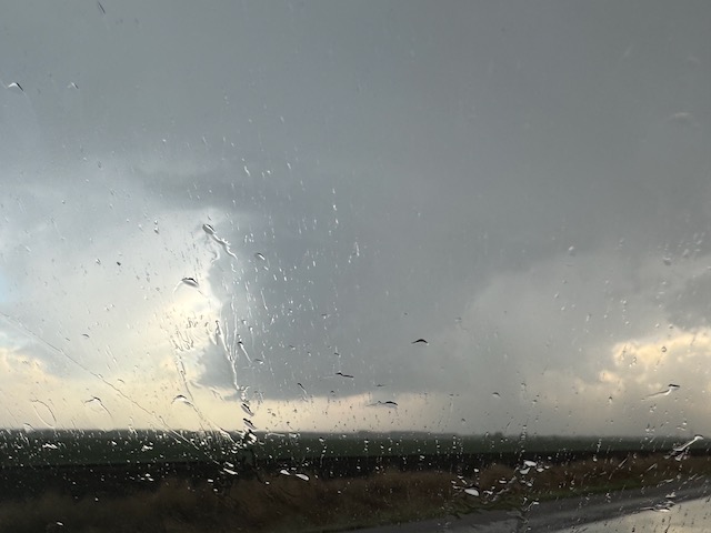
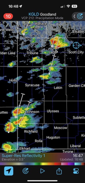
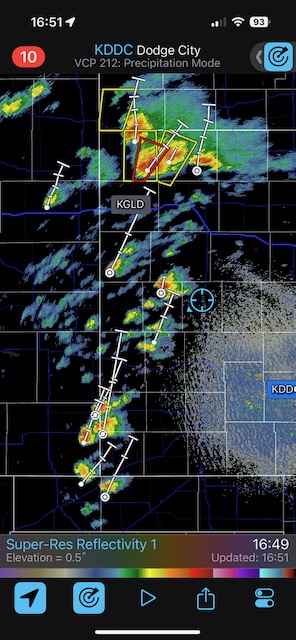
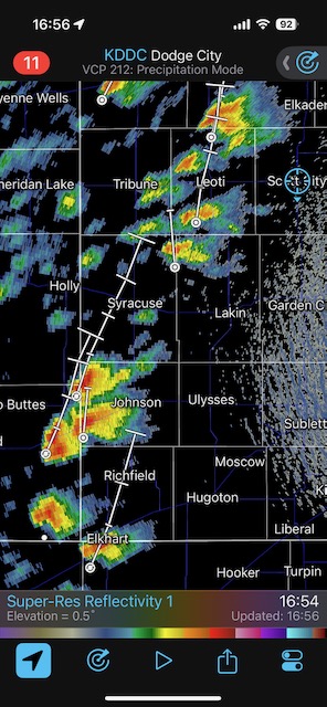
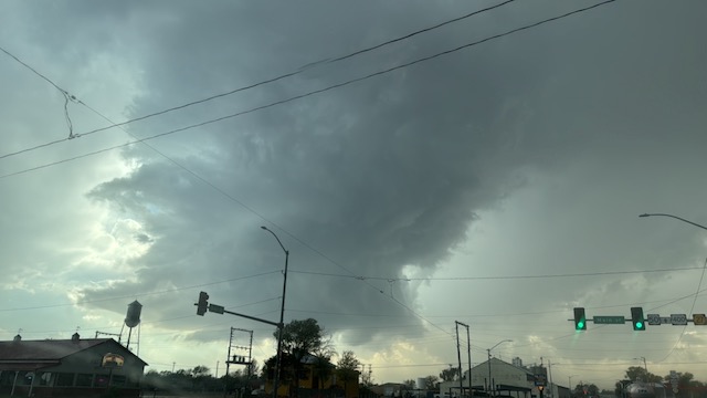
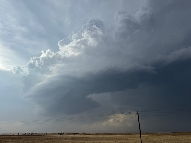
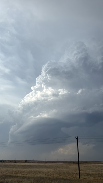
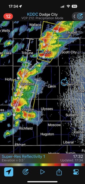
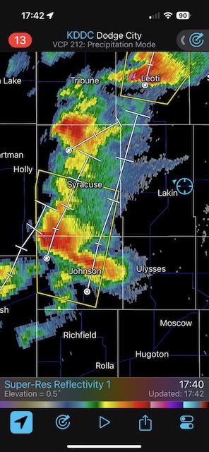
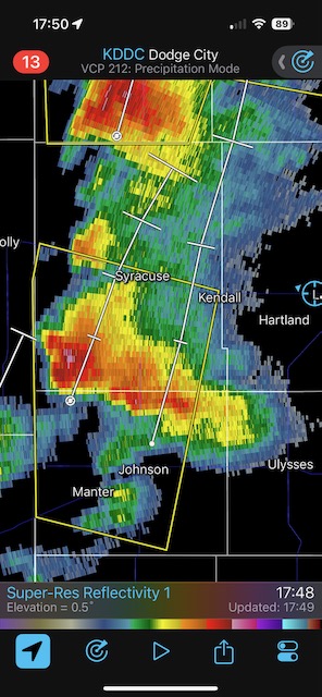
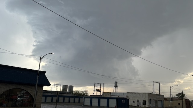
Our group motored northward to the warm front which was a little north of Oakley. Storms which were moving to the NNE, north of I-70 (see first radar grab at 16:33), found themselves above a cool and much-too-stable low-level airmass. I spent about 5 minutes in the cool east winds and said “Forget this noise.” If we were going to salvage something today, it would be to the south on dry line storms. We made our way to Syracuse and vicinity and watched this rather anemic updraft for a while (first three pics below). BLAH.
Then we tried a little farther south, near Rolla, where the cap held.
This was the final chase day for Tour One. Instead of heading to southeastern Nebraska for the big event the next day (April 26th), we had to drive back to OKC. Darn the luck.
Leave a Reply
You must be logged in to post a comment.