
Start: Littlefield, TX/lunch: Chillax Cafe in Morton/End: Lubbock/331 miles
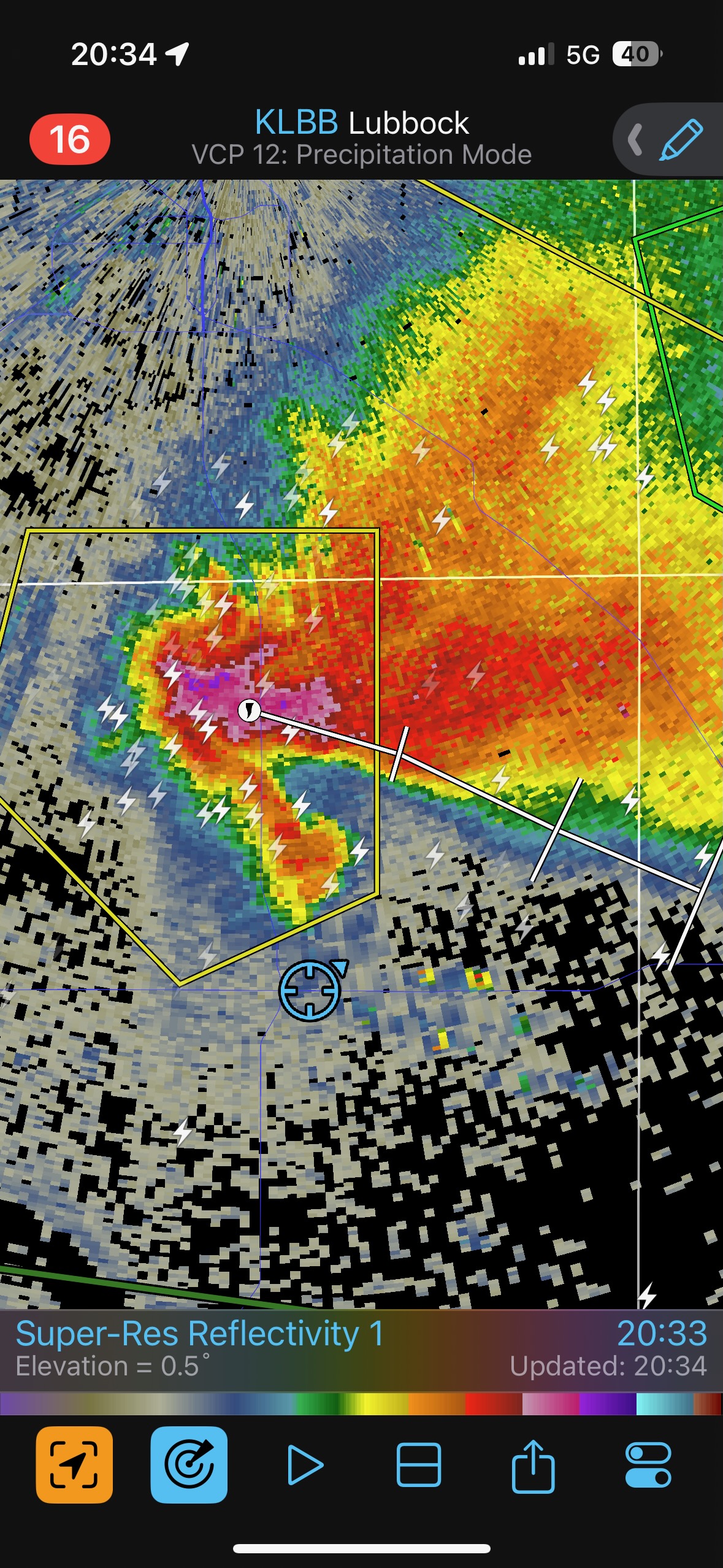
Mesoscale Discussions. 3:54 p.m. CDT. 6:18 p.m. CDT. 7:11 p.m. CDT. 7:26 p.m. CDT. 8:57 p.m. CDT
———–
Youtube link to my video for the chase.
———-
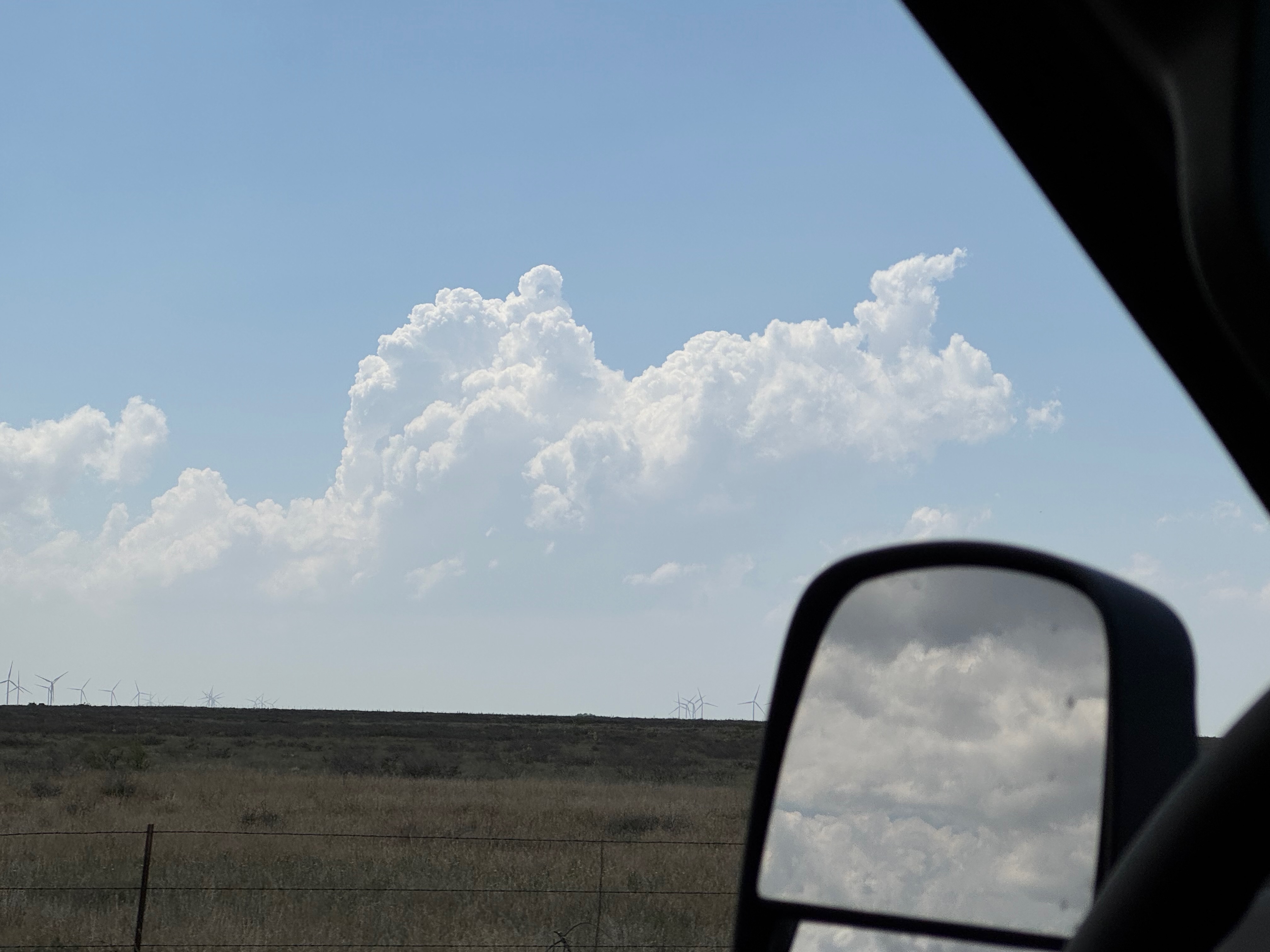
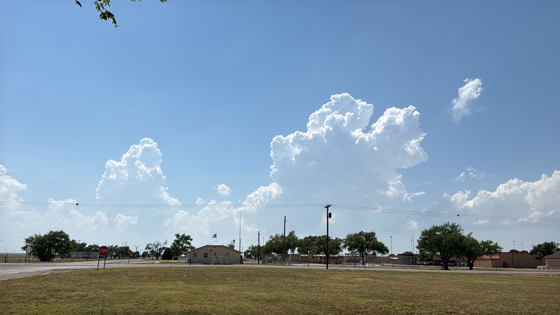
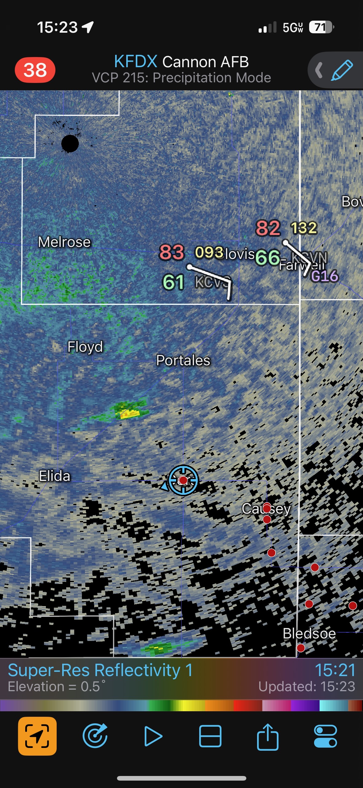
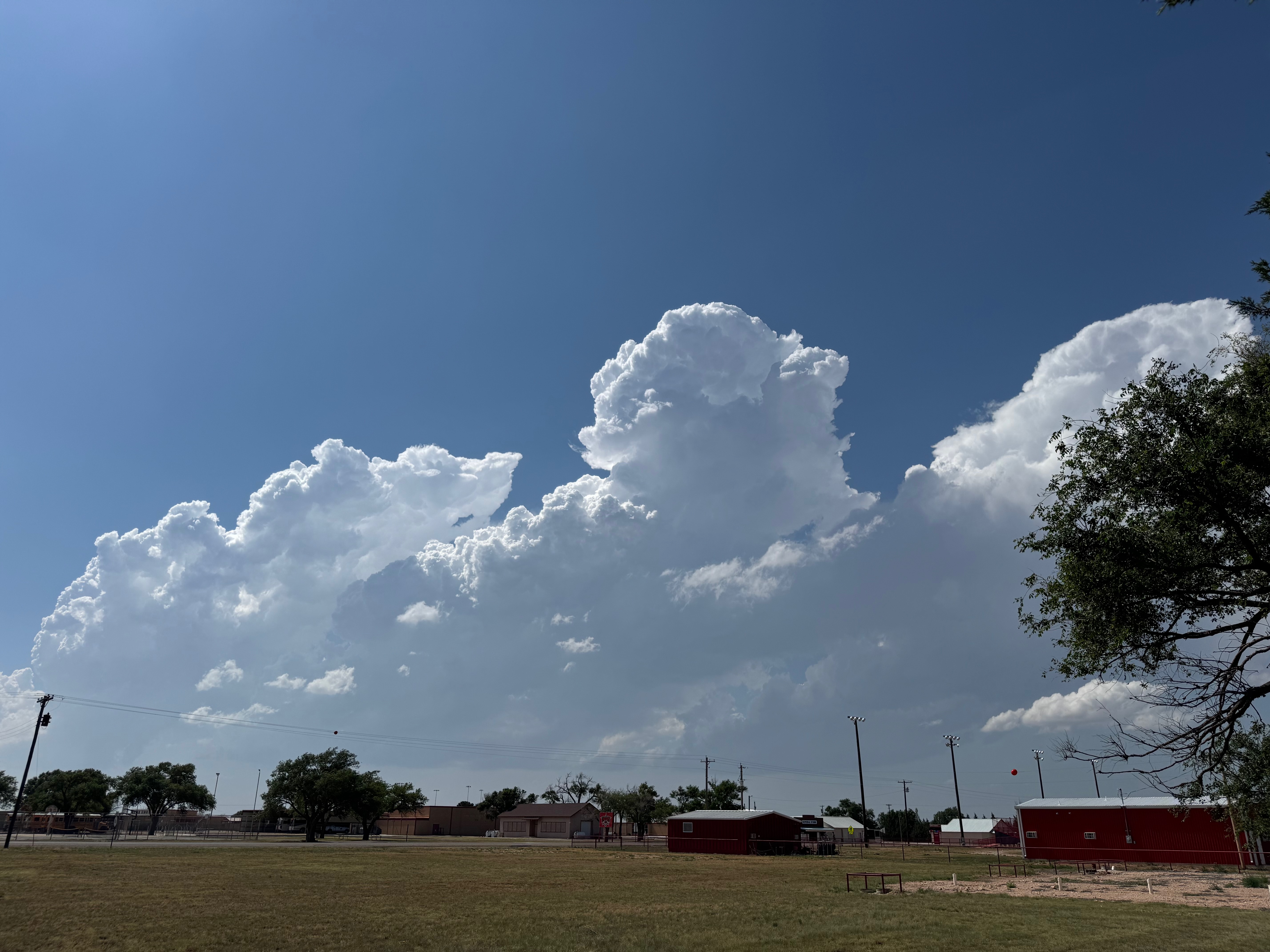
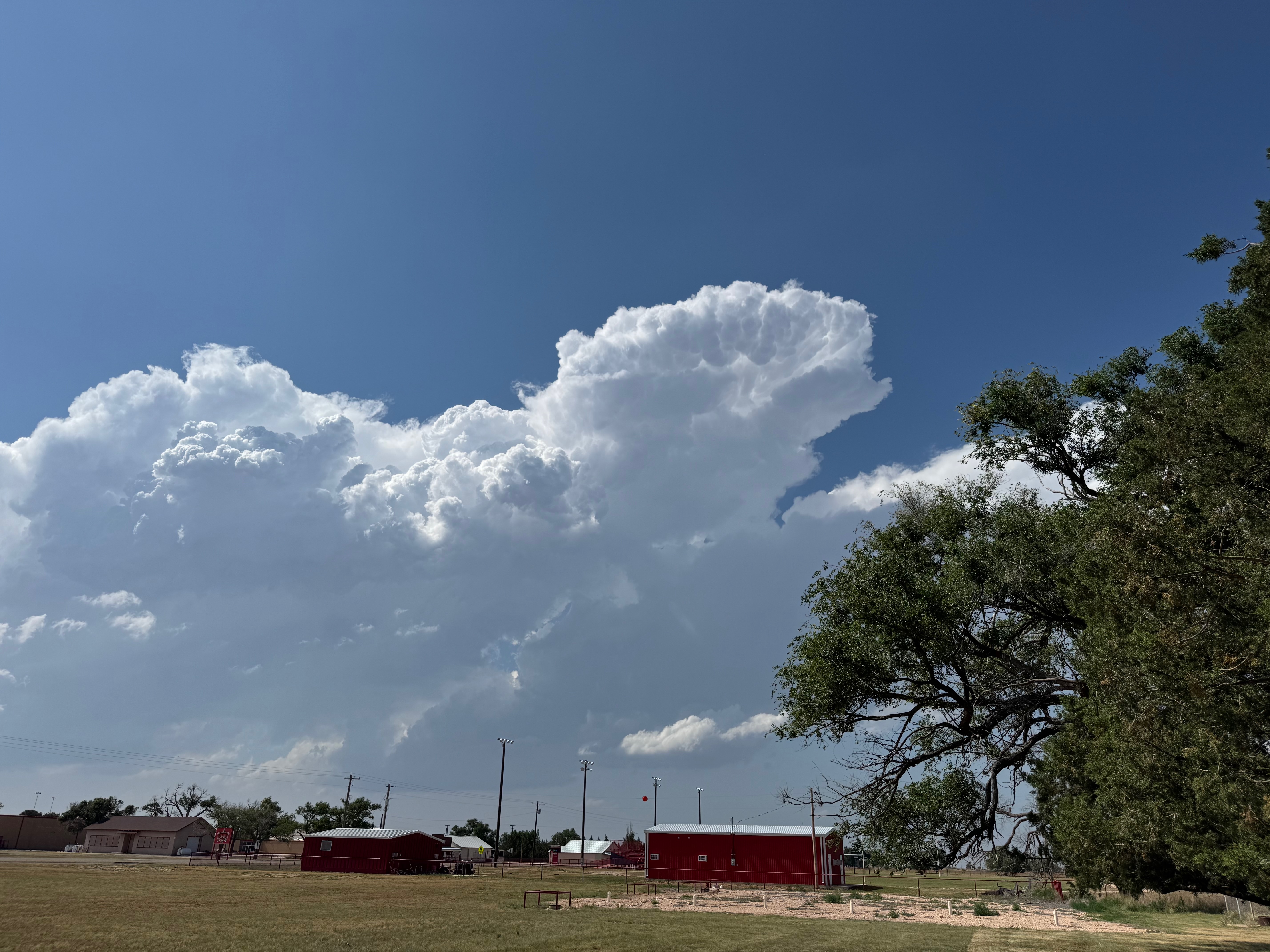
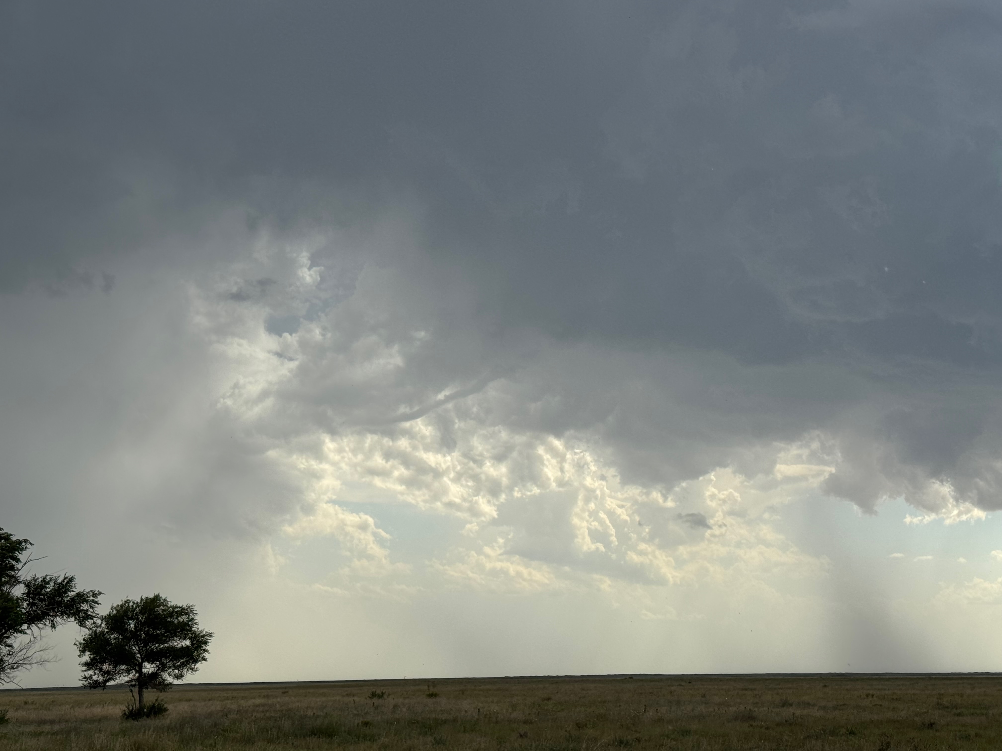
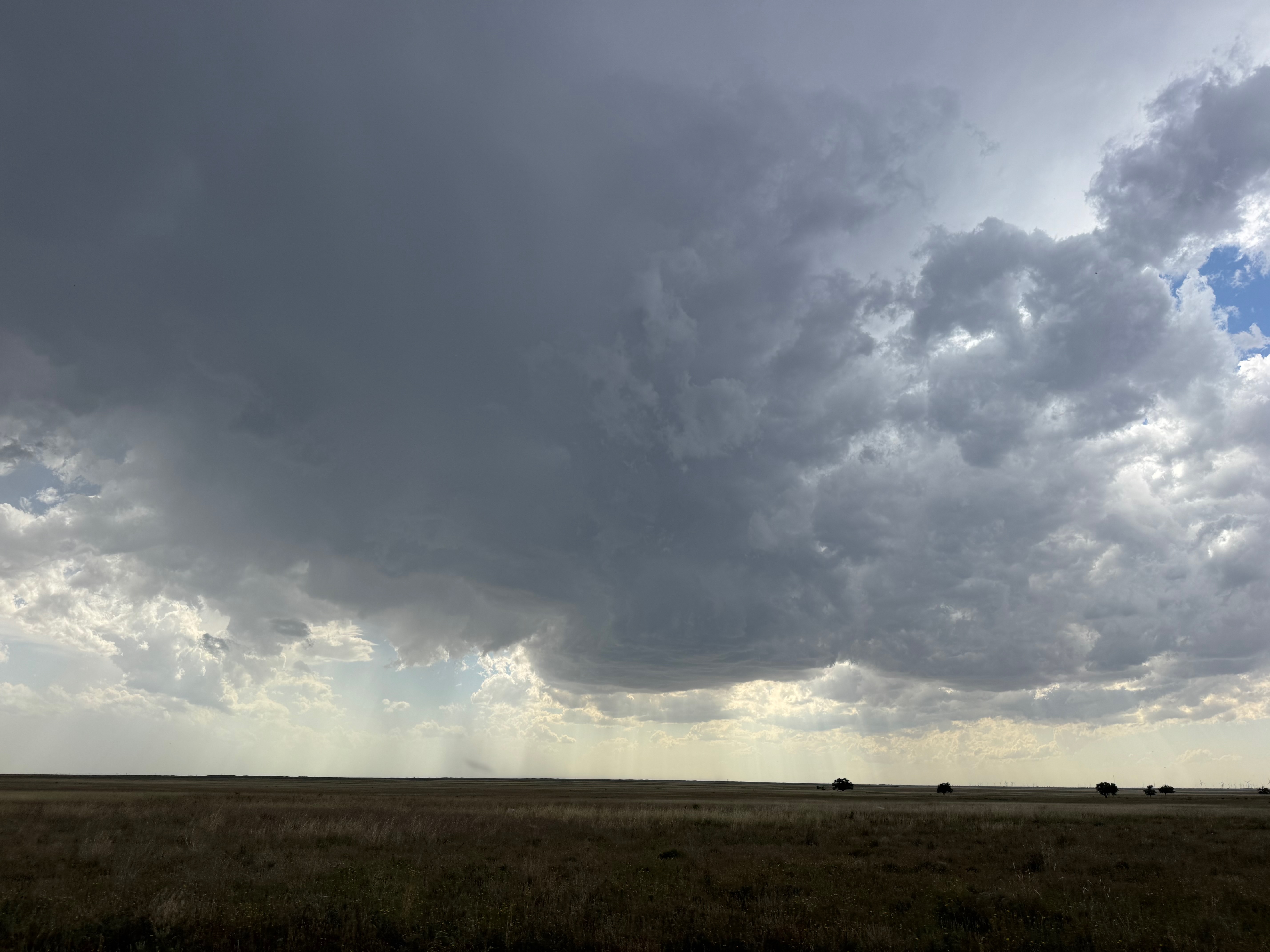
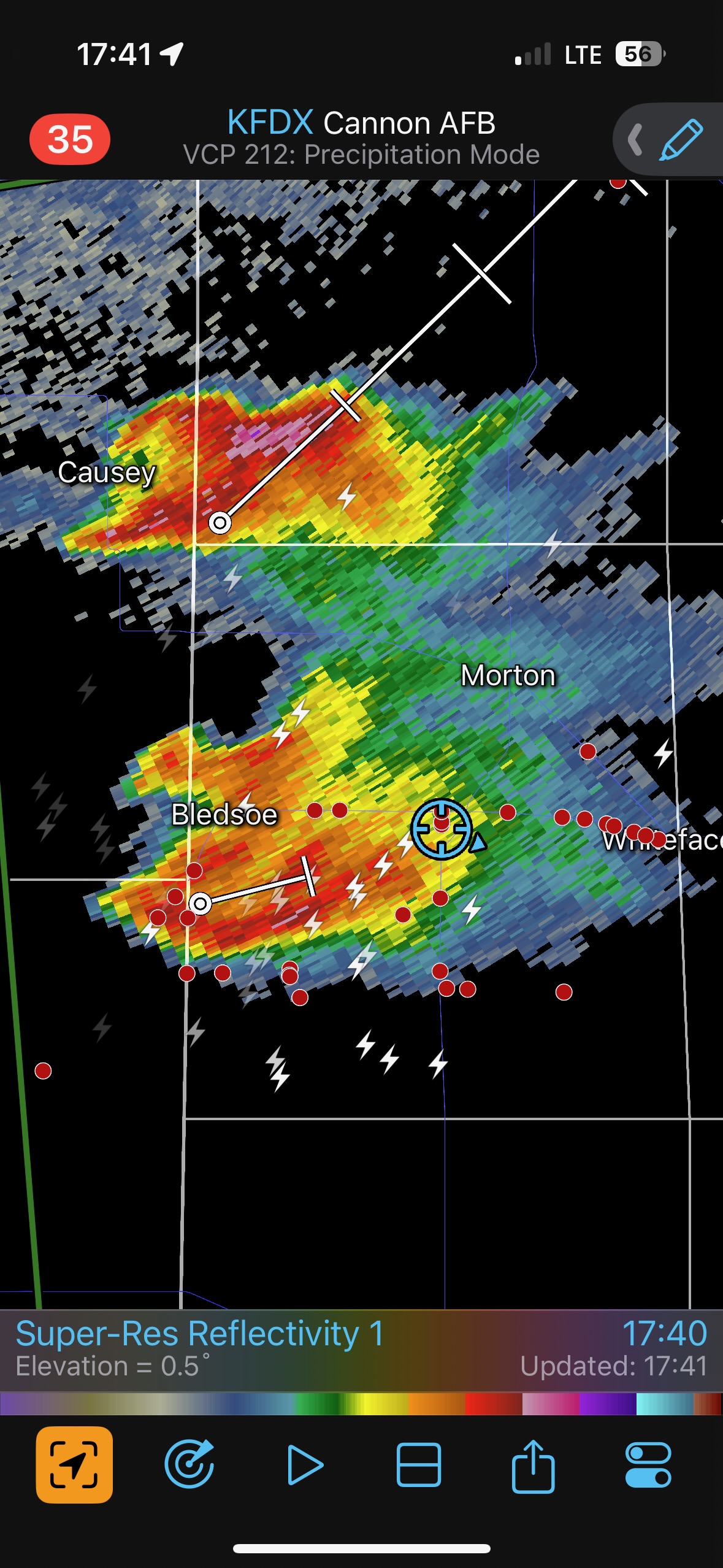
Like the day prior, conditions for severe weather and probably a tornado or two looked rather good west of the Lubbock area, out to the TX/NM border. A subtle E-W outflow boundary was again a player. See the map by SPC on the mesoscale discussion at 6:18 p.m. linked above. Unlike the day prior, we had plenty of time to have a relaxed and reasonably decent lunch in Morton. Yay! By mid-afternoon the cumulus clouds were percolating on the New Mexico side of the state line, and we drifted towards the Dora, NM, area to watch a storm develop.
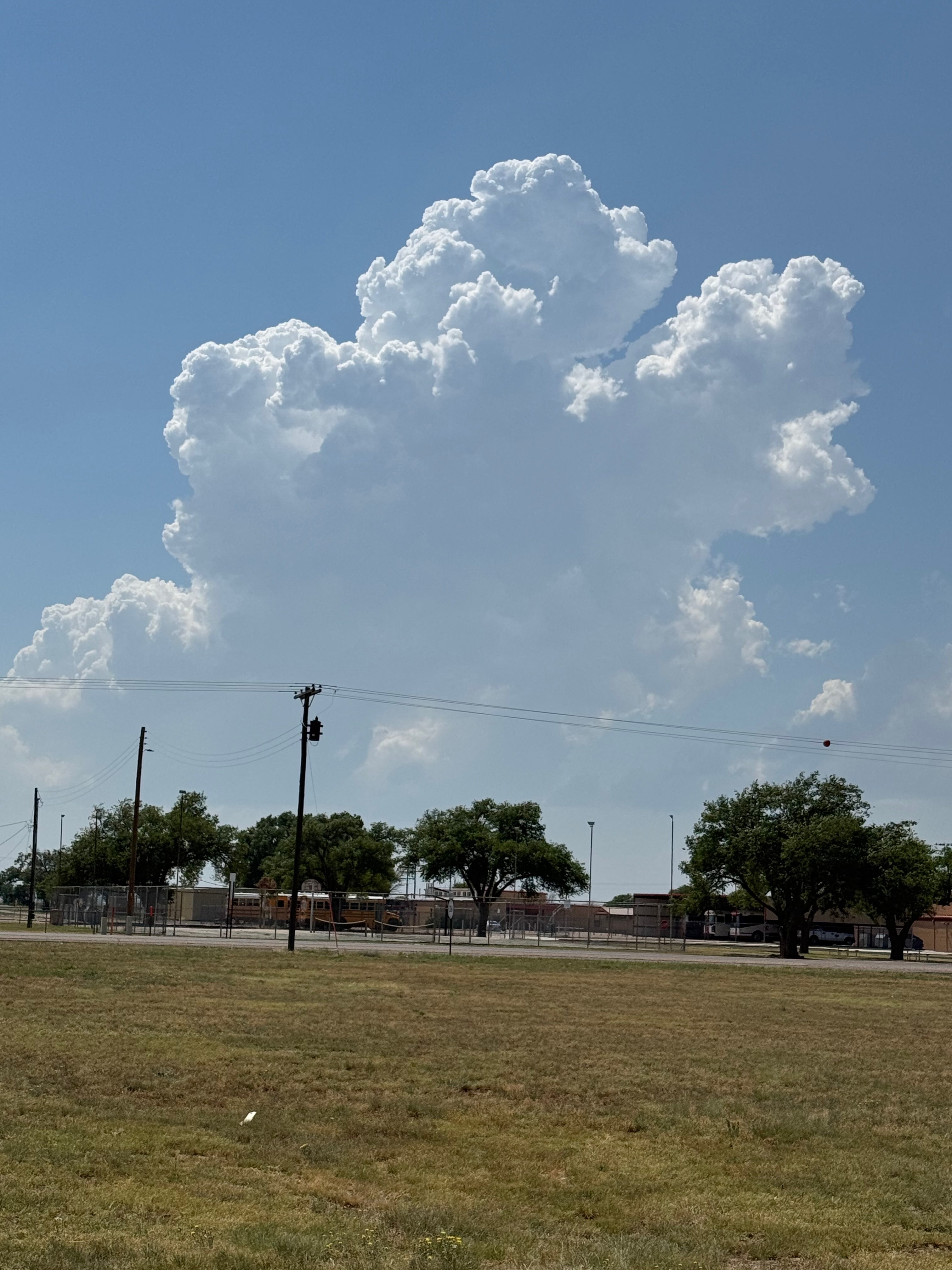
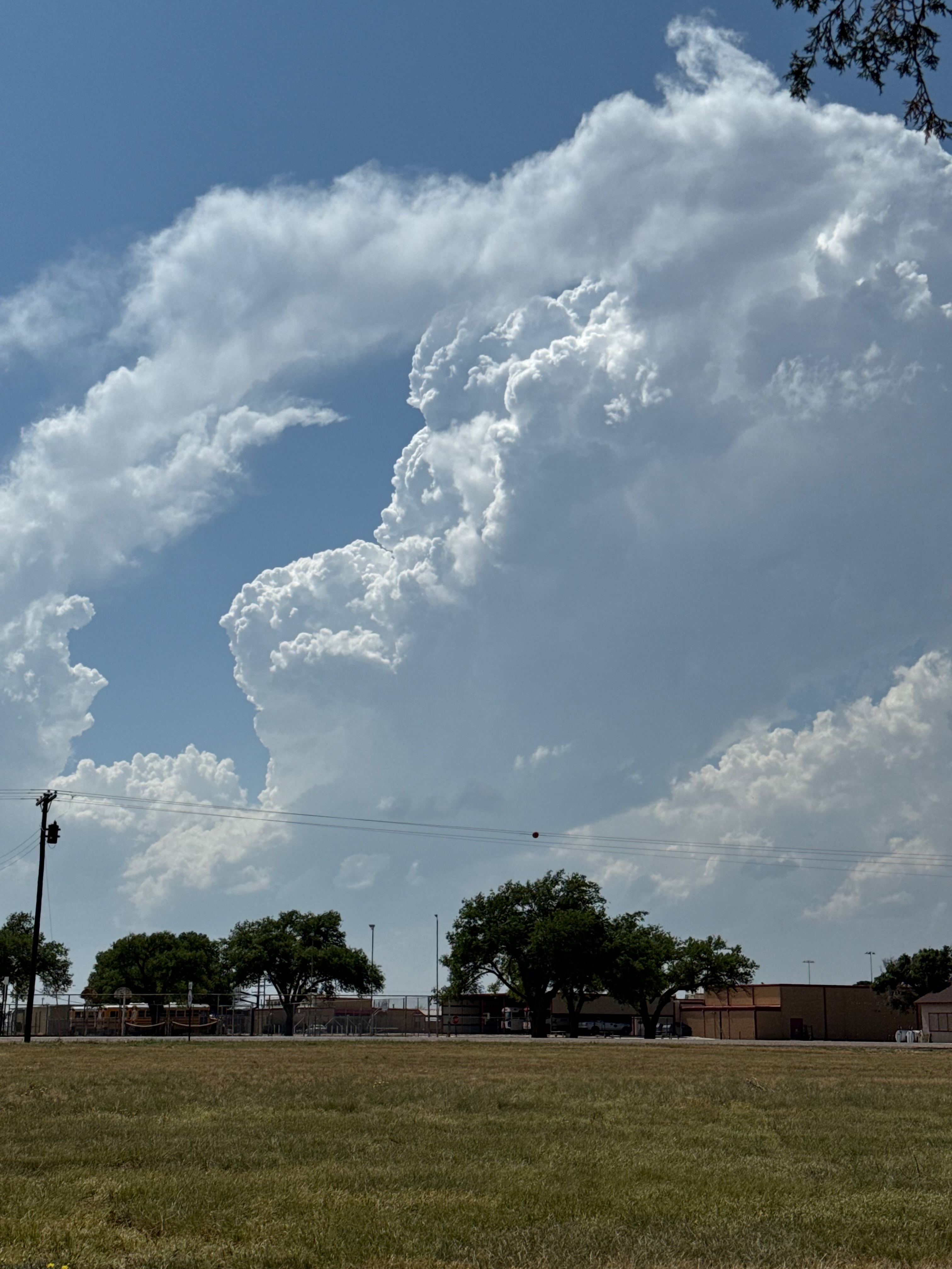
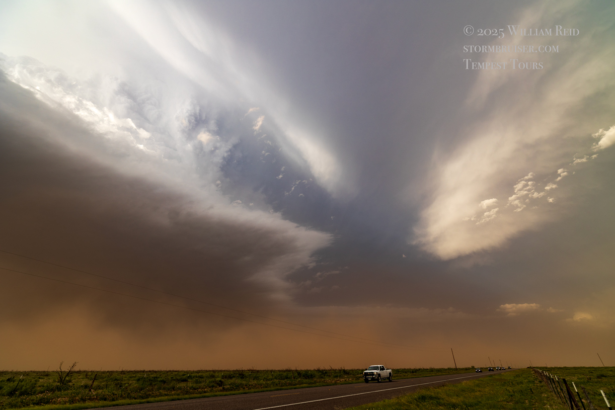
This one looked big and beefy for a bit, but another one to its south strengthened quickly. The southern one was close enough to the boundary to warrant close attention, and was close enough to the Dora updraft to throw shade and rain onto the Dora storm’s inflow region. We don’t like that, so I had Alex and Matt take the group south and east a little to get in front of the “Bledsoe” storm.
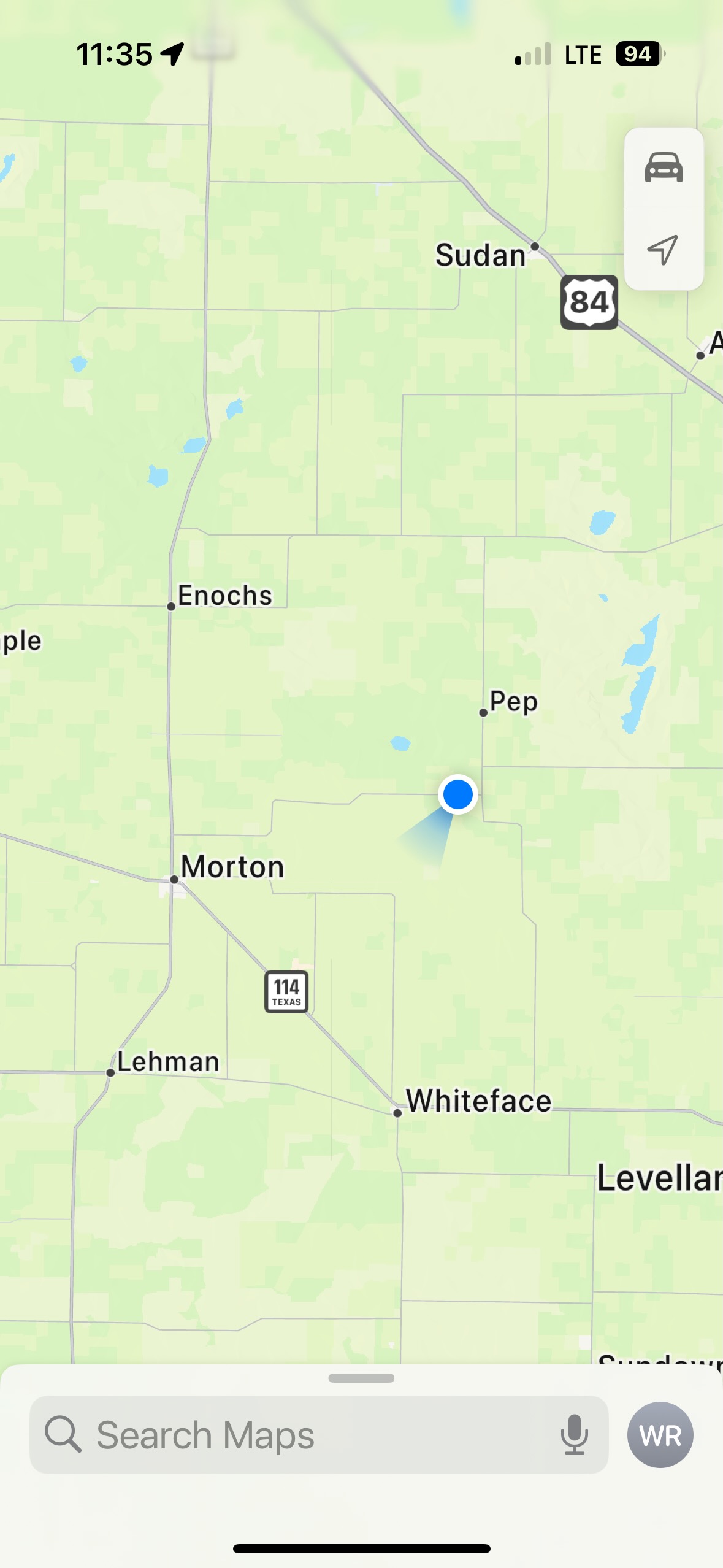
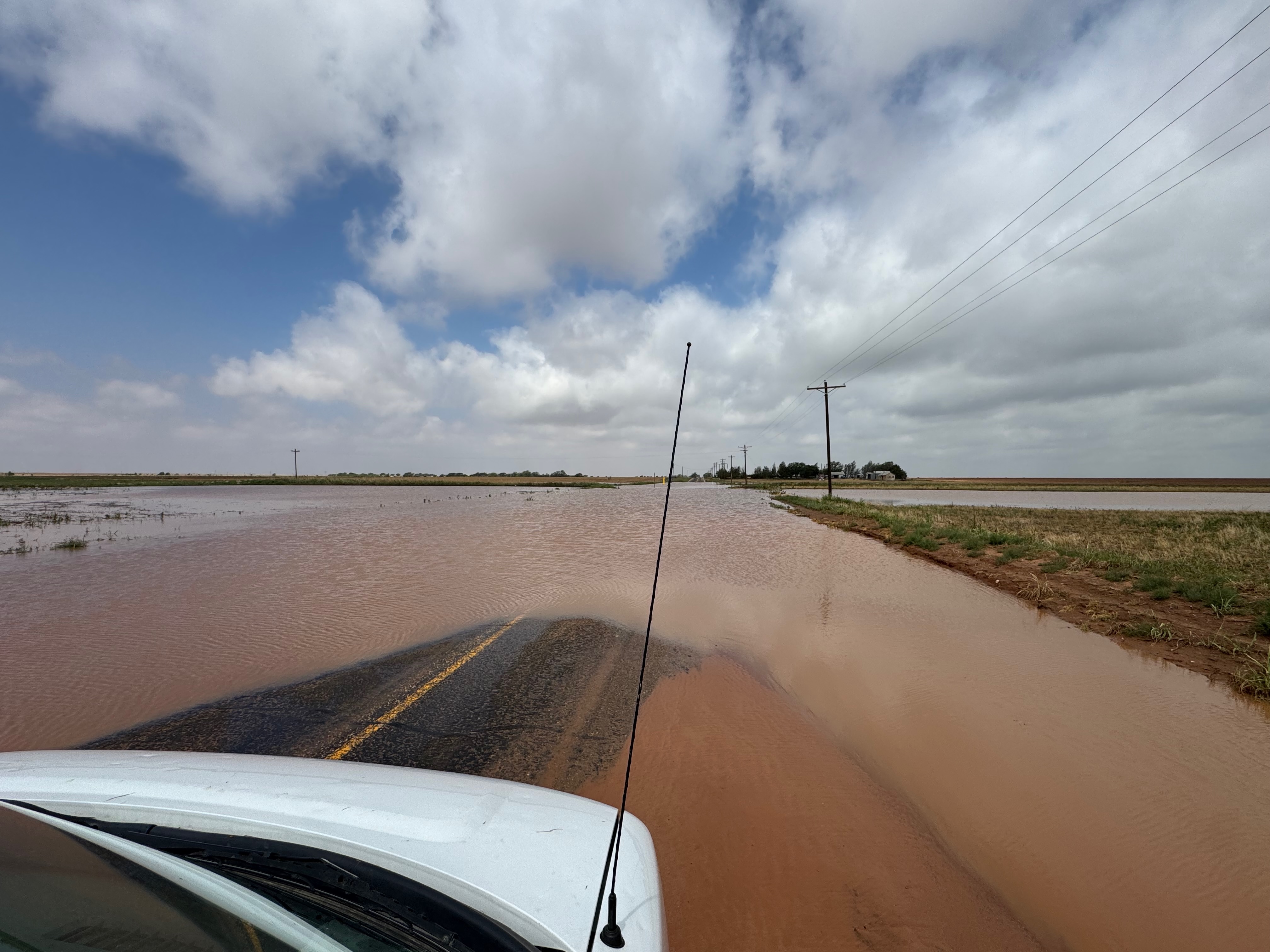
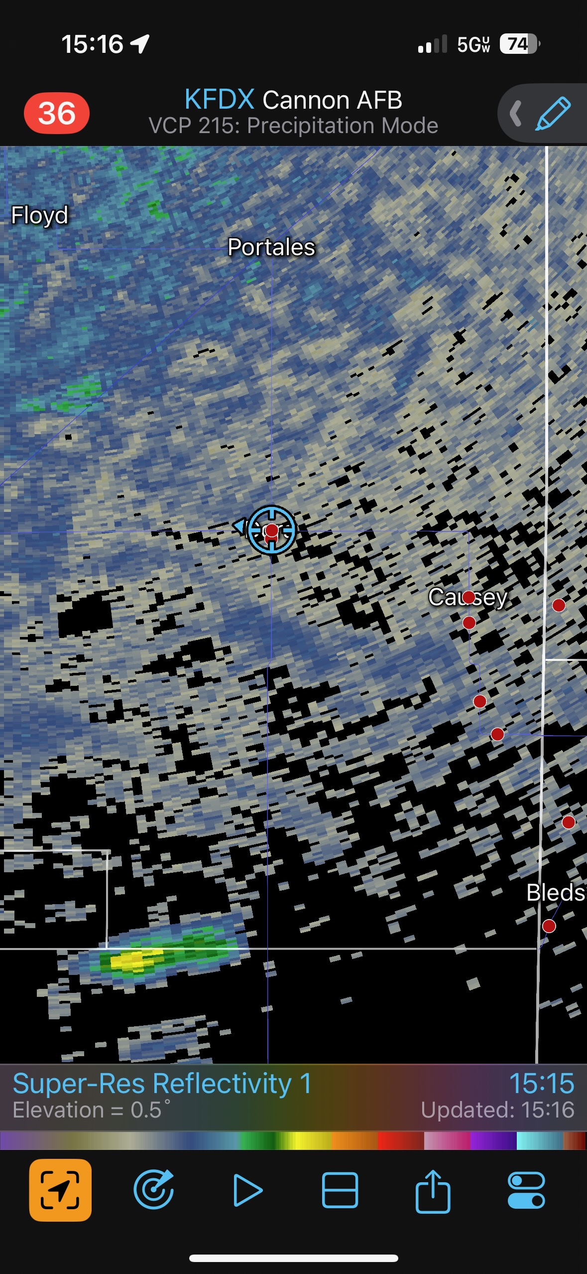
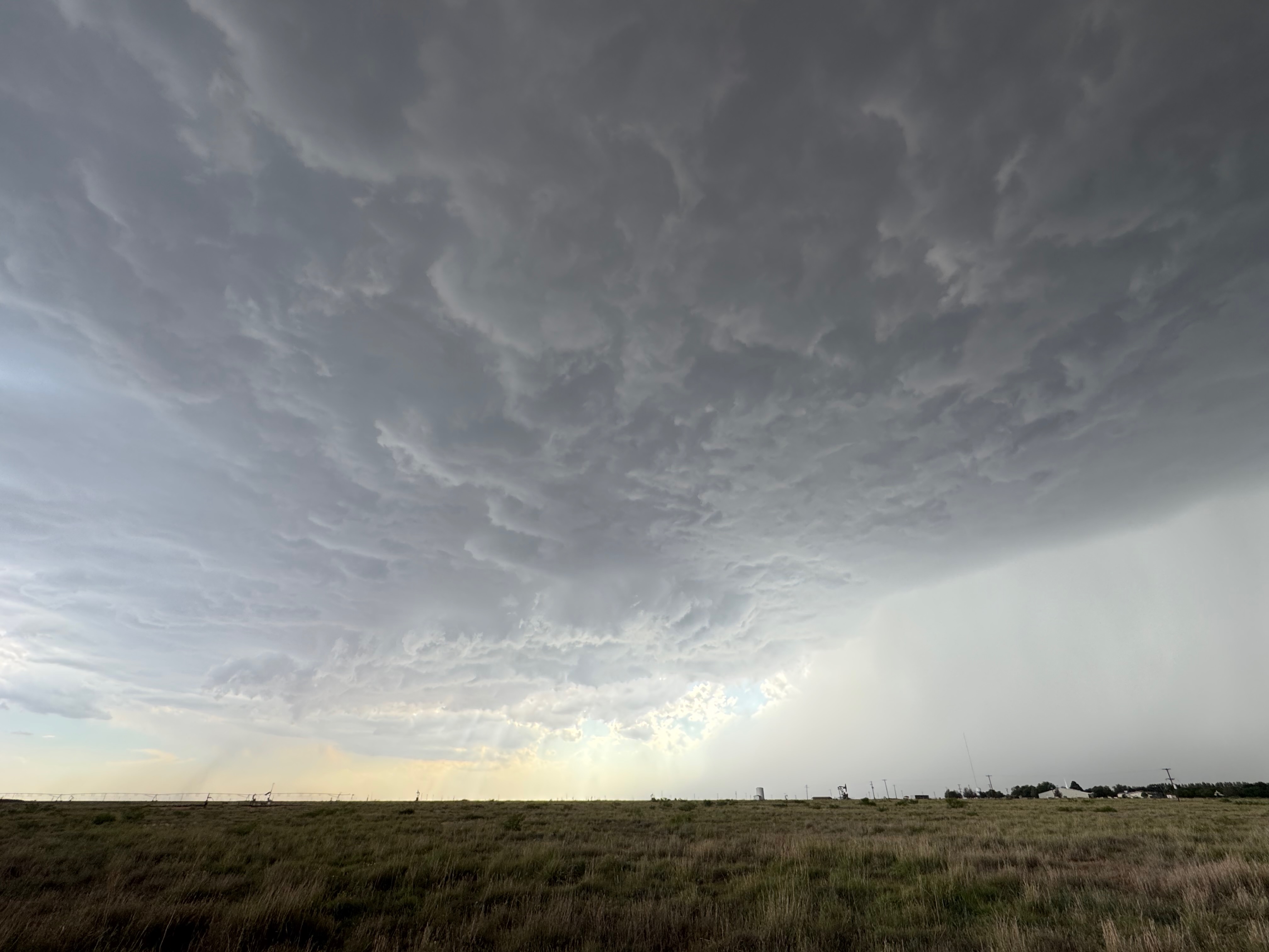
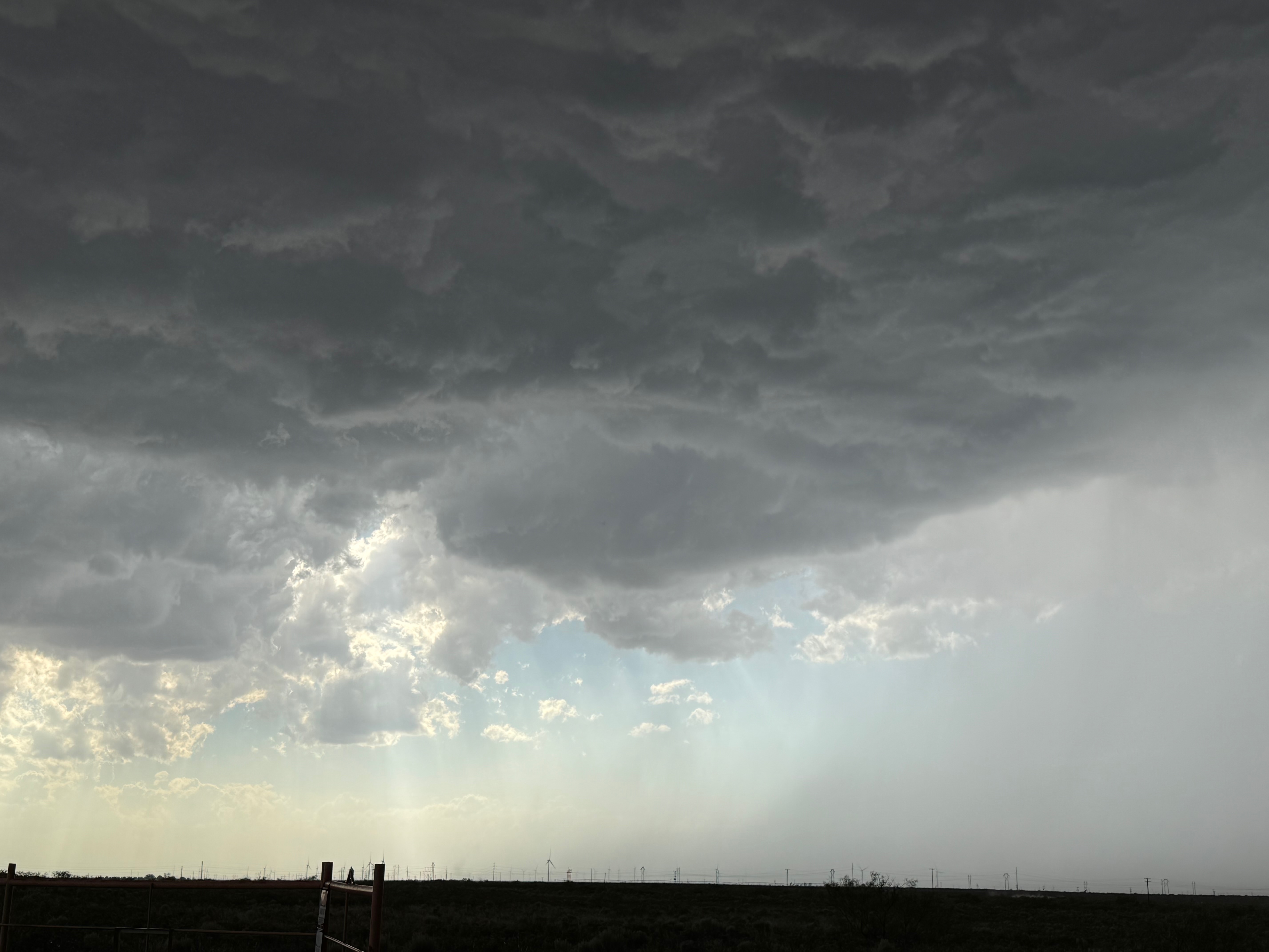
The first three photos below show a flooded E-W road south of Pep. This was due to the nasty supercell just north of Morton (that we chased) on the day prior. (And perhaps due also to additional nighttime storms.) We had to take an alternate route to Morton for lunch. The other photos in the group below show our location and the developing storm northwest of Dora; and the nice and moist backed winds in the Clovis area.

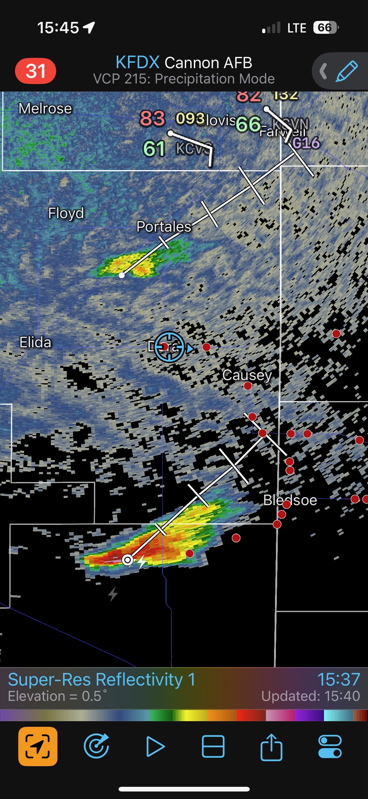
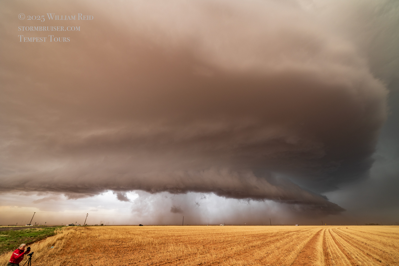
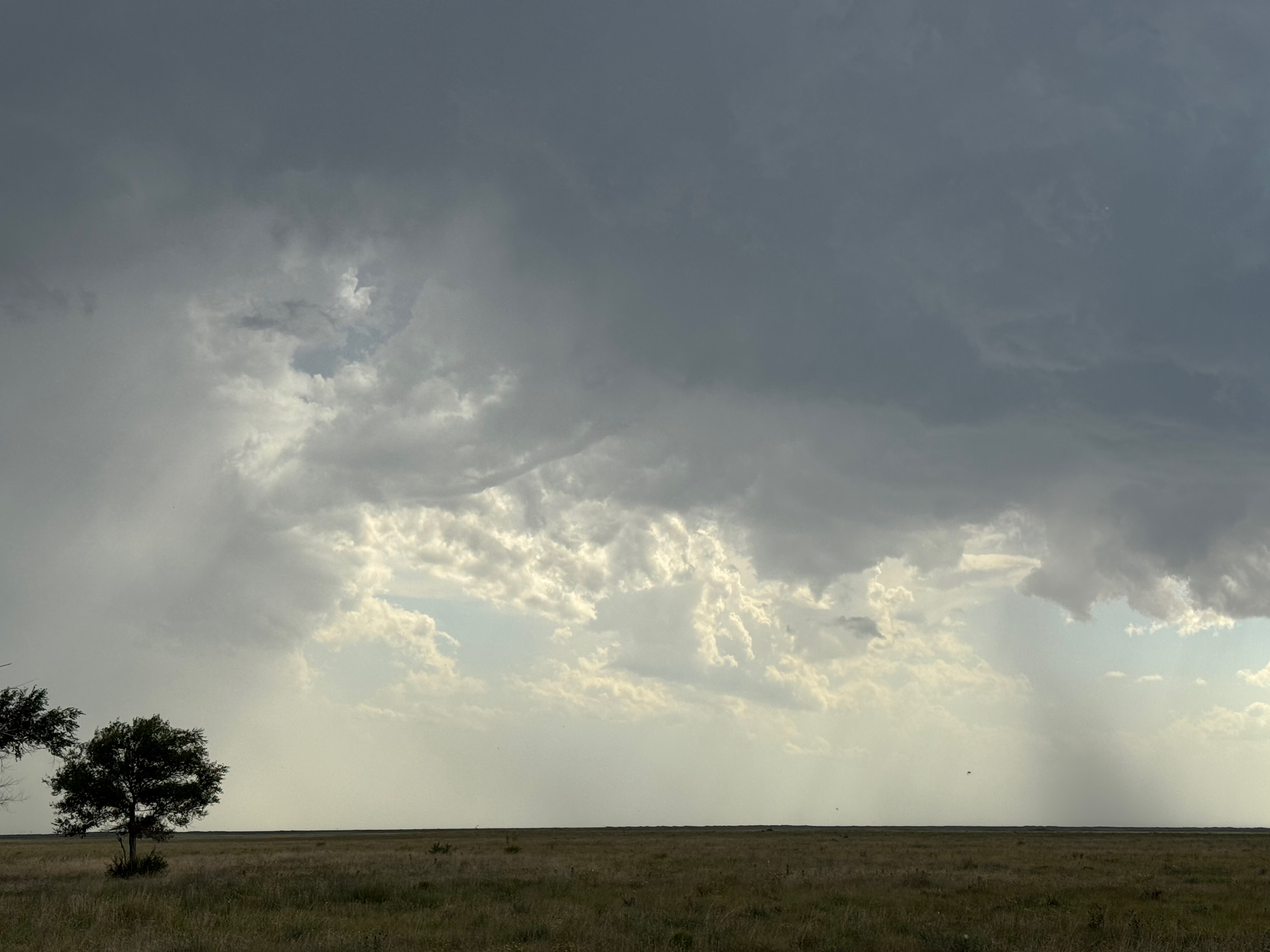
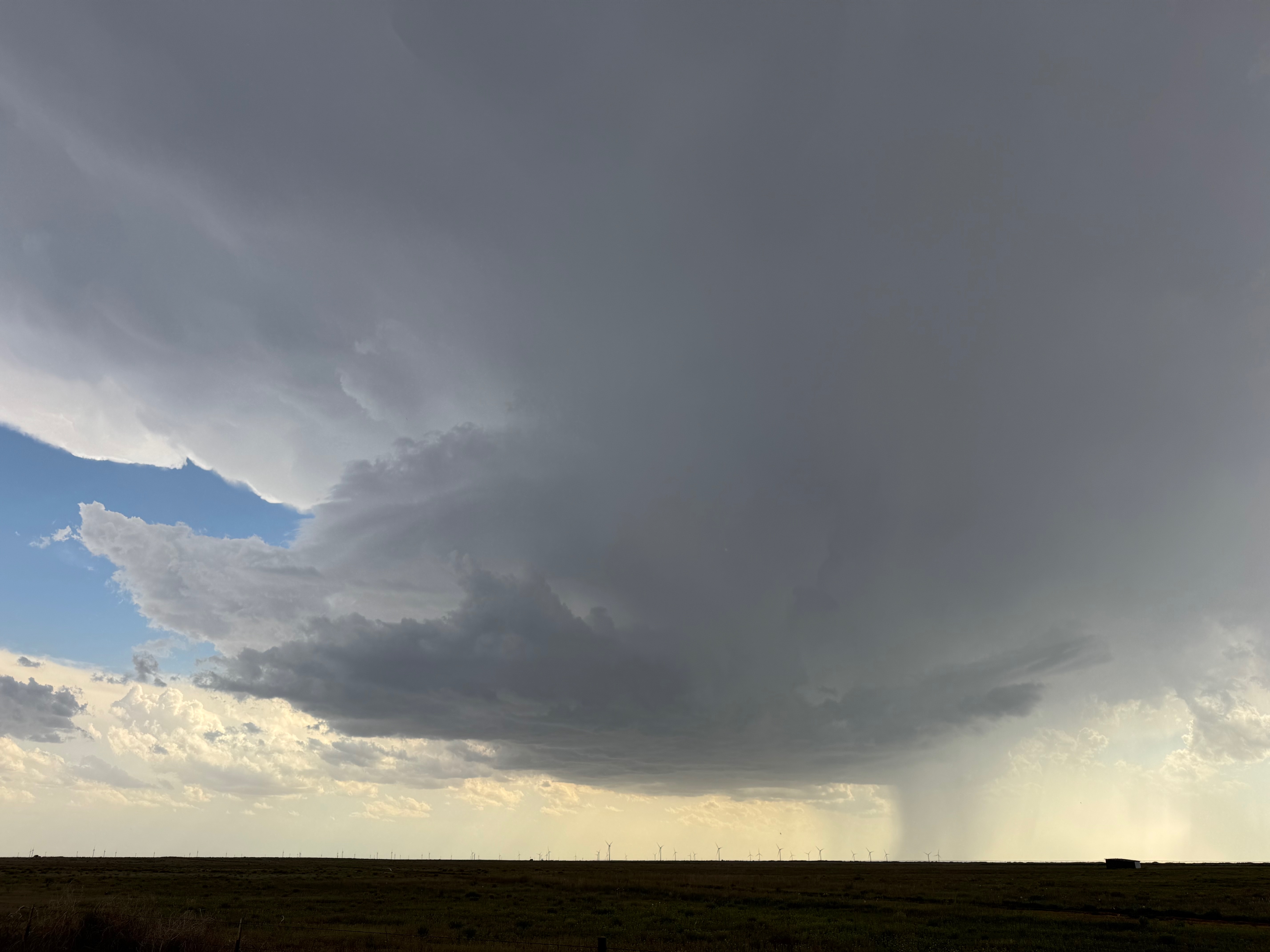
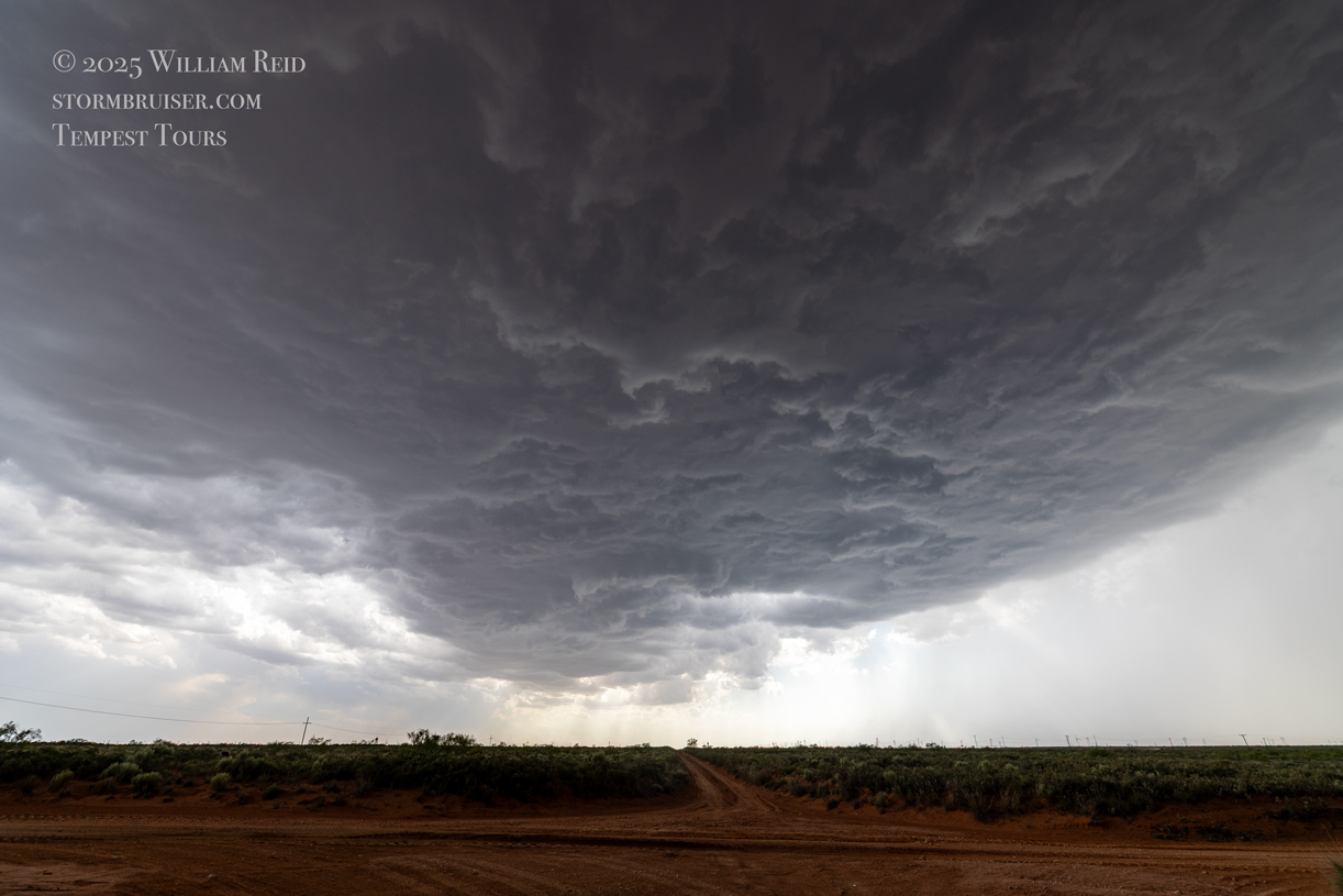
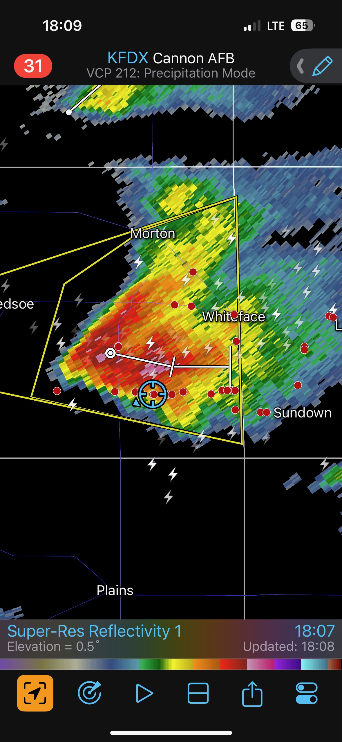
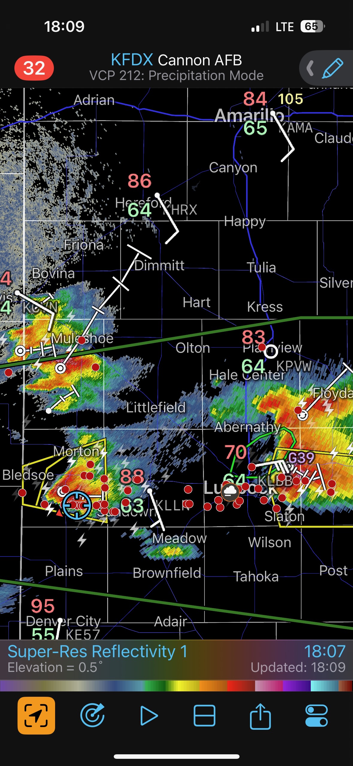
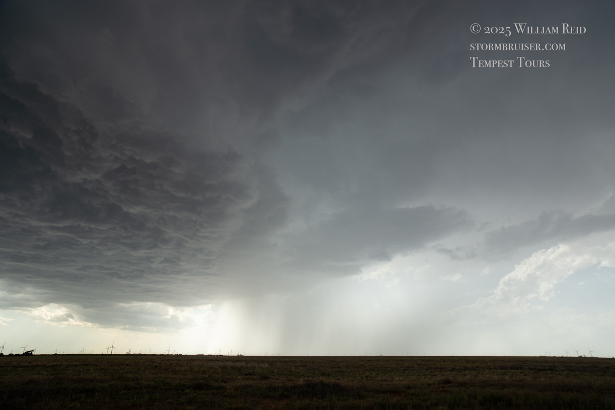
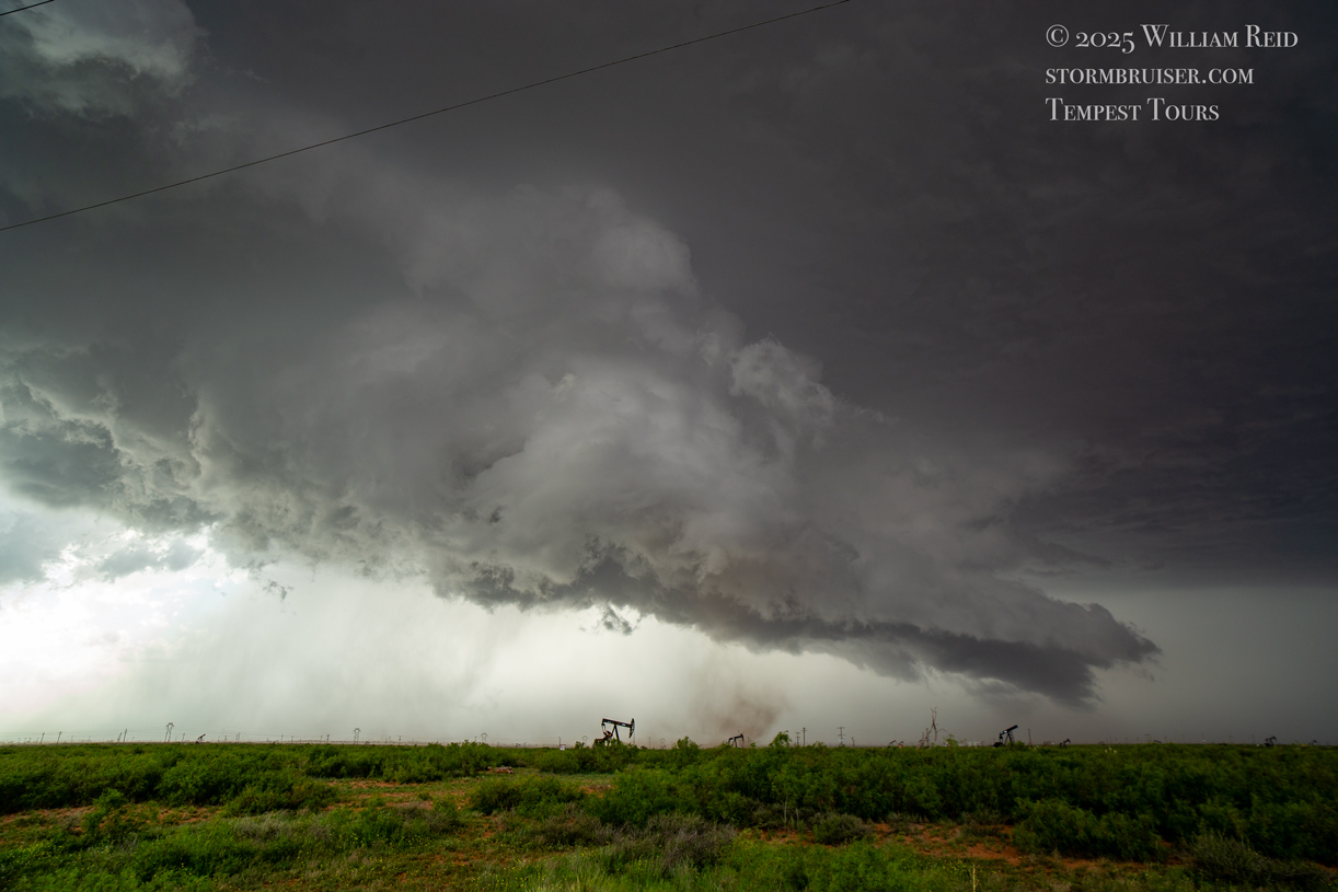
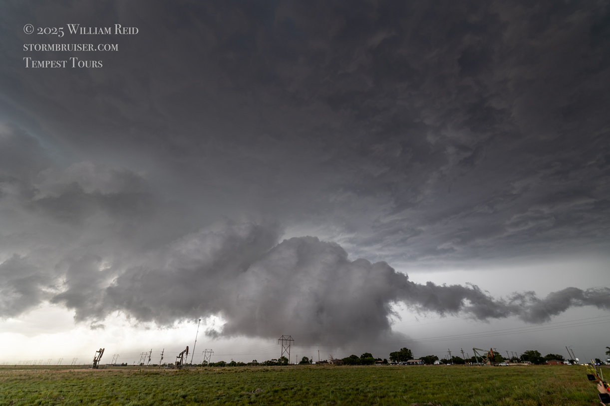
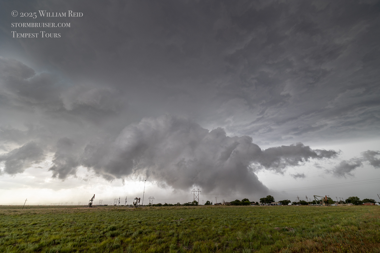
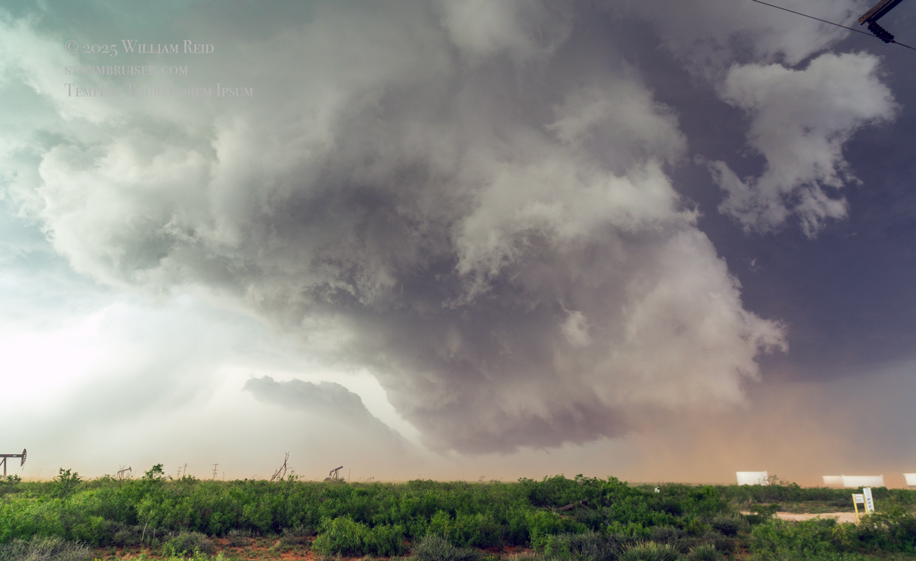
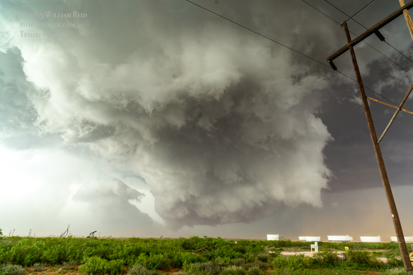
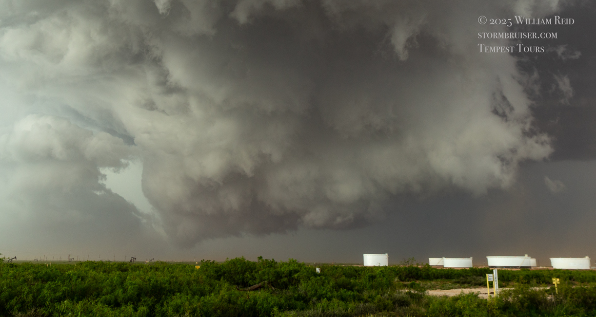
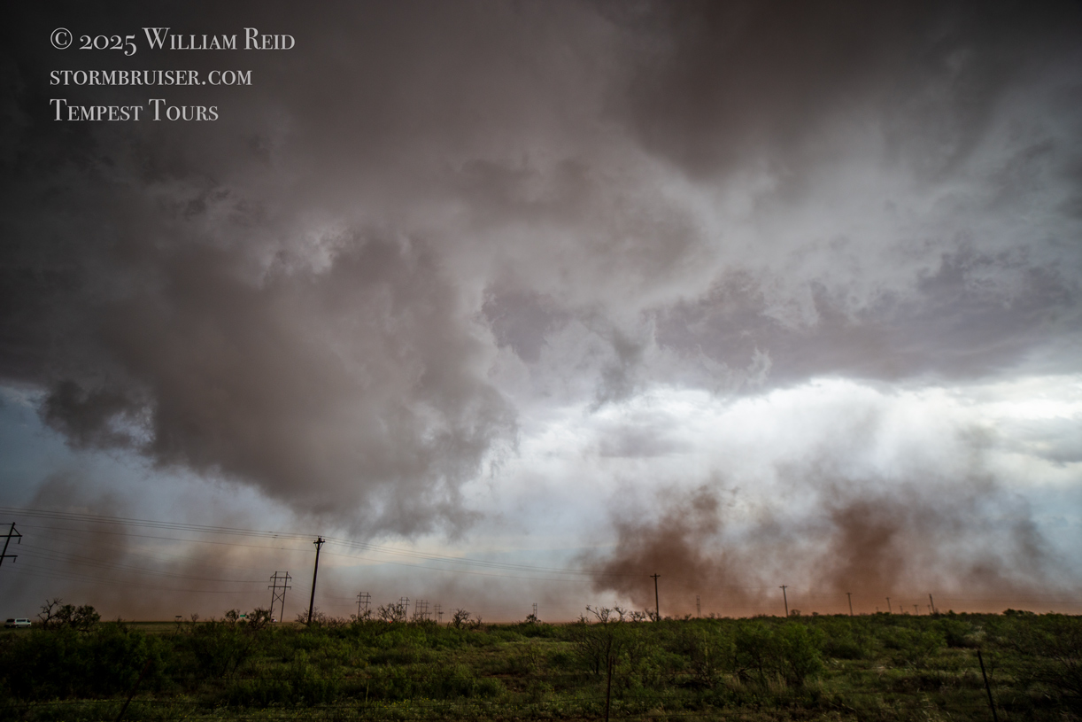
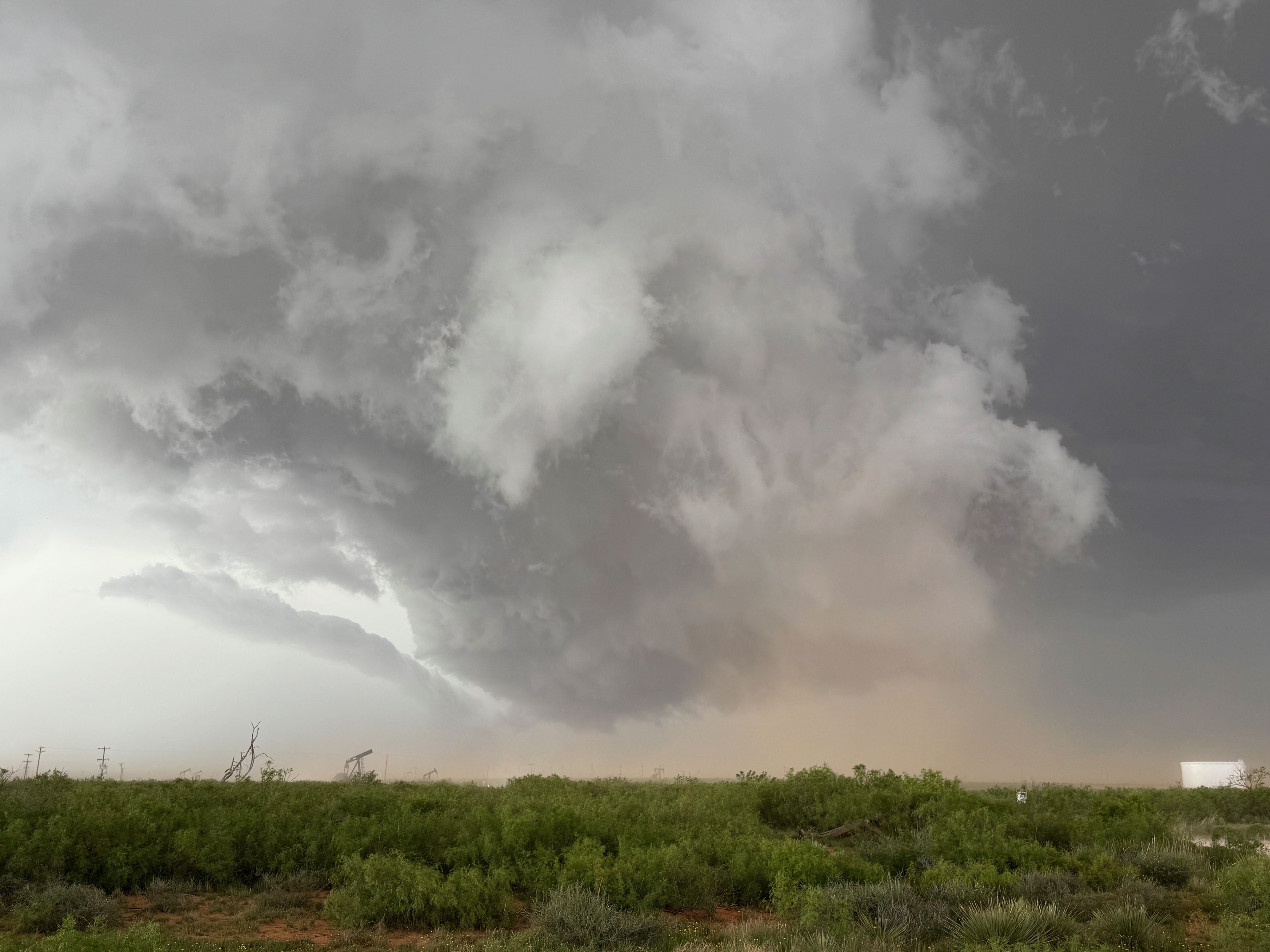
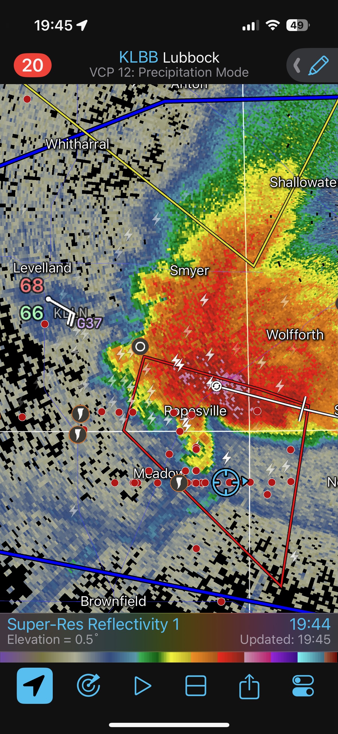
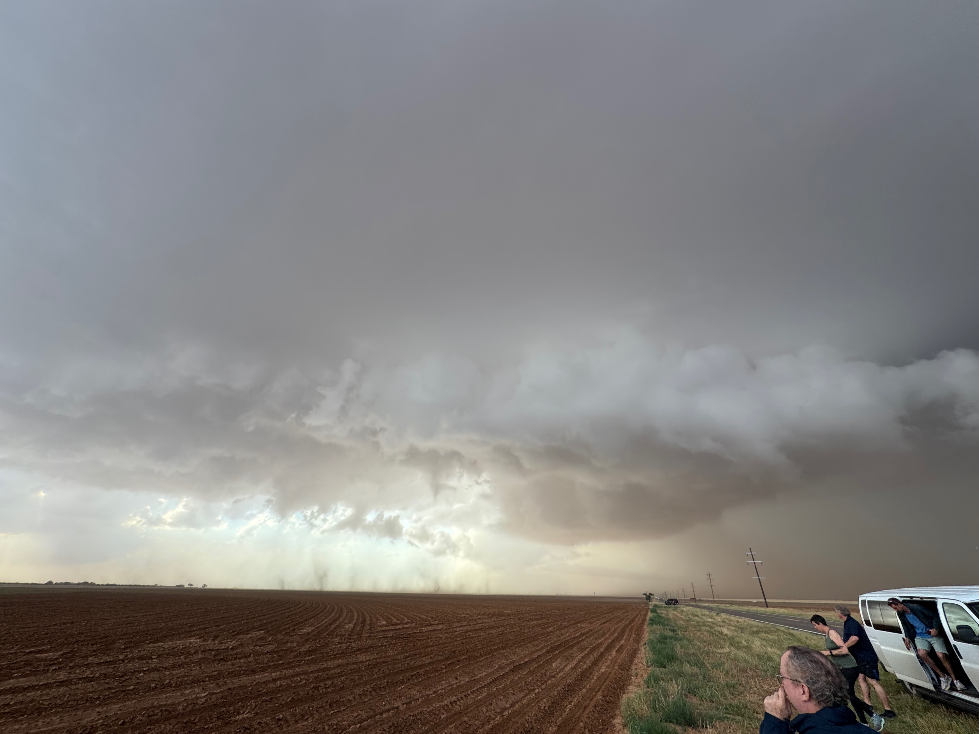
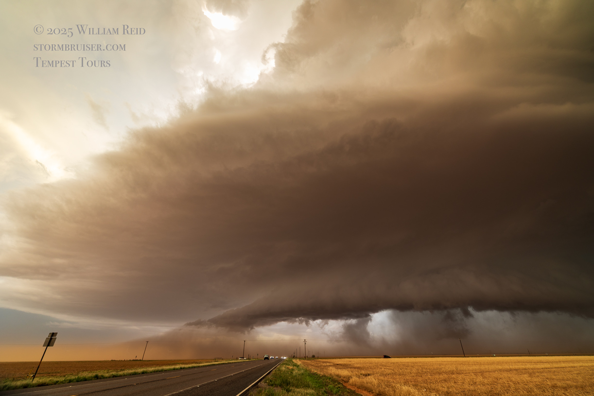
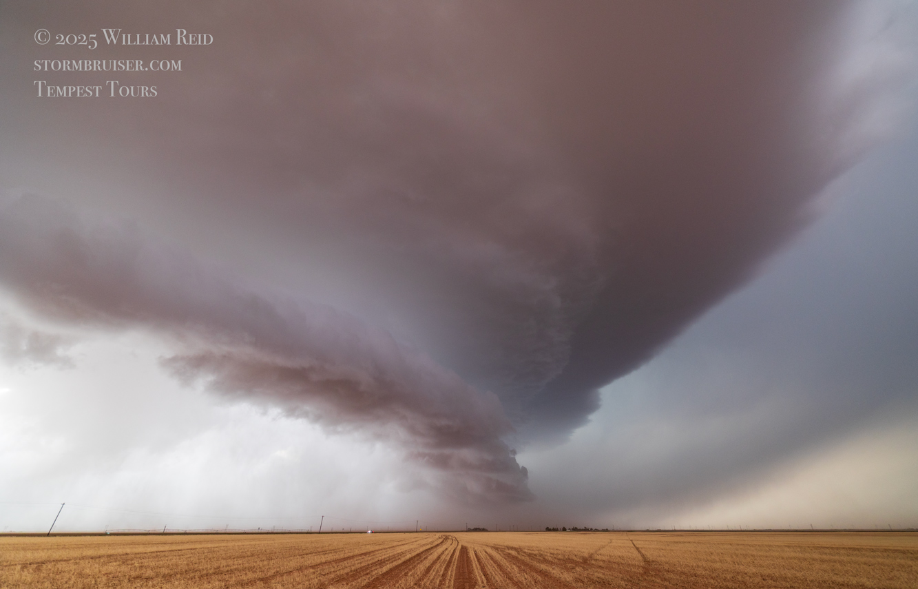
We easily made it in front of the intensifying Bledsoe supercell in Cochran County, TX. There was a skinny horizontal funnel aloft along the storm base and some decent storm structure east of Bledsoe. As is often the case, when precipitation increased in and around the updraft base, the base lowered some and more RFD dust and spin-ups transpired. The storm was poking along eastward. We were forced south some, southwest of Whiteface and west of Sundown. Baseball-sized hail was reported 13 miles southeast of Bledsoe, and we made sure to avoid that. A position directly east of the storm base seemed to be fairly safe along the road west of Sundown.
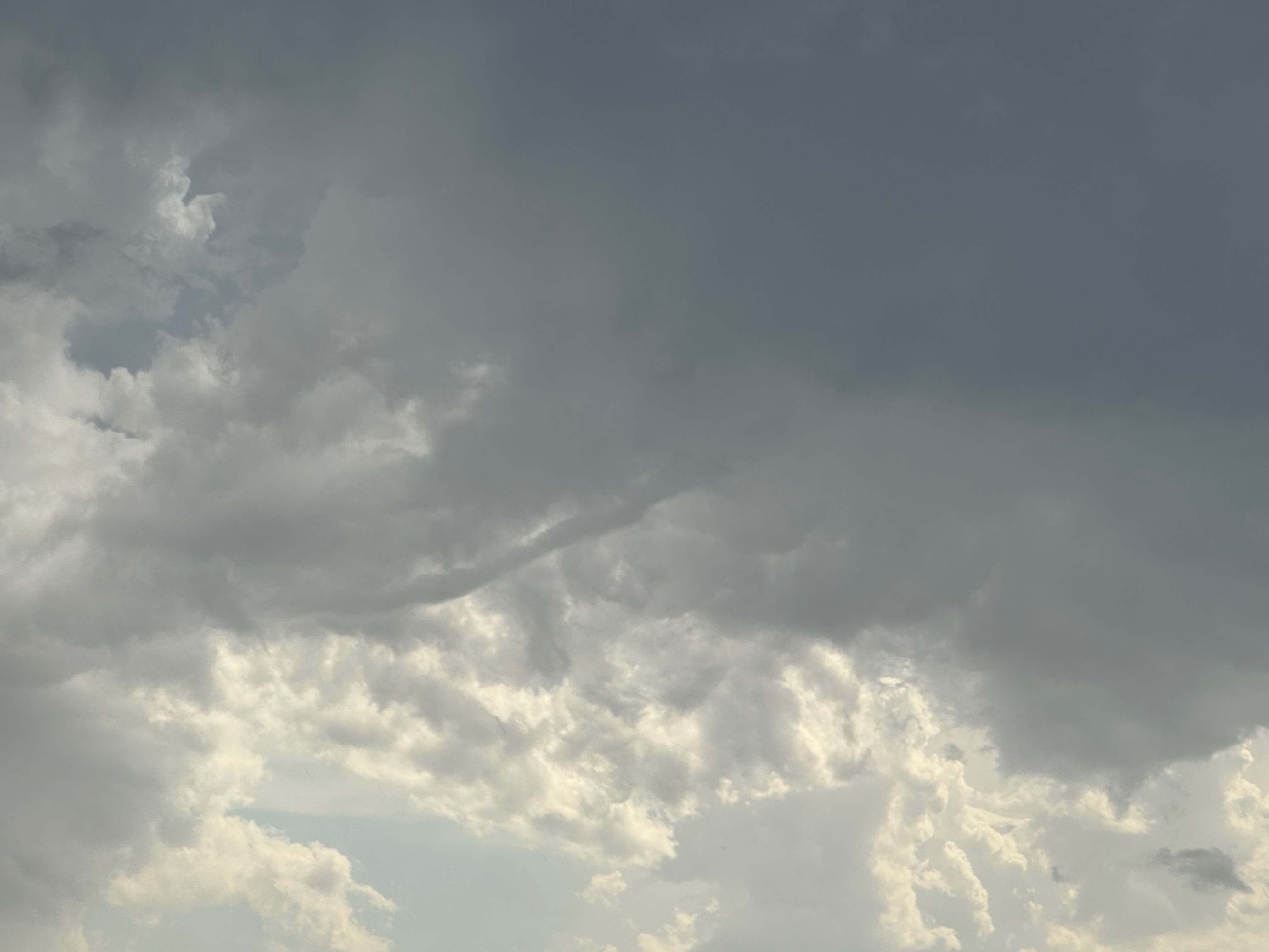
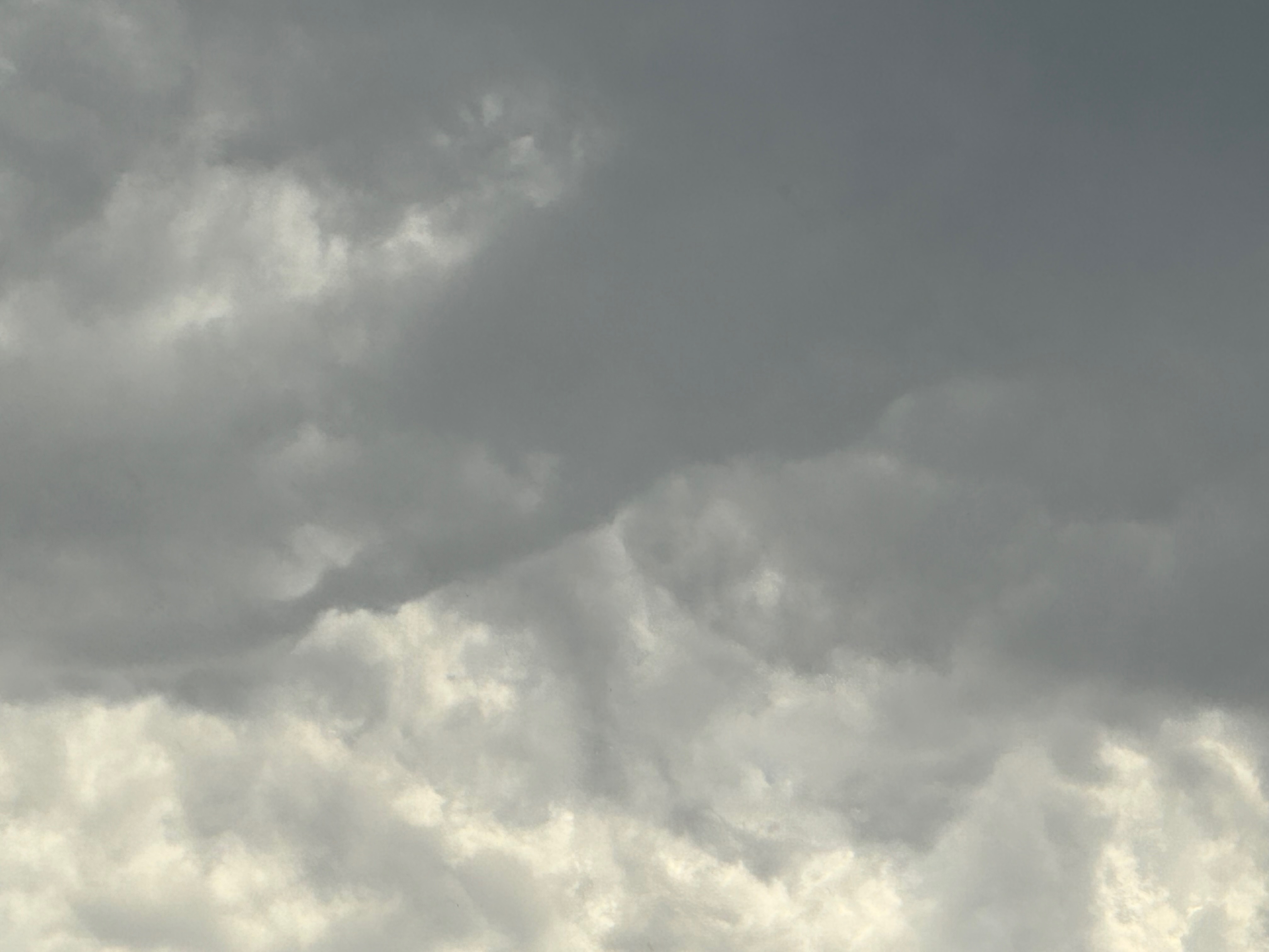
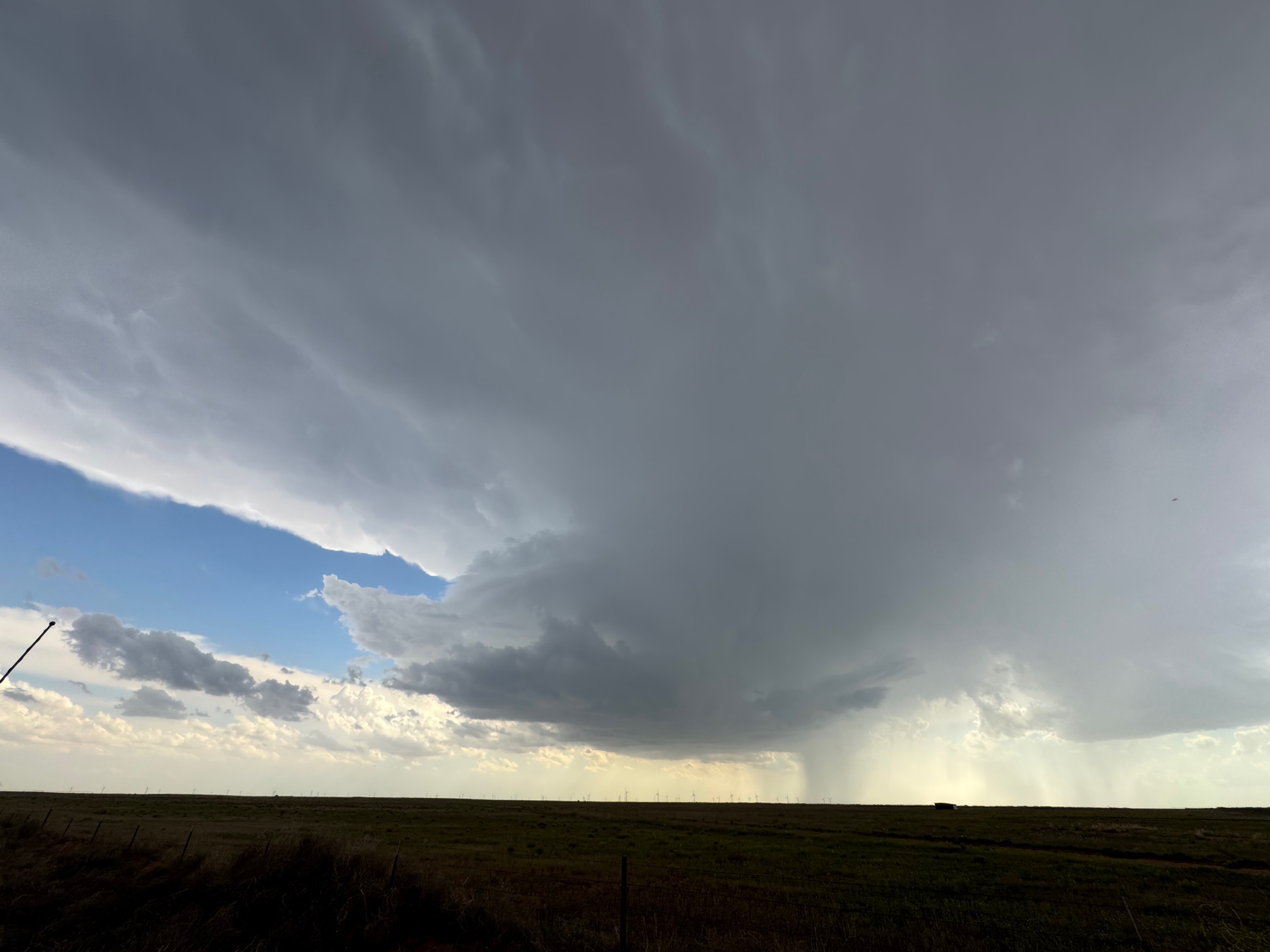
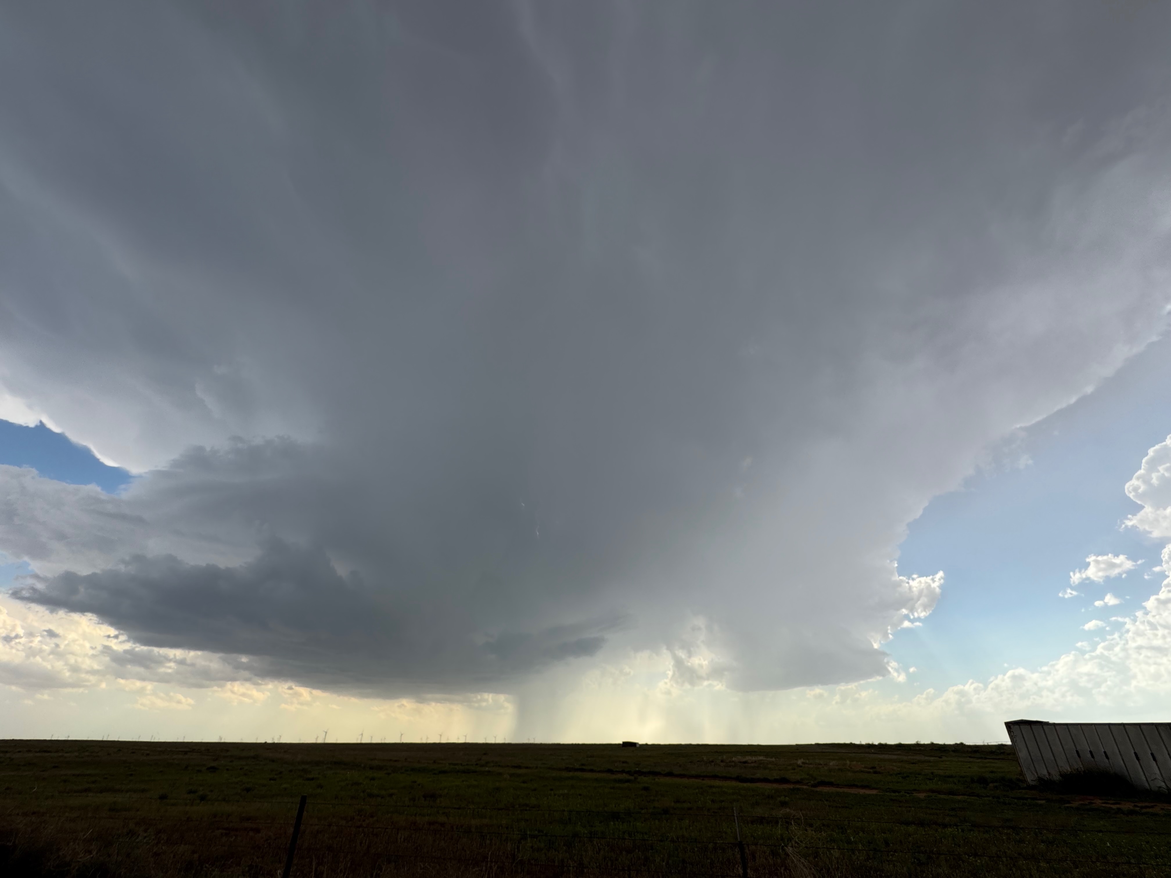
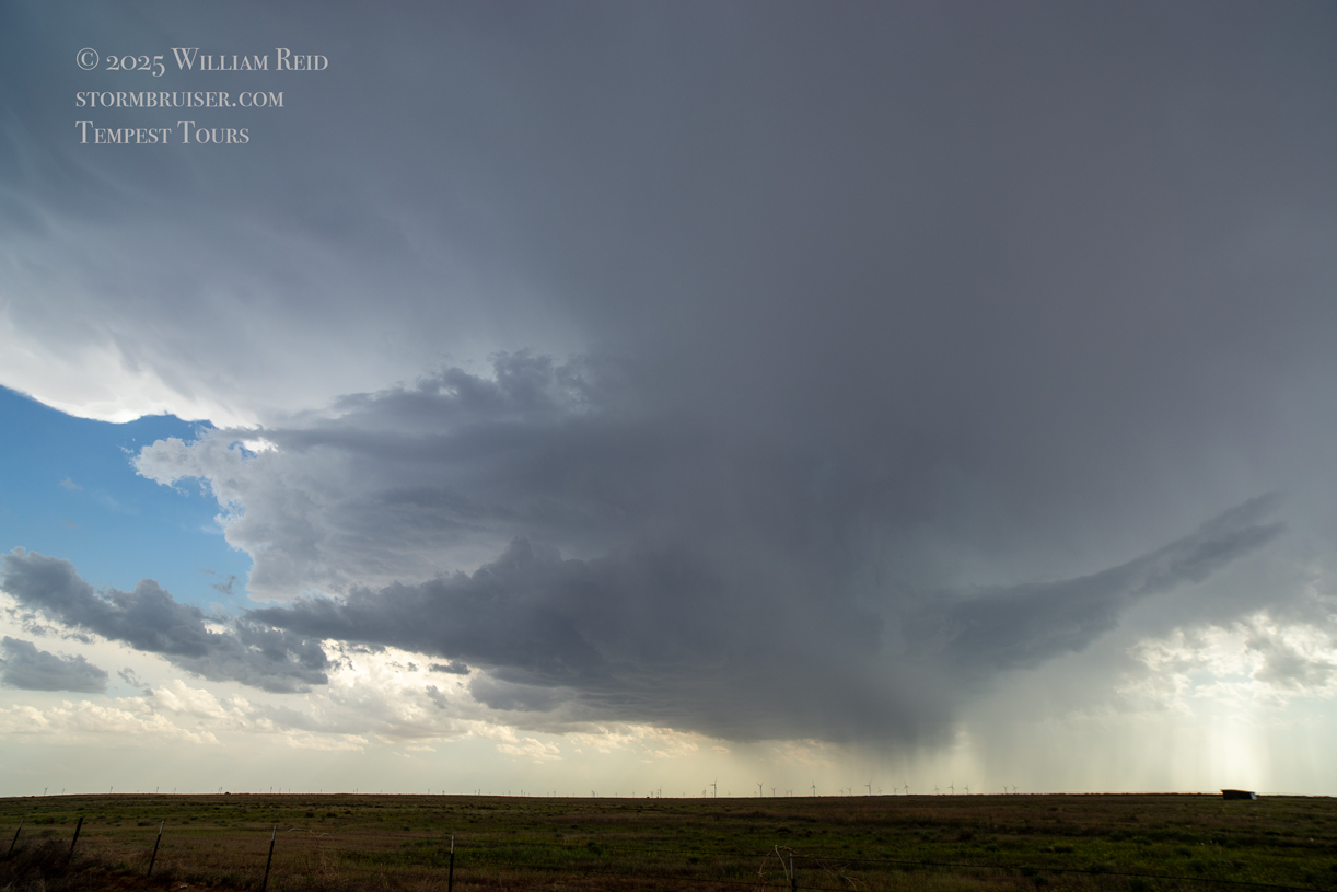
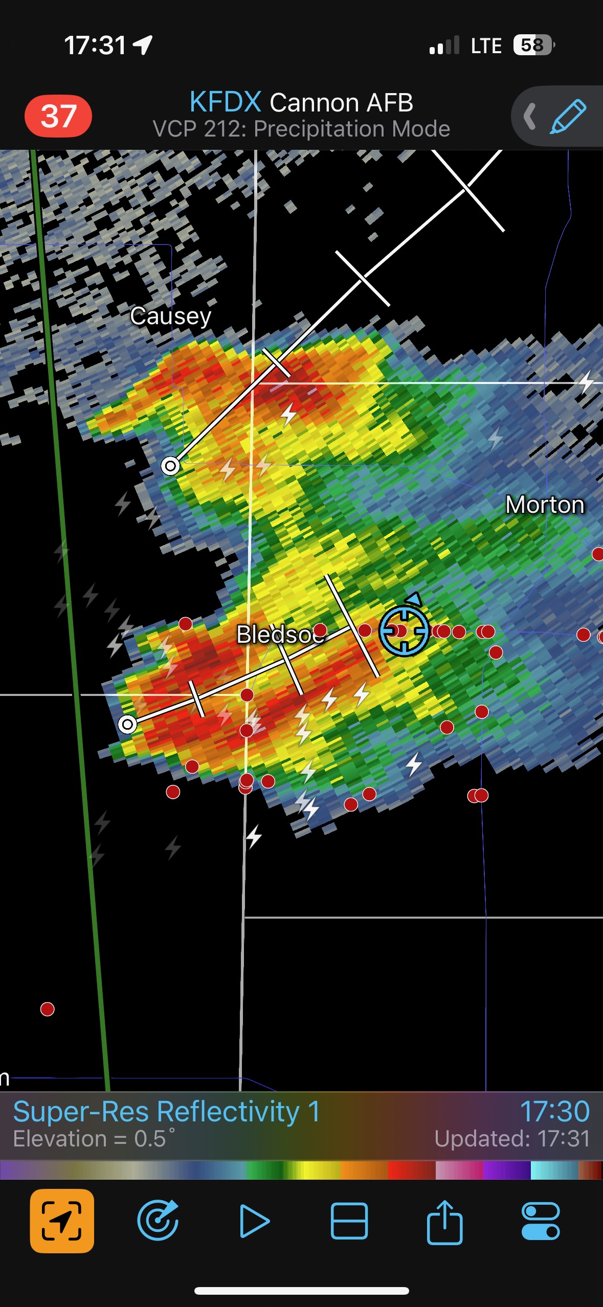
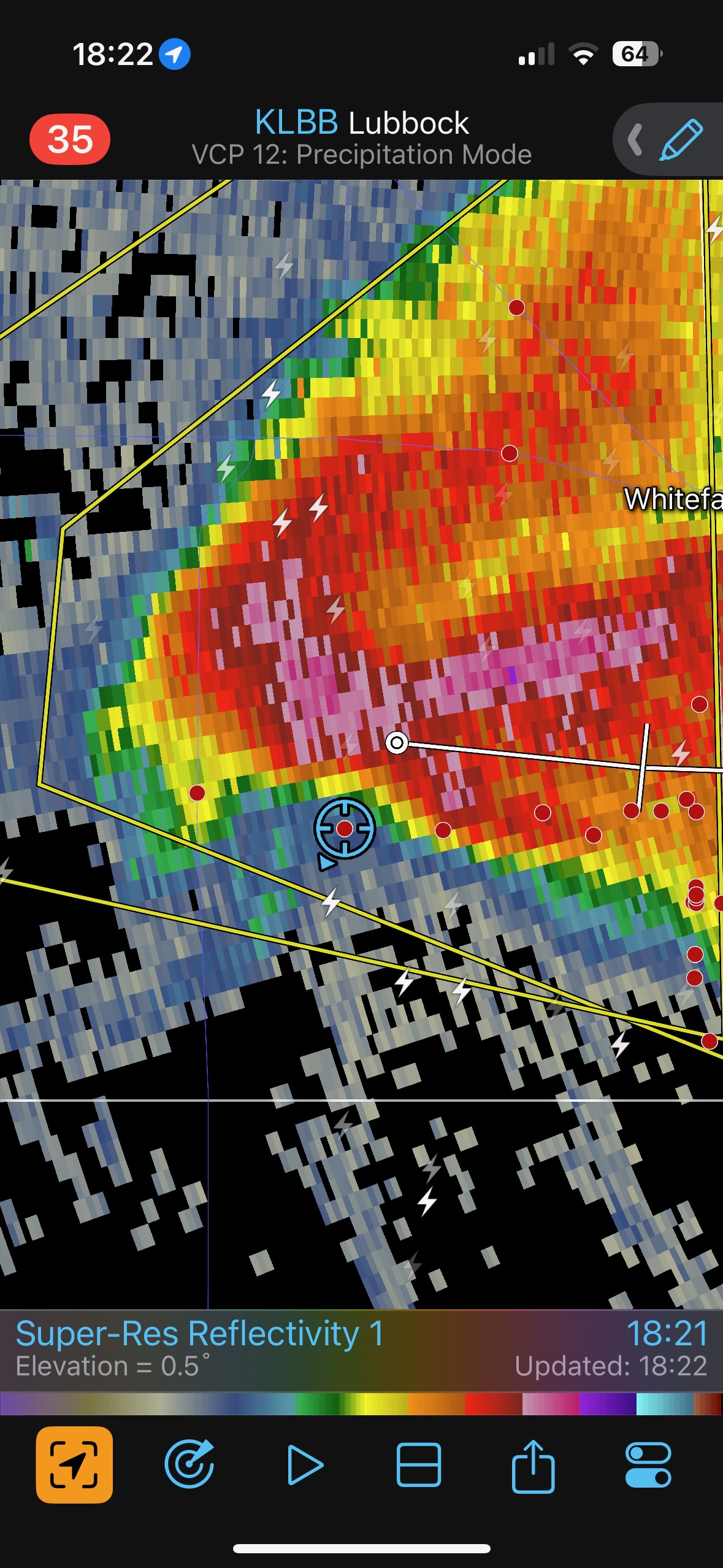
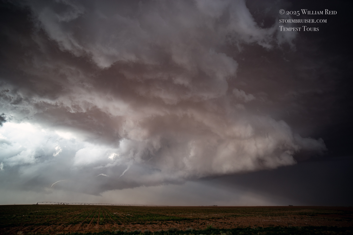
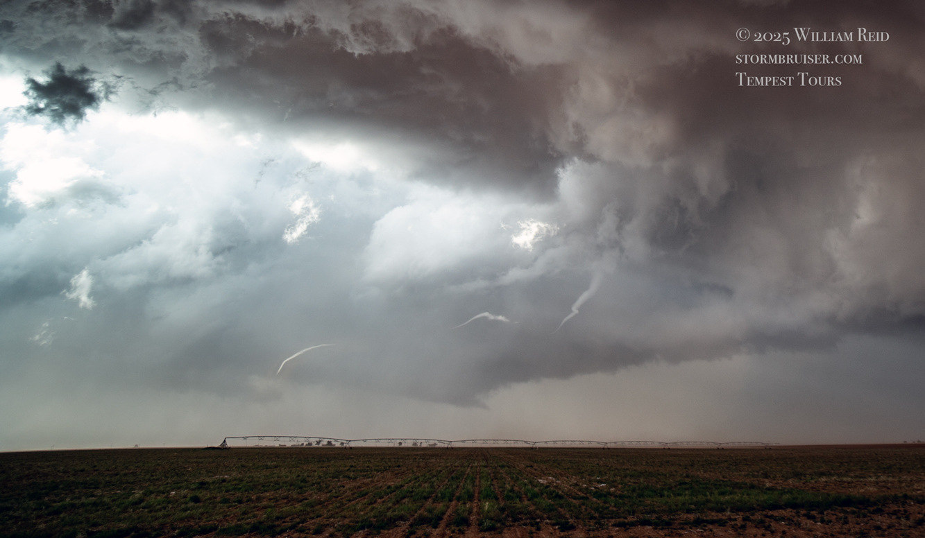
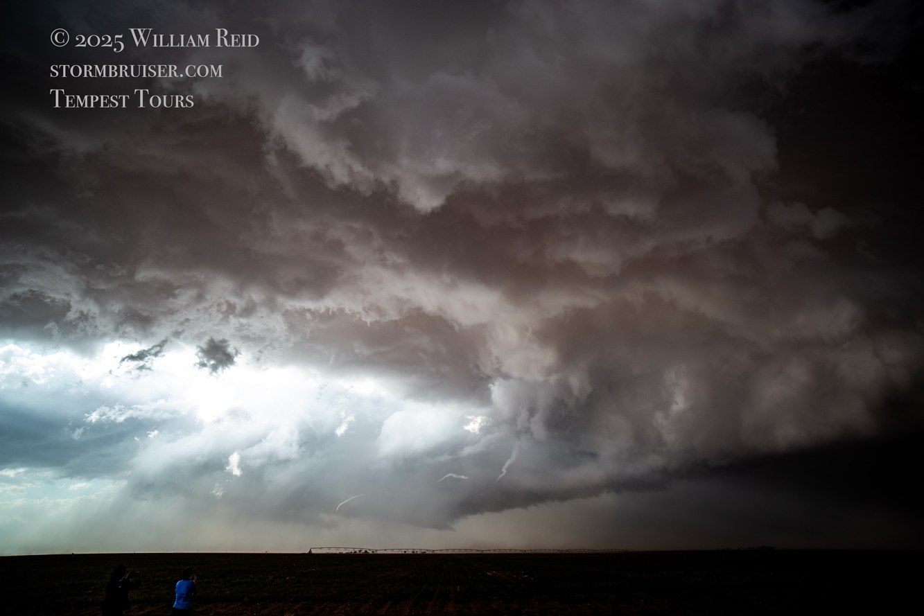
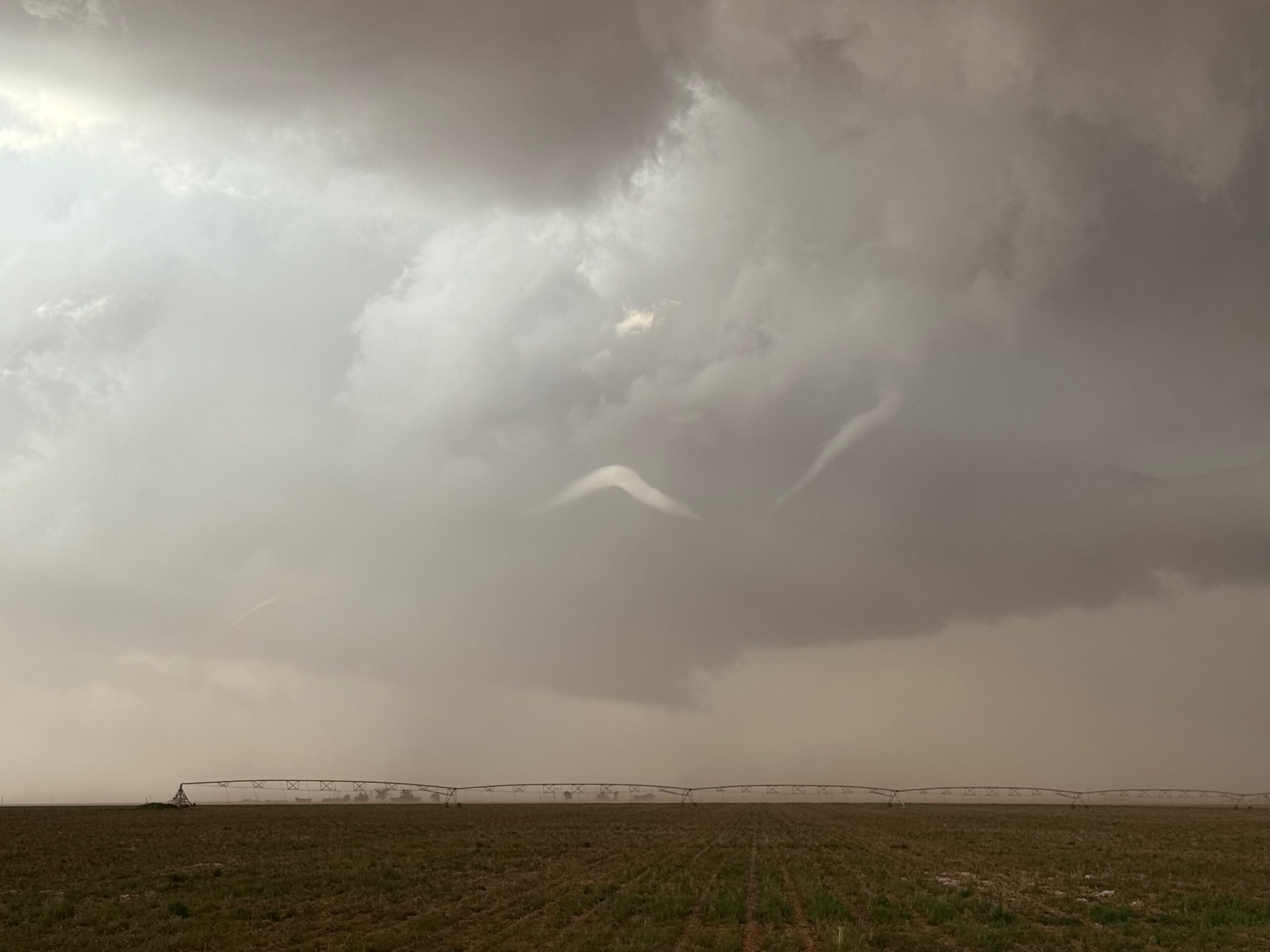
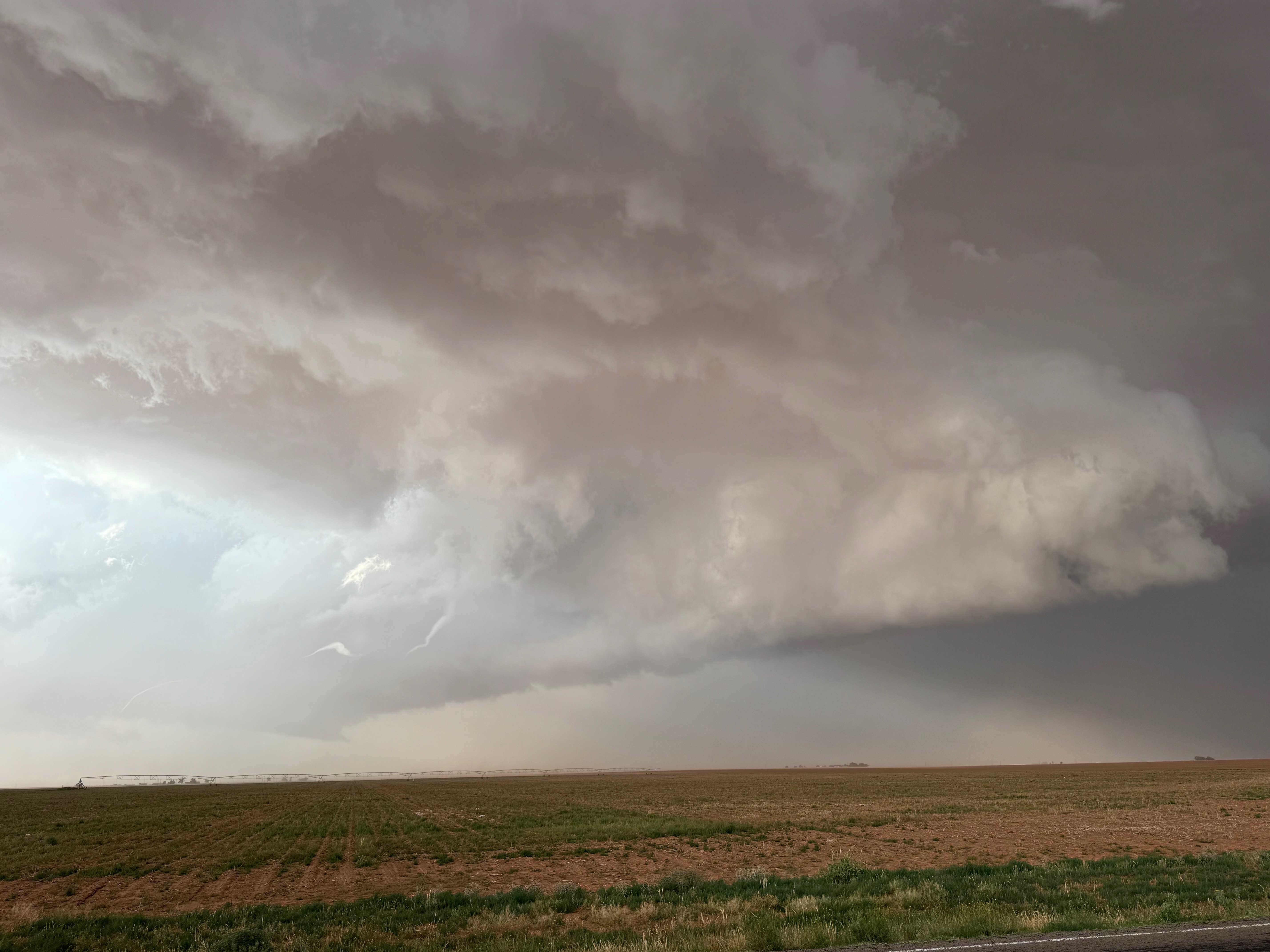
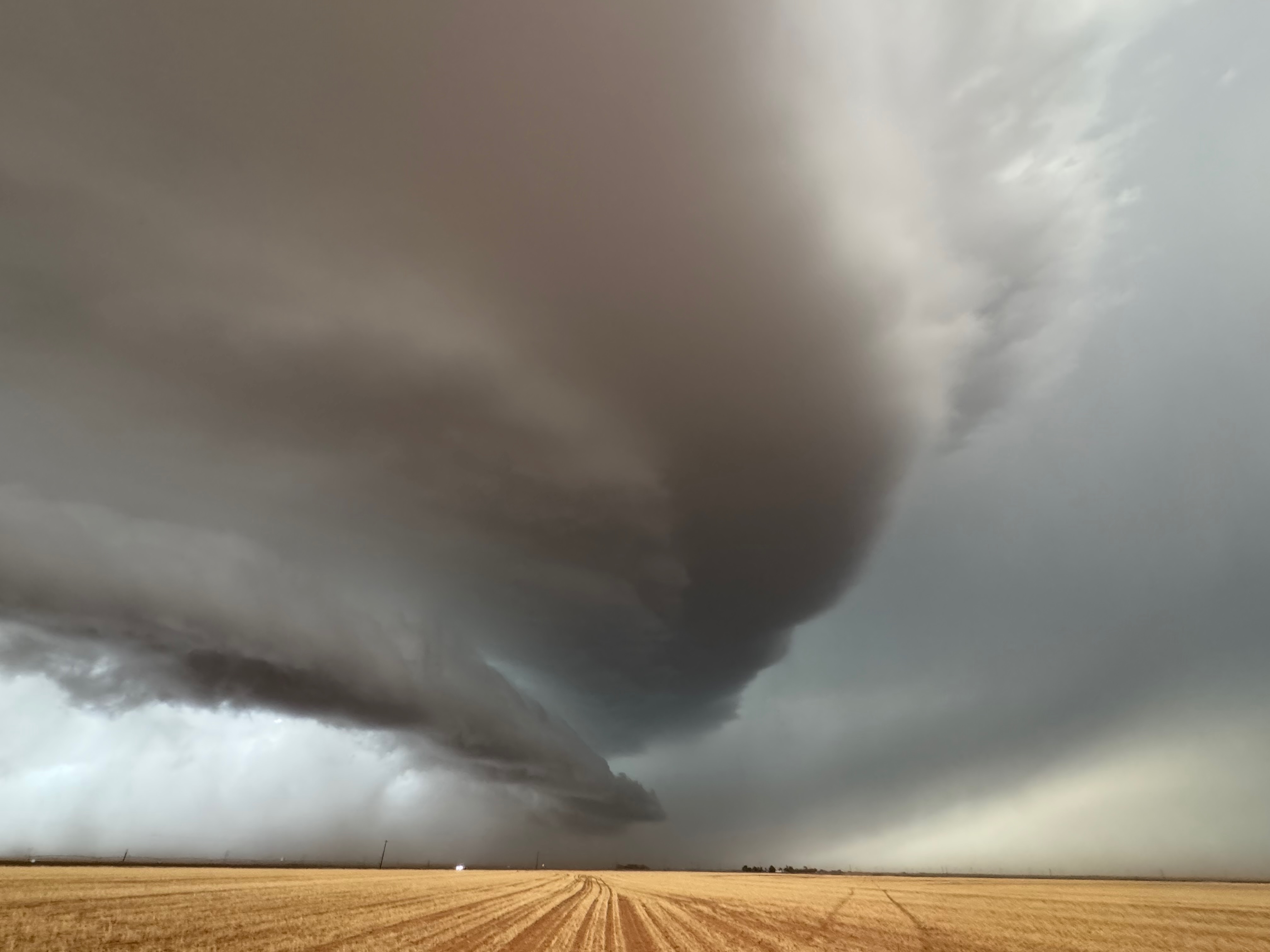
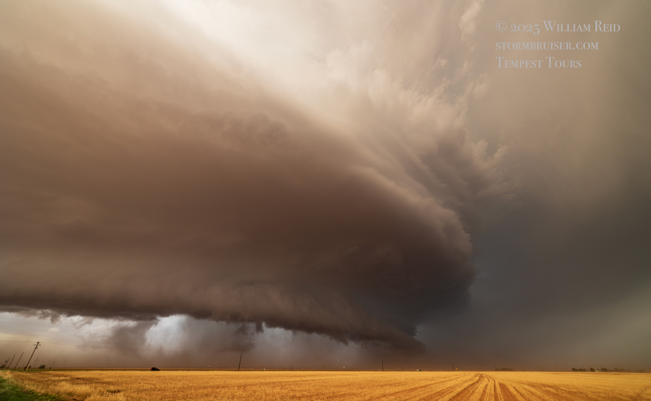
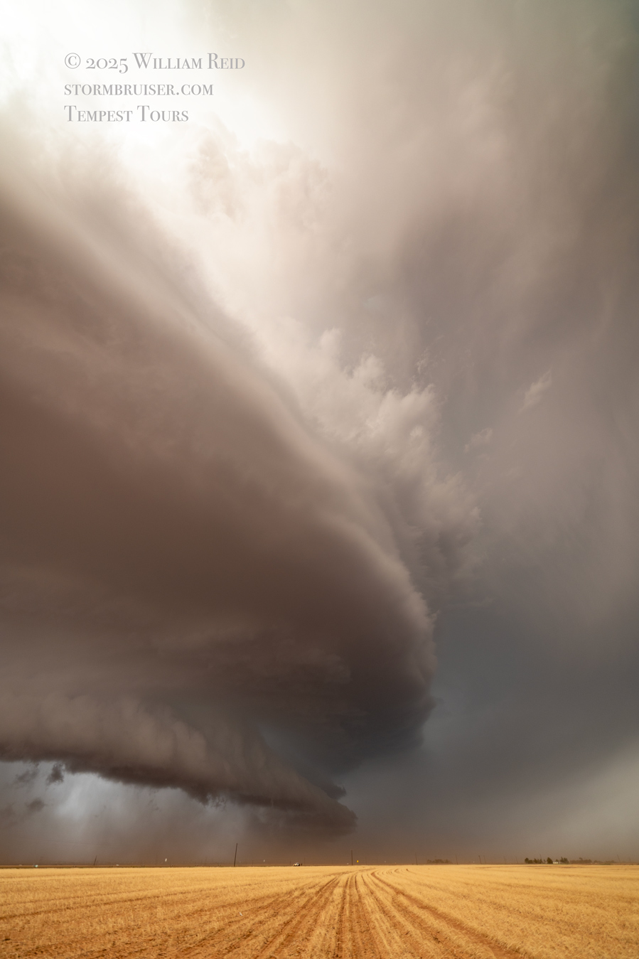
The supercell got really serious about making a tornado, really quickly. This was west of Sundown by perhaps 3-6 miles. The storm must have hit a batch of better moisture, or maybe latched firmly onto that E-W boundary, or maybe just because it was Tornado Time between 6 and 7 p.m. A lowering along the front end was rotating rather violently, but horizontally, as it was pulled up against the updraft base from northeast to southwest. It was mesmerizing, we were very close, and I was a bit afraid and concerned…was something big and nasty about to commence?! The two images below show this active horizontal vortex that was feeding into the storm.
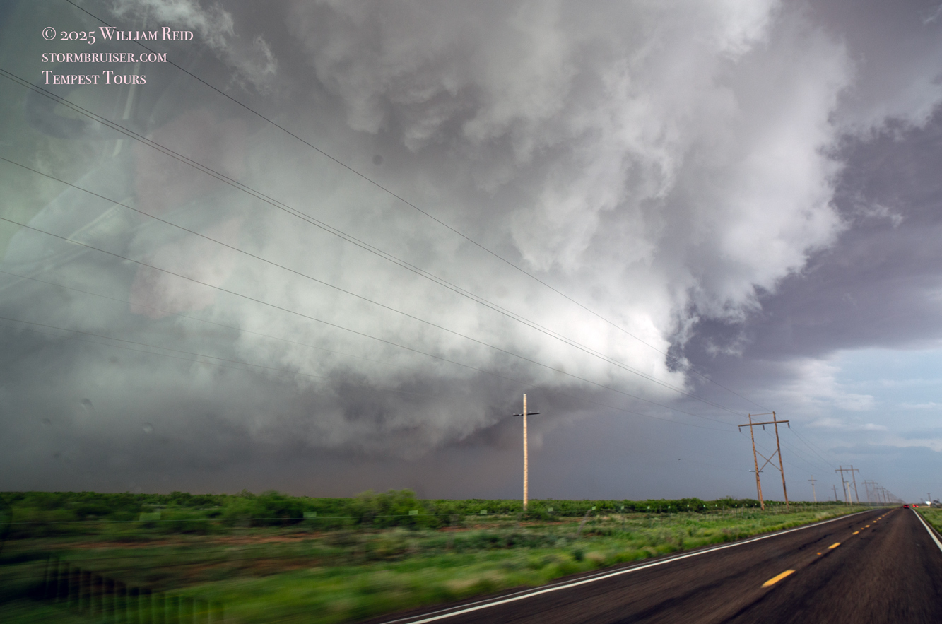
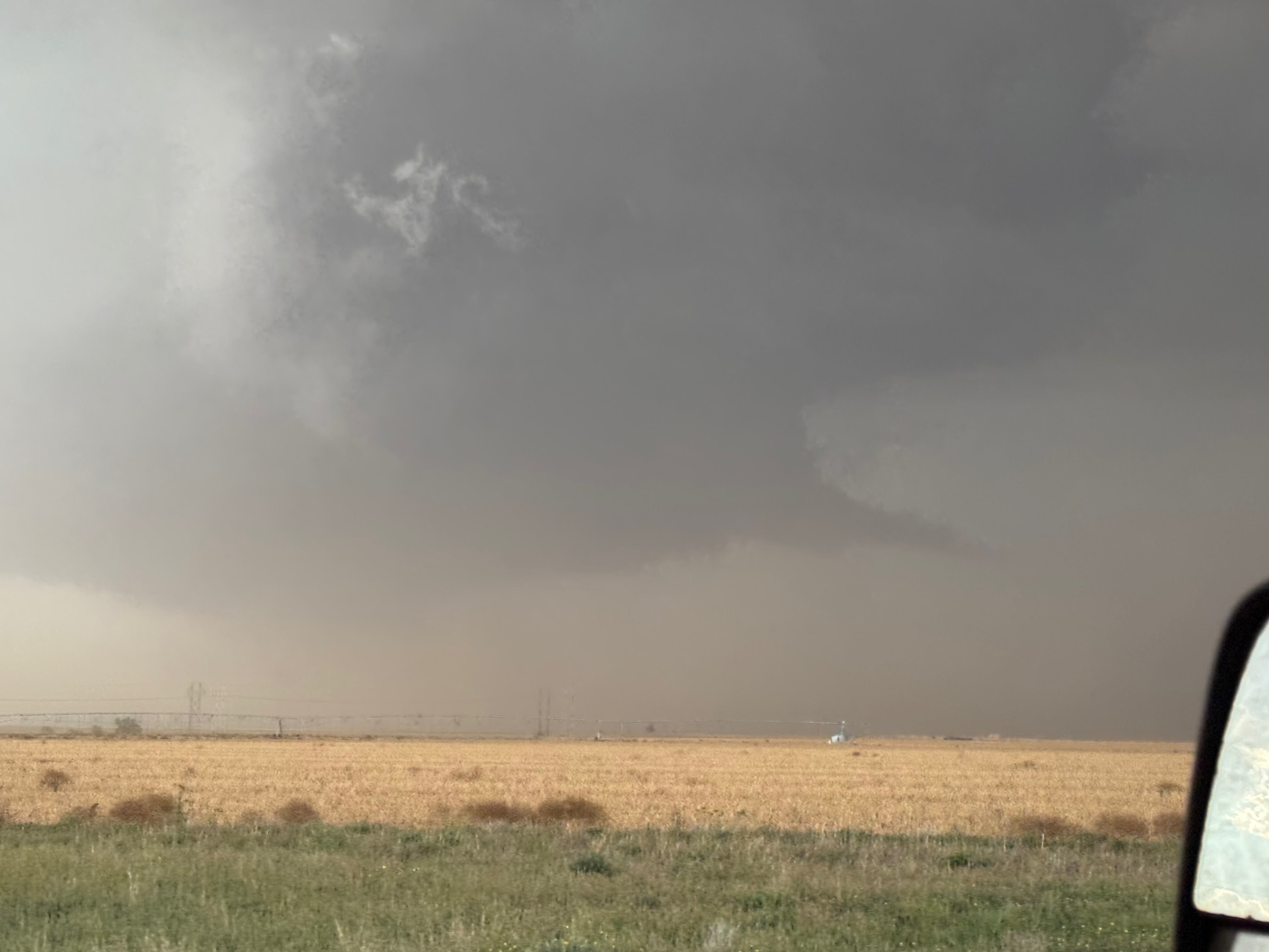
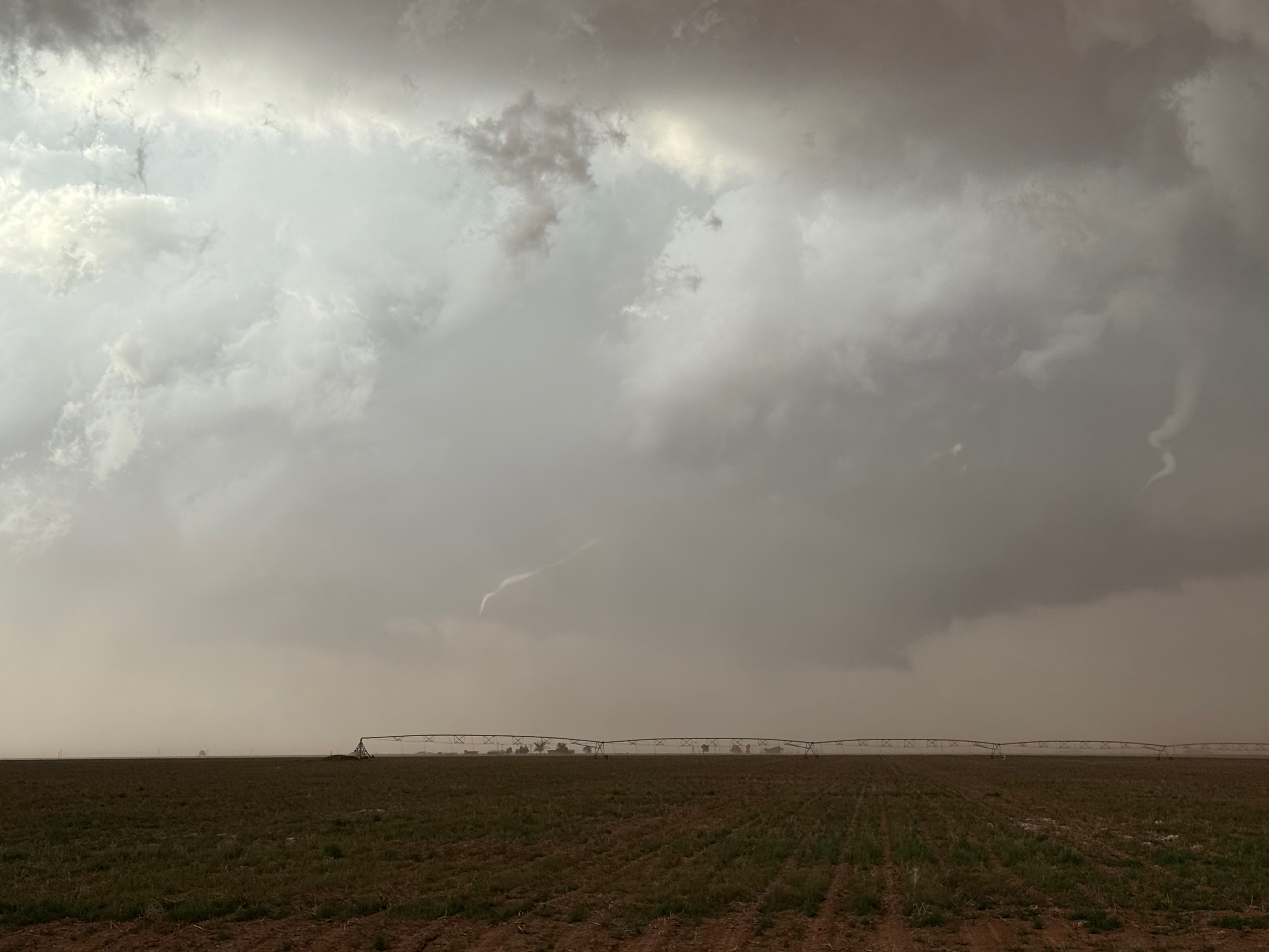
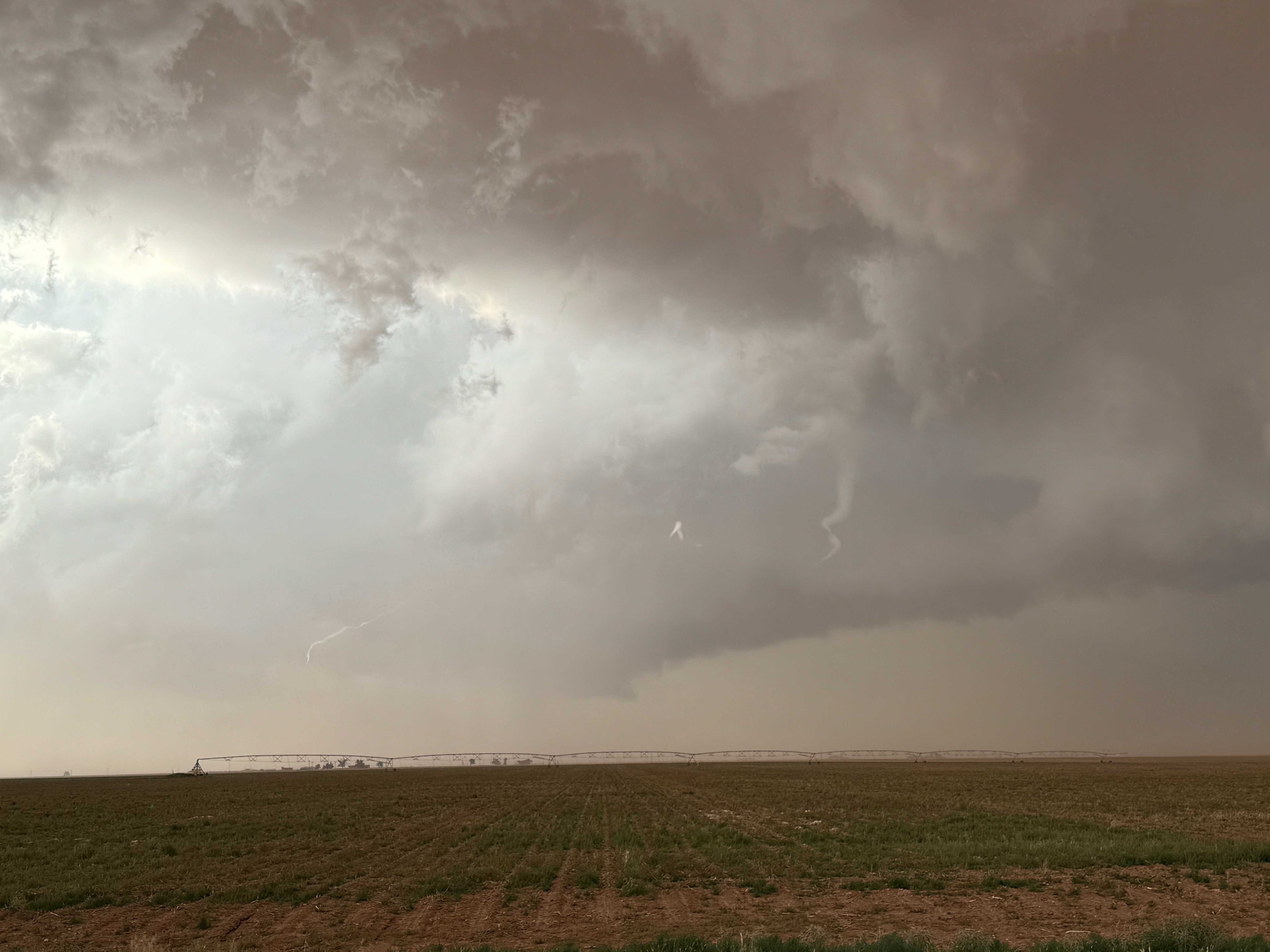
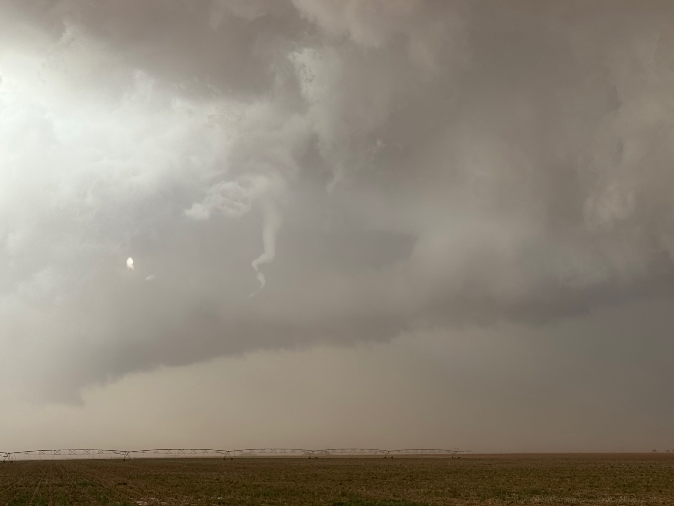
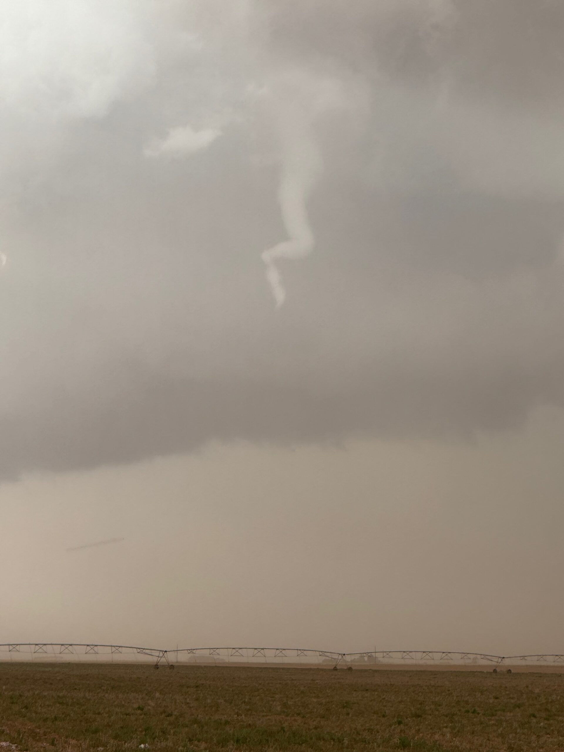
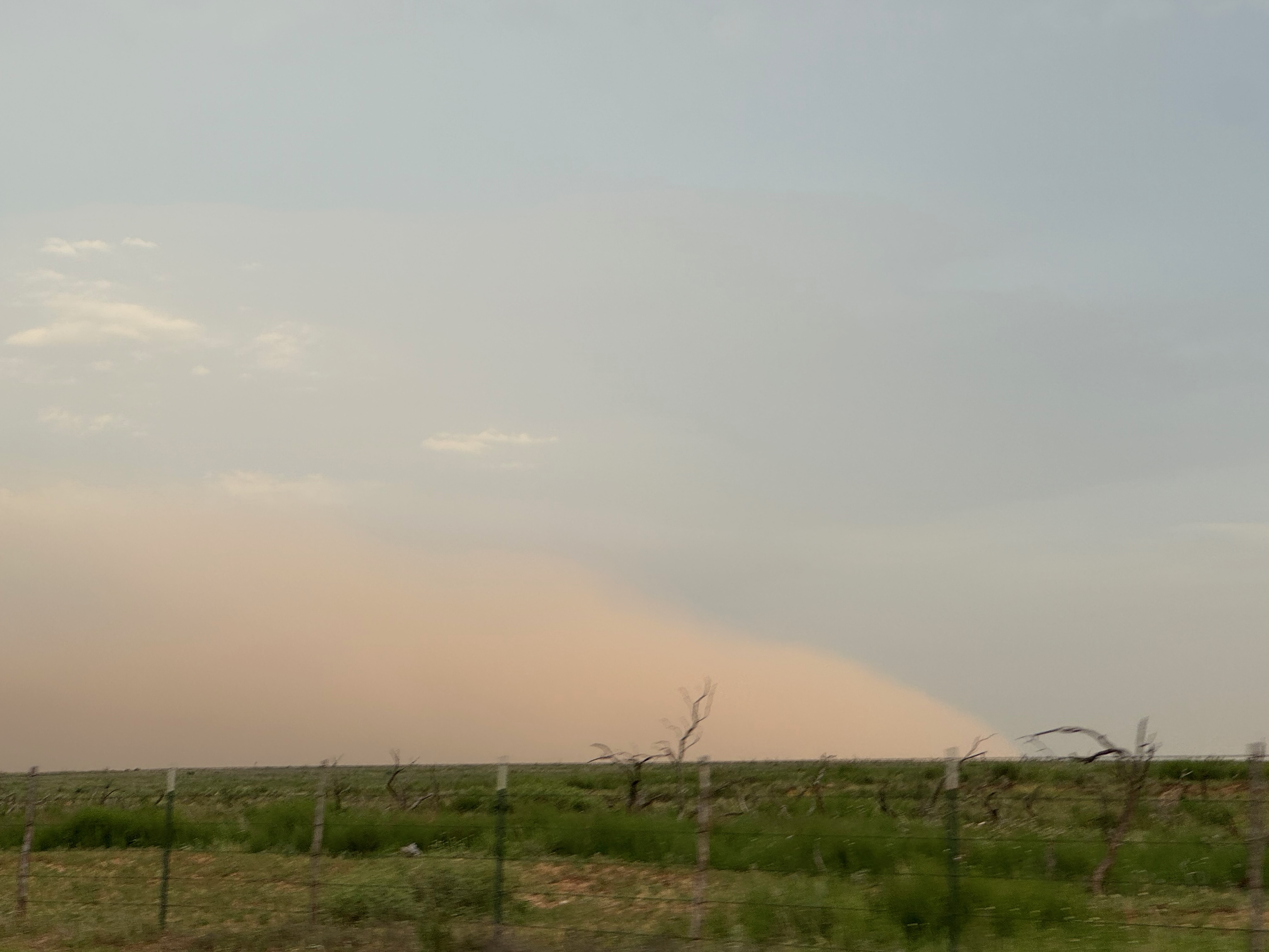
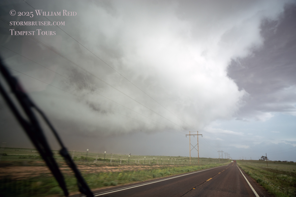
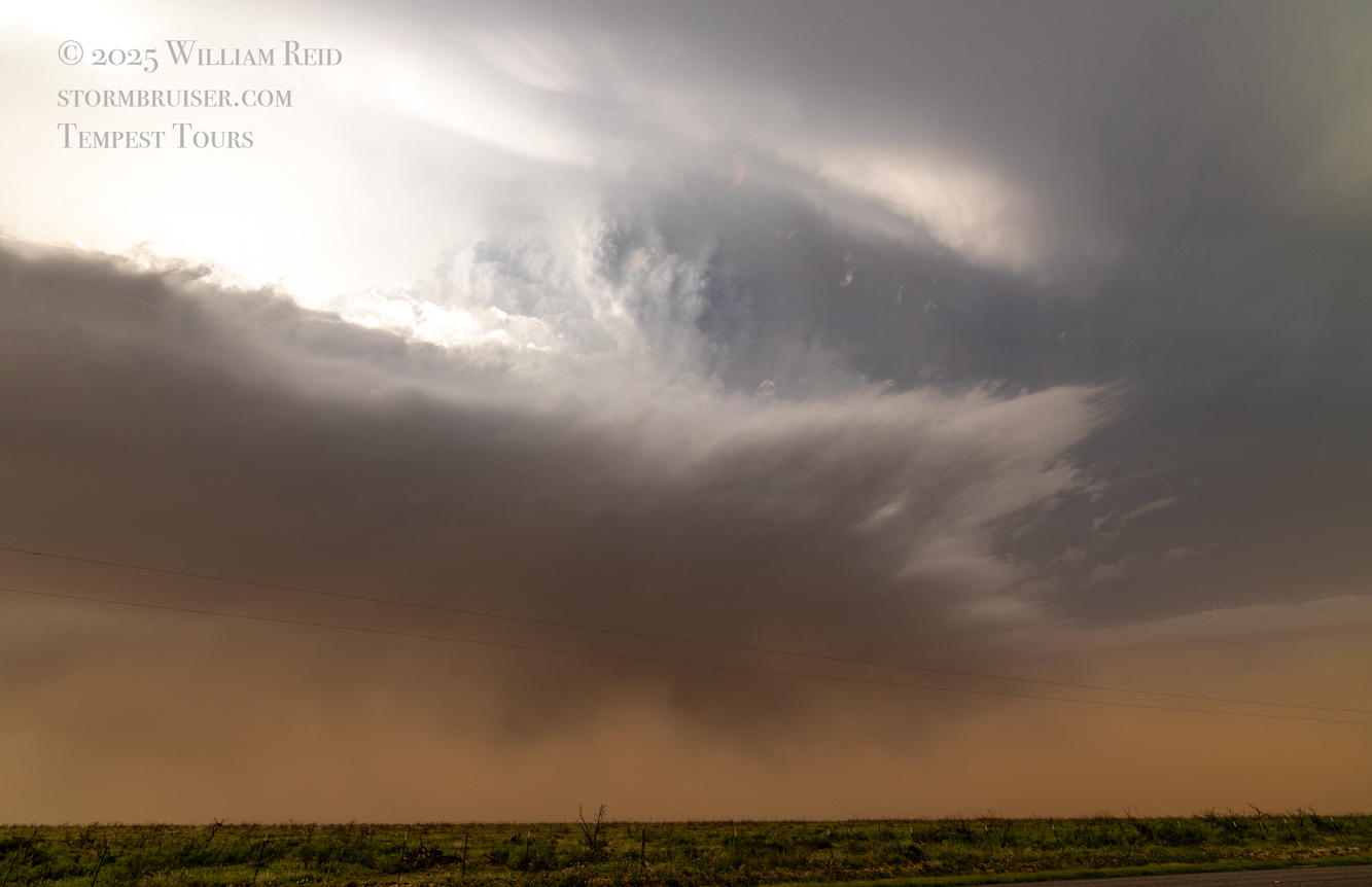
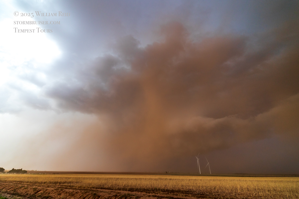
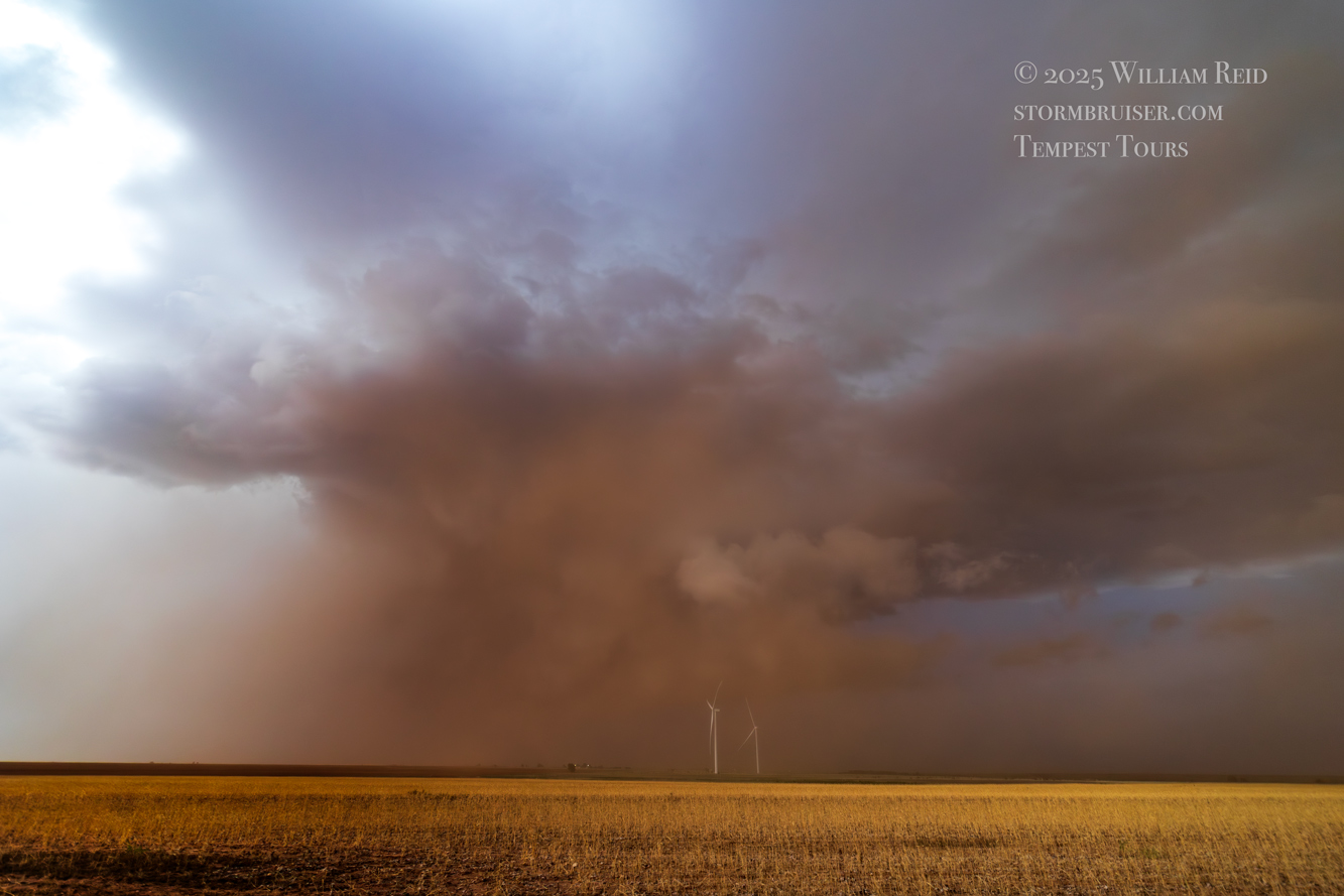
The next hour or so was a bit frantic as we stayed close to the storm base. We had to bail south at Sundown to highway 41 where we went east again. As we approached Highway 385 (about halfway between Levelland and Brownfield) we had a good-sized lowering to the north. Was there a tornado beneath that? It was almost comical that there was NOT! (Apparently.) To make matters more interesting, it seems a large (but not too strong) meso circulation took shape practically overhead as we tried to get south on 385 from Hwy 41. We made it out of there, and headed east again on the road to Meadow. On this road, and west or east (who knows?!) of Meadow, we stopped to observe a snaky tornado to our north. This thing stretched out big-time and persisted for a few minutes. Below are some images off of the Canon cameras for this timeframe.
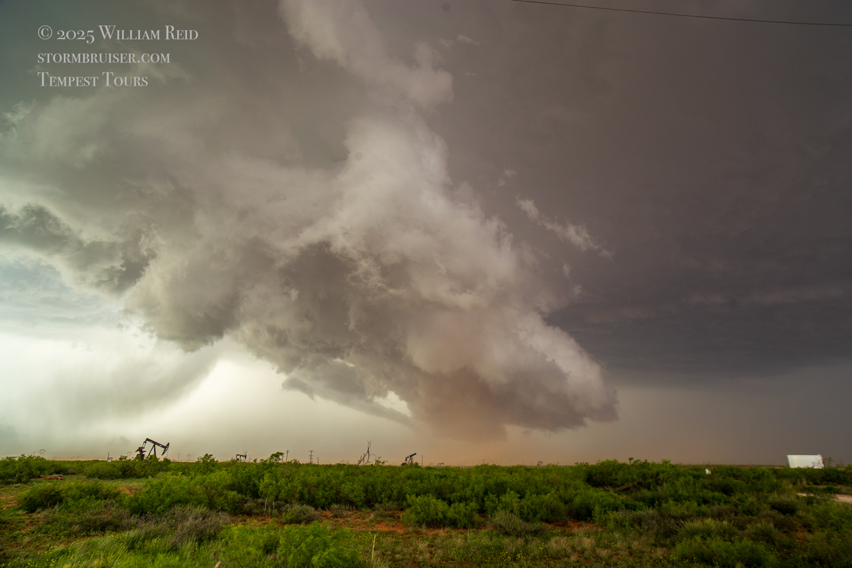
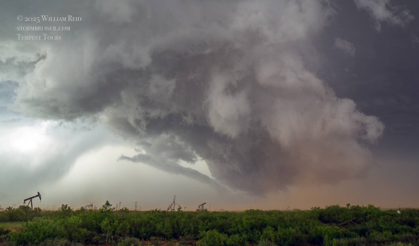
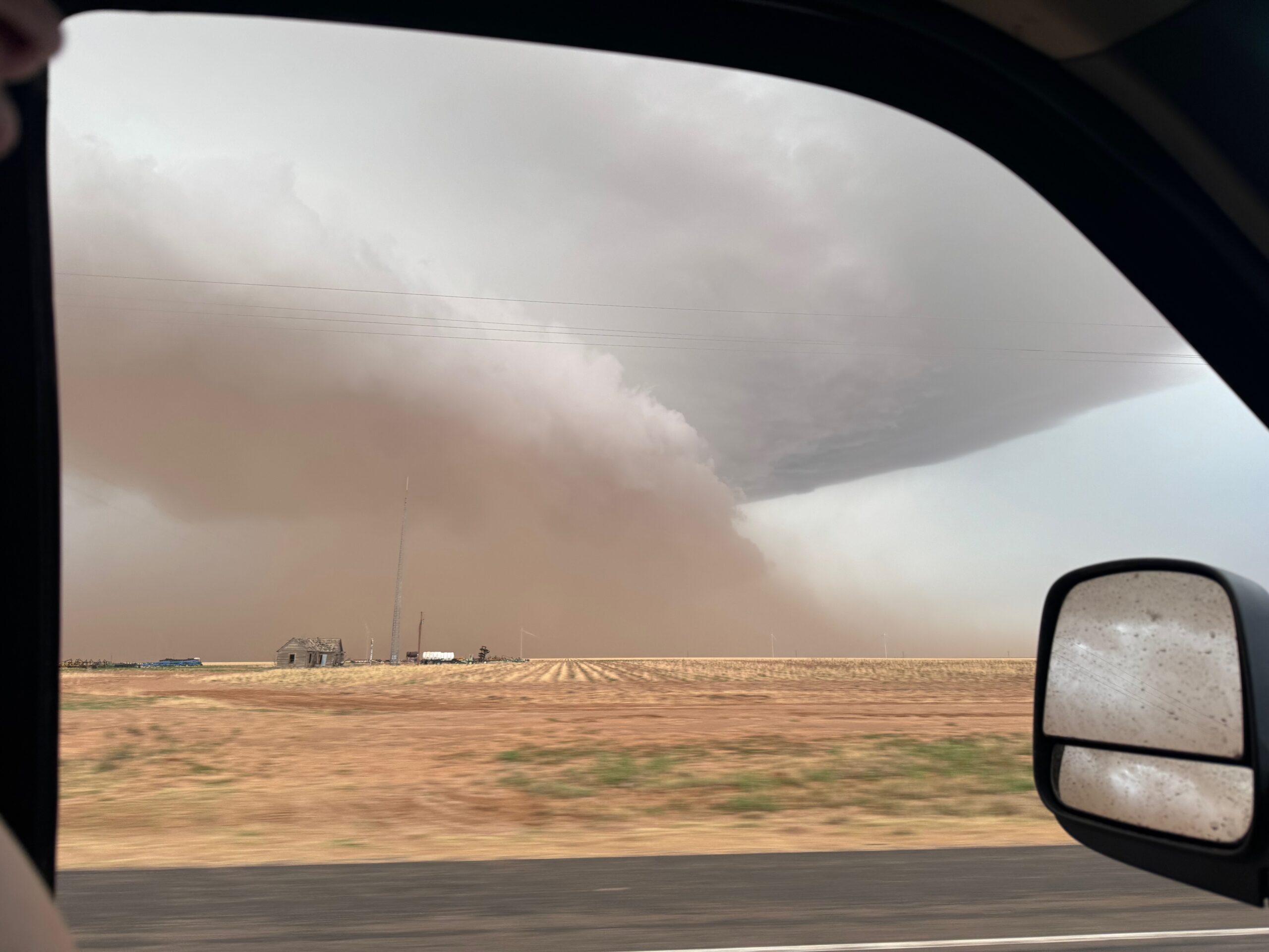
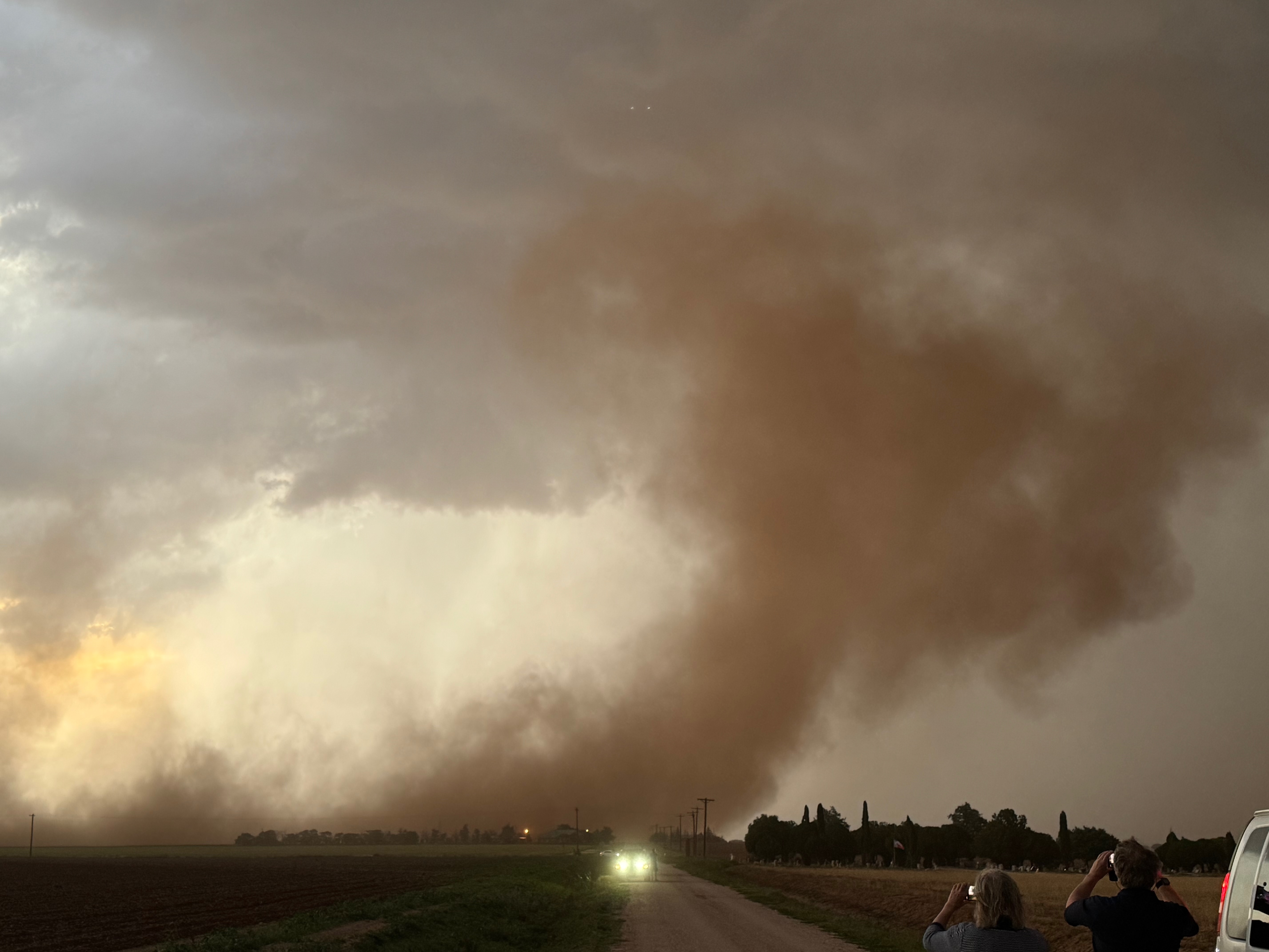
There was a very large RFD cut! The little snaky tornado was a bit of an embarrassing “afterthought” gift to storm chasers. If any storm could spin up a significant tornado, like the big Morton tornado yesterday, it seemed like this one would be able to. But it did not.
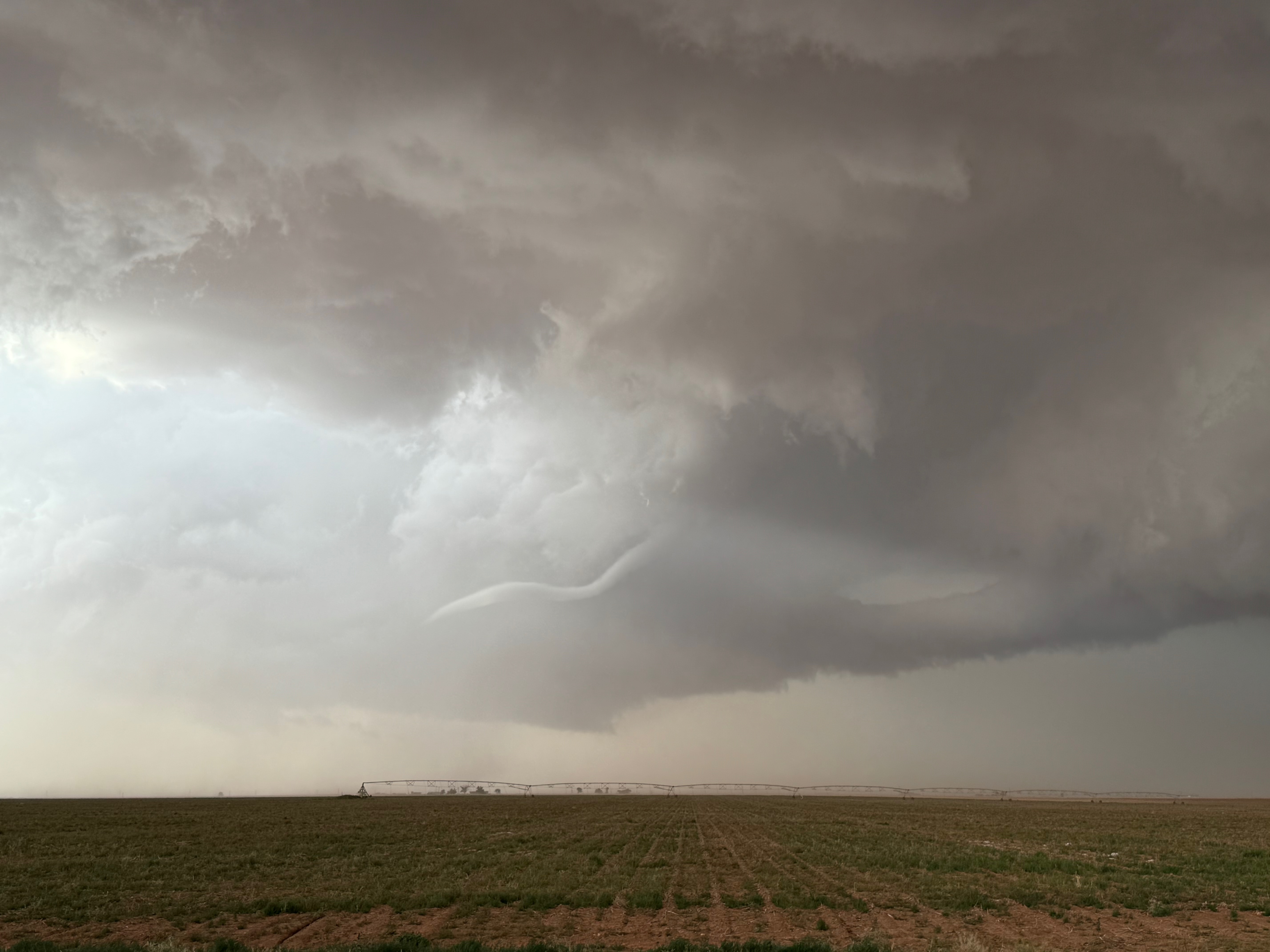
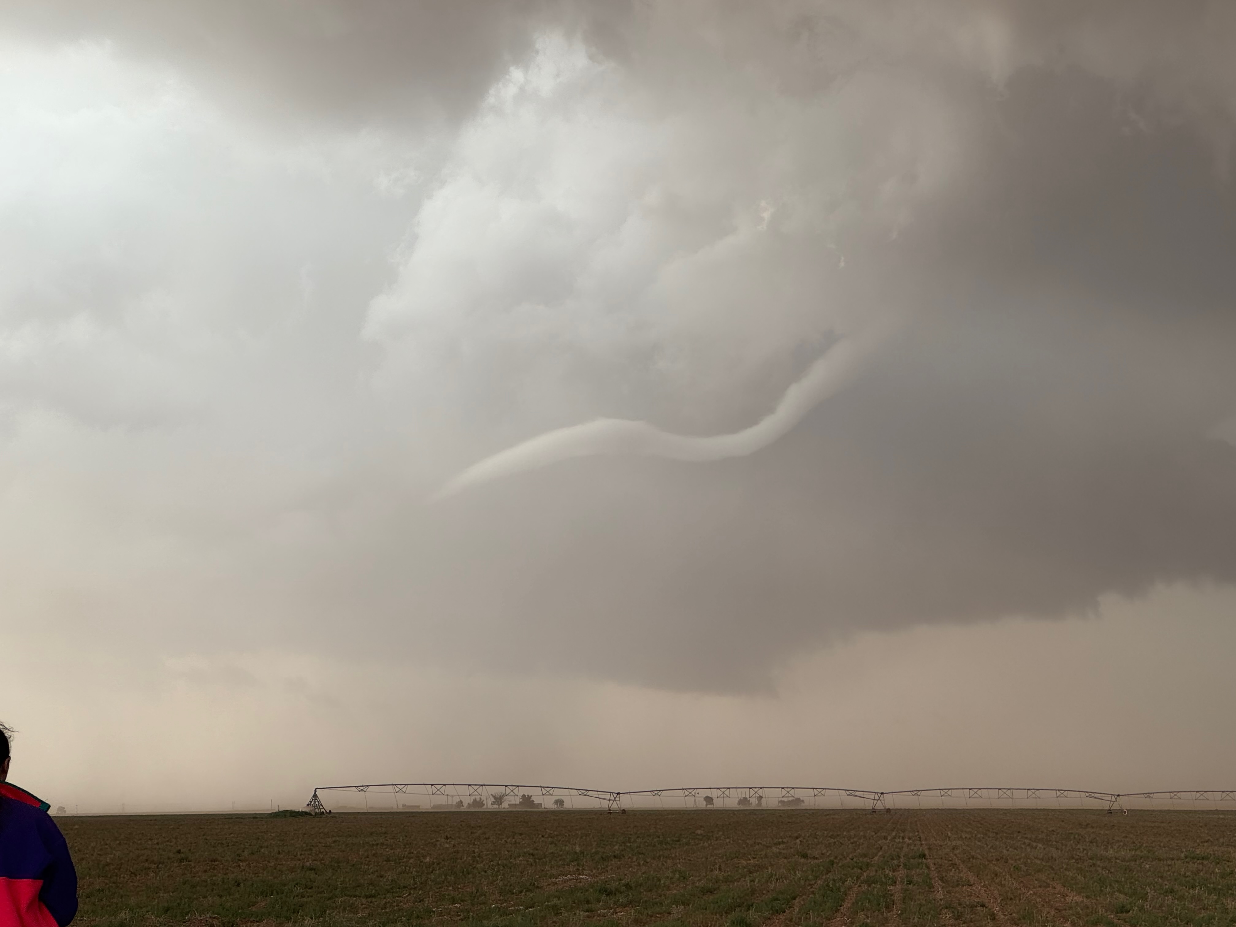
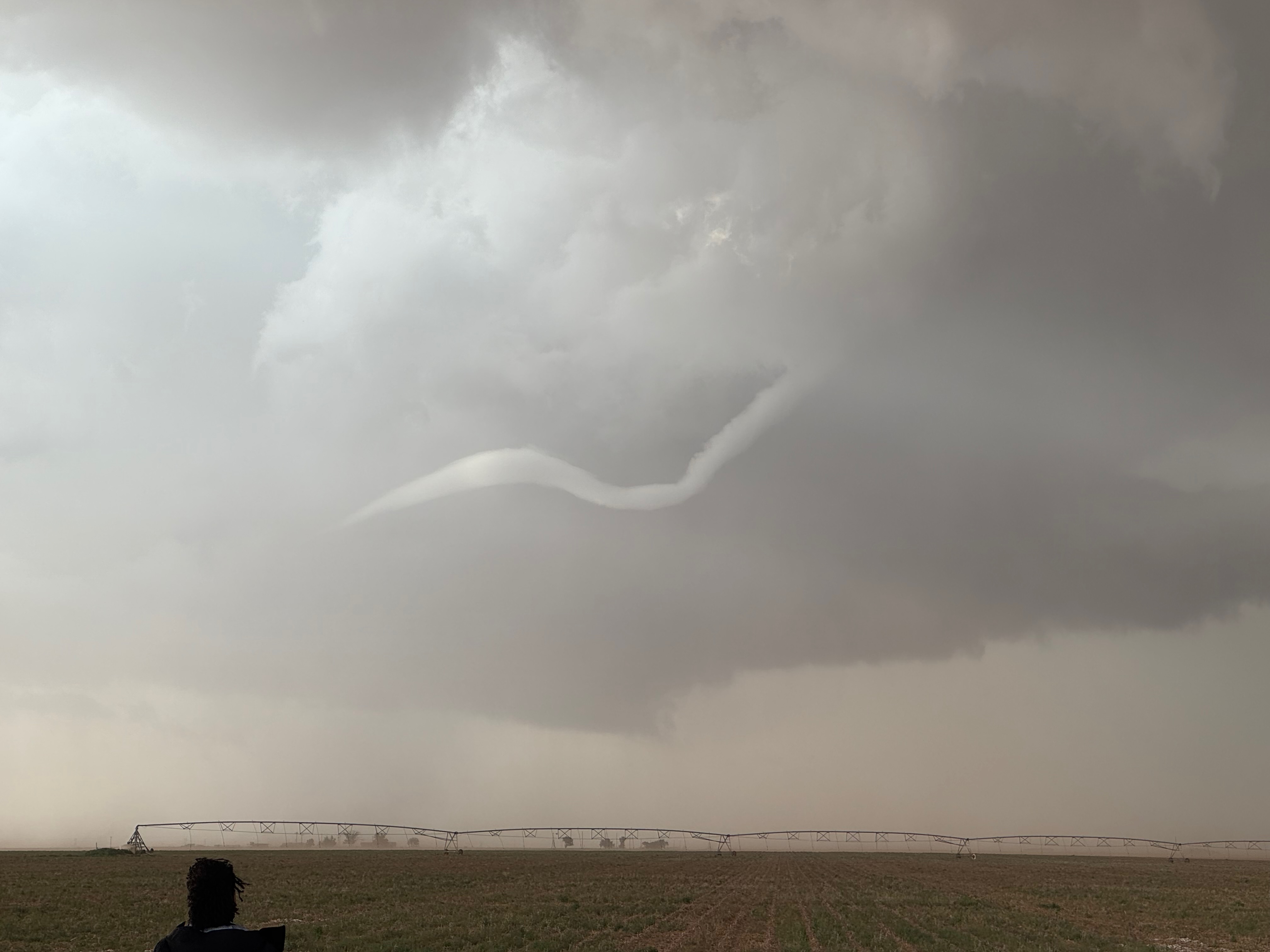
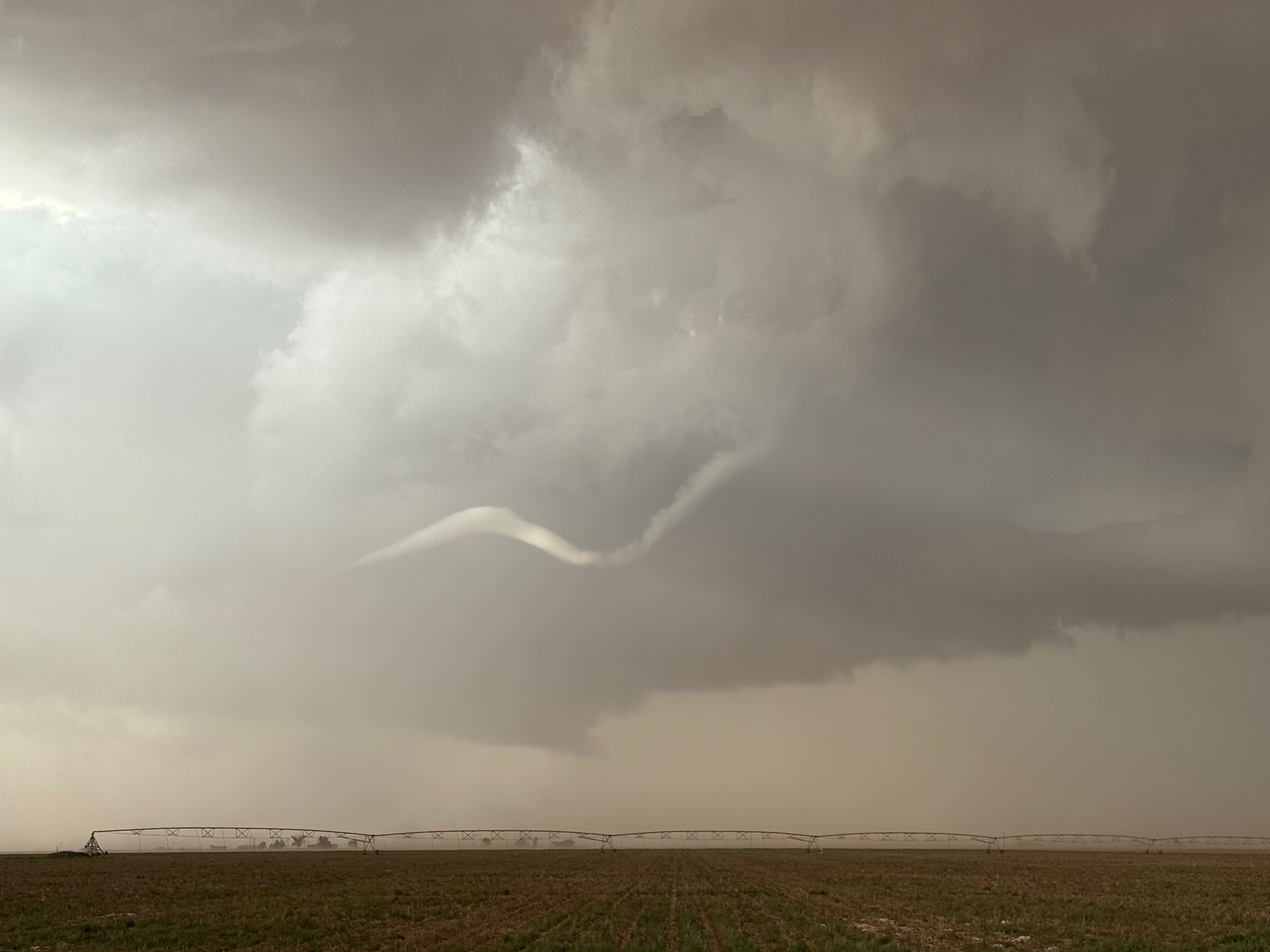
Below are a bunch of stills off of the iPhone of the “Ropesville” ropy tornado. Storm Reports has it 8 miles west of Ropesville at 7:32 p.m. CDT.
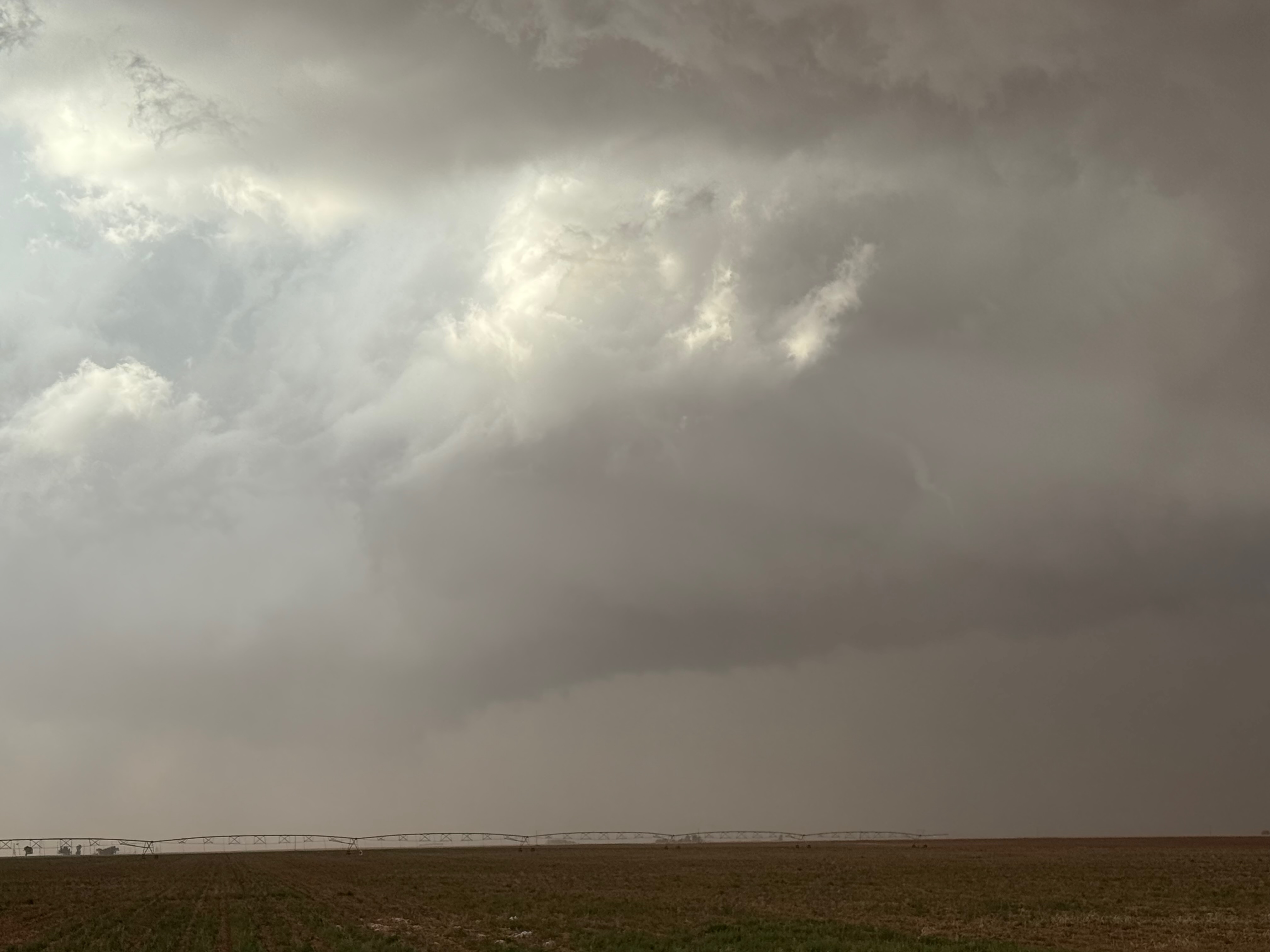
We stayed with the supercell a little bit farther east and southeast, but it was becoming a bit HP and maybe outflowish. We backed off some for a look at structure. Here are some iPhone shots…
…and some shots from the Canon cameras, starting with another one of part of the “meso” area which formed near 385 north of Brownfield.

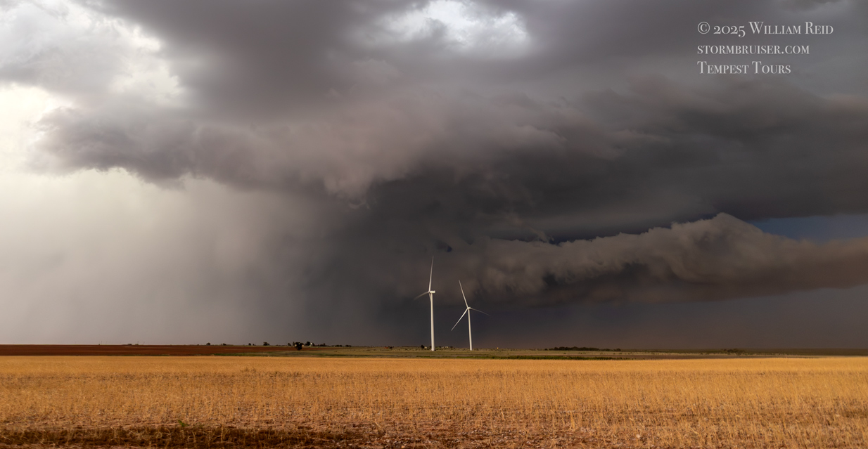
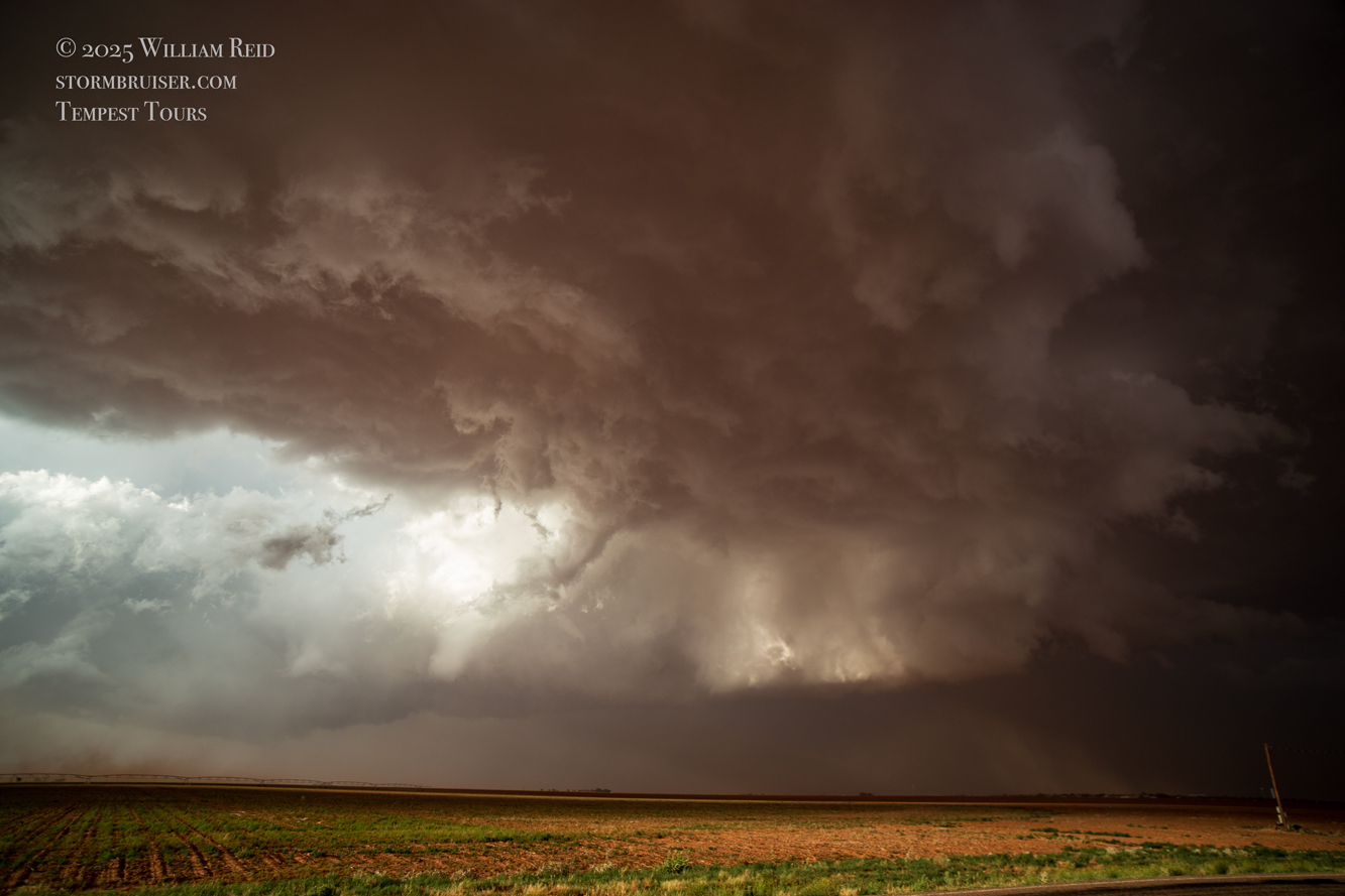
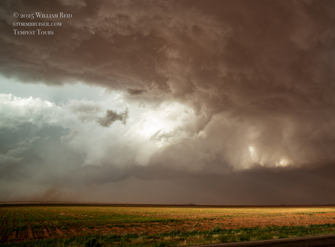
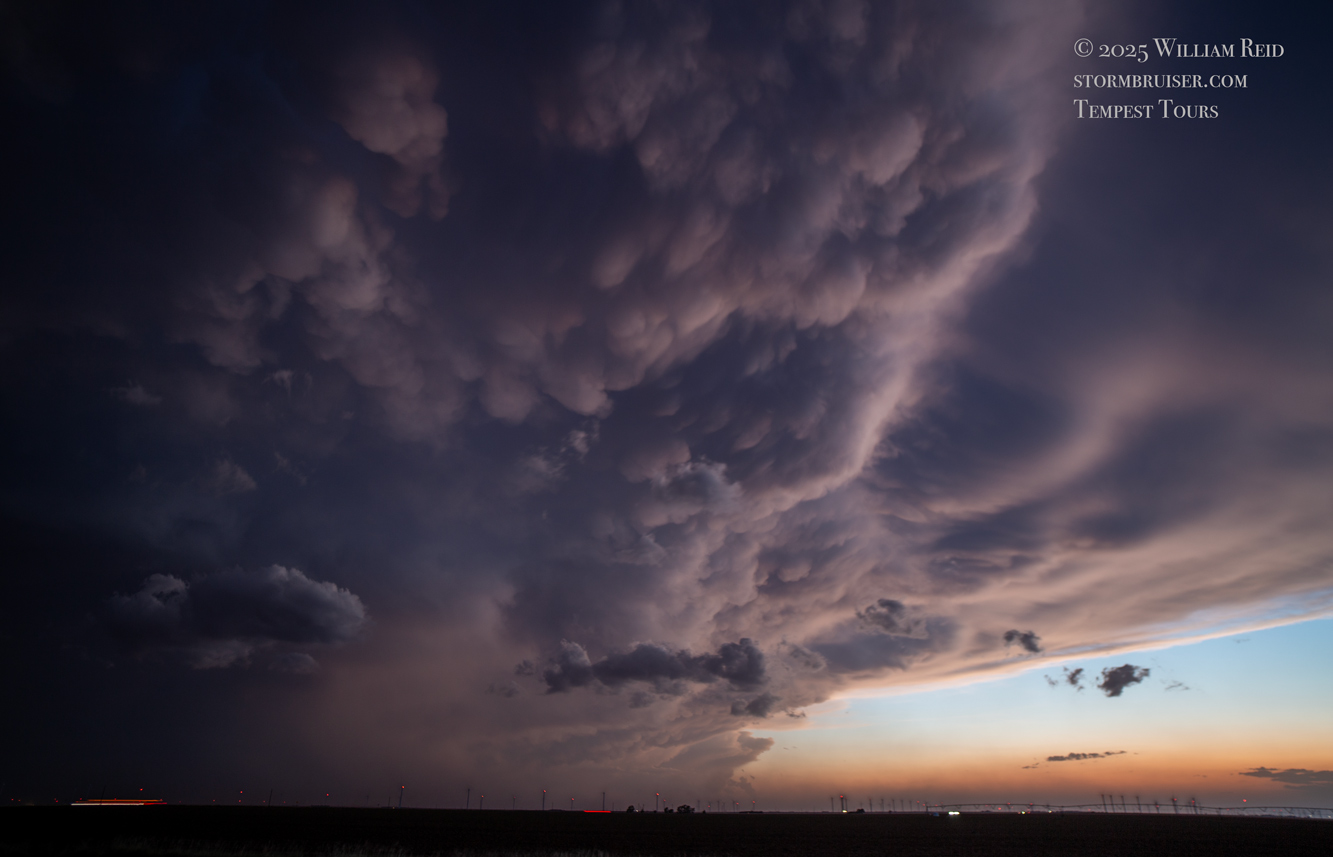
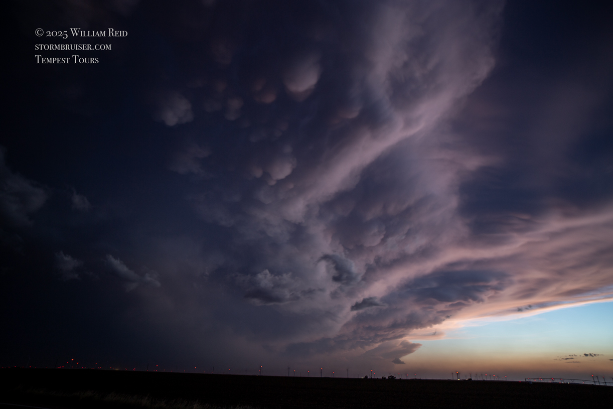
As you can see, this was quite the beast of a supercell on the Texas Panhandle South Plains. Some of the photos above show the splendid laminar sides of the supercell around sunset when it was near Tahoka and Grassland.
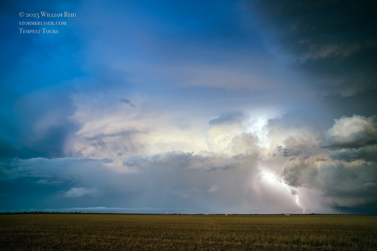
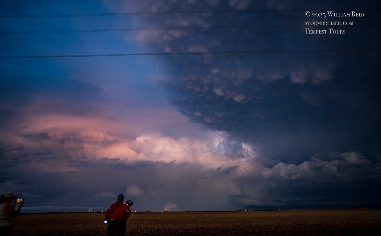
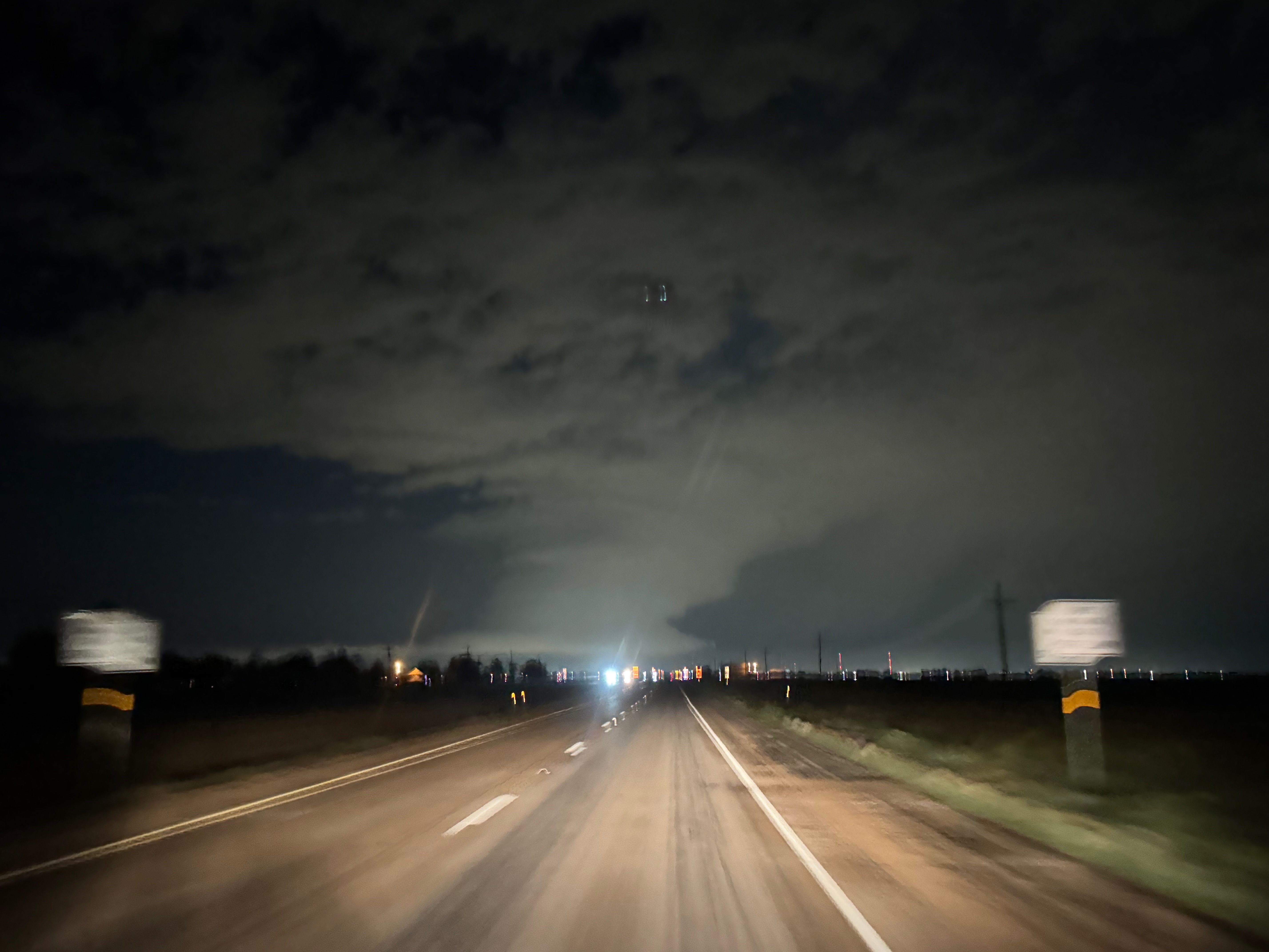
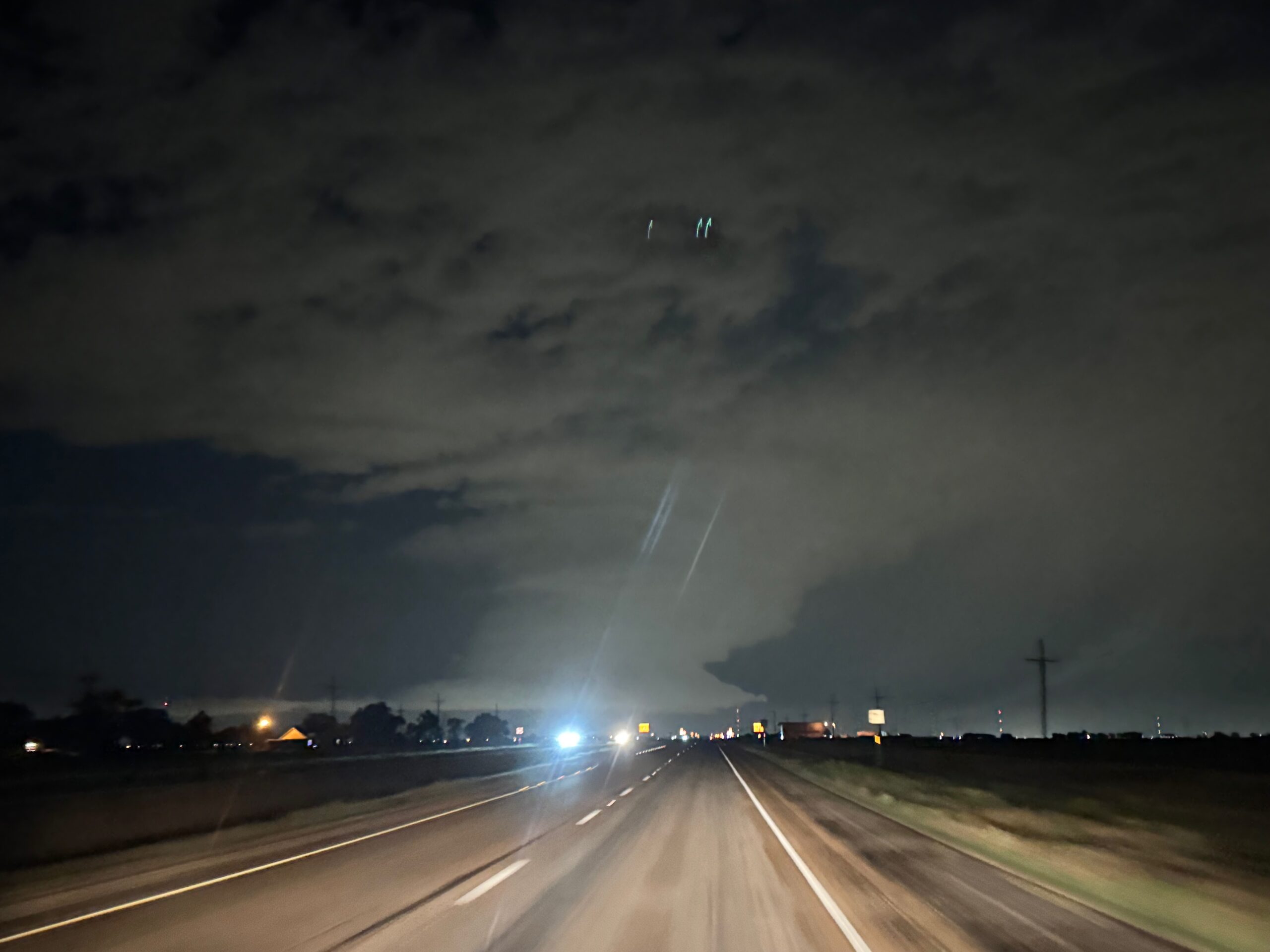
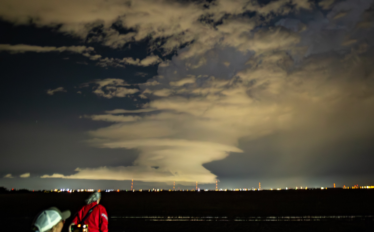
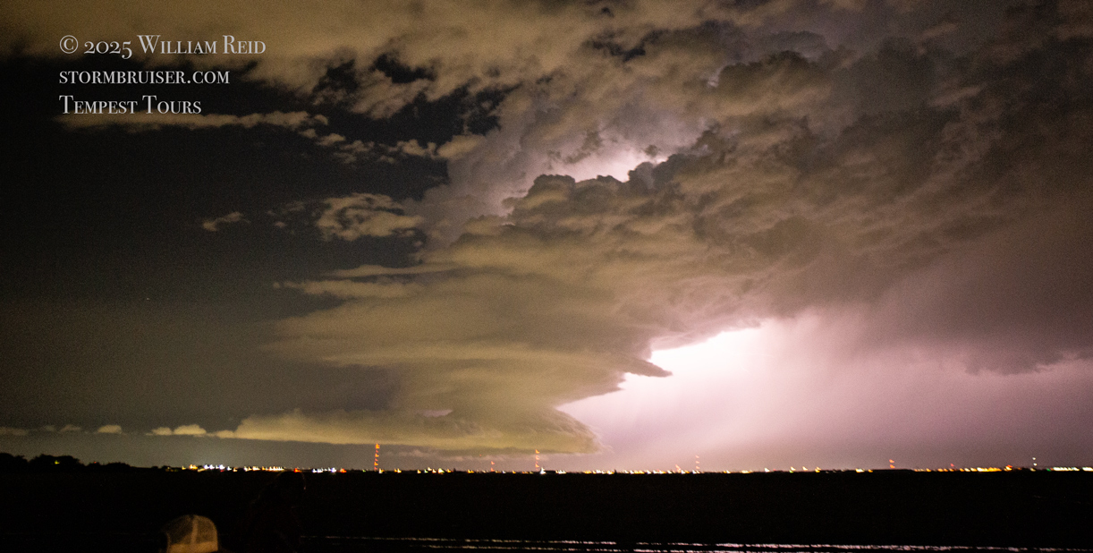
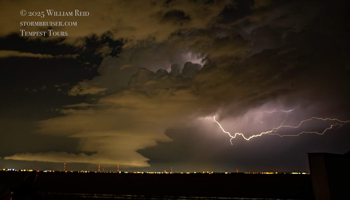
As darkness drew nigh, we headed west and north towards our Lubbock hotel. Another supercell was near Lubbock, and we stopped to shoot the structure and lightning with that for a little bit south of Lubbock (see pics below).
Leave a Reply
You must be logged in to post a comment.