

Start: Holyoke, CO/lunch: Grandma Jo’s in Sidney, NE/End: Valentine, NE/409 miles
Mesoscale Discussions 2:13 p.m. CDT (Montana) 3:49 p.m. CDT. 7:27 p.m. CDT. 7:54 p.m. CDT.
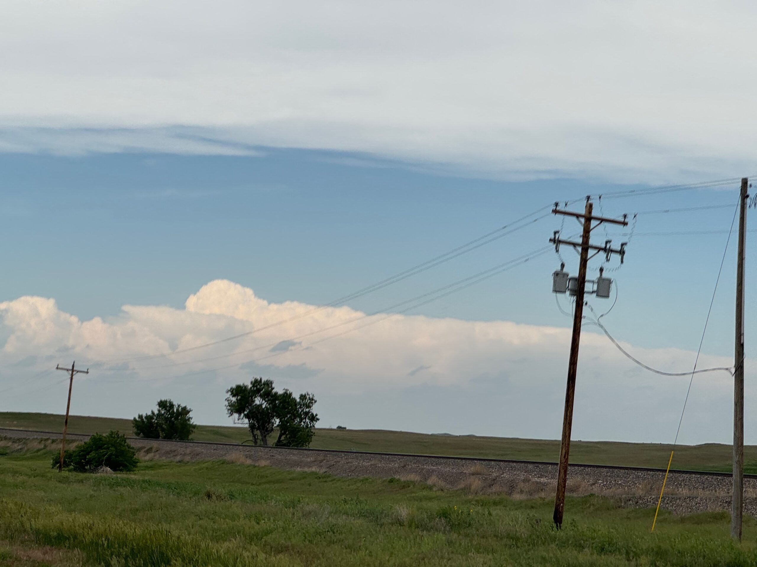
This chase day unfolded a bit differently than expected, and wound up to be a good one. We need to back up to the day prior, however, to tell the whole story. Tour 7 began on June 14 out of Denver, and the severe weather risk for that day was mediocre on the High Plains. On the 14th, SPC was showcasing a medium high-end severe risk for the 15th up in eastern Montana and vicinity. Did I want to commit to chasing the northern High Plains on the 15th? If yes, then it would be prudent to get the group well up into eastern Wyoming on the 14th. The risk up in Montana and northeastern Wyoming for the 15th, though, was looking more like a wind and hail event and not much of a tornado threat. Instead of wording such as “nice slow-moving and discrete tornadic supercells,” the SPC verbiage was more about fast-moving clusters and bow echos with outflow and strong winds. Yuck. I have chased plenty of those types of scenarios up there, and more often than not I wind up wishing that I had opted for a chase somewhere in or near the Nebraska Sandhills.
By the afternoon of the 14th I had decided not to go for the Montana play the next day. Yes, it looked like a “sure thing” with regard to an interesting severe weather event, but it was a long way to go for a fast-moving shelf cloud…which is what I was envisioning. On the 14th we chased some so-so storms on the Cheyenne Ridge in WY/NE/CO, ending the day in Holyoke.
On the 15th we headed back northwest and then west on I-80 along the Cheyenne Ridge. It was looking like another active severe weather day from the Chugwater area of Wyoming and eastward. SPC and the CAMs (convective-allowing models) were suggesting that high-based development would congeal and spread into the Nebraska Panhandle, with hail and a strong wind threat. Instability was quite high along and east of Highway 385 in Nebraska. Tornado threat was low, at just 2 percent per SPC in western Nebraska…and only 2 percent in Montana and northeastern Wyoming.
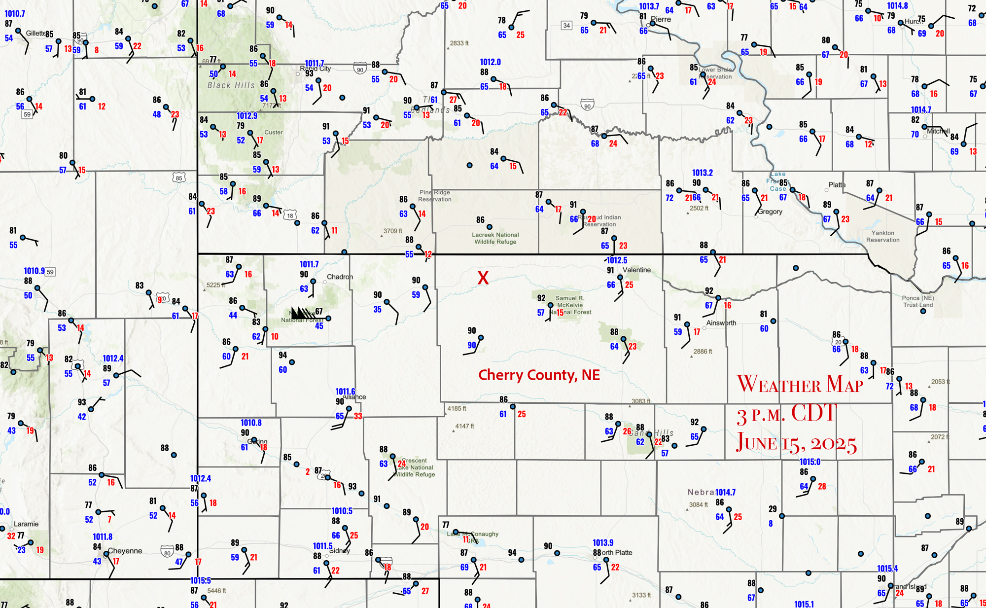
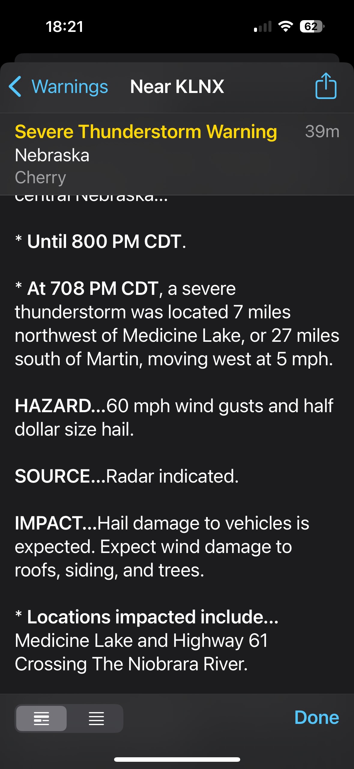
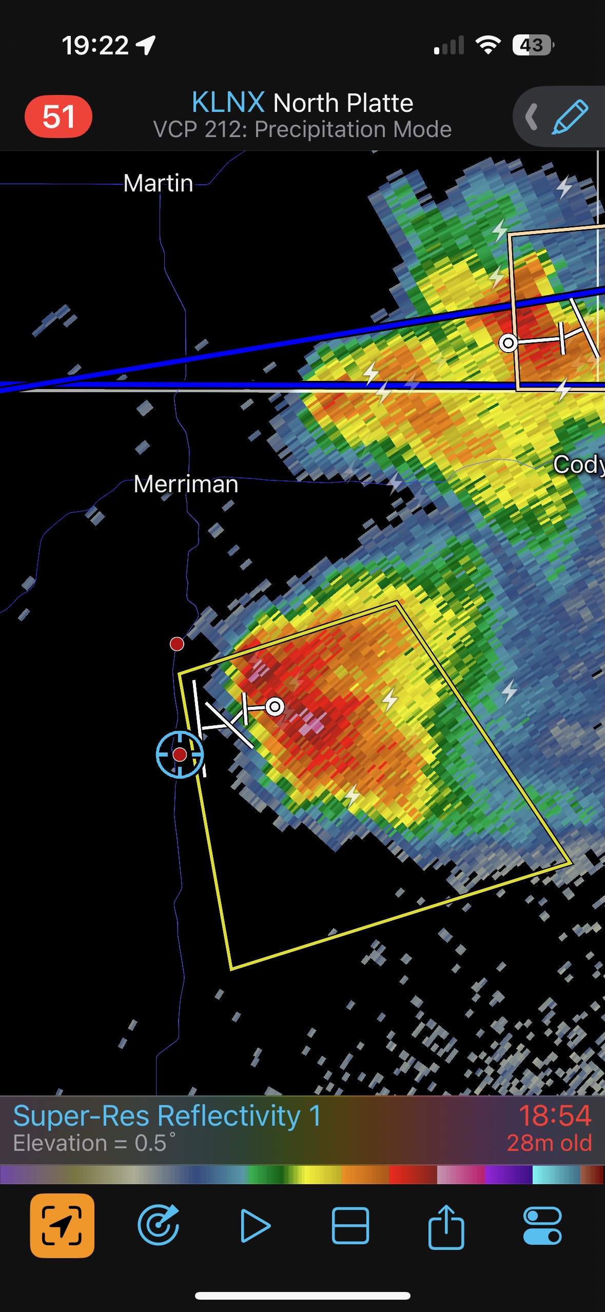
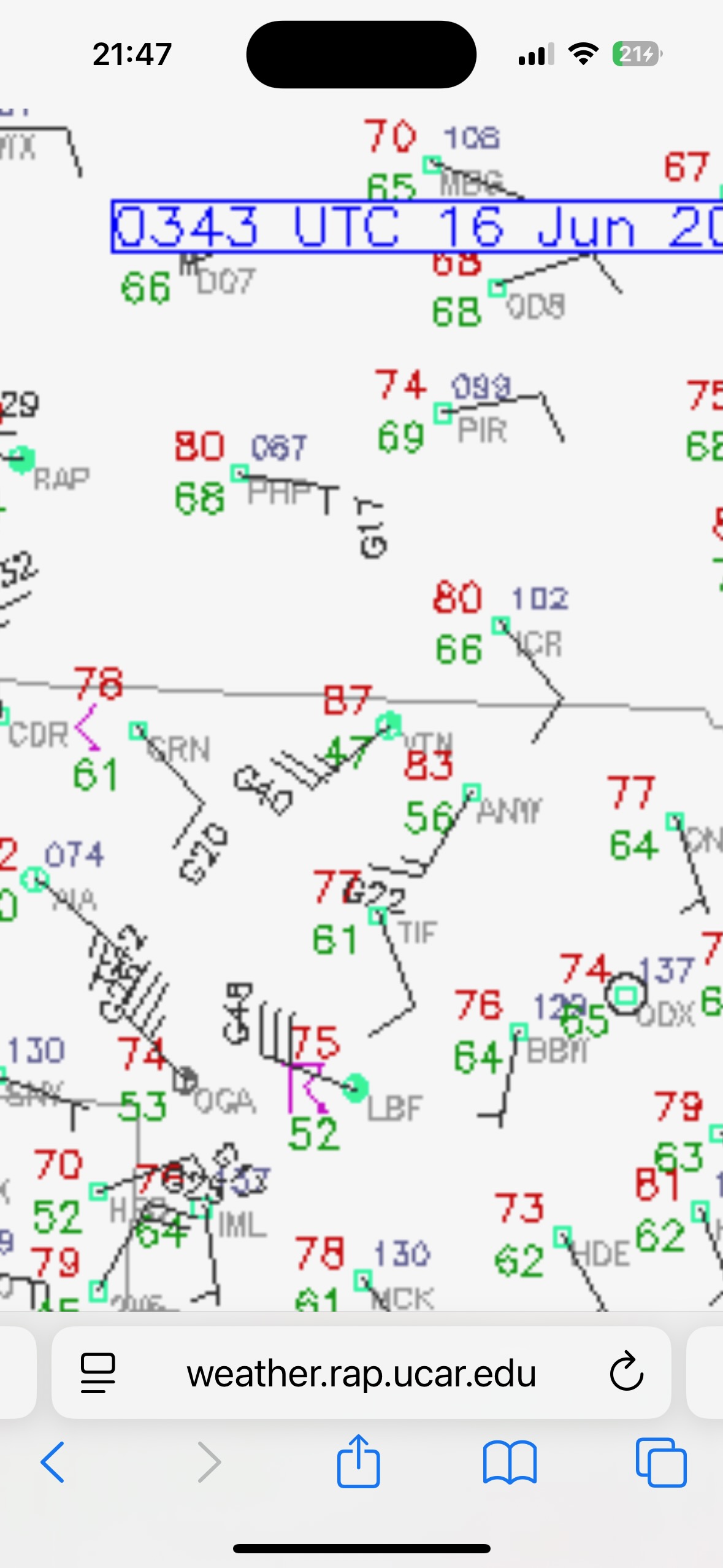
I wasn’t sold entirely on the “Chugwater” play on the 15th. Around late morning we stopped for coffee at the Wild Flour in Lodgepole, and then lunch after noon in Sidney. It was relaxed. I wasn’t ready to charge westward, as I was a little reluctant to totally blow off the possible target area around Valentine and north-central Nebraska. Some model runs showed a nice discrete storm or two towards sunset up there. But most models showed little or nothing in and around Cherry County later on. The cap was strong. There was a surface boundary/wind shift along the NE/SD line which looked a lot like a warm front. The map below shows conditions at 2 p.m. MDT/3 p.m. CDT. I made it easy for you to locate Cherry County, and the “X” is where we wound up watching a beautiful supercell. Sidney is southwest of Cherry County, near the bottom of the map. Its dew point of 61F is pretty good for the elevation of 4300 feet. Dew points in eastern Cherry County were in the mid 60s, falling a bit closer to 60F in western Cherry County.
When we finished up the somewhat late lunch at Sidney, the indications for a good play up towards Cherry County and vicinity were still looking rather murky and weak. I needed to get the group on a decent storm today, even though it would probably be a squally and outflowy mess. I had Tom and Ron point the vans to the west.
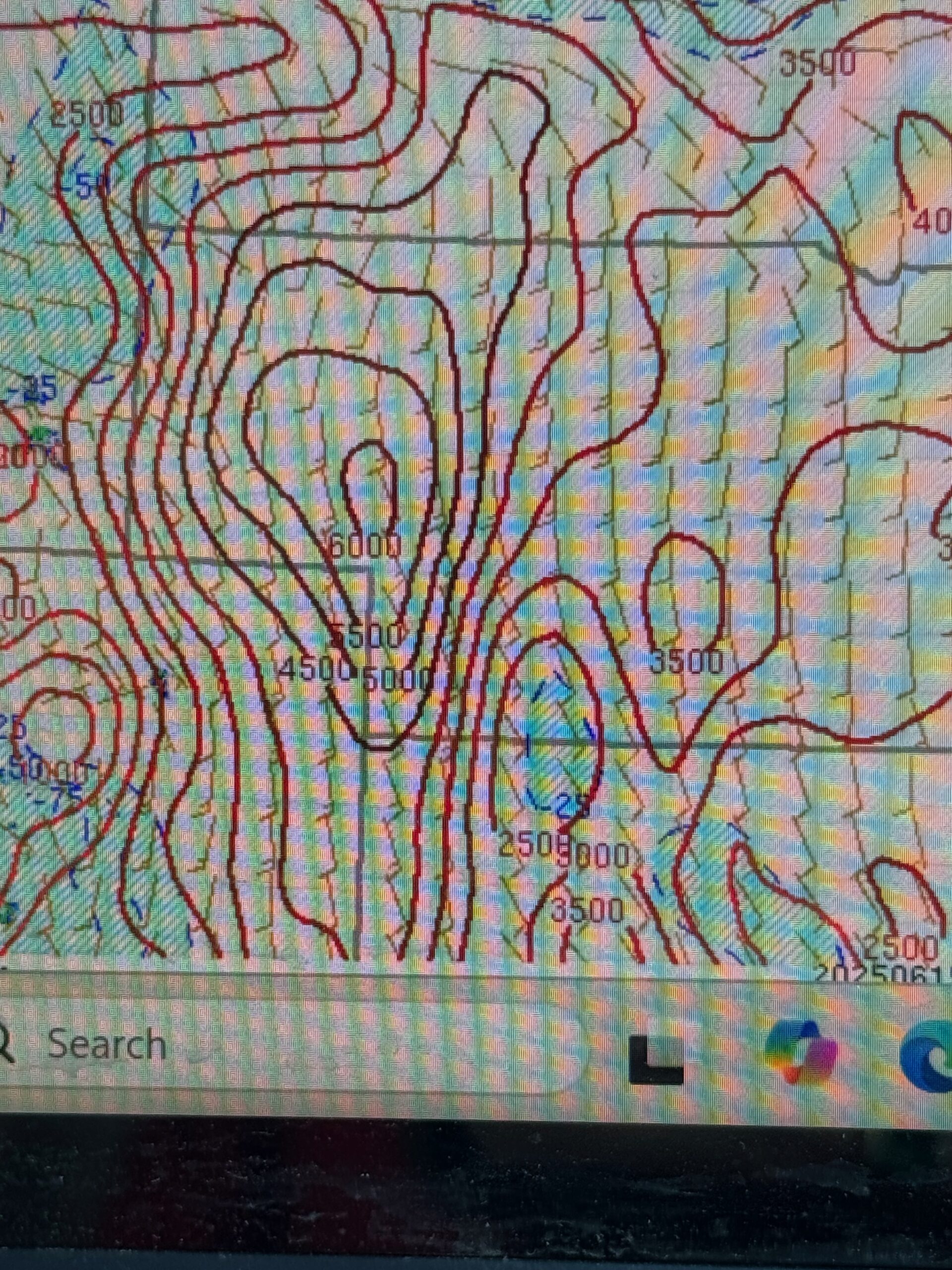
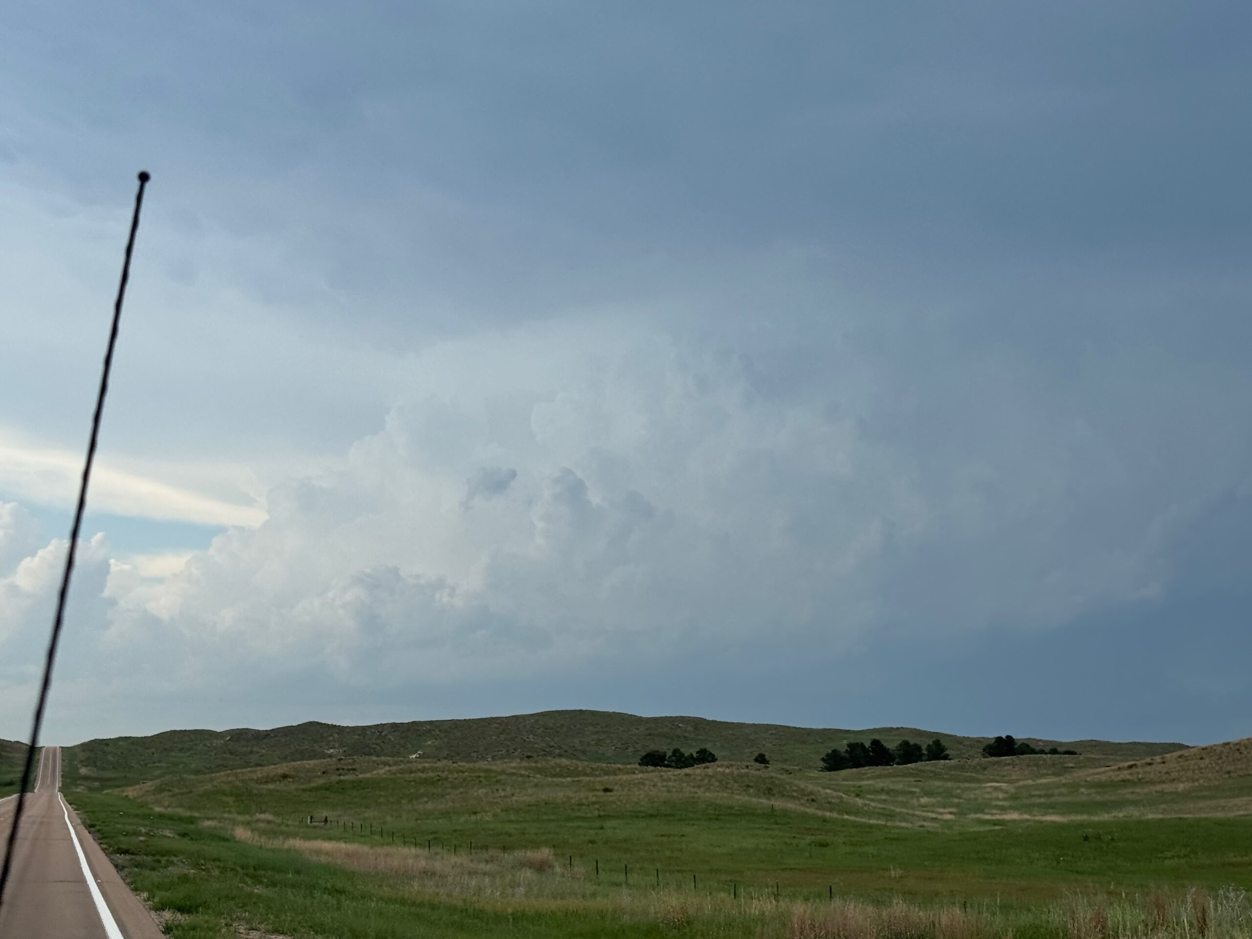
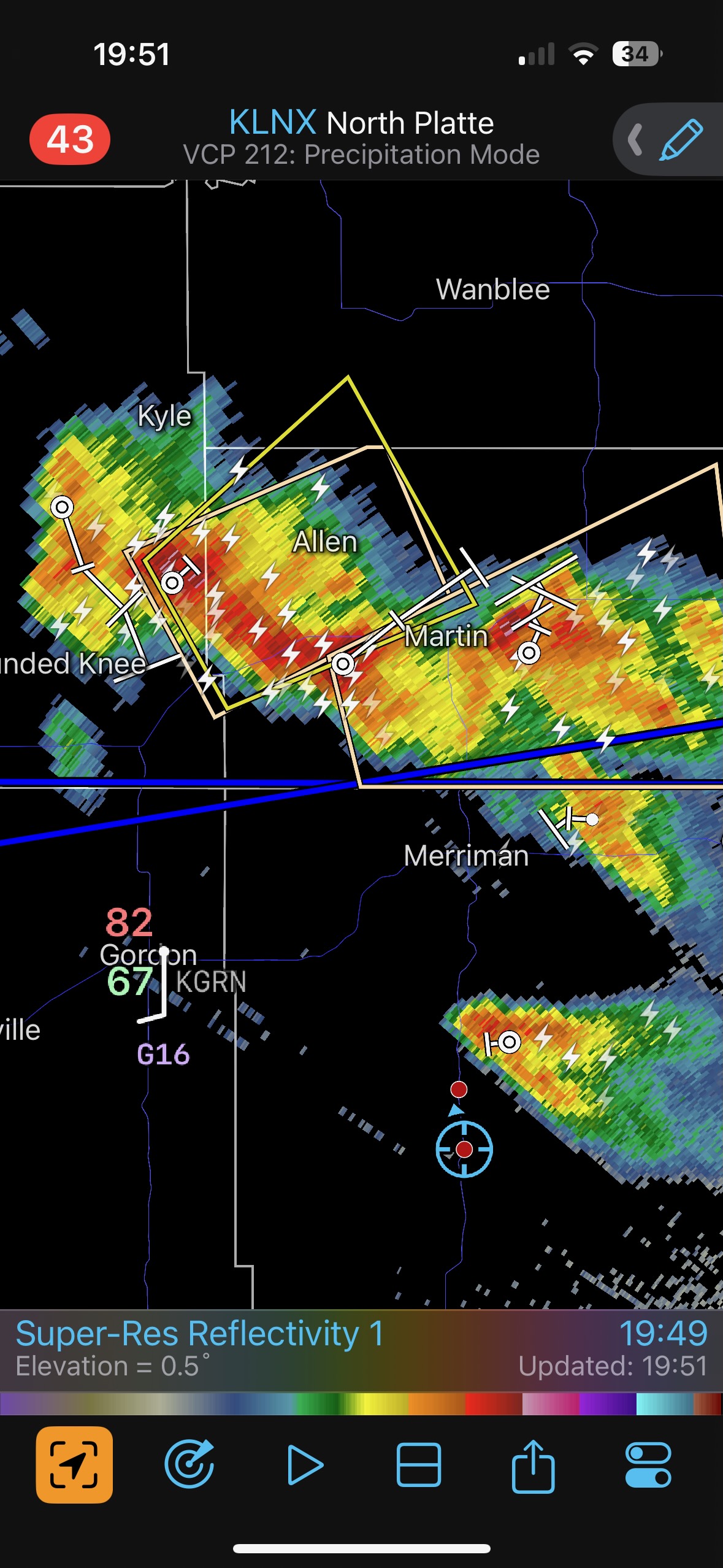
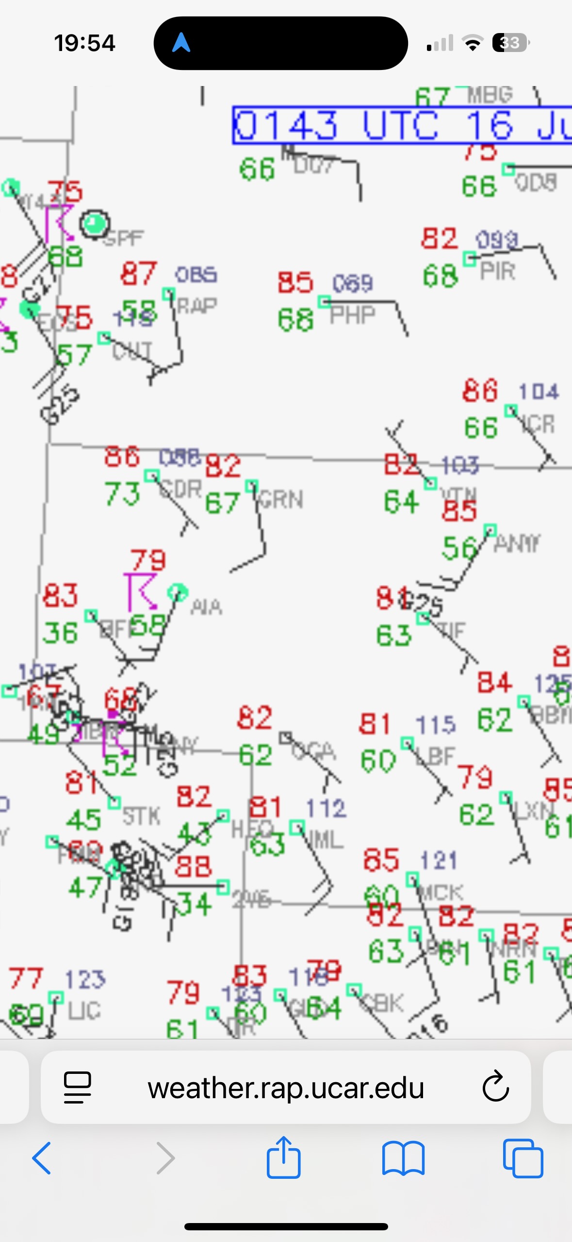
The CAPE values a county or two to the east and northeast of Sidney were very high, see pic below. About 15 miles west of Sidney I took a look over my shoulder towards the northeast. Cumulus clouds were bubbling hard, WAY far away! The radar now showed a blip or two in Cherry County. It was around 3 p.m. MDT. The radar also showed the development that was about an hour away to our west, in Wyoming. We could see those storms. The area was severe-warned. I turned the tour around. I knew that the Cherry County play would likely prove much more compelling and interesting, compared to this High Plains play. But that was only if it got strong and stayed strong for a while! A chaser cannot ignore an isolated storm in that big CAPE environment when there is adequate shear. We were about three hours away, so I needed a storm that would be strong towards sunset, and I needed a storm that wasn’t moving away from me to the east and making life more difficult. Is that asking too much?!
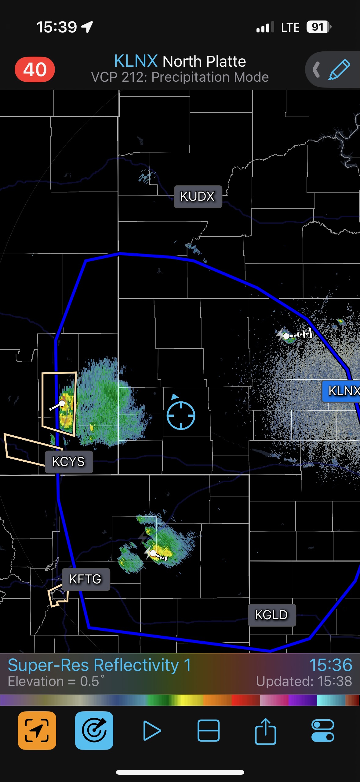
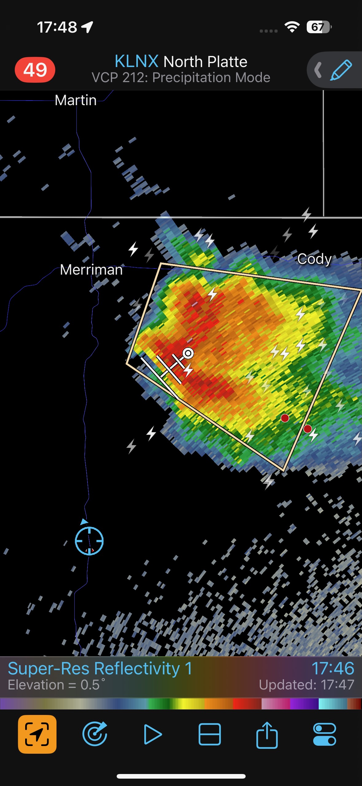
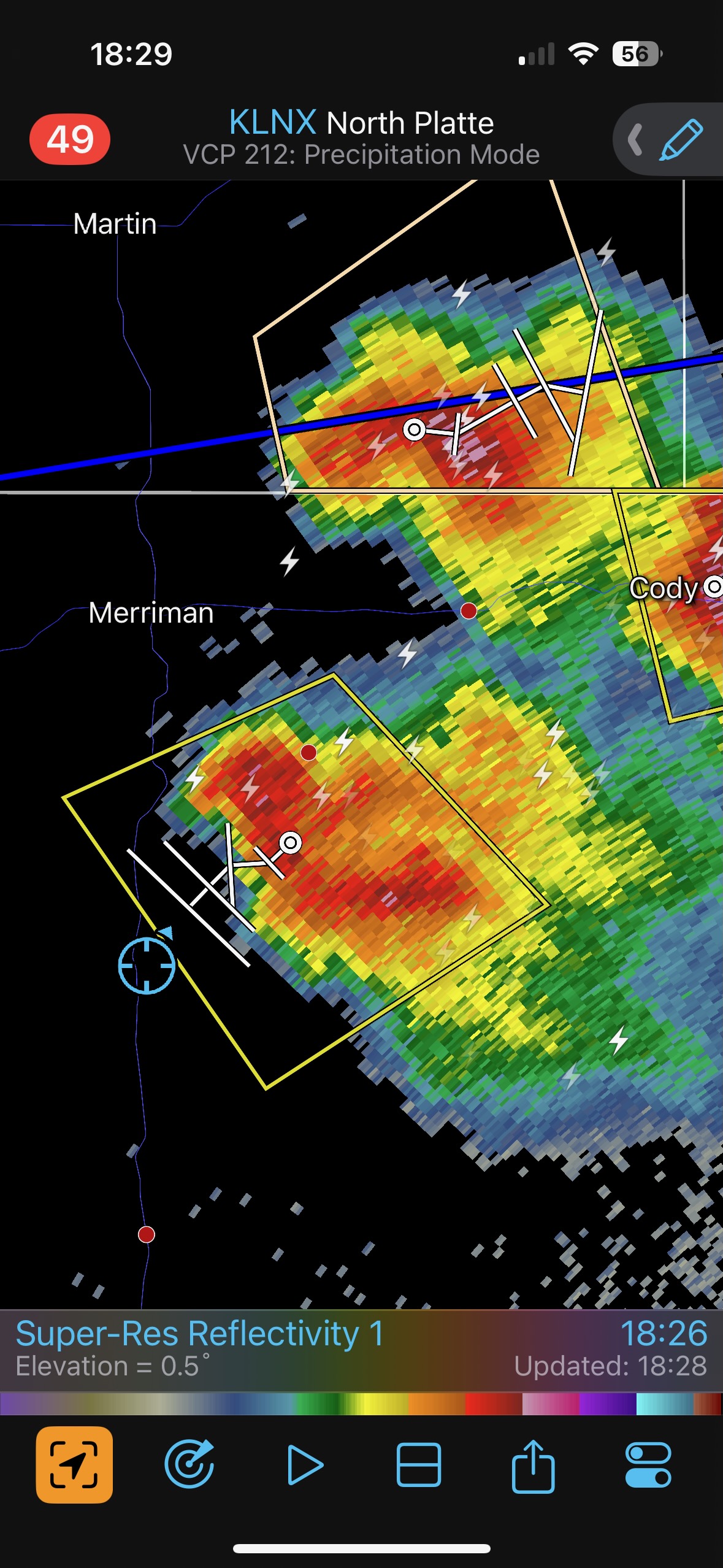
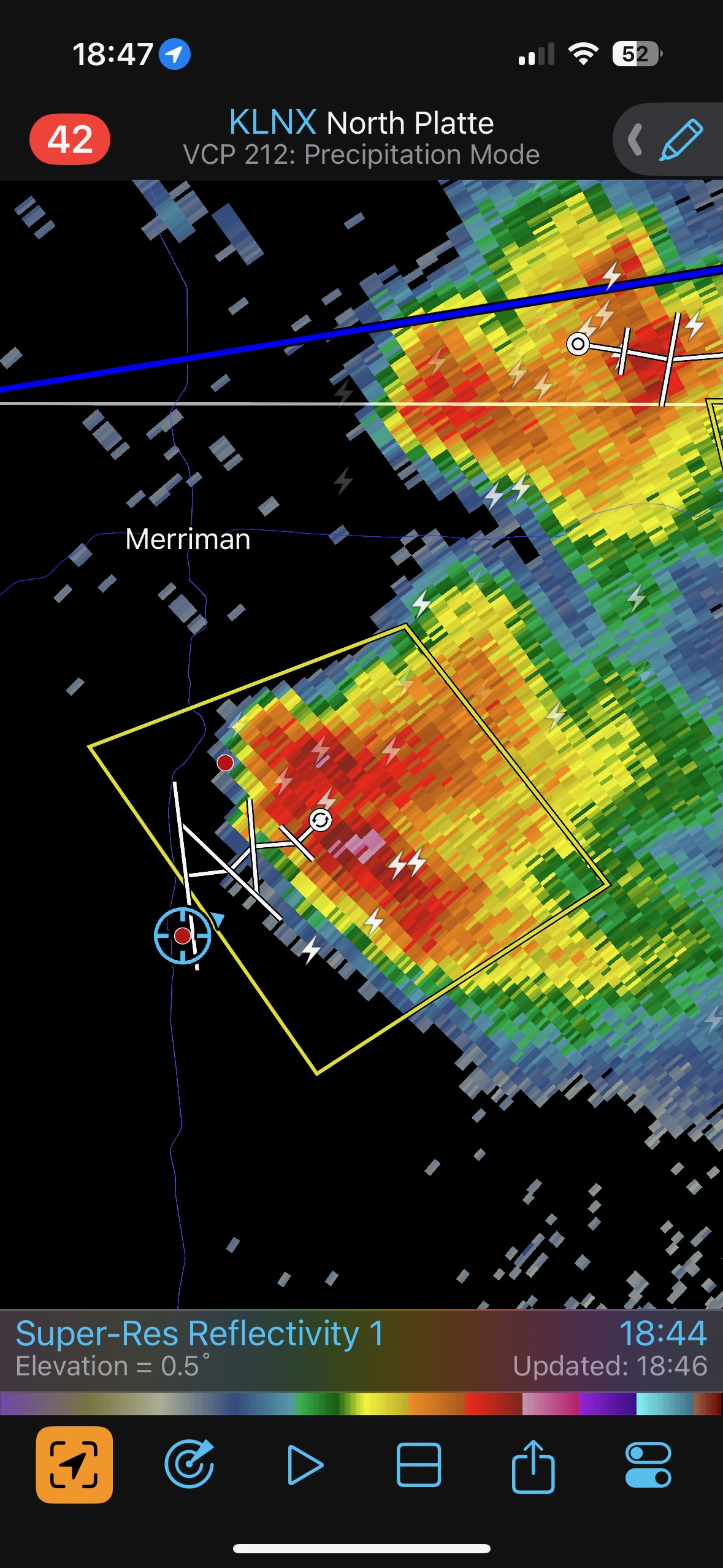
The radar grab at 15:39 shows dinky returns drifting to the east, a little south of U.S. 20 in Cherry County to our northeast. The next picture shows exactly what we could see visually. We backtracked east to Sidney, headed north to Alliance on 385, and then east on 2 to Hyannis.
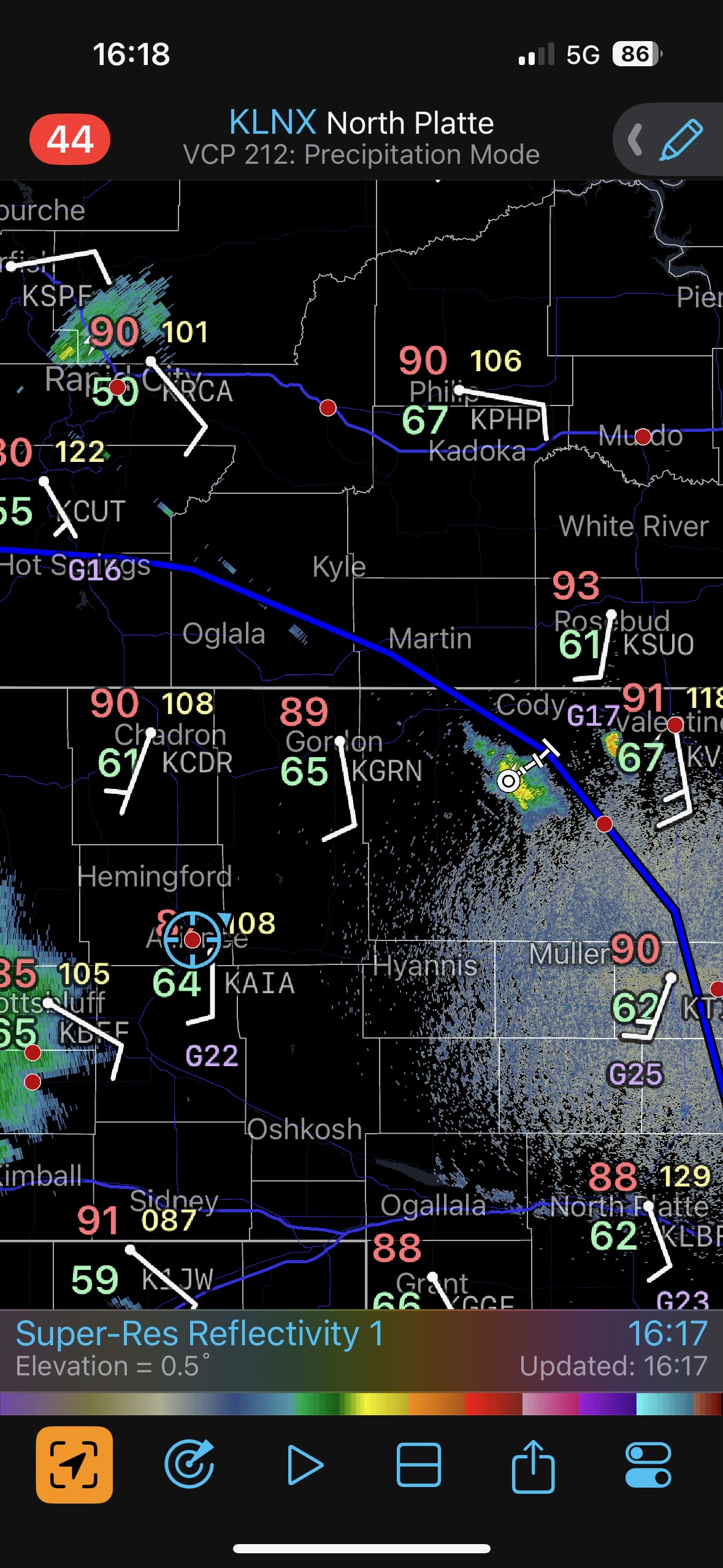
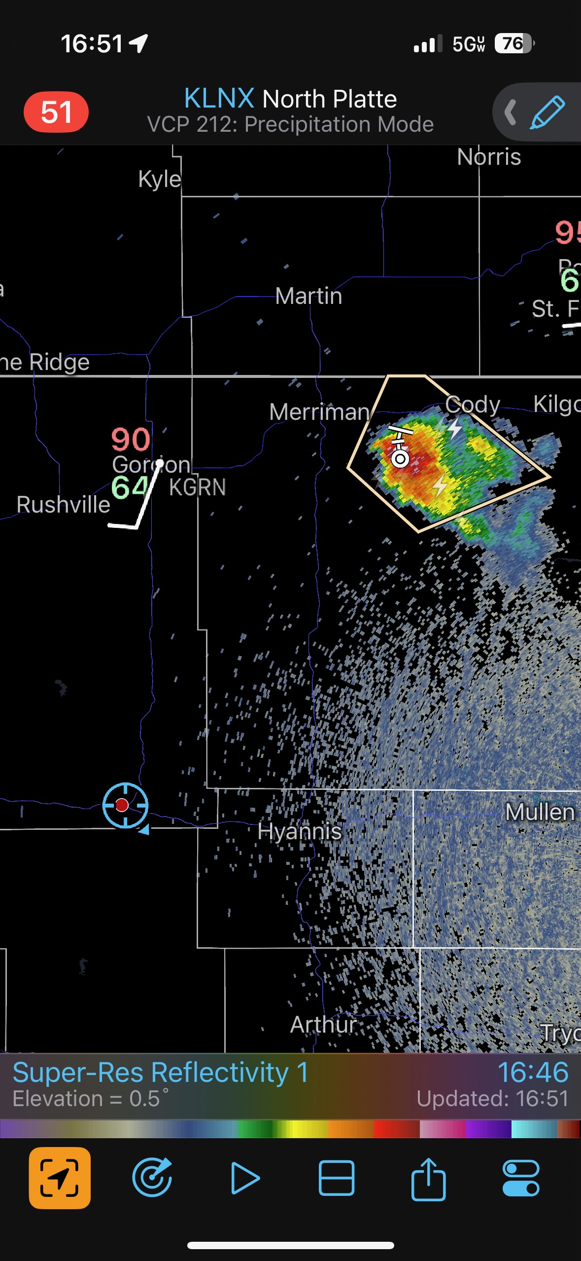
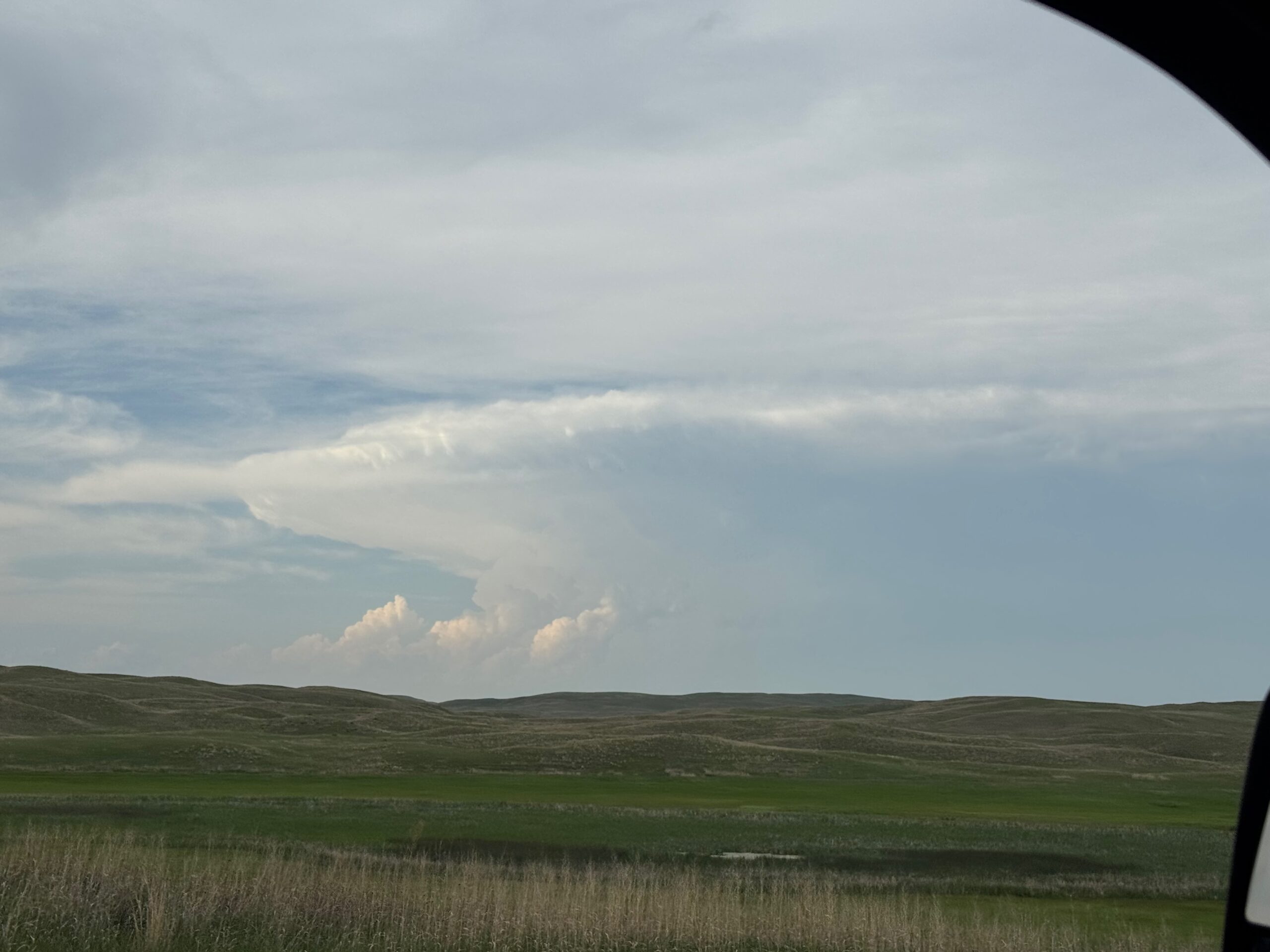
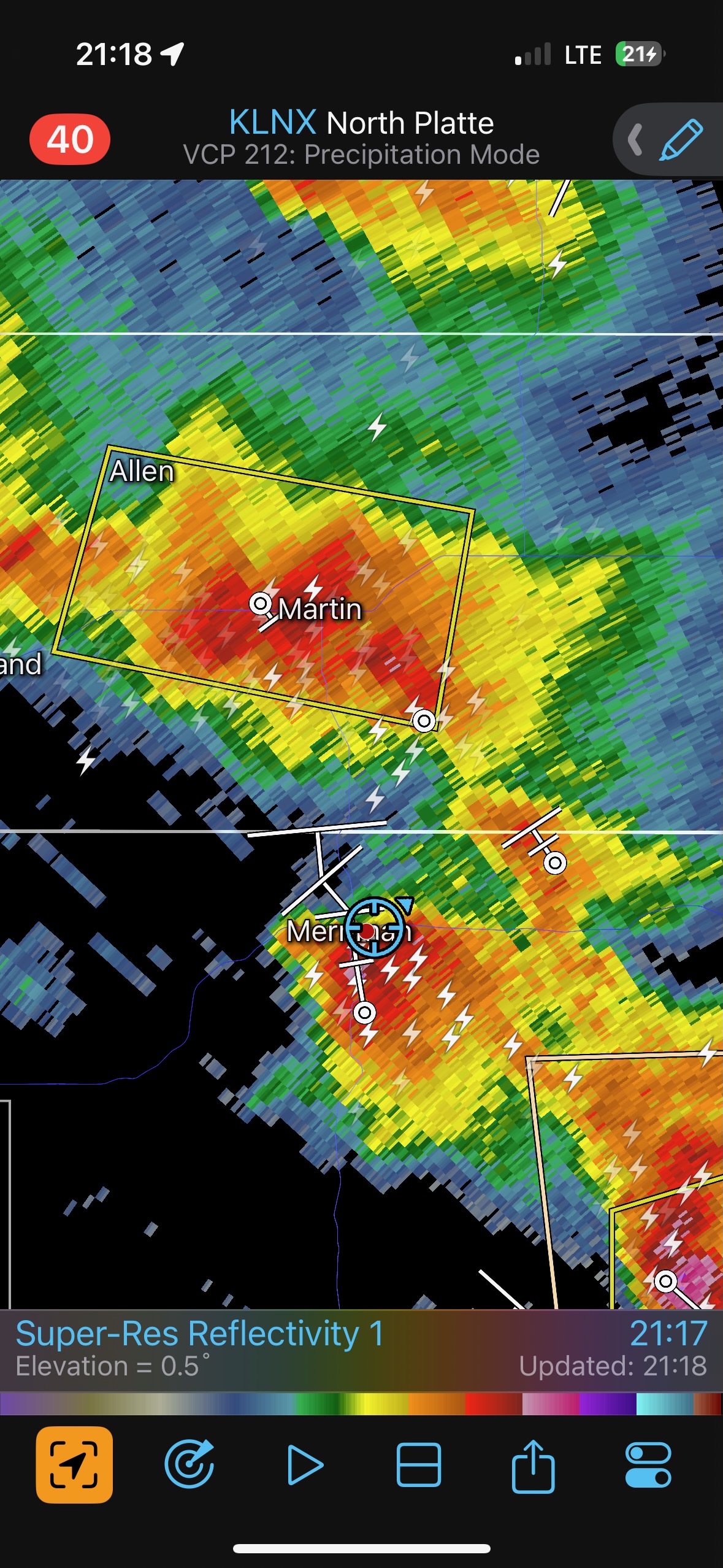
We could see the occasional updraft pulses on the distant storm(s). The cells were moving slowly to the east, which was not good for us. But it looked like there was active back-building towards northwestern Cherry County, which was good. We wanted the western-most cell, presumably! The surface obs off of the screenshot at 16:18 above show that the wind shift associated with a boundary is decidedly north of the border and north of this storm development. The dew points are nice, up to 65F at Gordon, NE. But why were these storms developing here? I don’t have an answer.
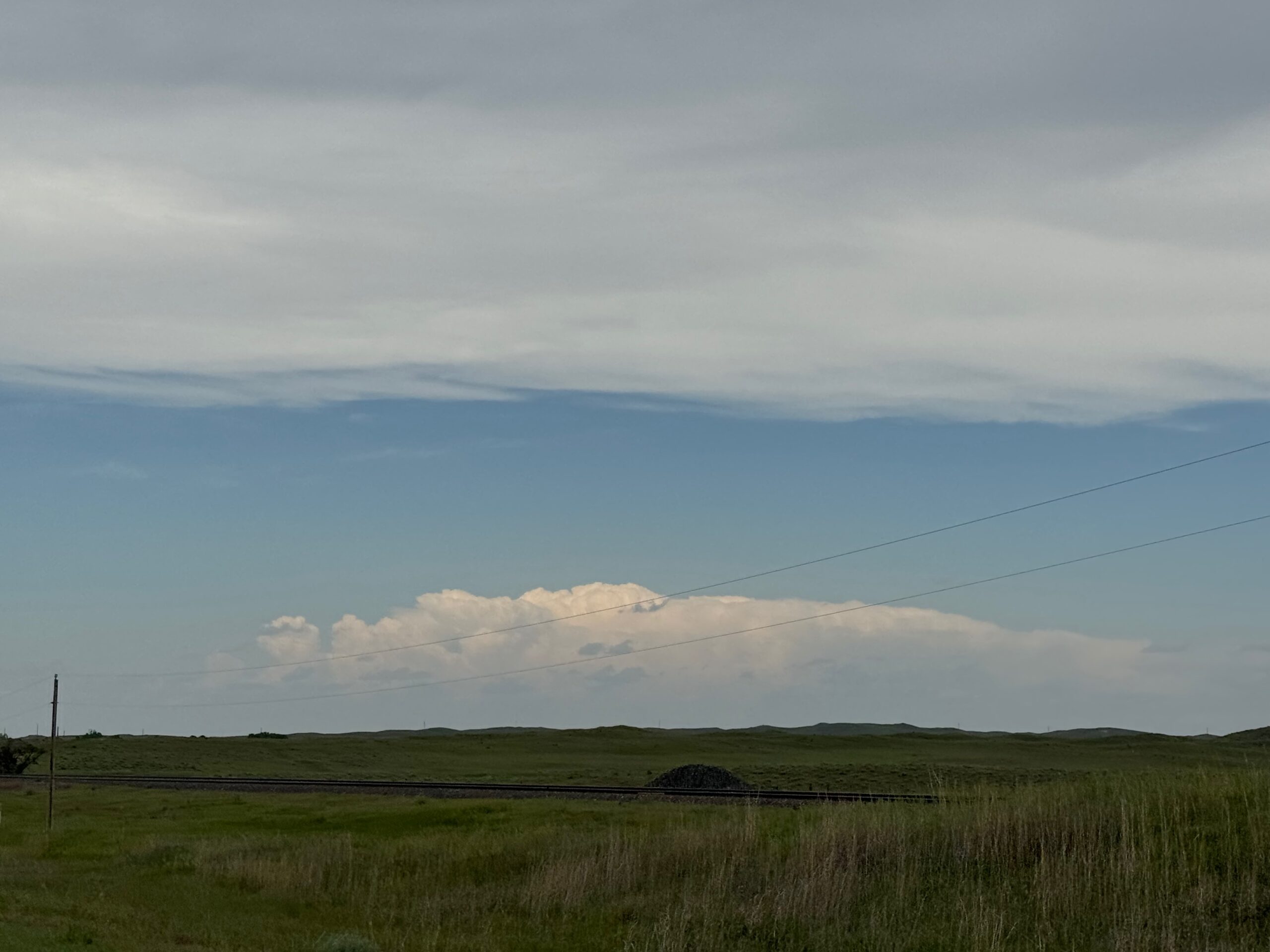
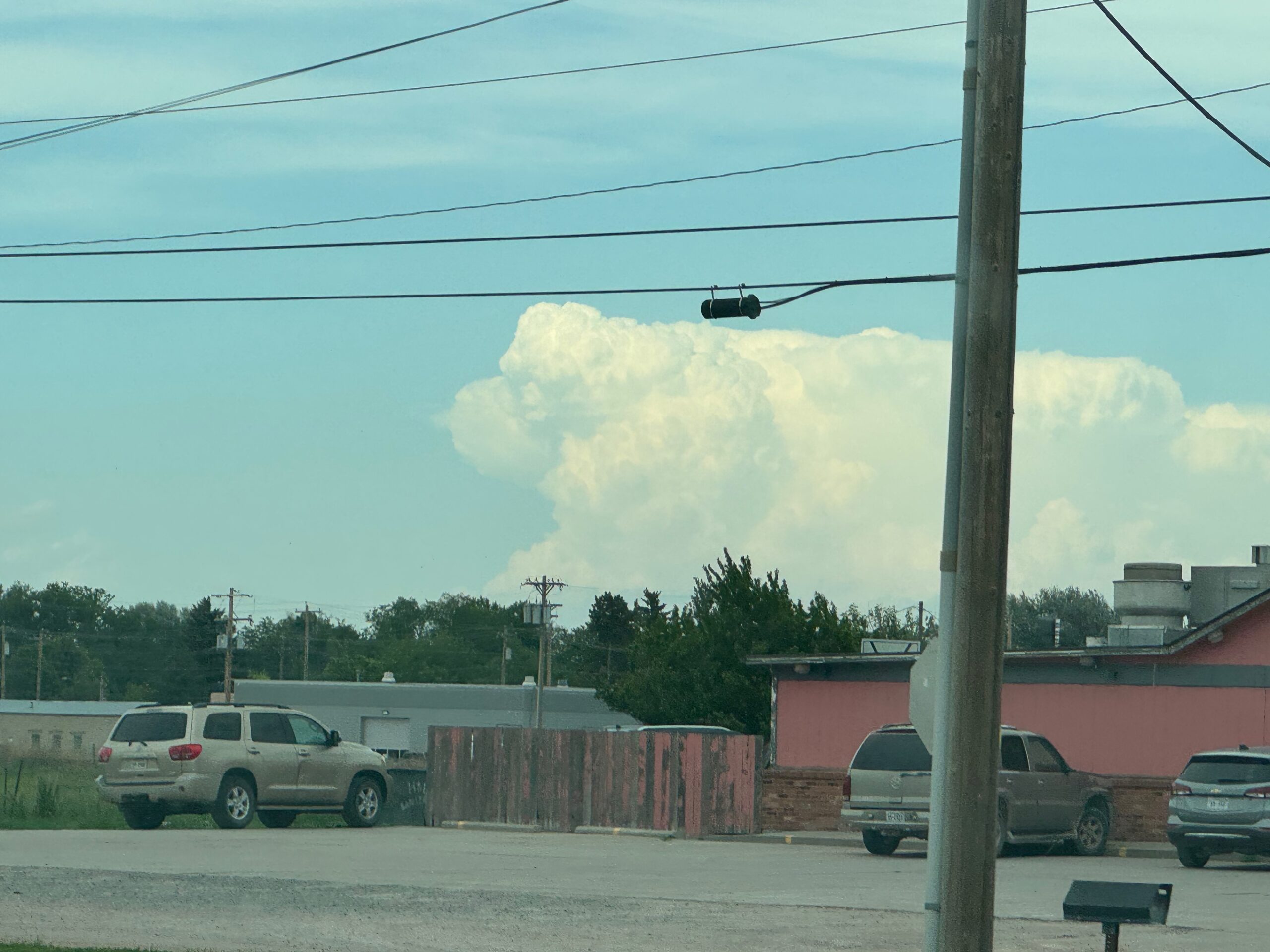
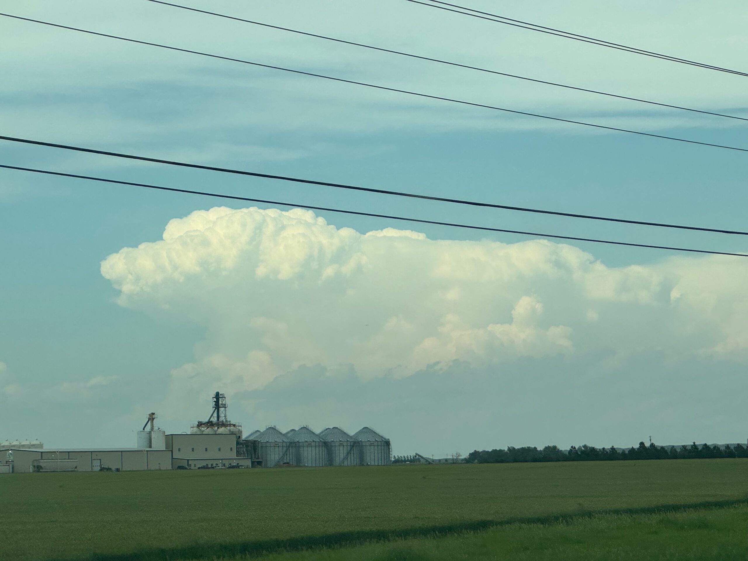
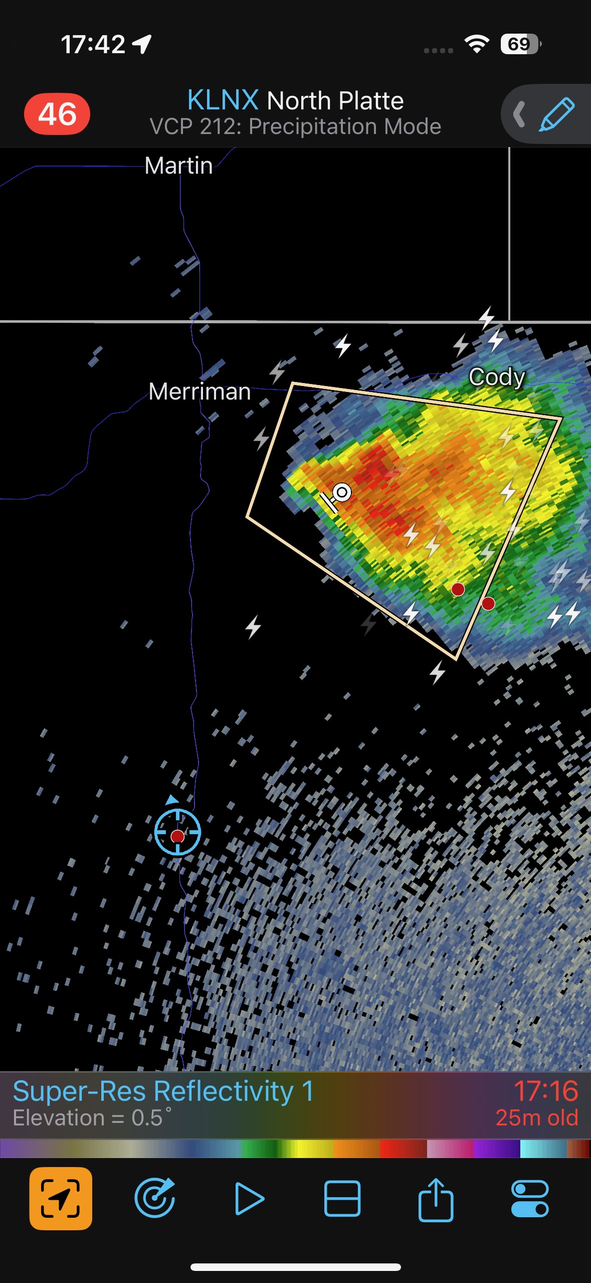
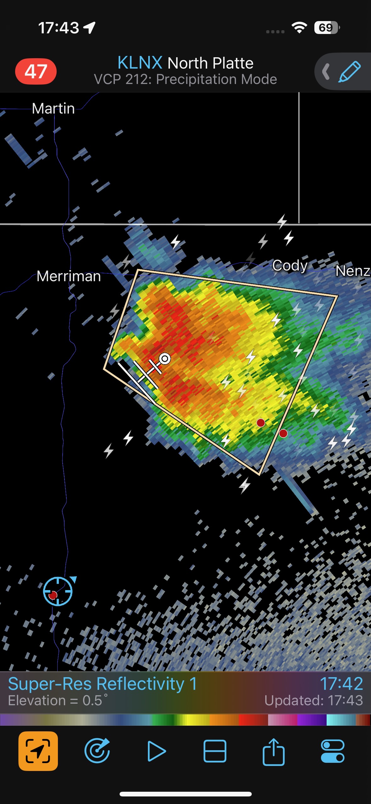
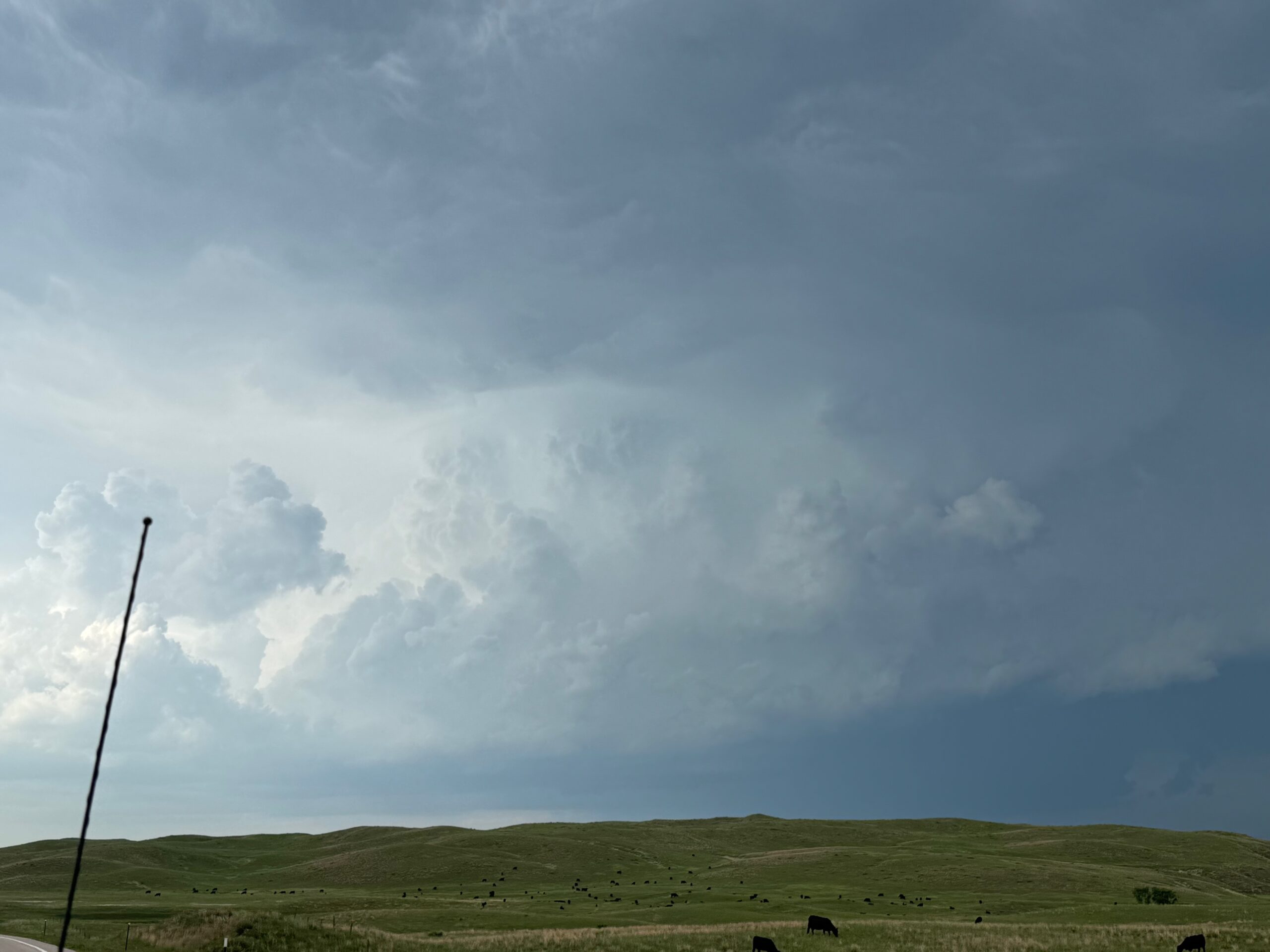
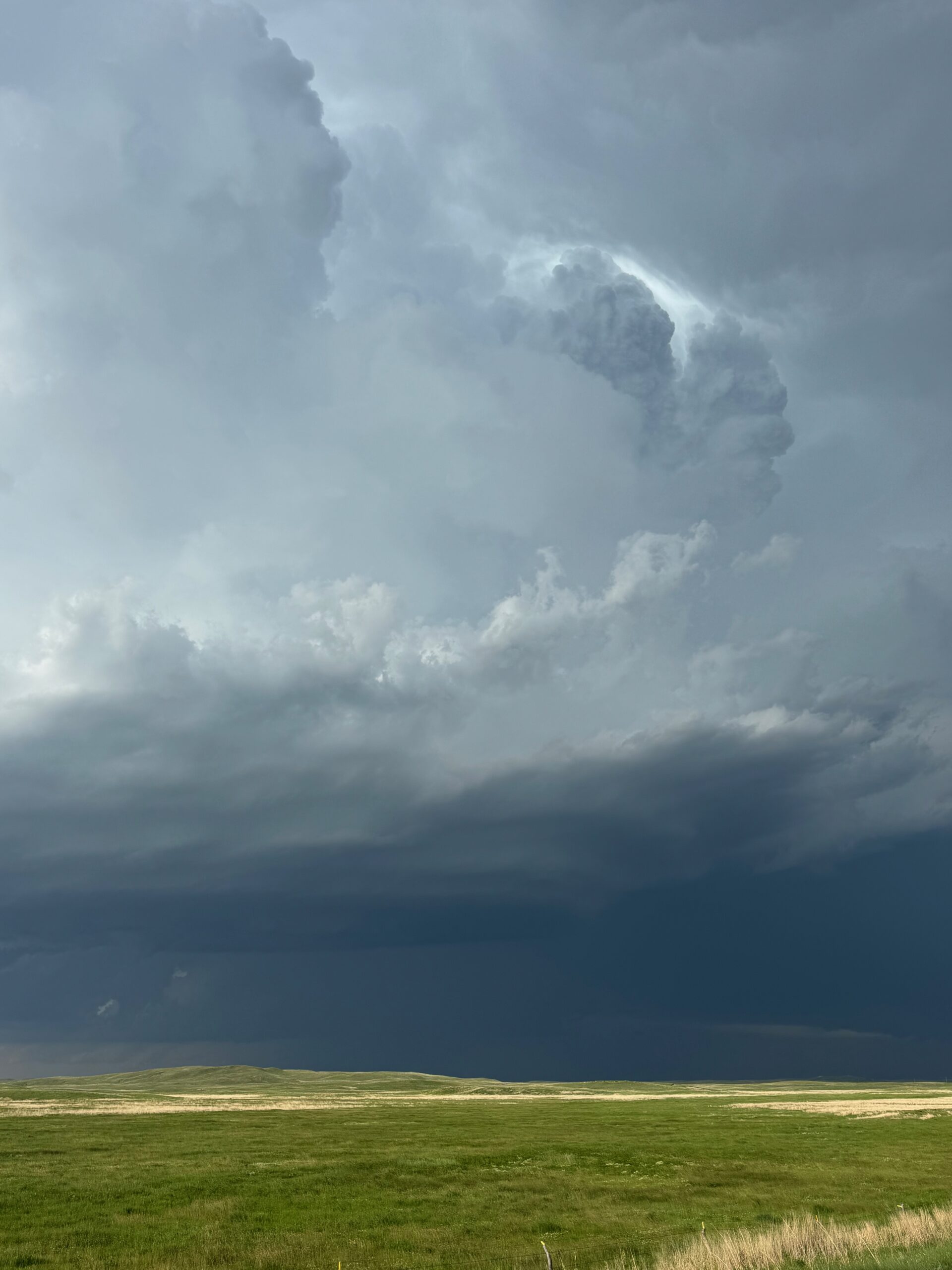
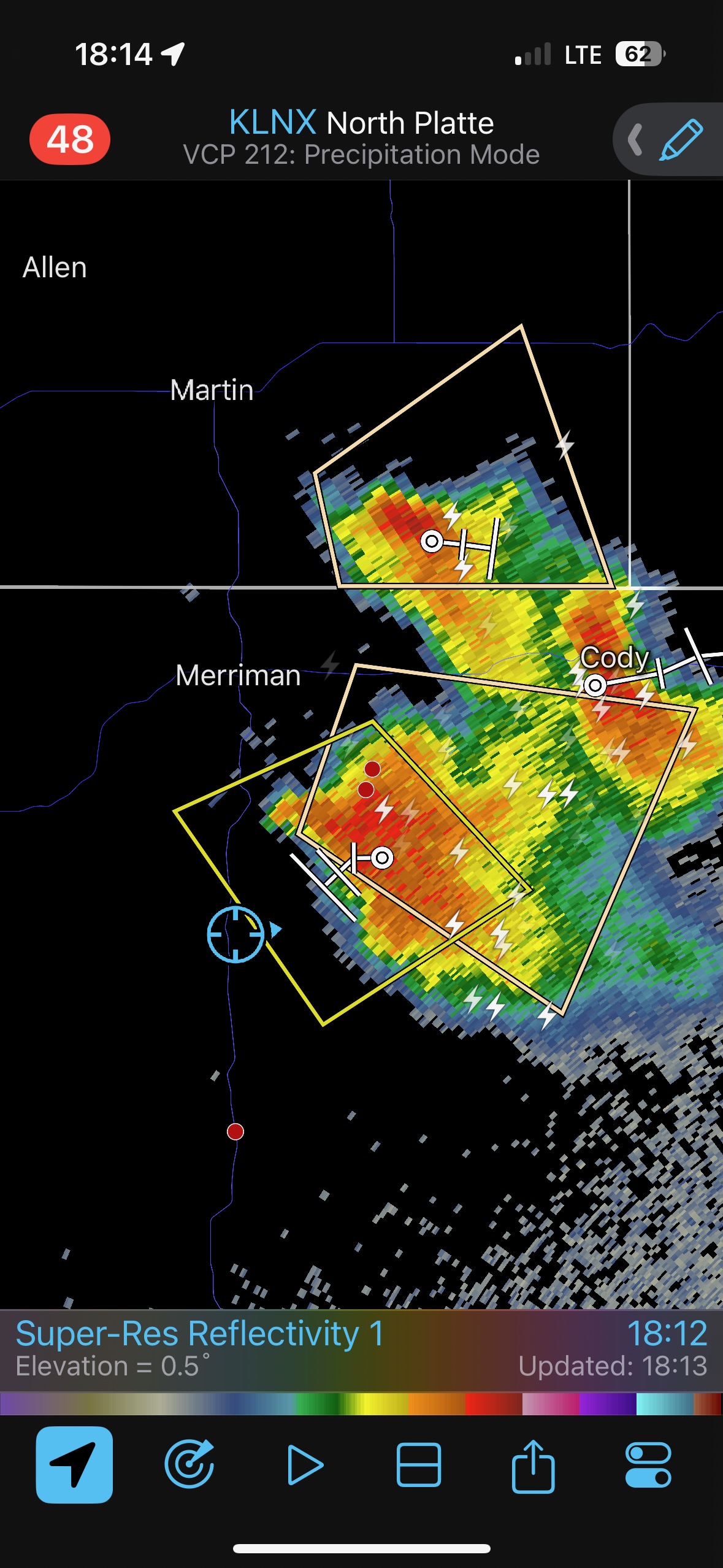
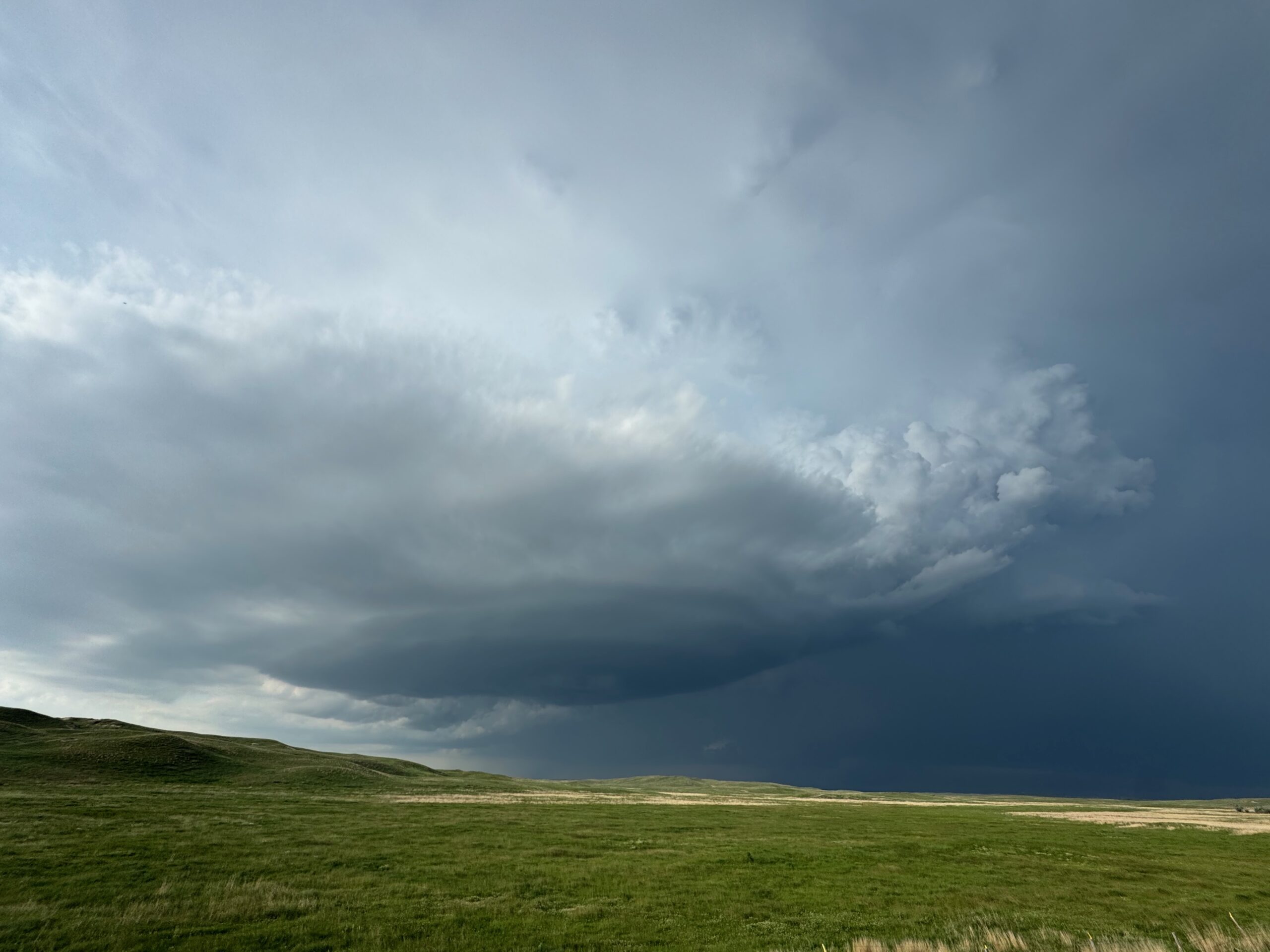
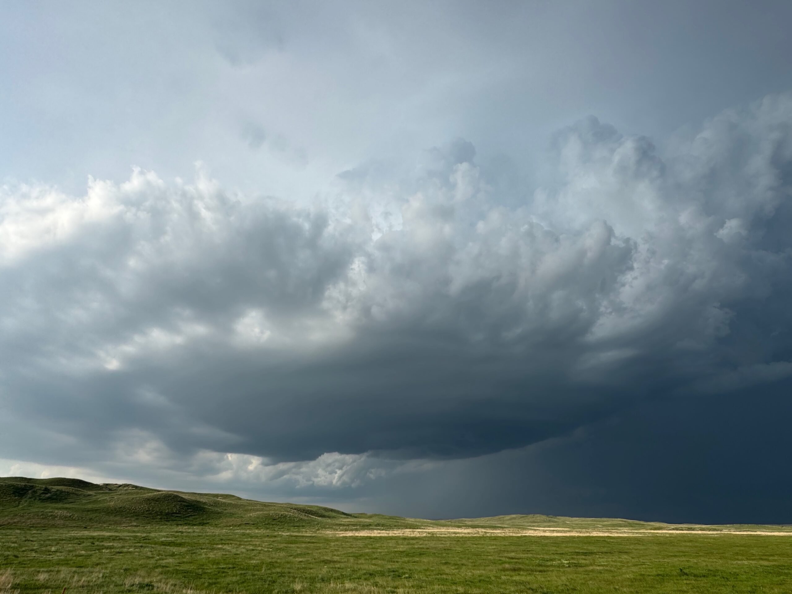
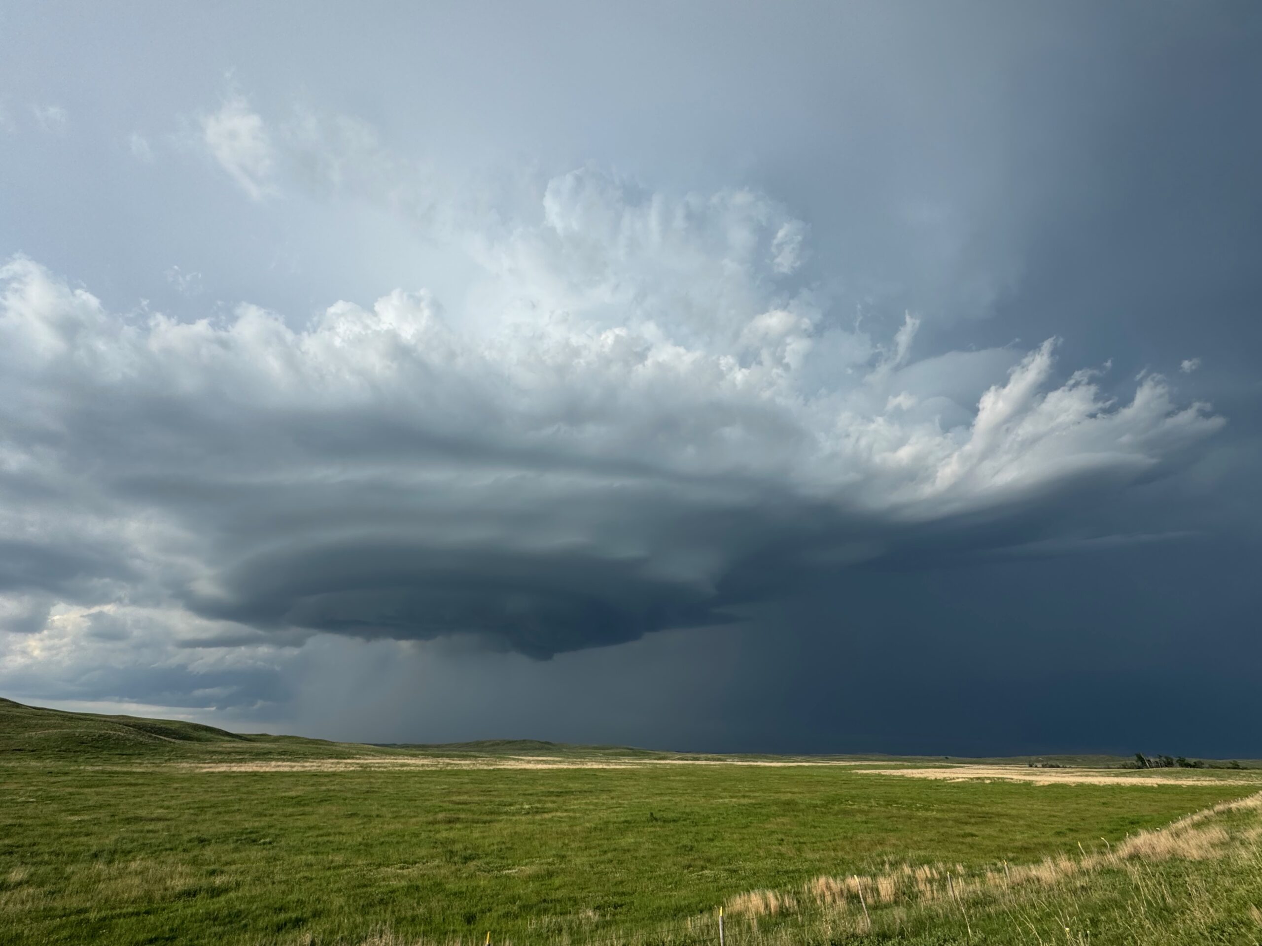
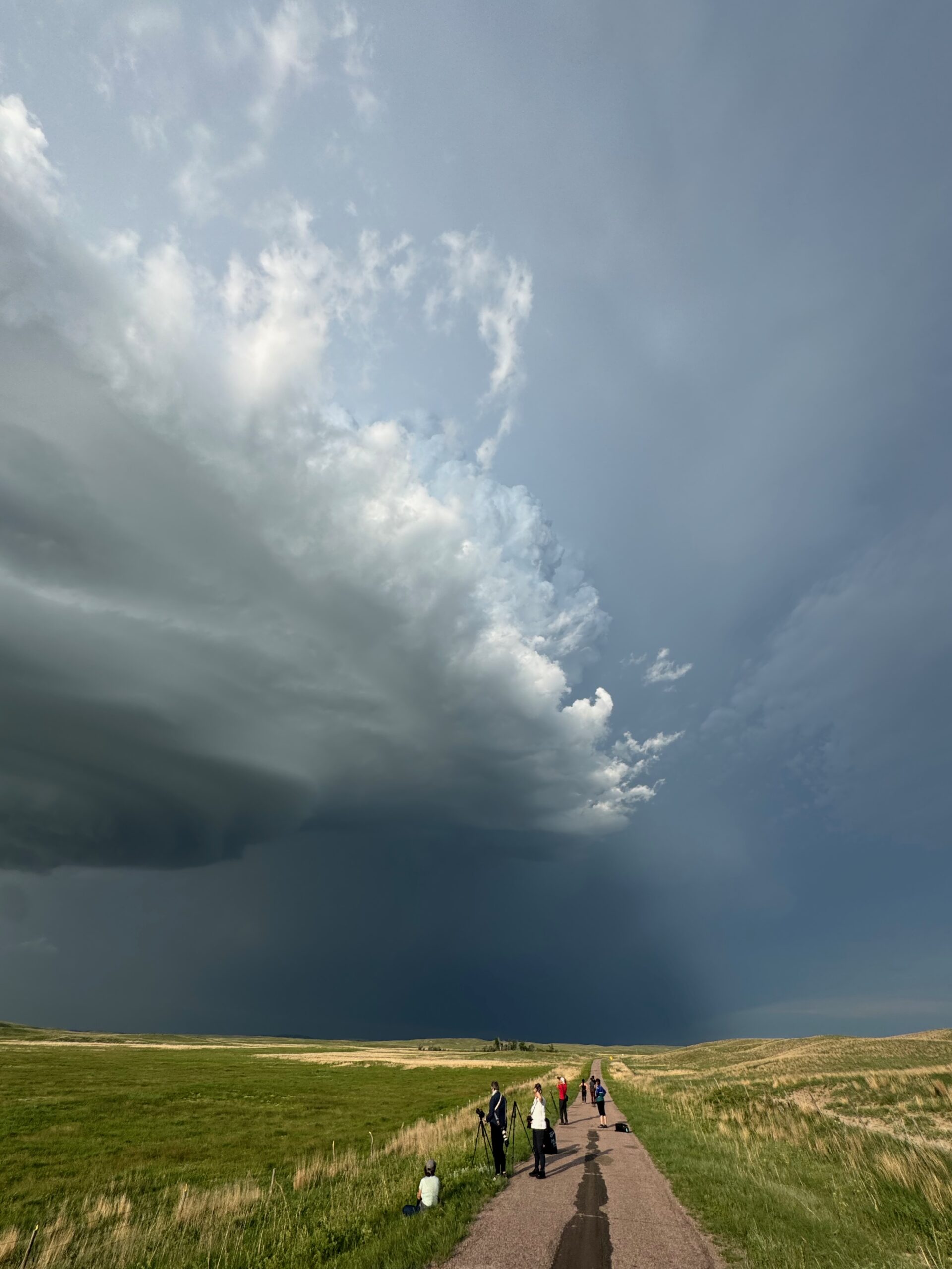
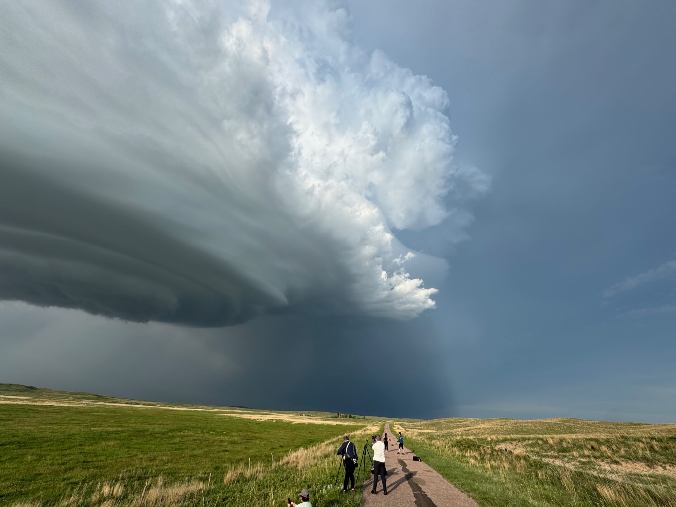
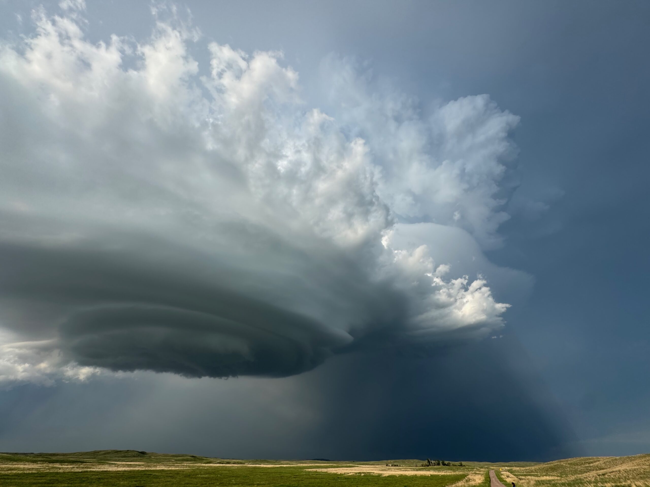
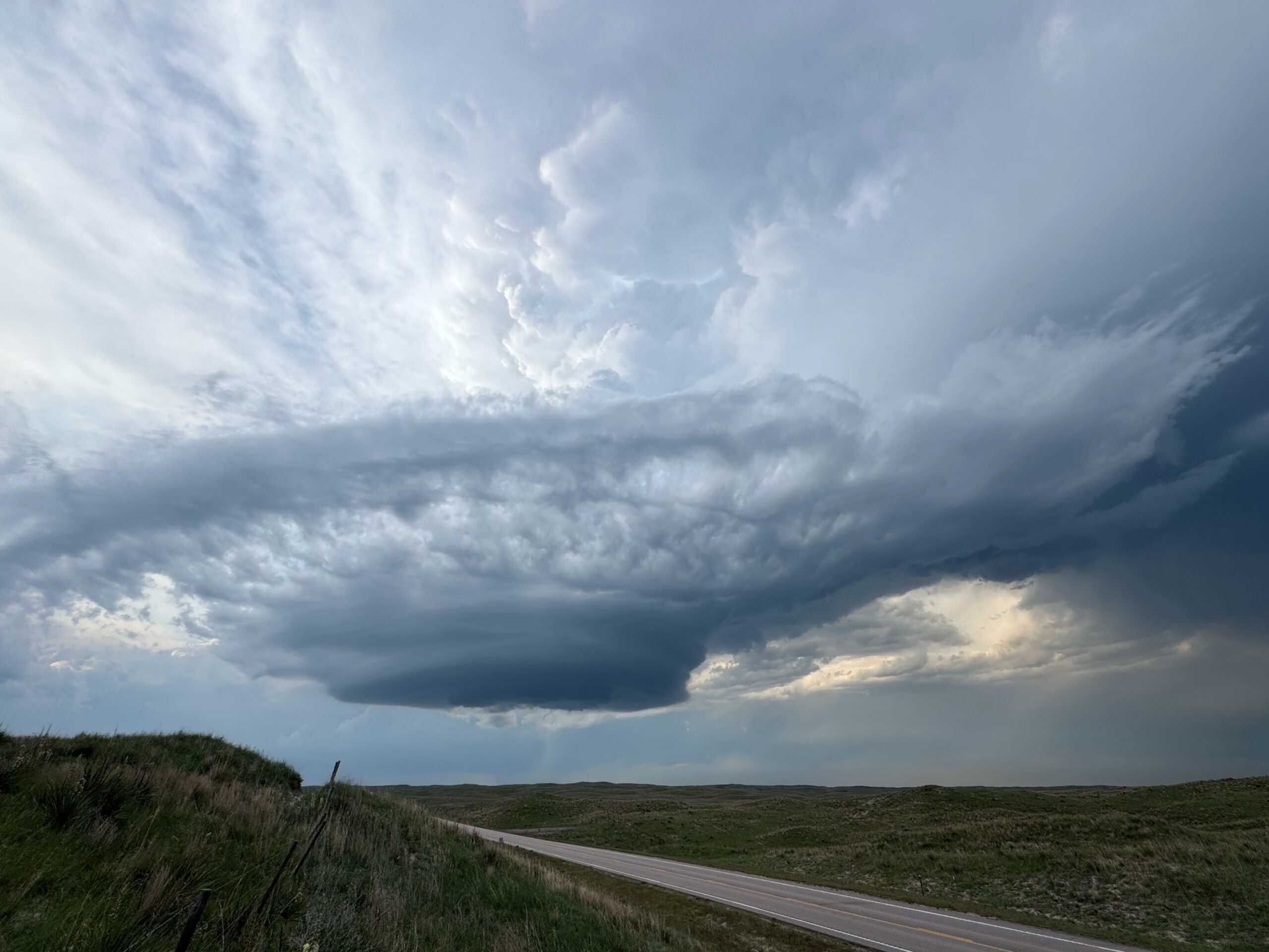
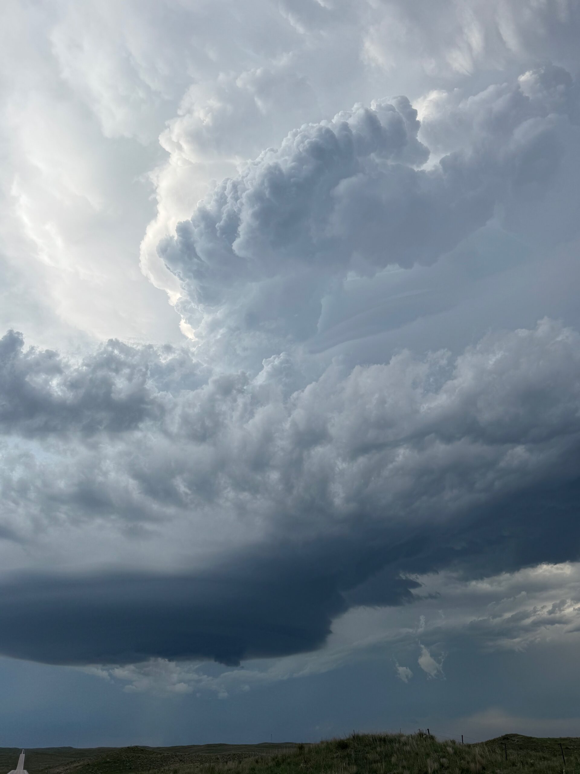
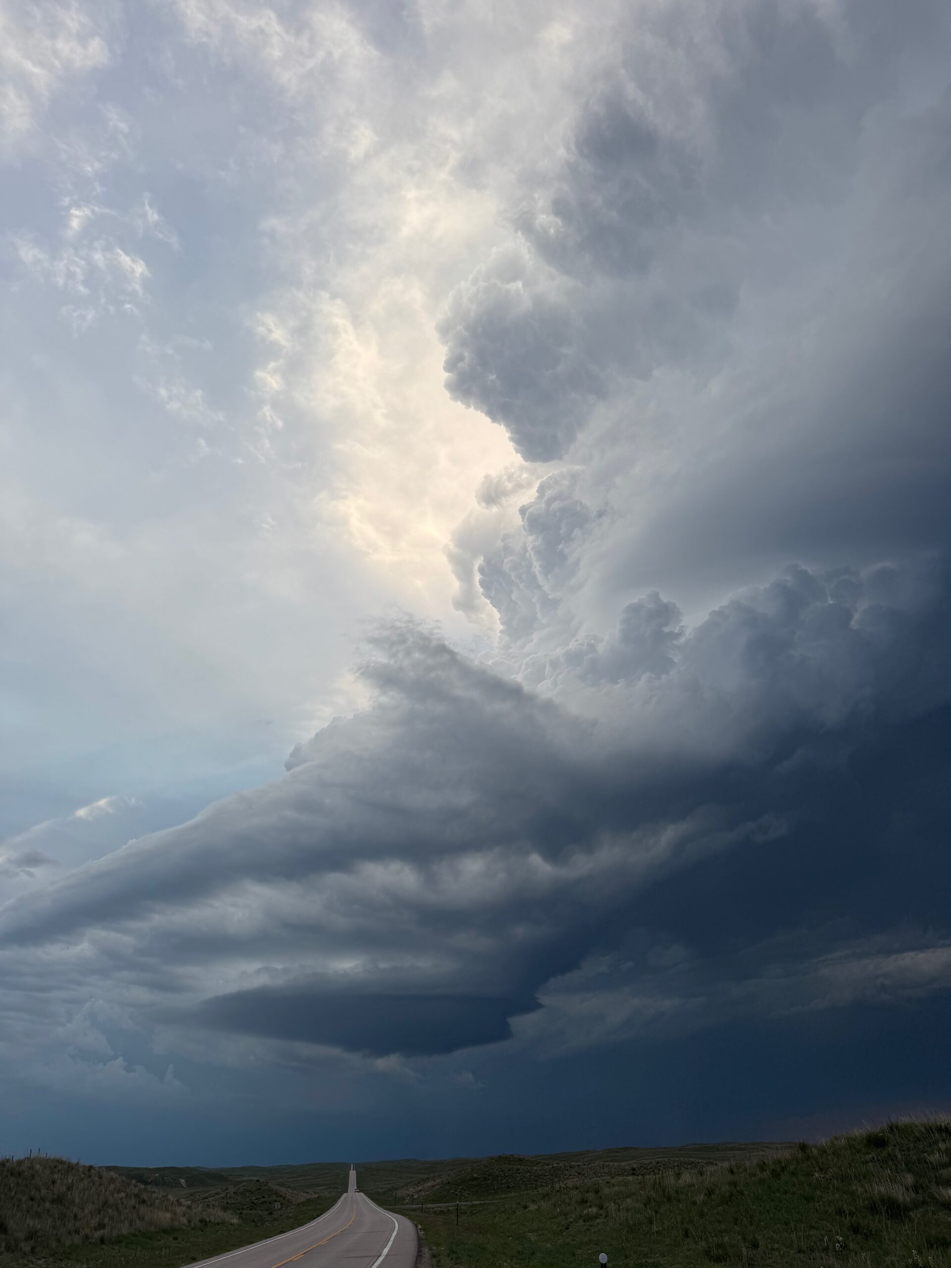
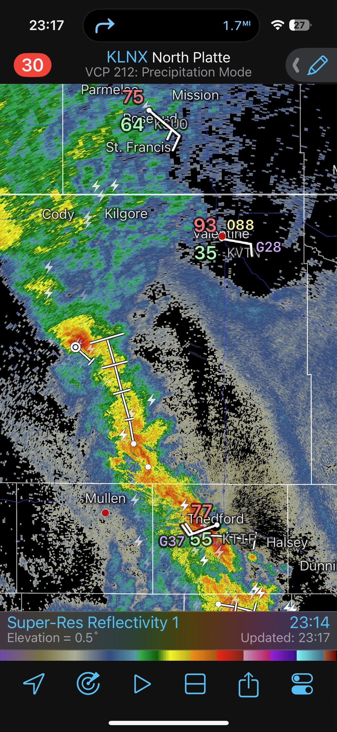
The next group of iPhone shots (below) shows the development of the thunderstorm, located about 15 miles ESE of Merriman, in the Sandhills (see radar at 16:51 p.m. MDT). These shots were taken as we headed eastward on Highway 2 from Alliance. There is a nice and beefy overshooting top, a solid storm anvil with some backshear, and a stout updraft, of course. It is severe-warned! And we were still about 90 minutes away — this is torture. Fortunately, the storm was nearly stationary, and even slowly back-building a little with each new updraft push. Along this stretch I had to decide if I should go north on 61 from Hyannis, which would probably put us a bit west of the storm ultimately. The other north options looked to be much too far to the east. We were in one of the poorest road networks on the Great Plains. We would turn left at Hyannis. It was about 5:15 p.m. MDT. The storm was looking fabulous!
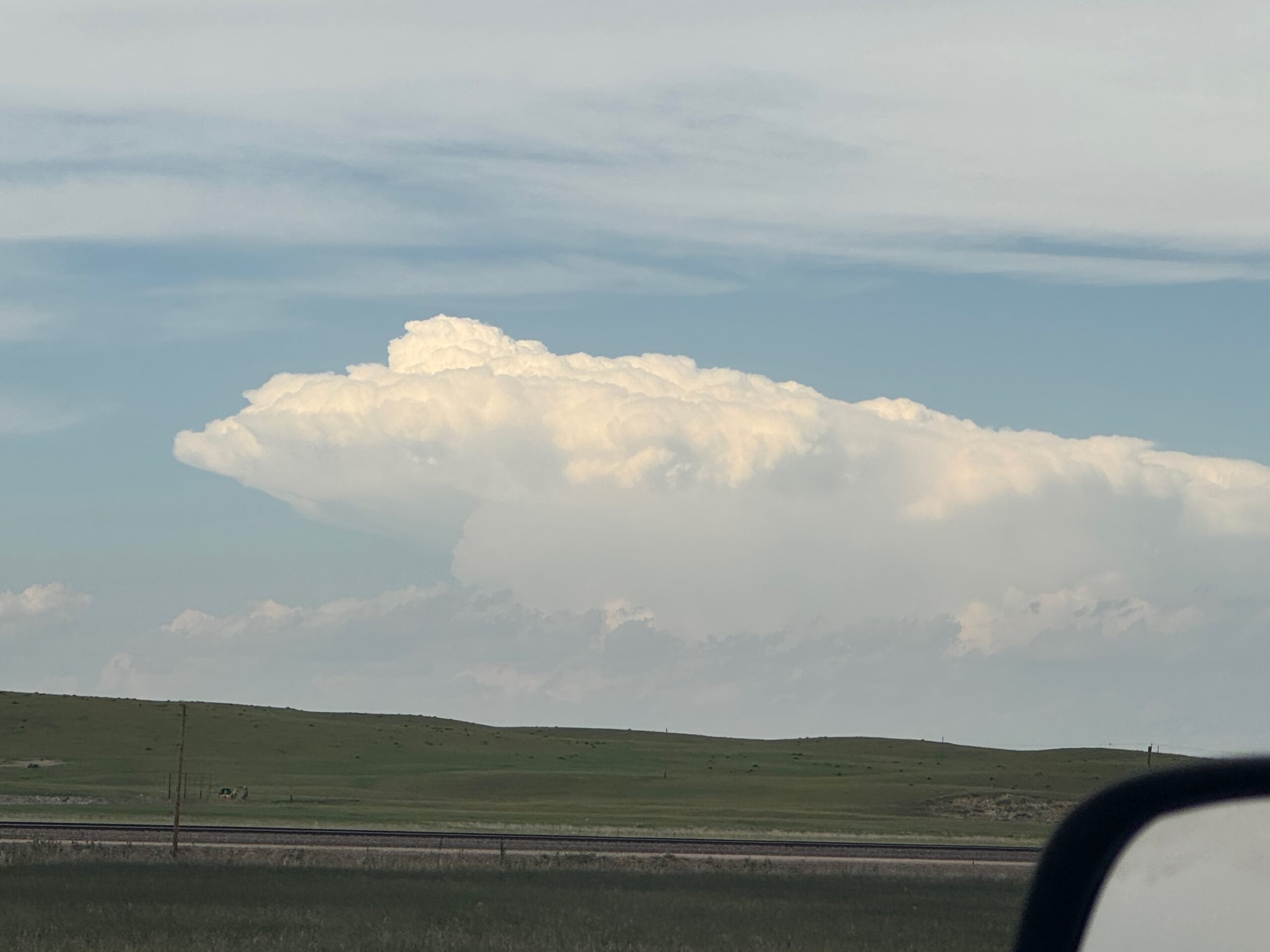
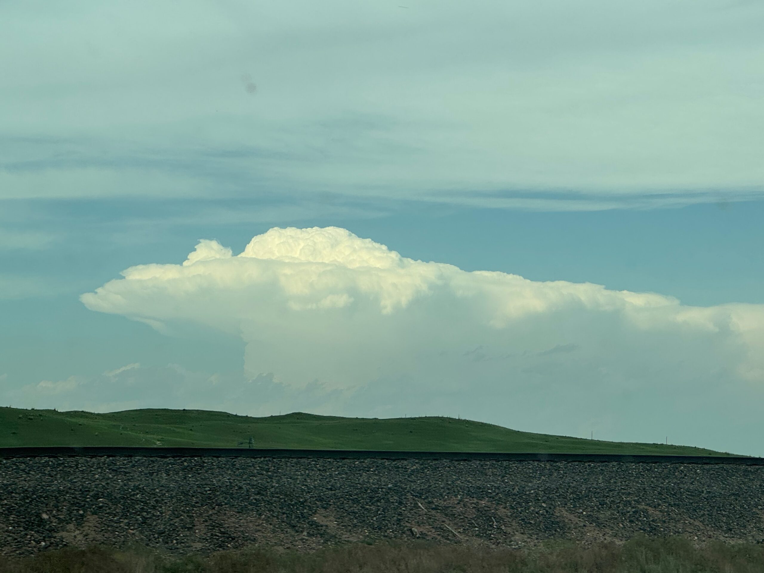
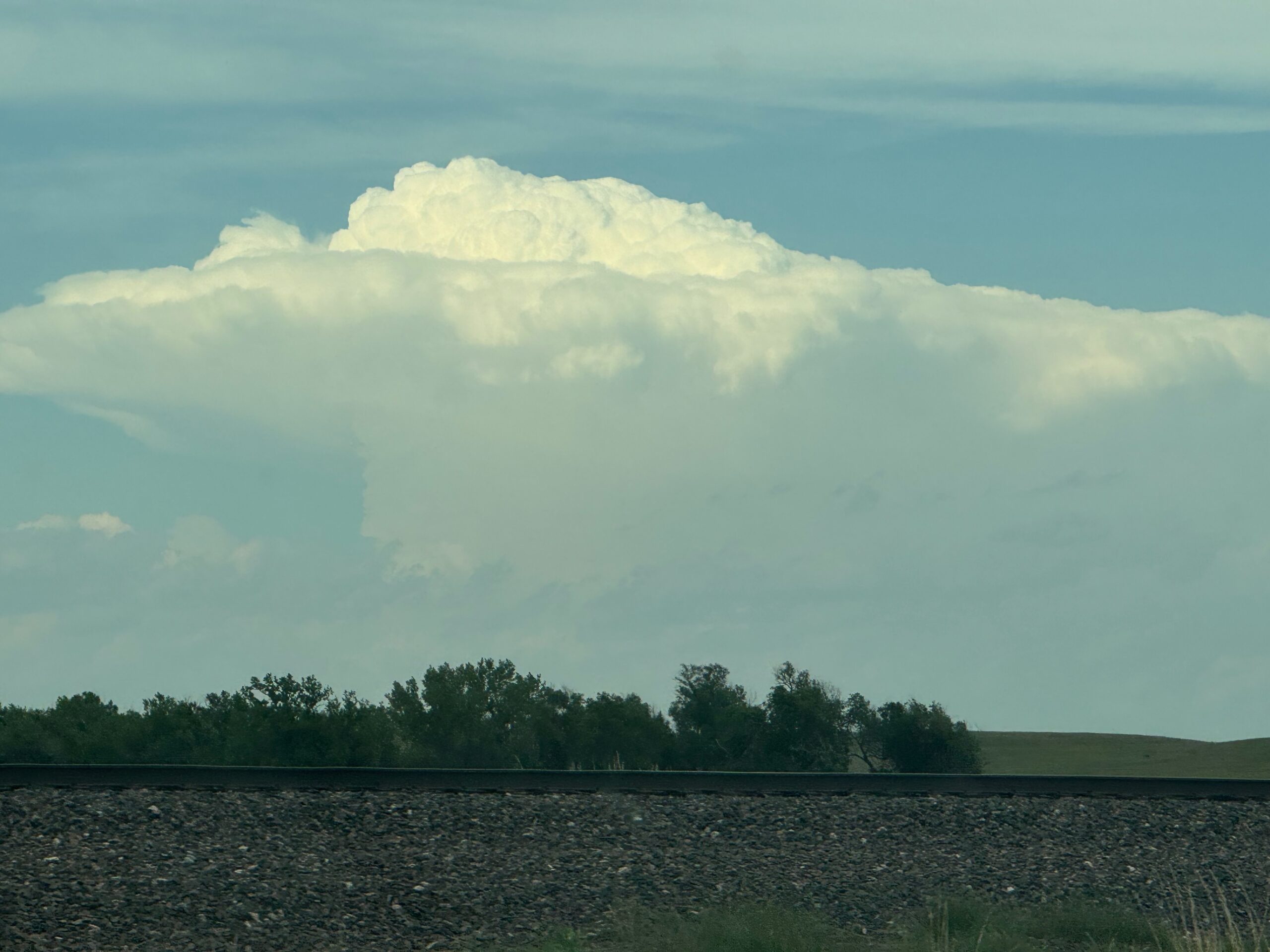
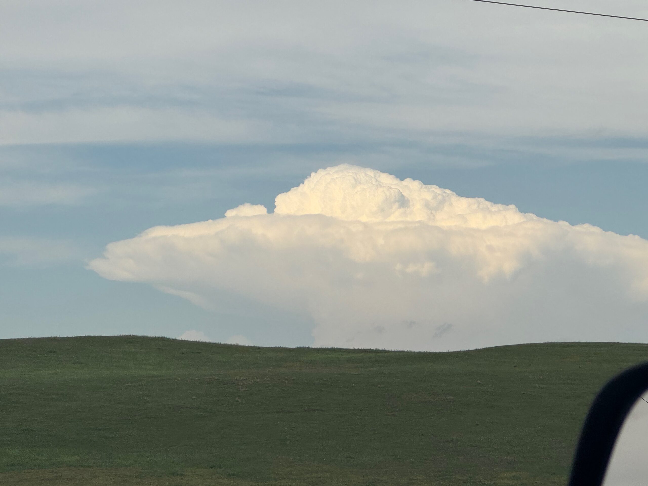
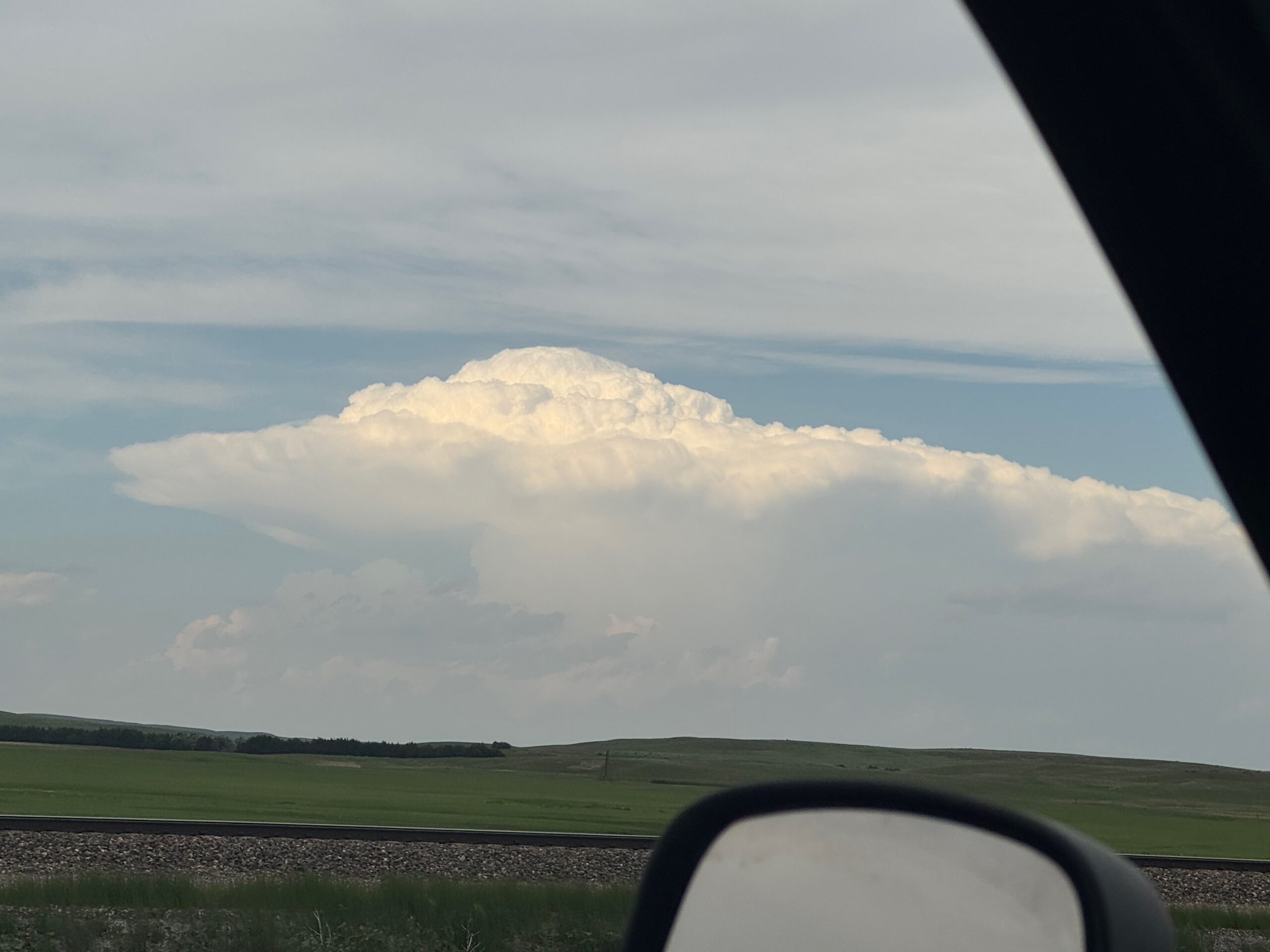
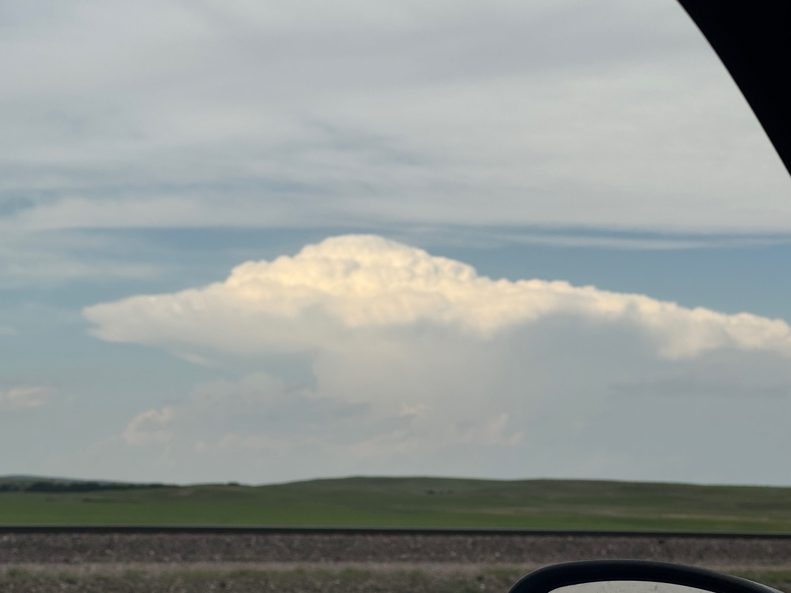
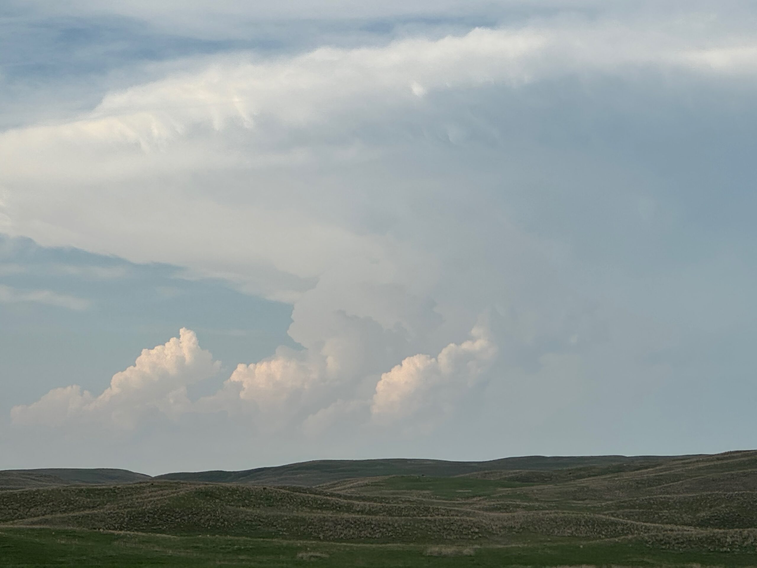
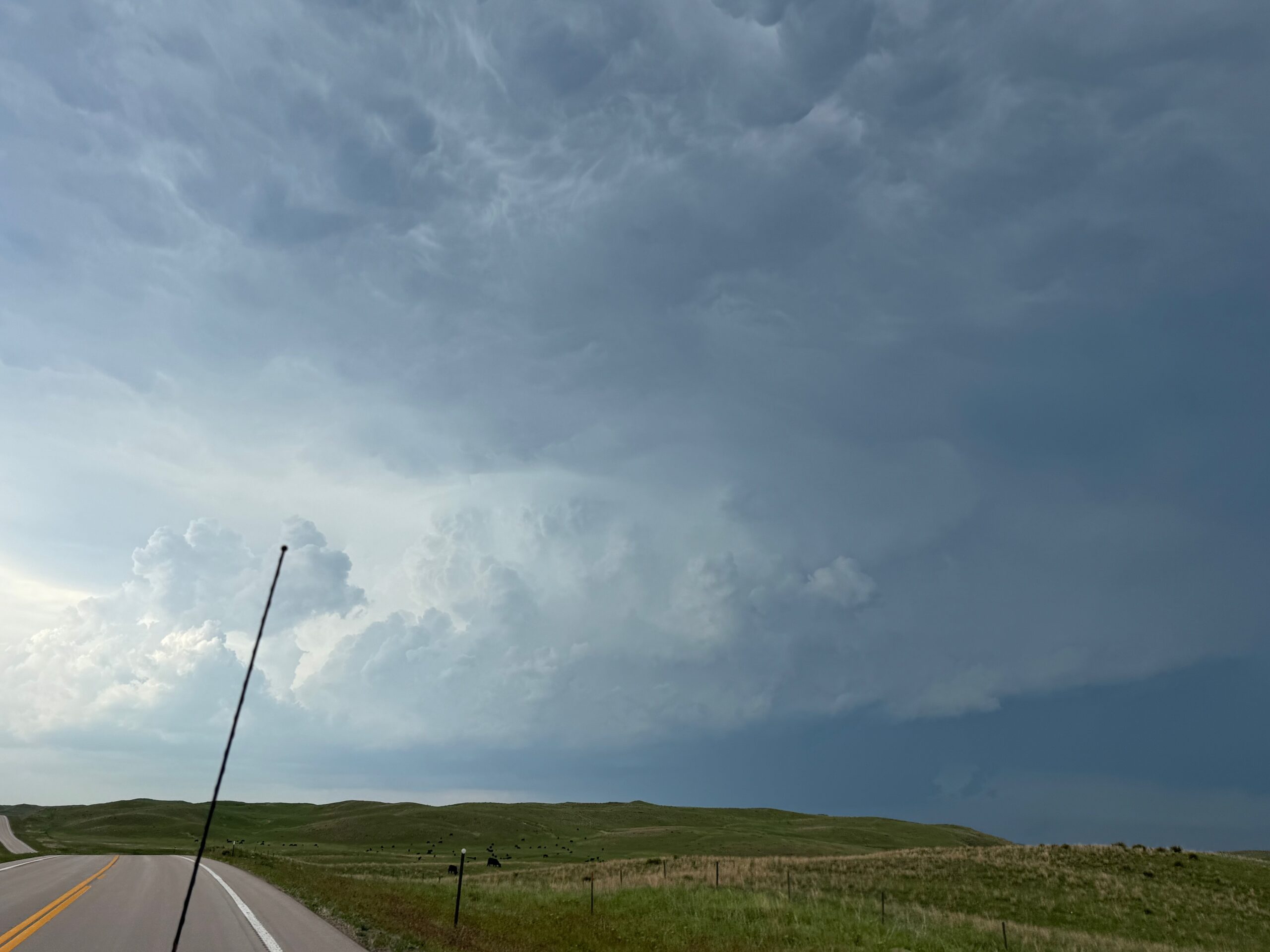
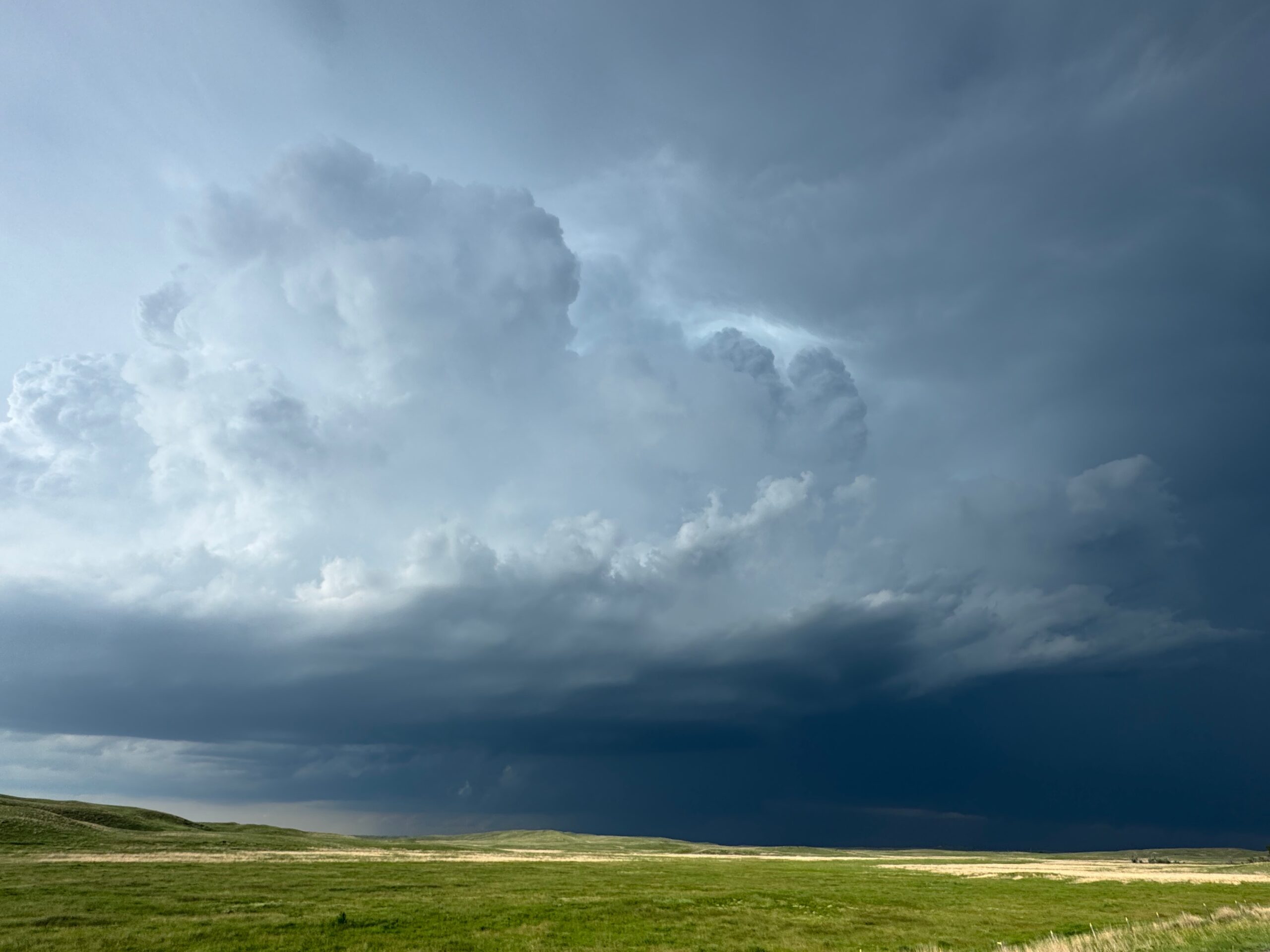
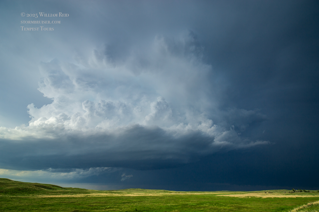
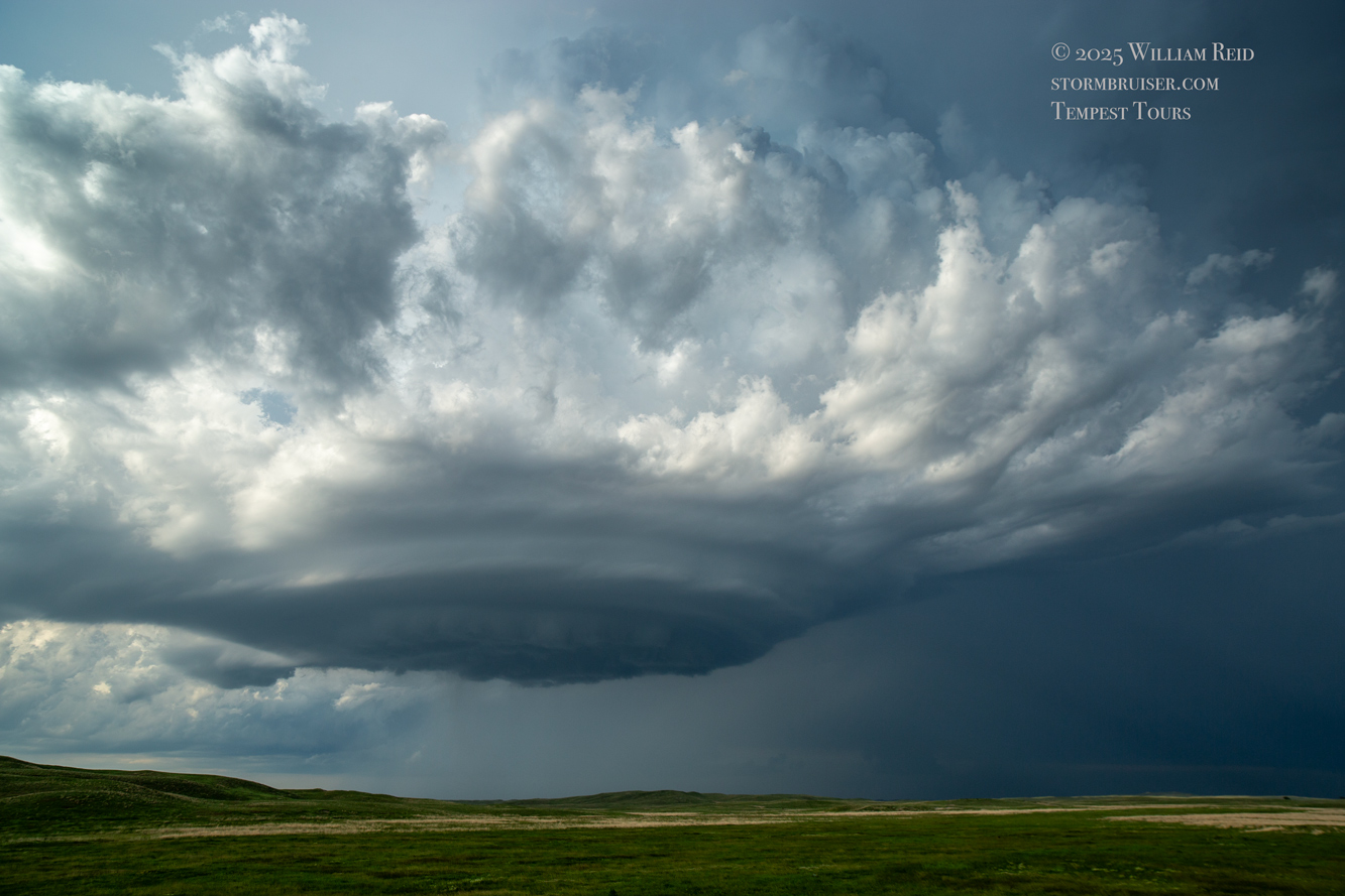
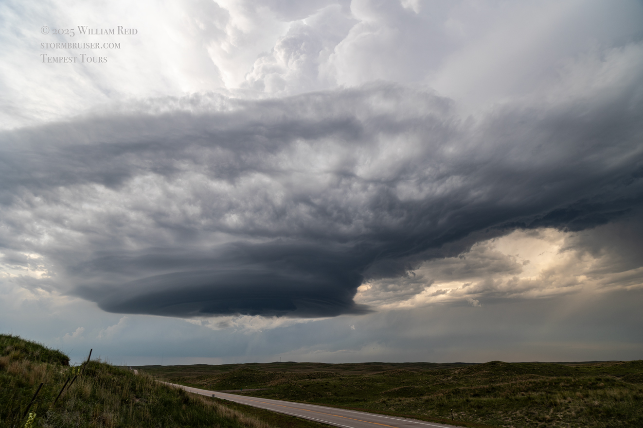
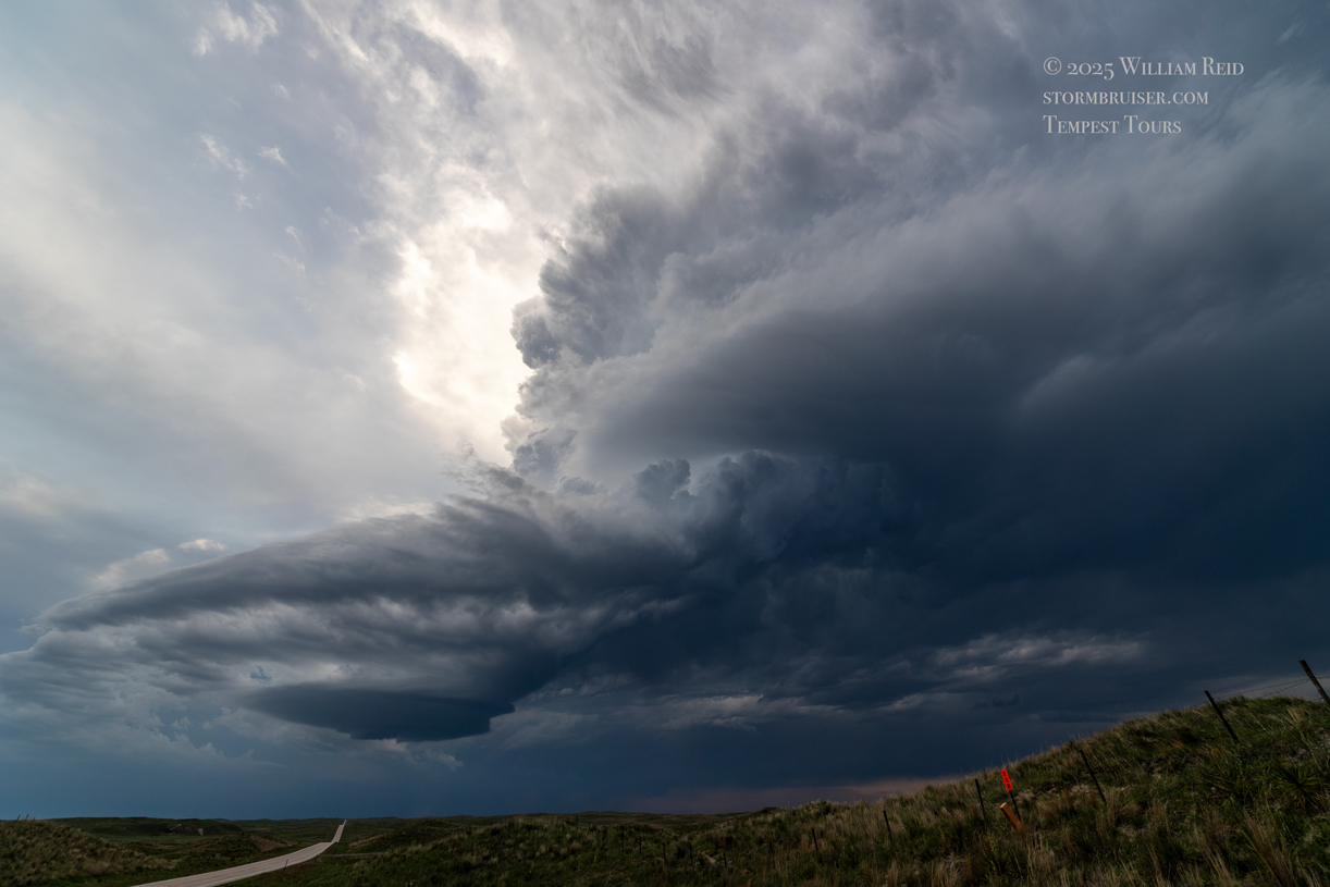
The next set of images below provides looks at the “Merriman” storm from about Hyannis northward on Highway 61. The storm is likely a supercell now, based on the radar look combined with the visual representation from about 60 miles away.

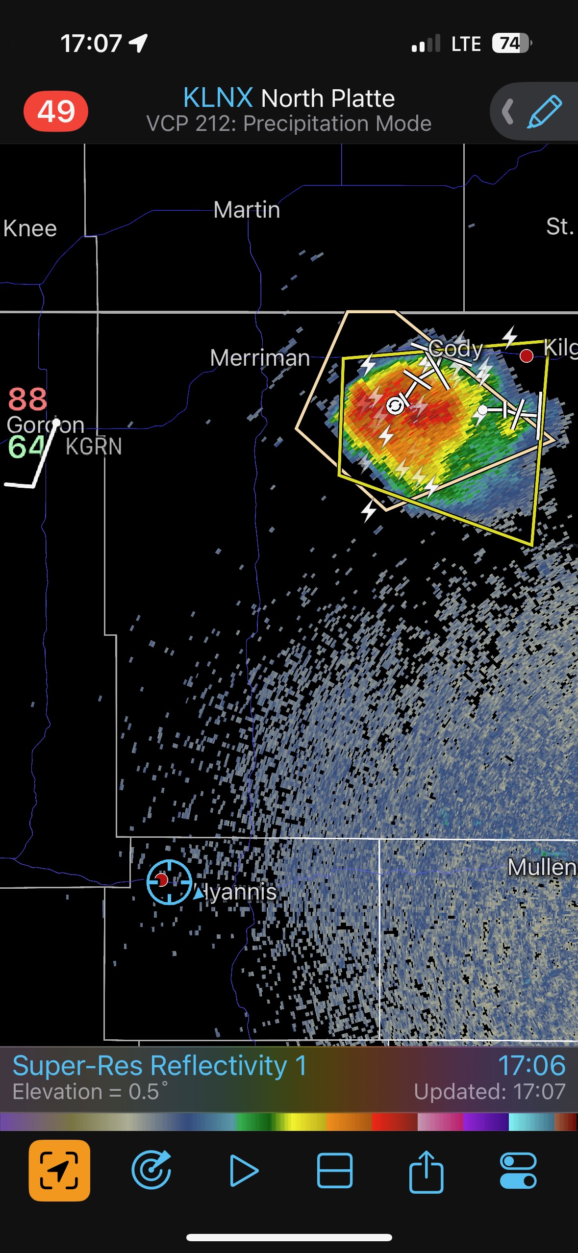
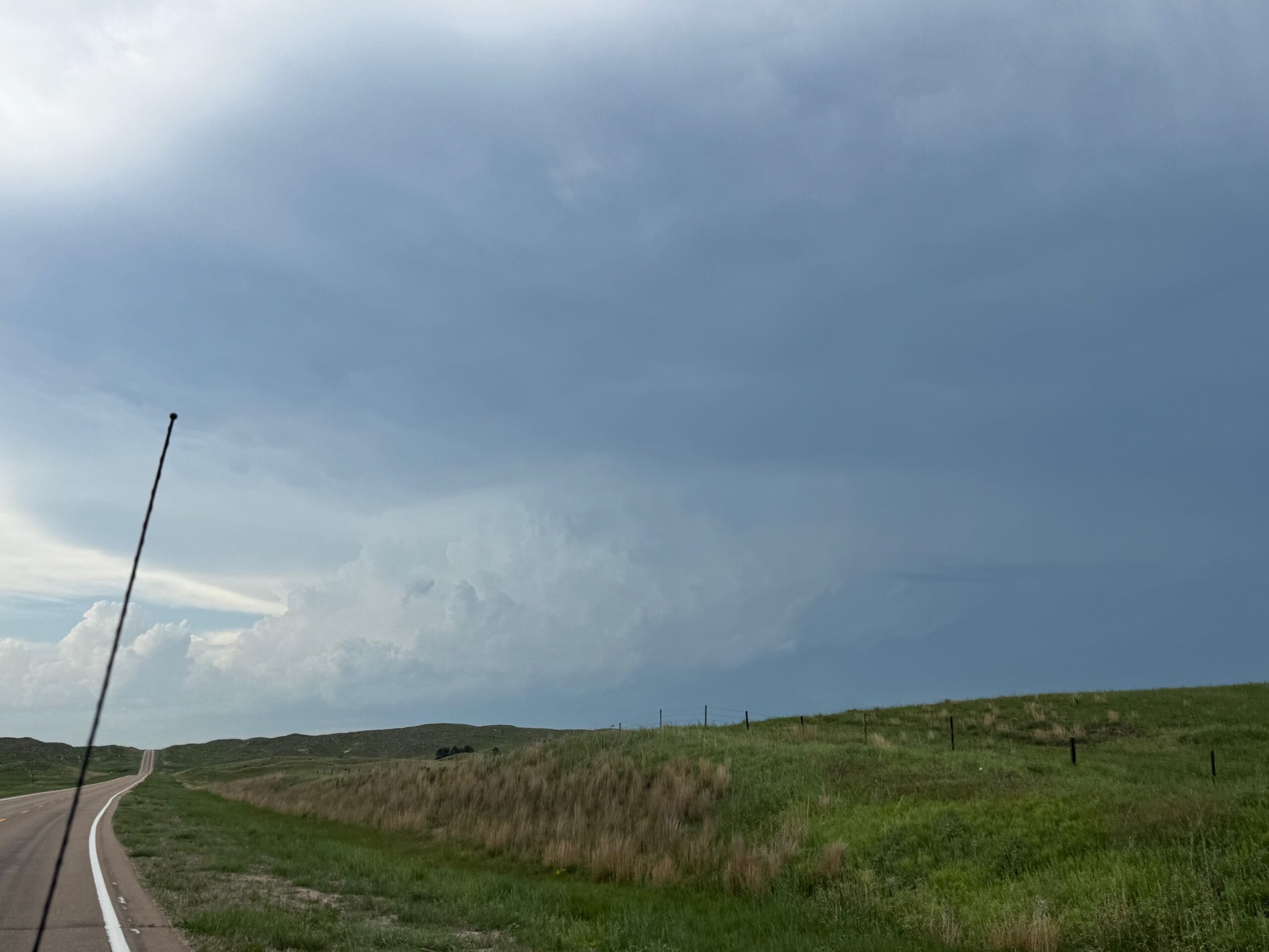
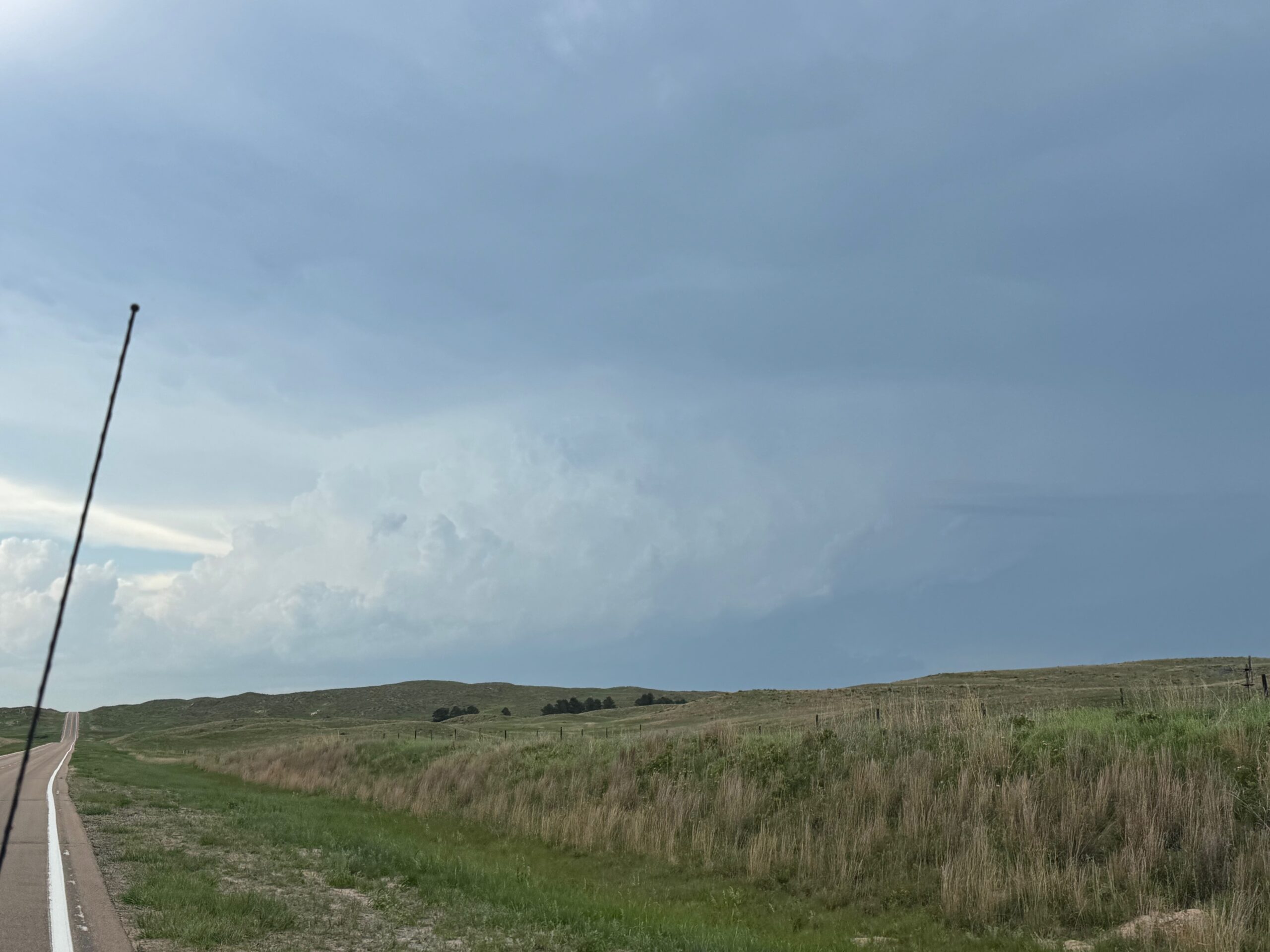
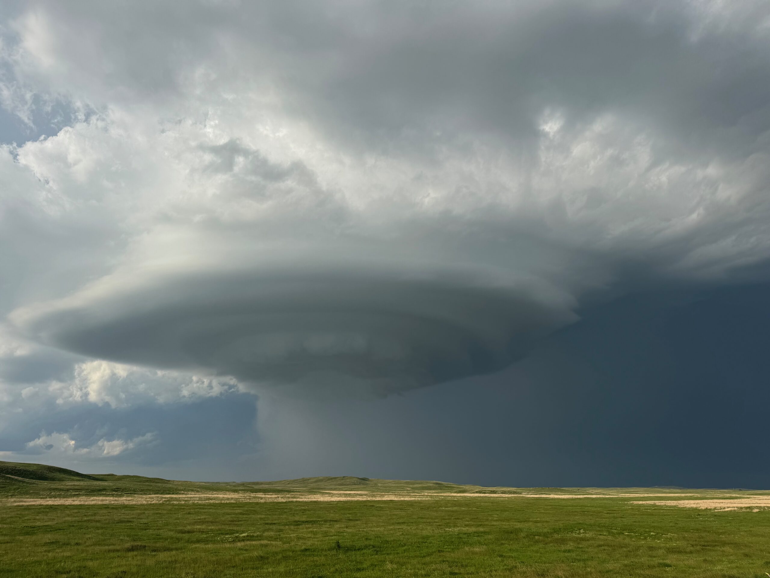
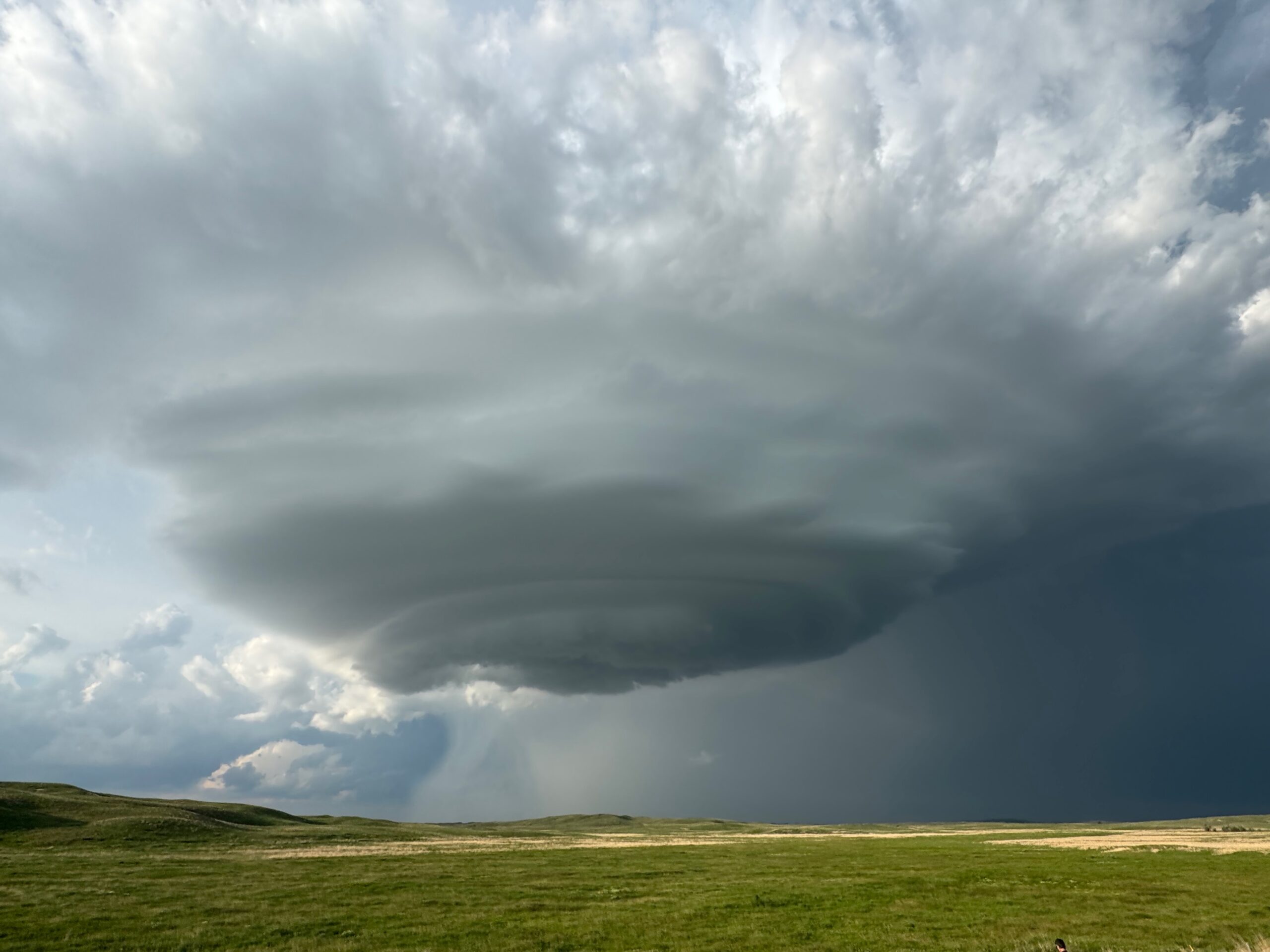
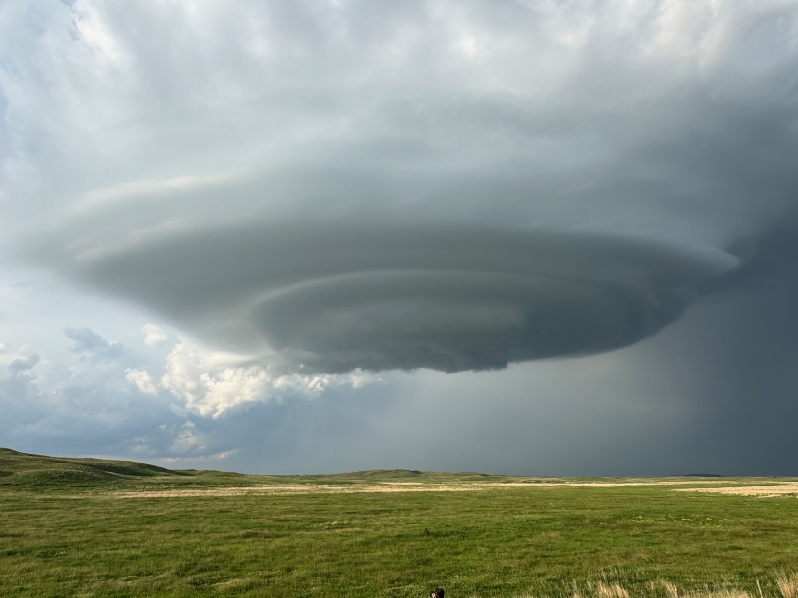
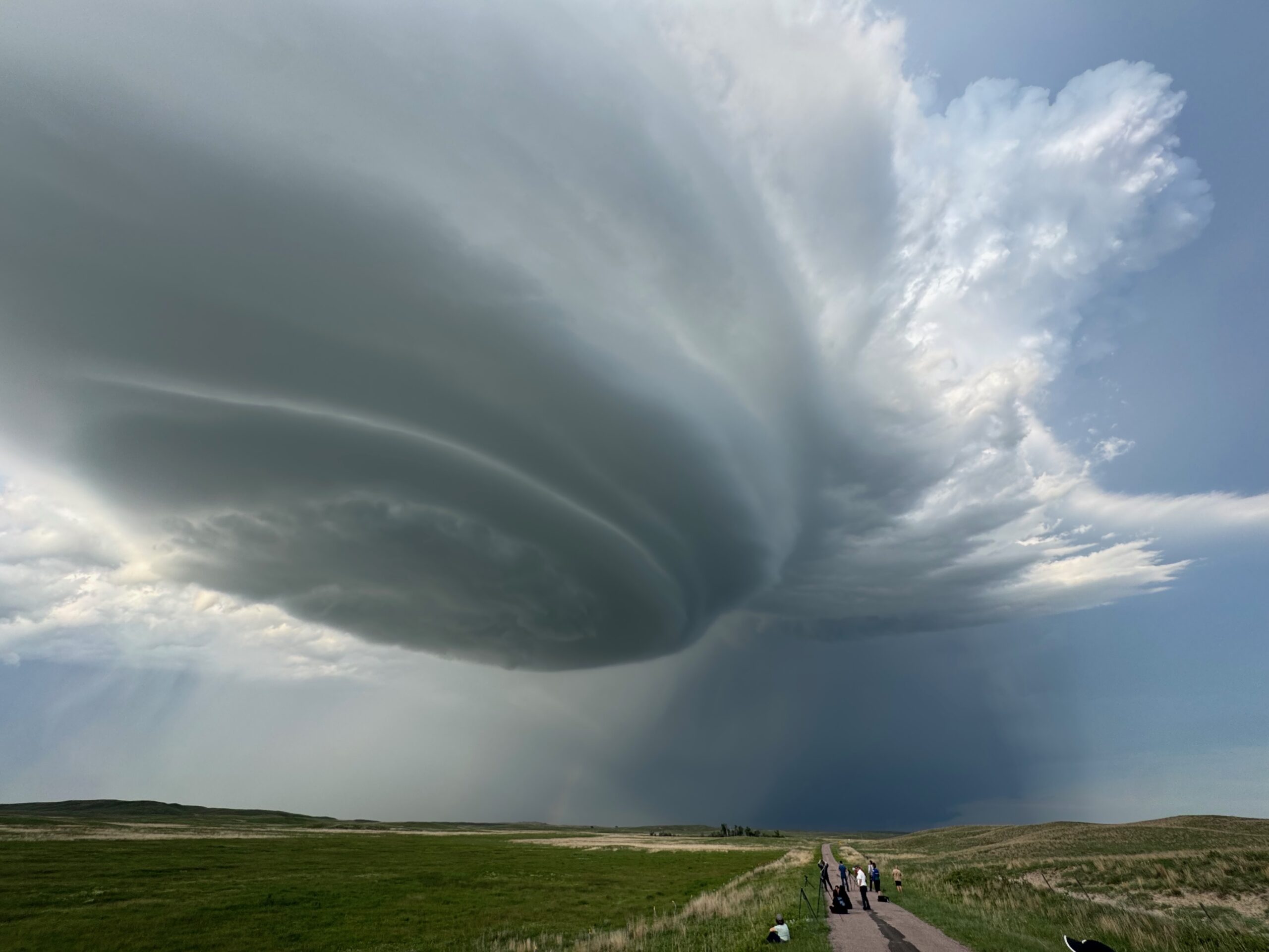
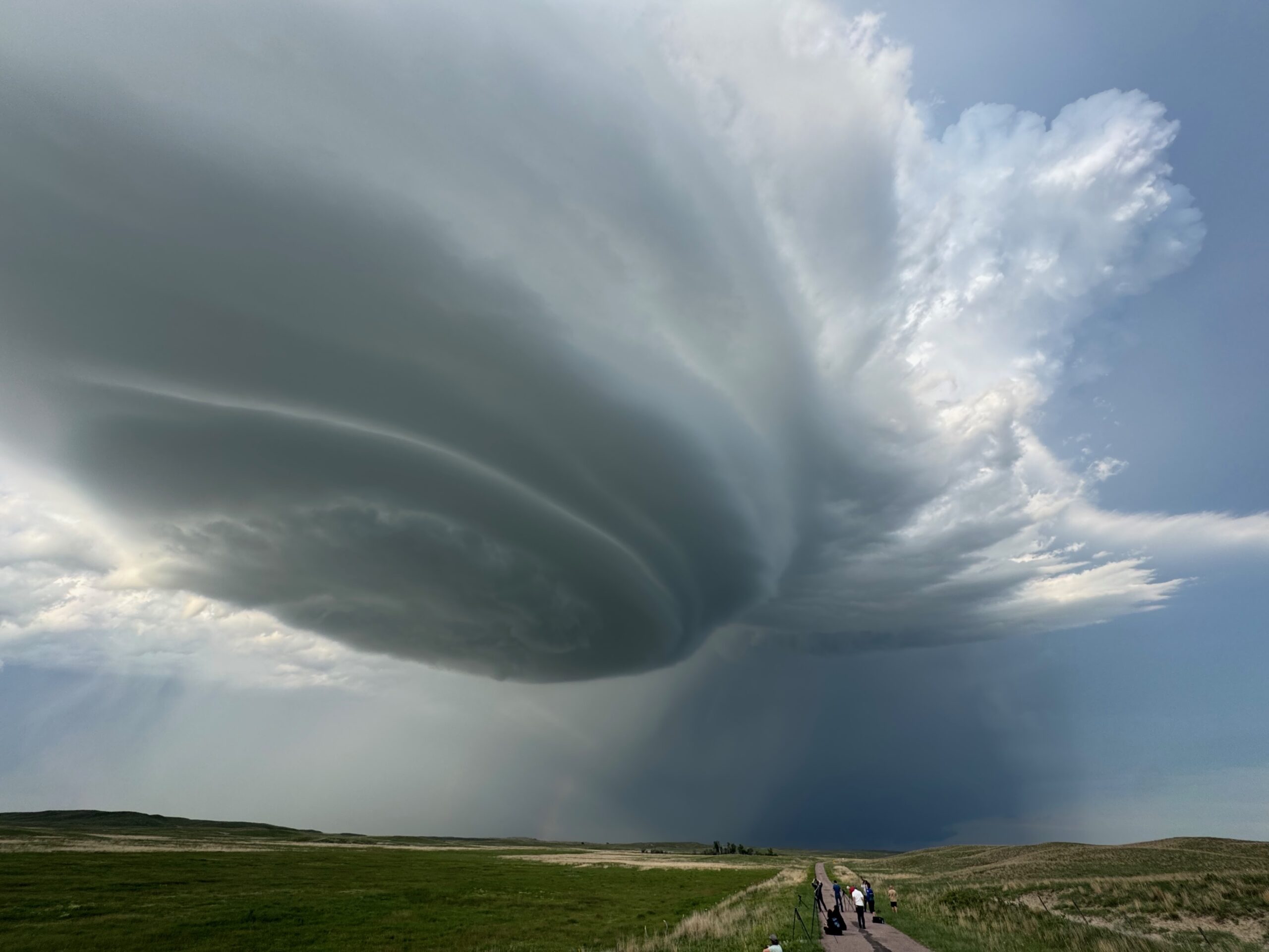
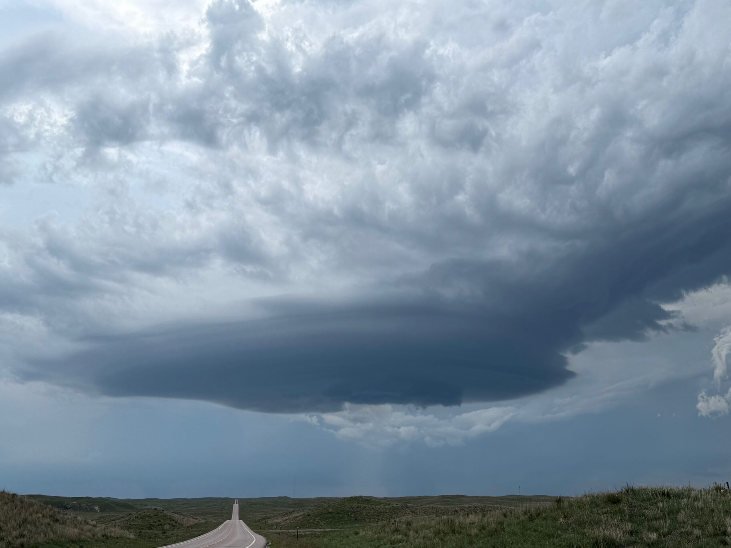
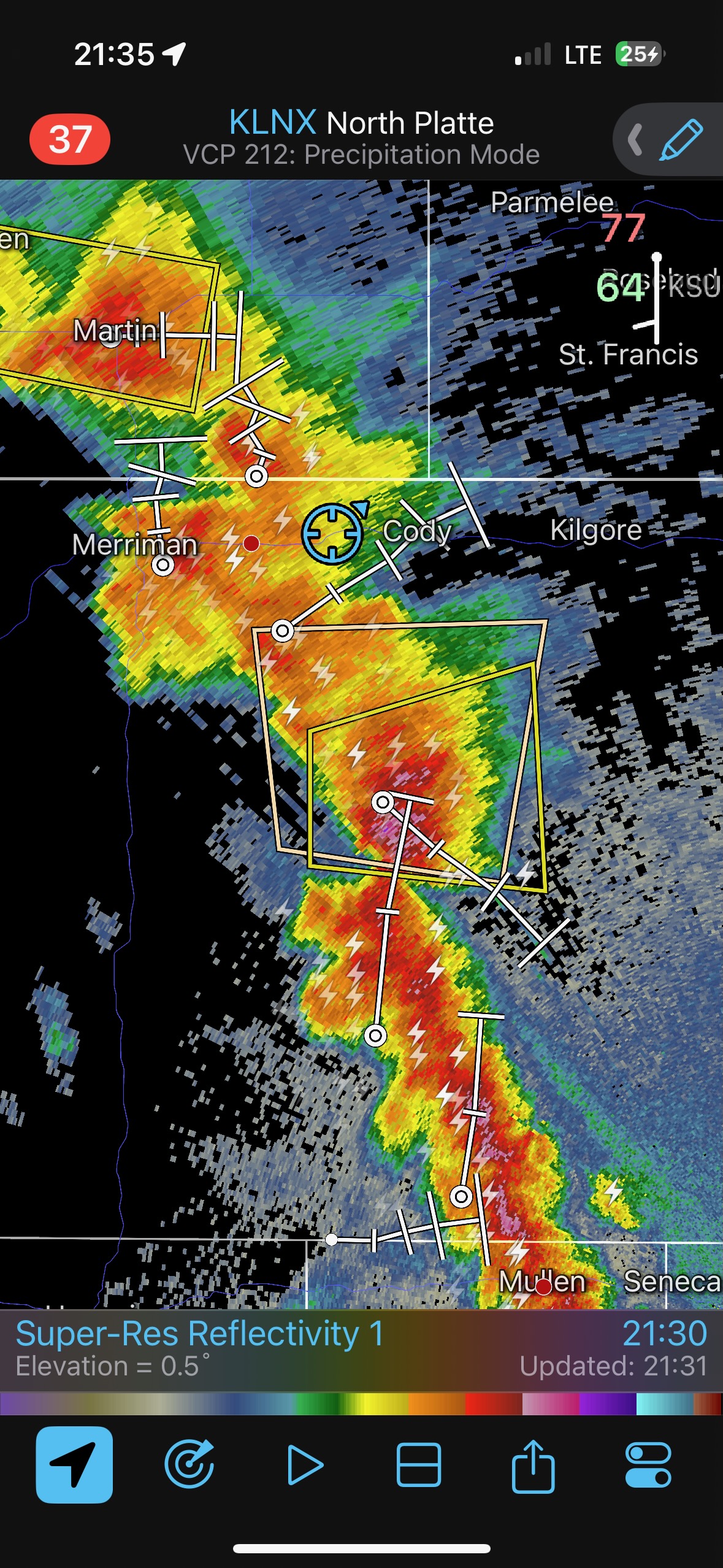
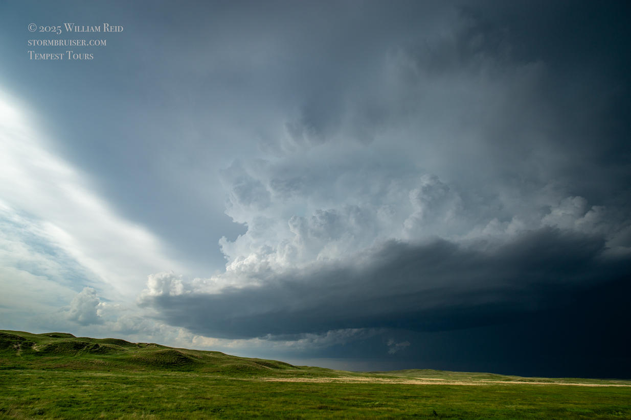
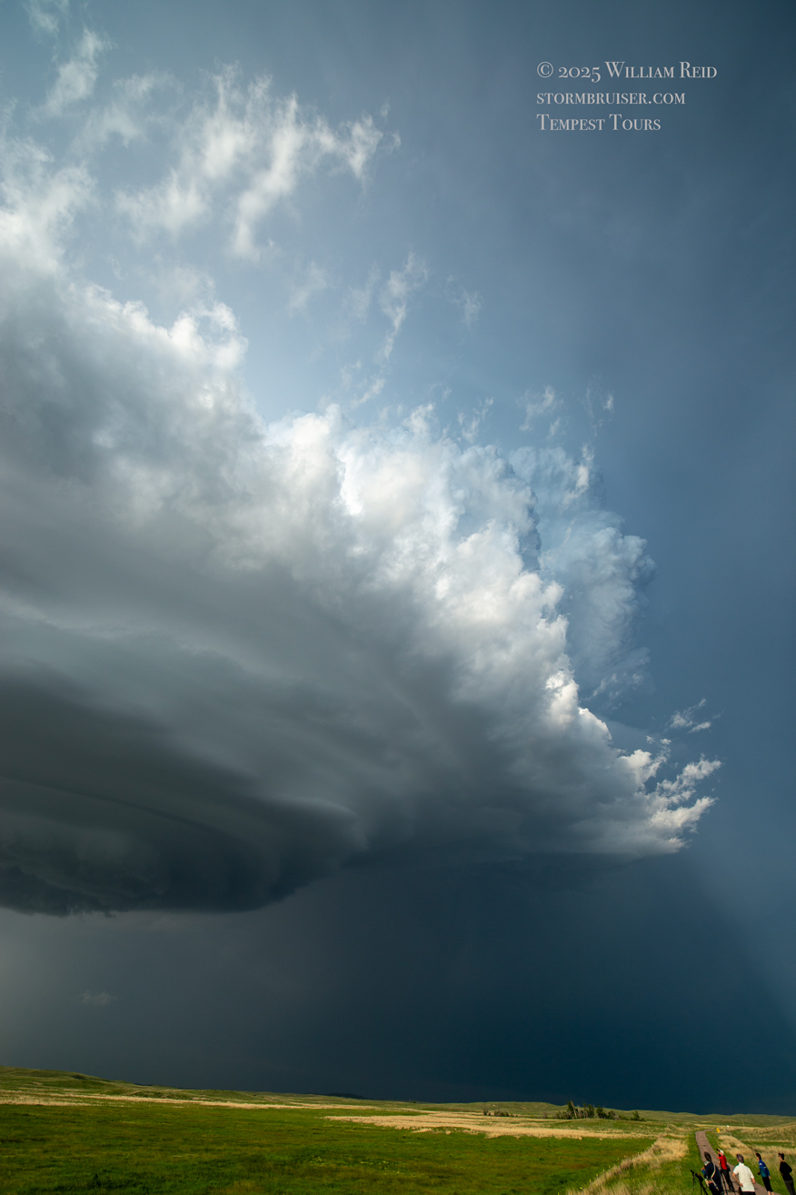
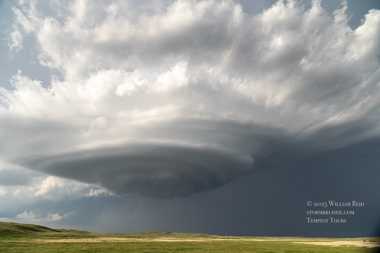
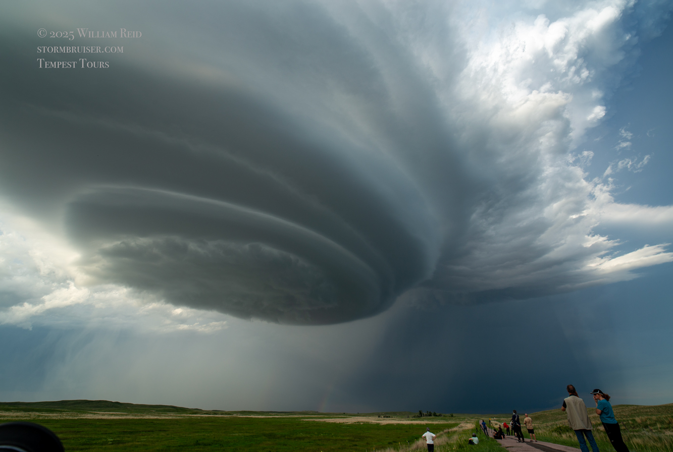
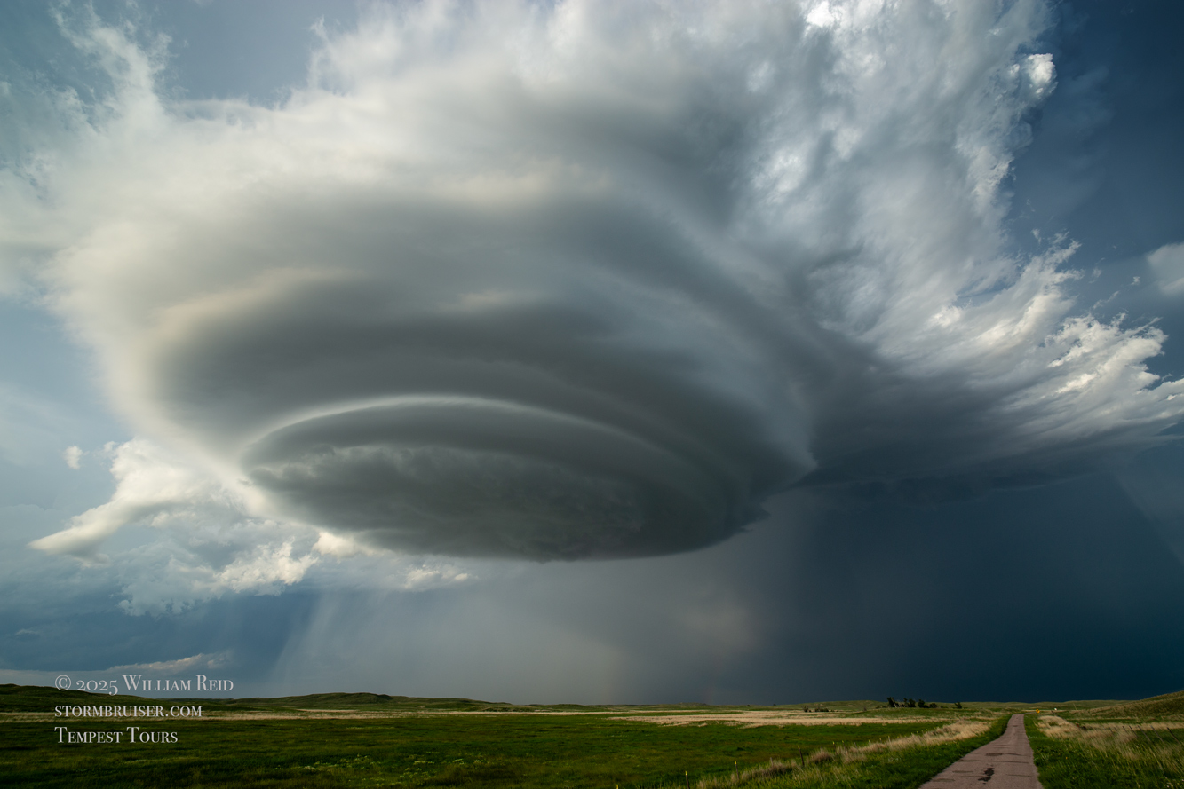
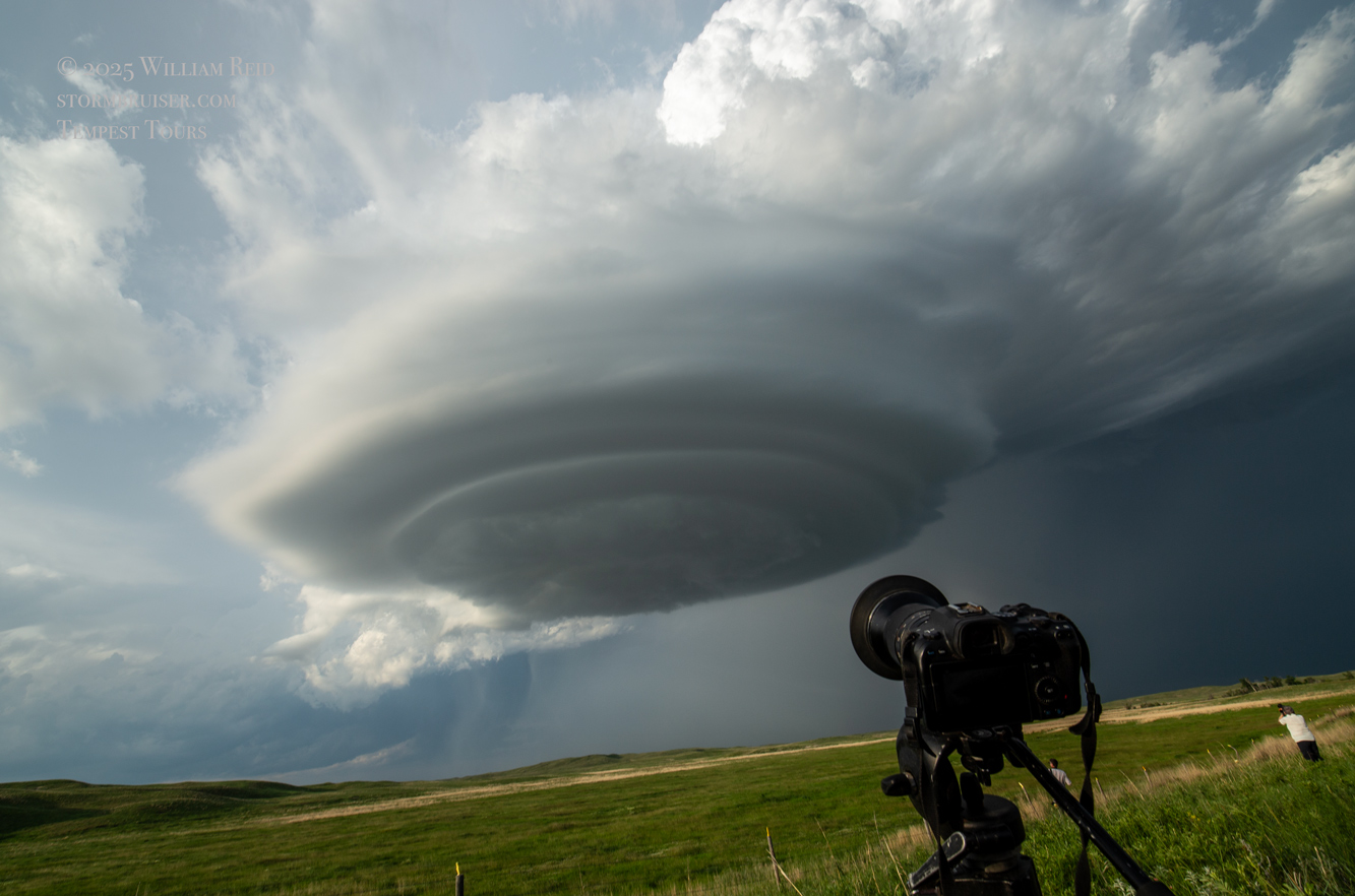
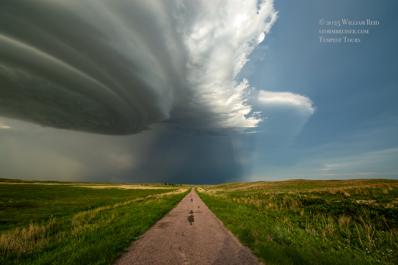
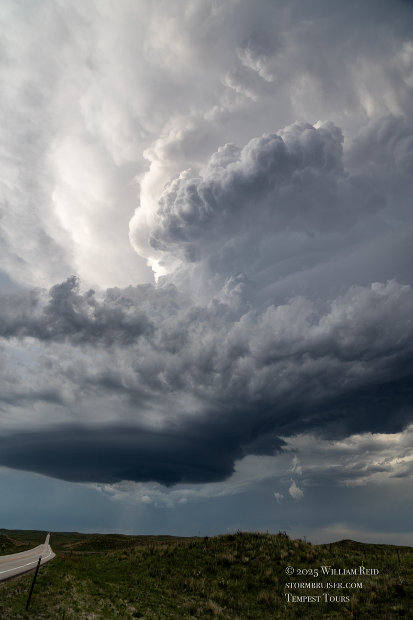
Below are additional storm images and associated radar grabs around 6 p.m. MDT. We came up on the southwest side of the updraft and had a splendid view. The base was medium low, there was a bit of a laminar look and organization at low levels, and a really big and beefy cumuliform updraft. The rain and hail were separated nicely from the base, and the late afternoon light was great. A large expanse of cirrus anvil from the WY/western NE Panhandle storms was spreading over much of the Sandhills, just to the south of this Merriman storm. Best of all, the cell continued to be mostly stationary. It was not moving deeper into the roadless void to its east and southeast. Highway 61 has worked quite nicely. We utilized a deserted and narrow paved road, stopping a mile or so east of Highway 61 and around 10 miles south of Merriman. It took nearly three hours, and we made it!
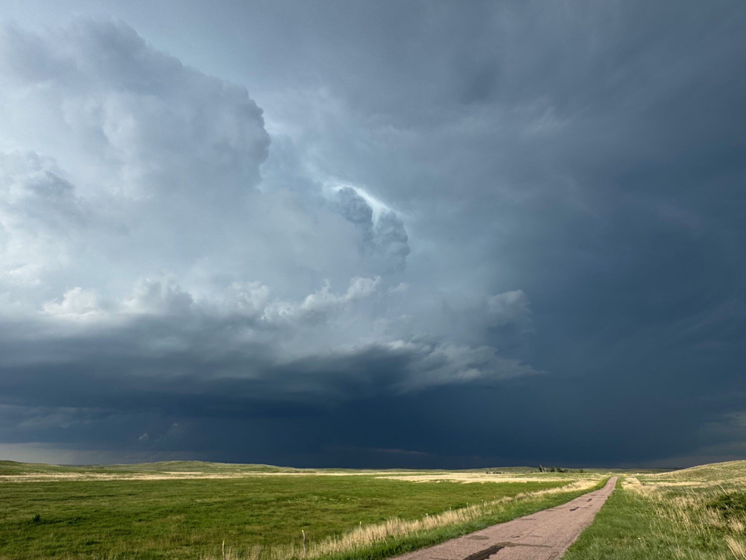

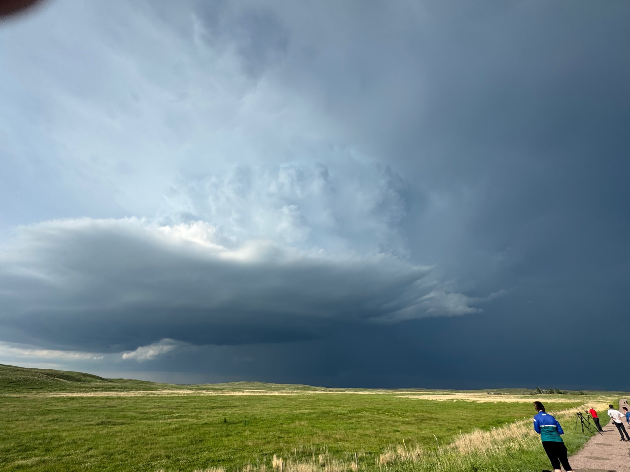

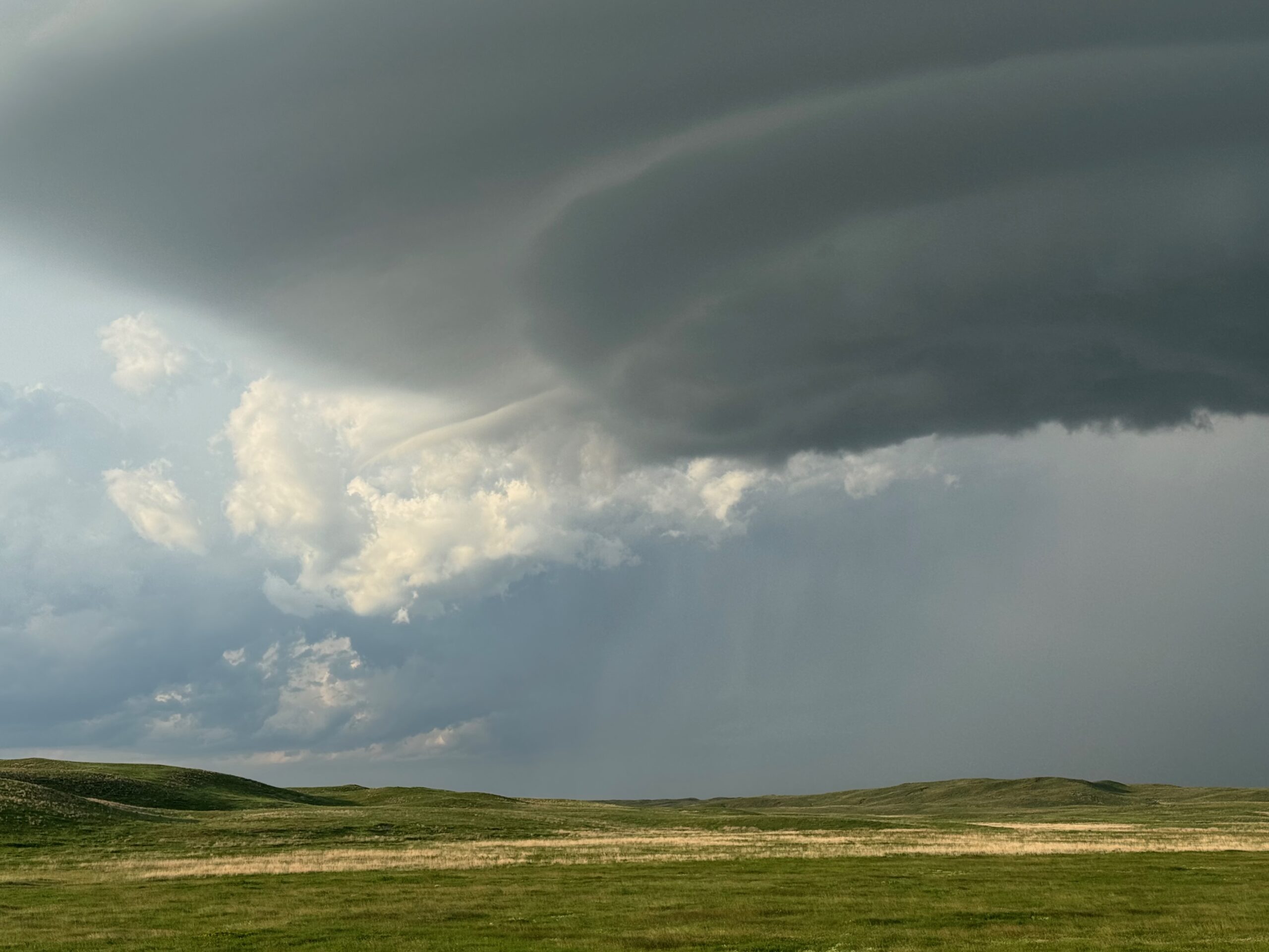
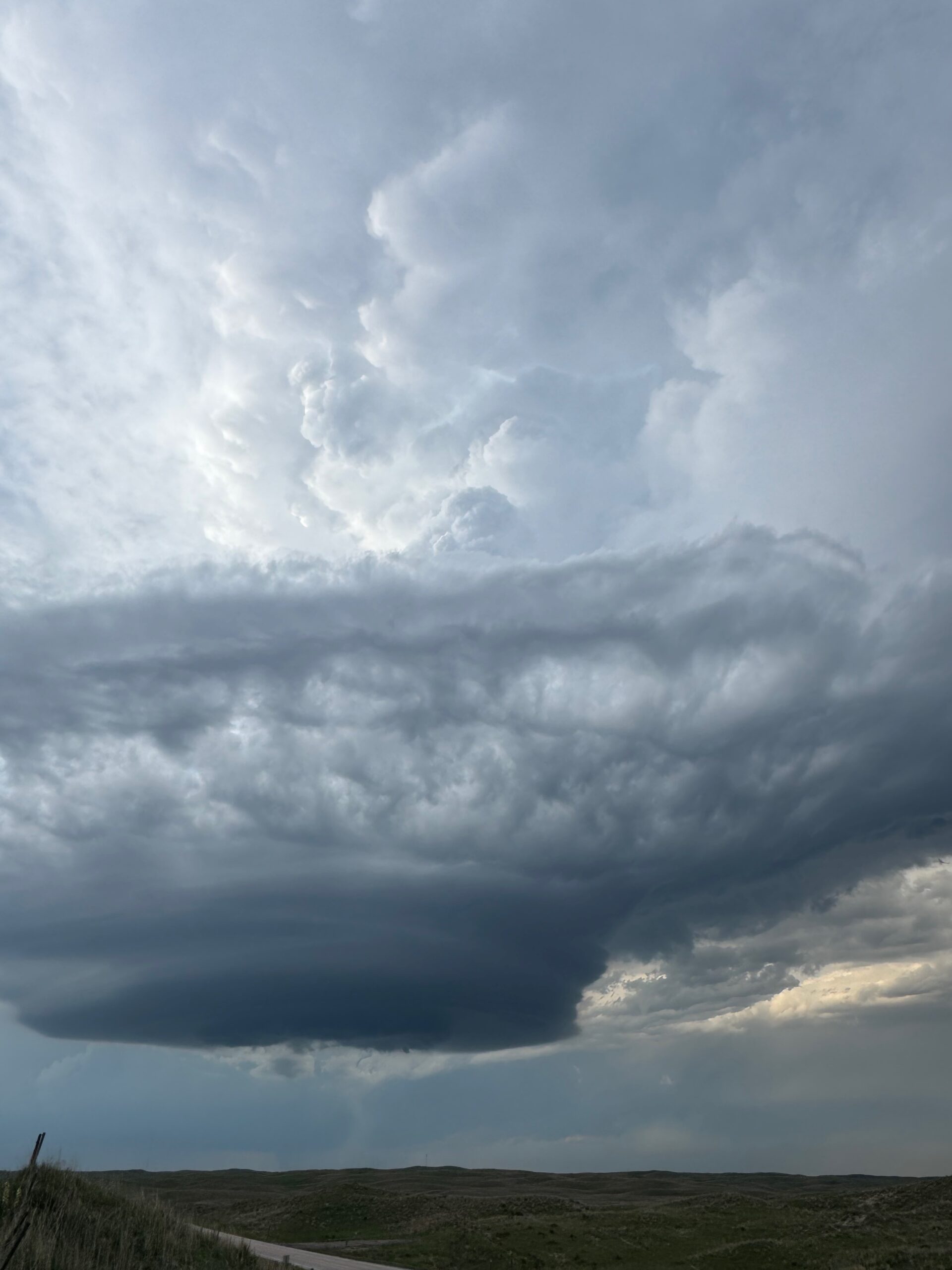
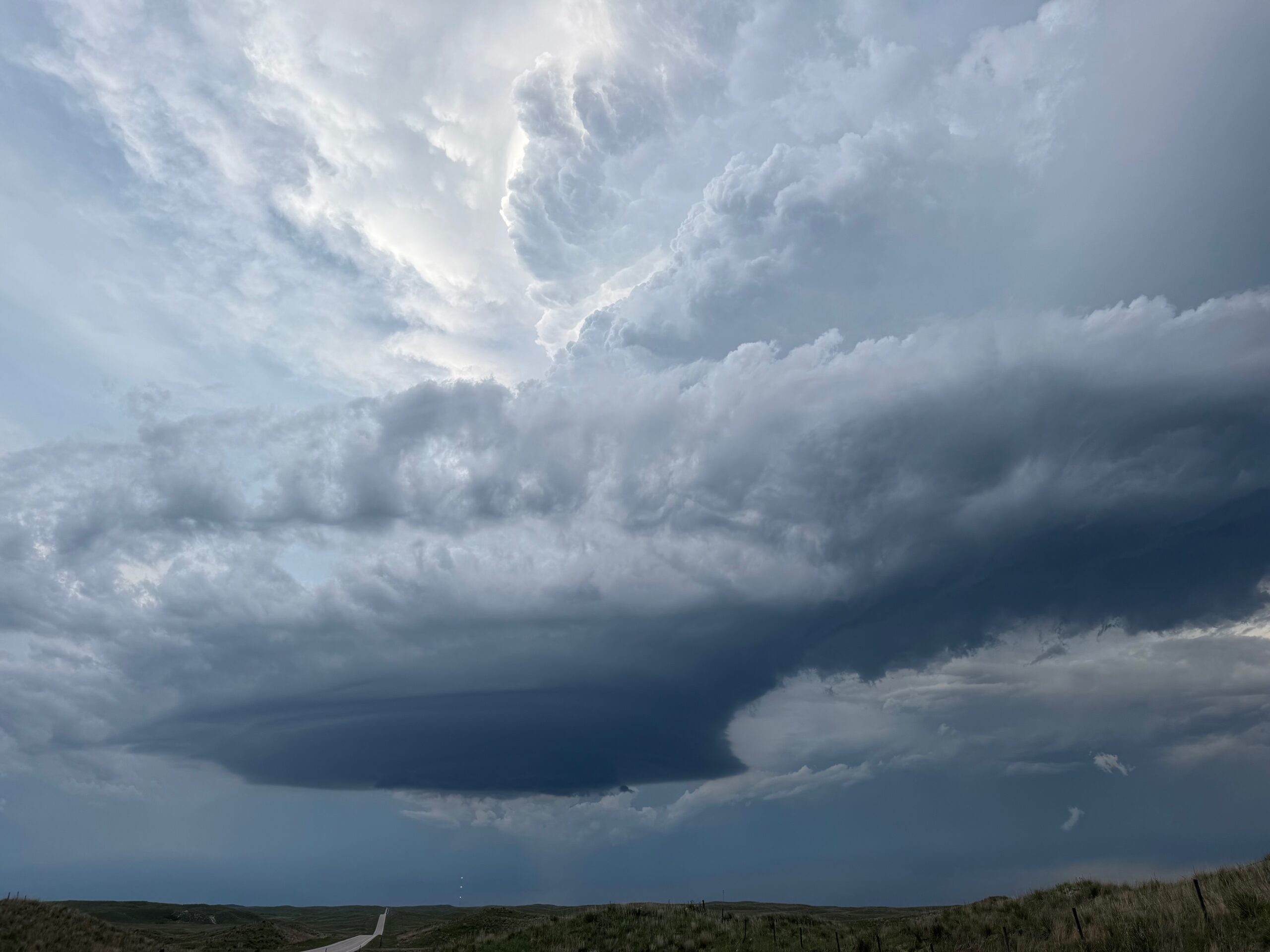
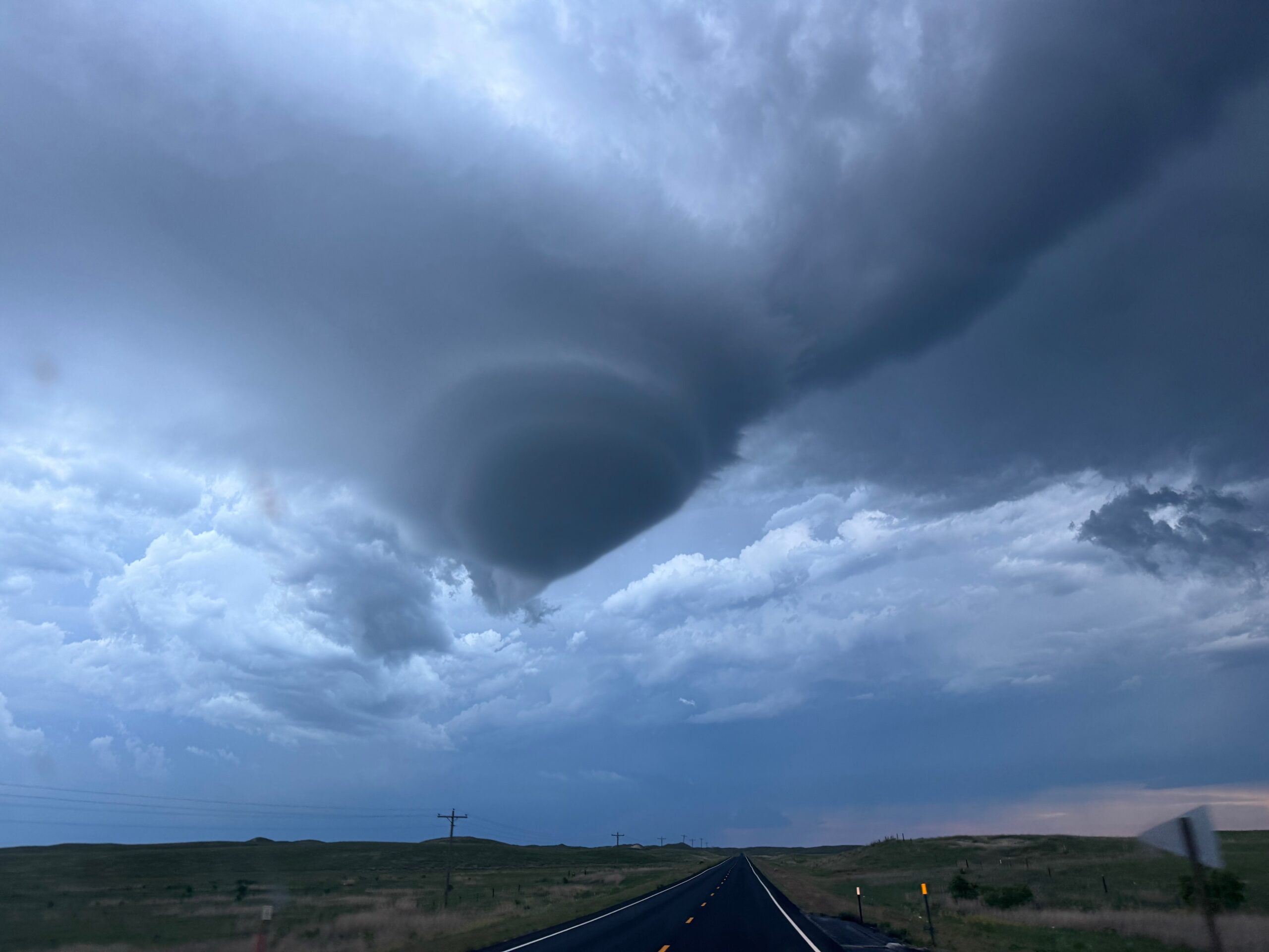
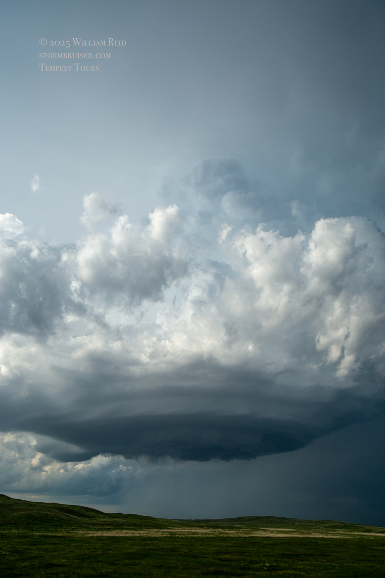
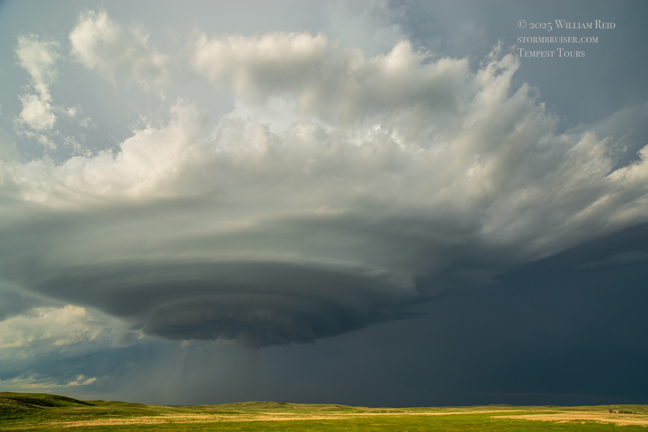
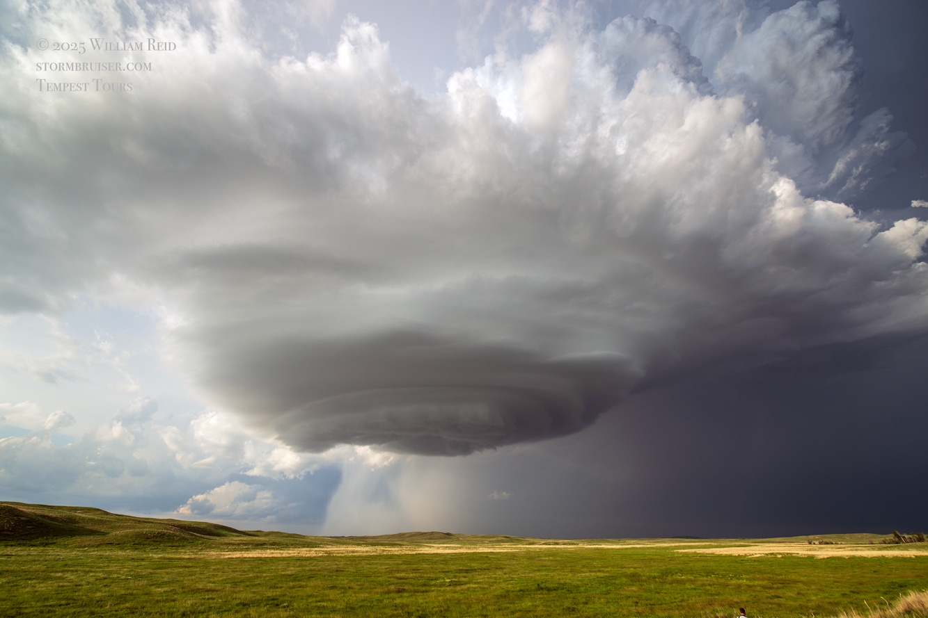
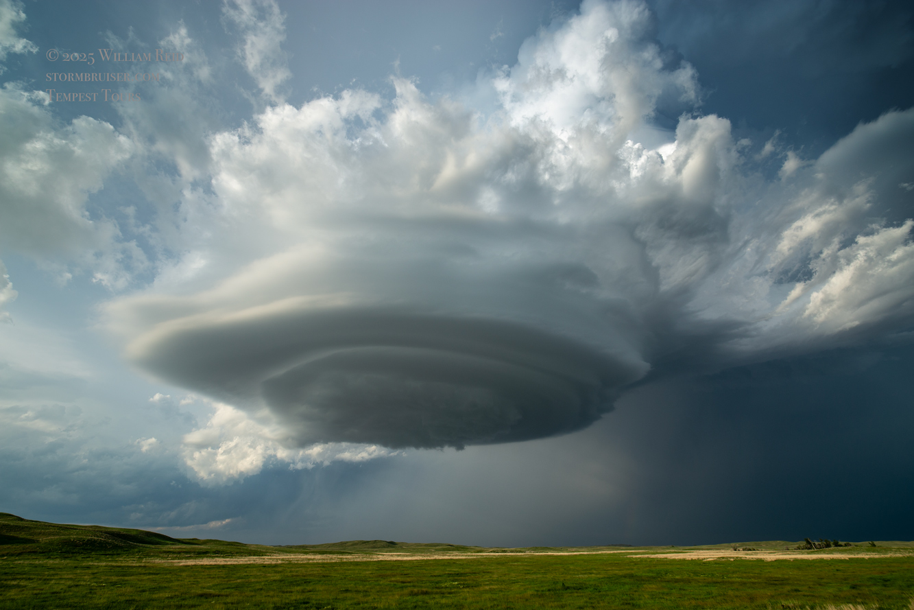
After maybe 30-45 minutes here, the storm base took on more of a “spaceship” appearance. It also drifted more to the south, towards our E-W road. See my time-lapse video that is linked near the top.
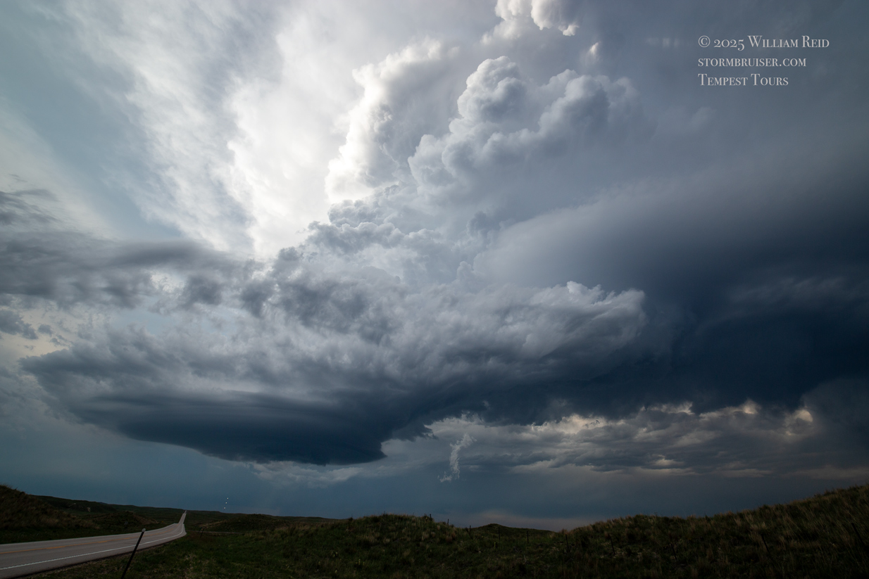
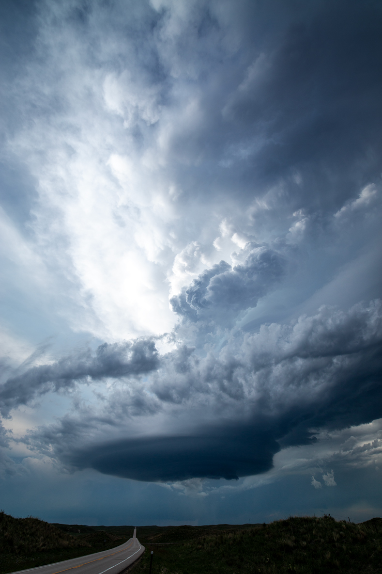
The pics below were taken from about 6:30 to 7:25 p.m. CDT. This updraft base was sagging towards us very slowly, and all we had to do was look up!


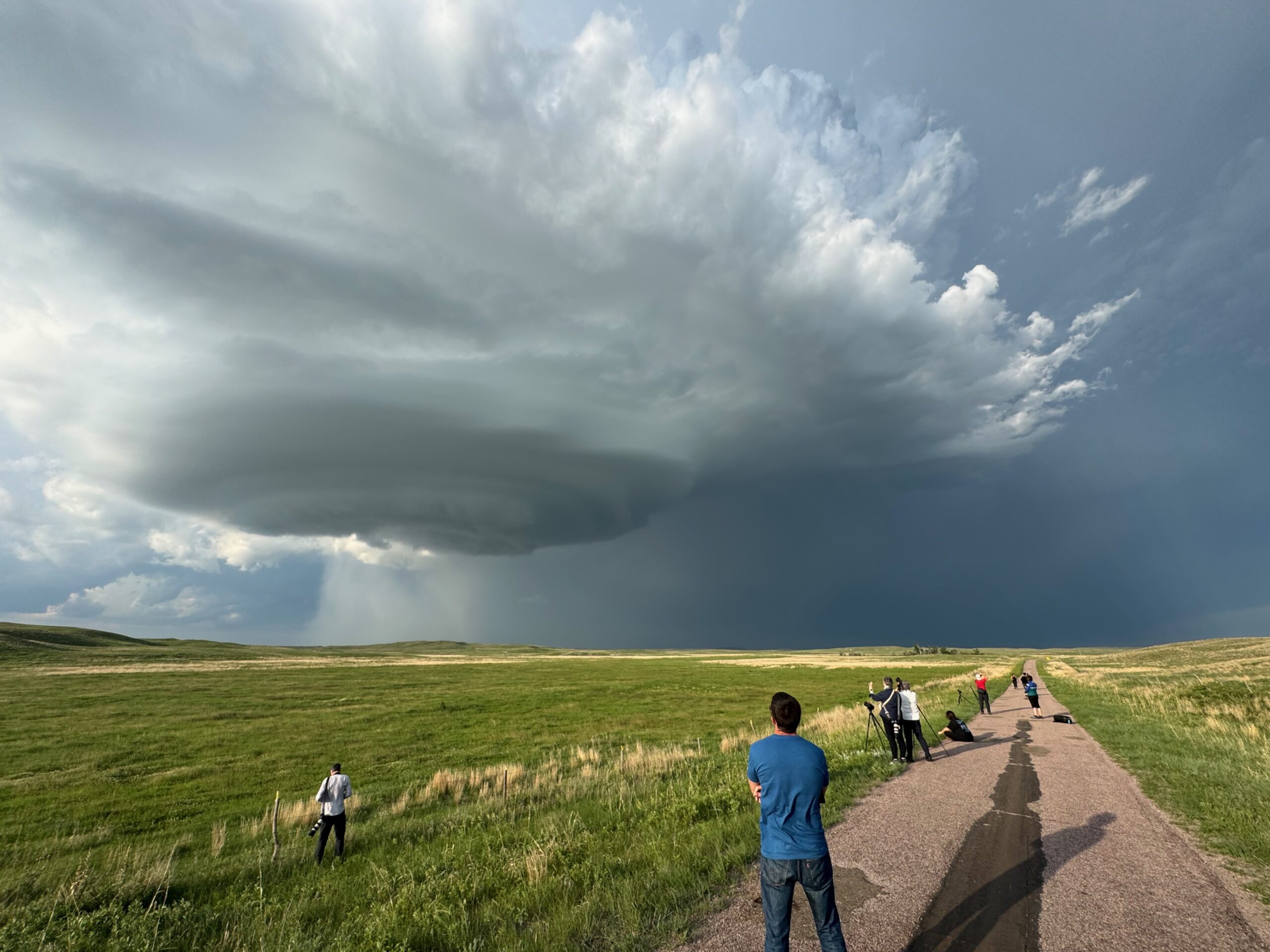

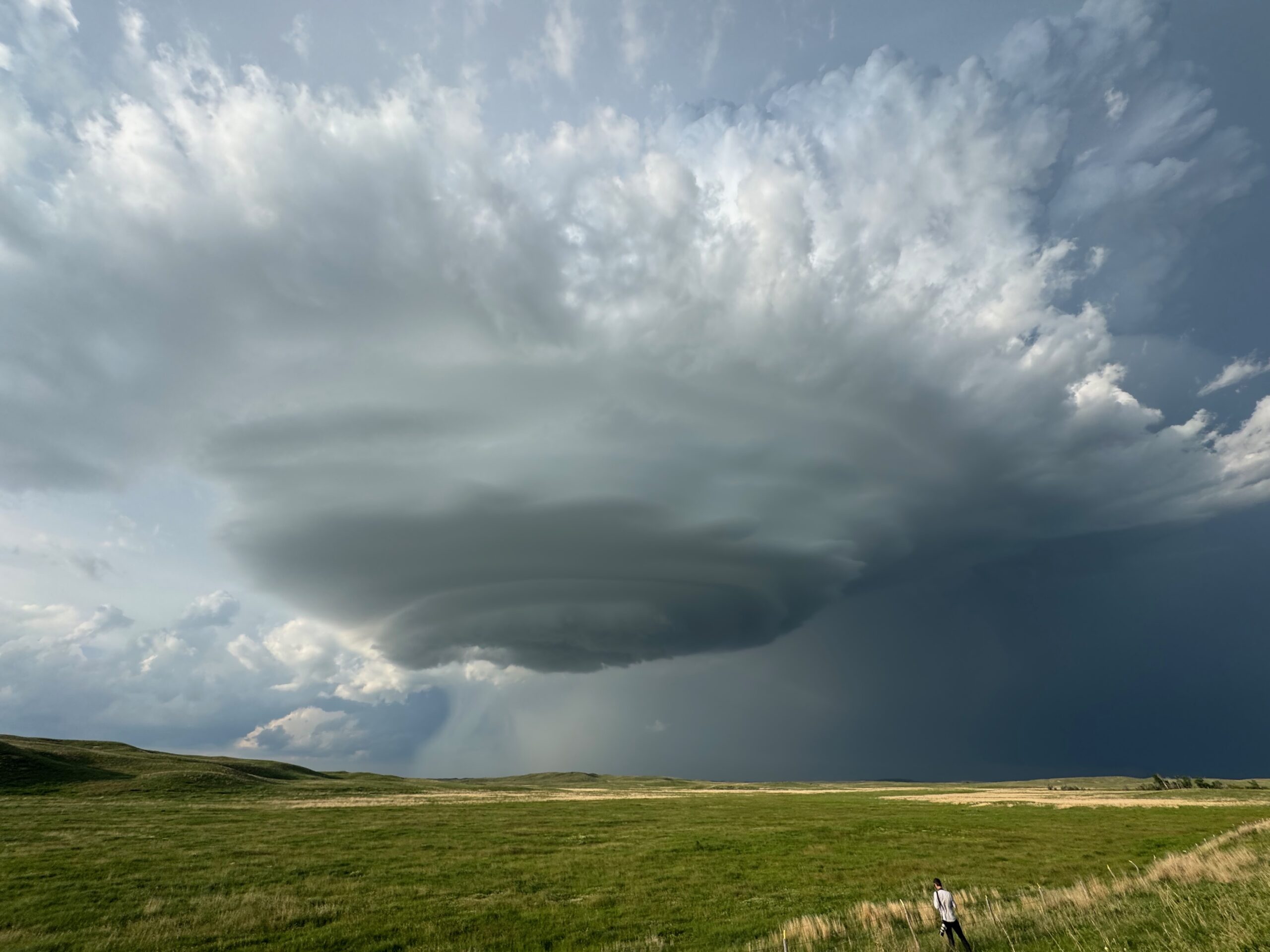

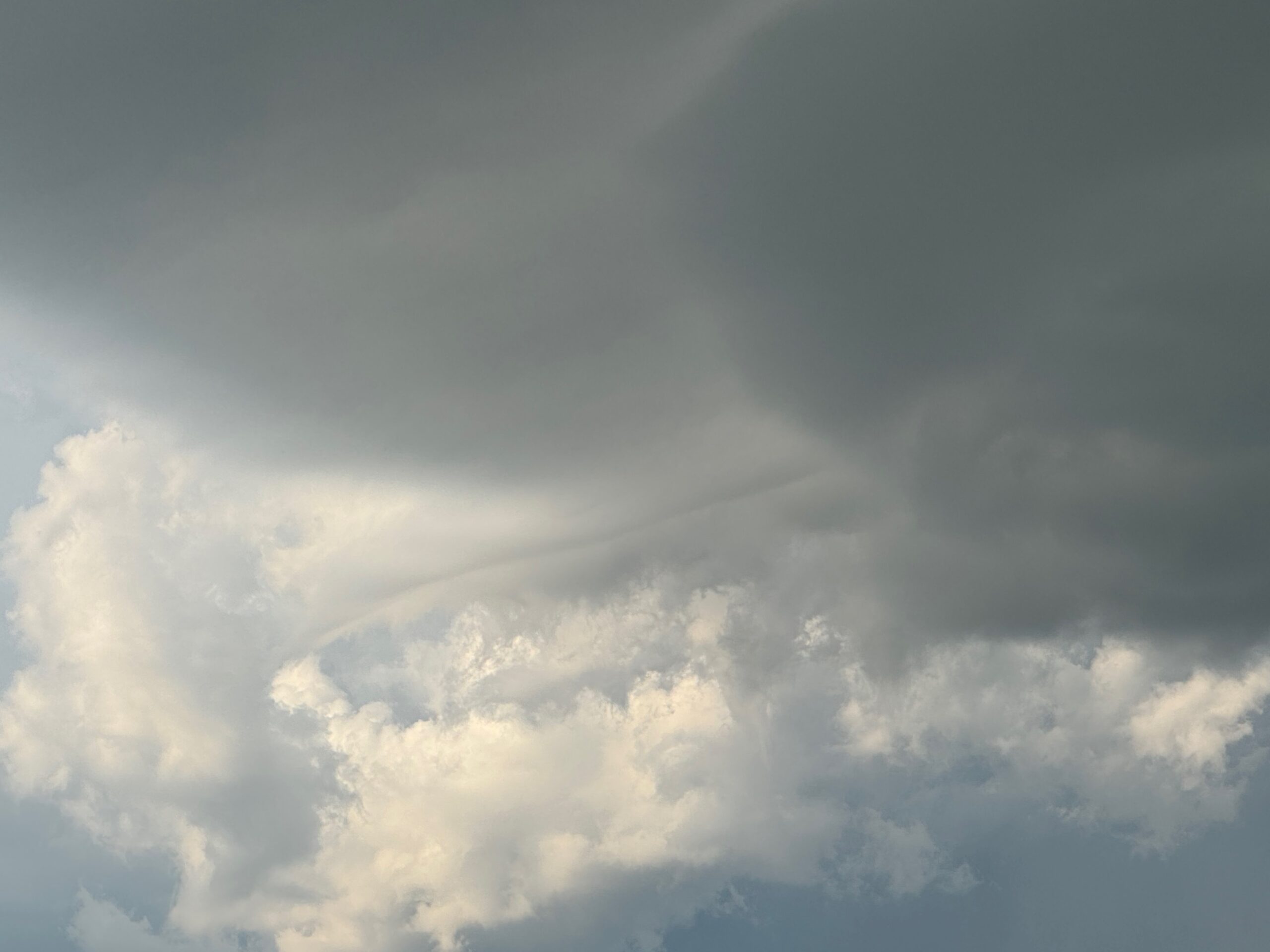

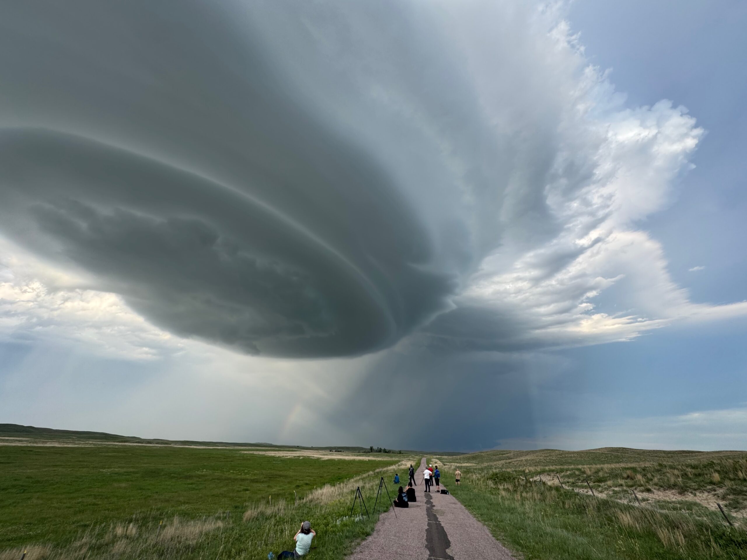
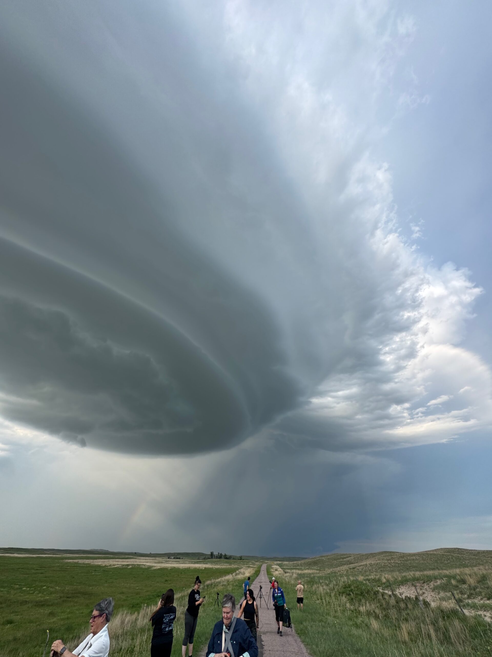
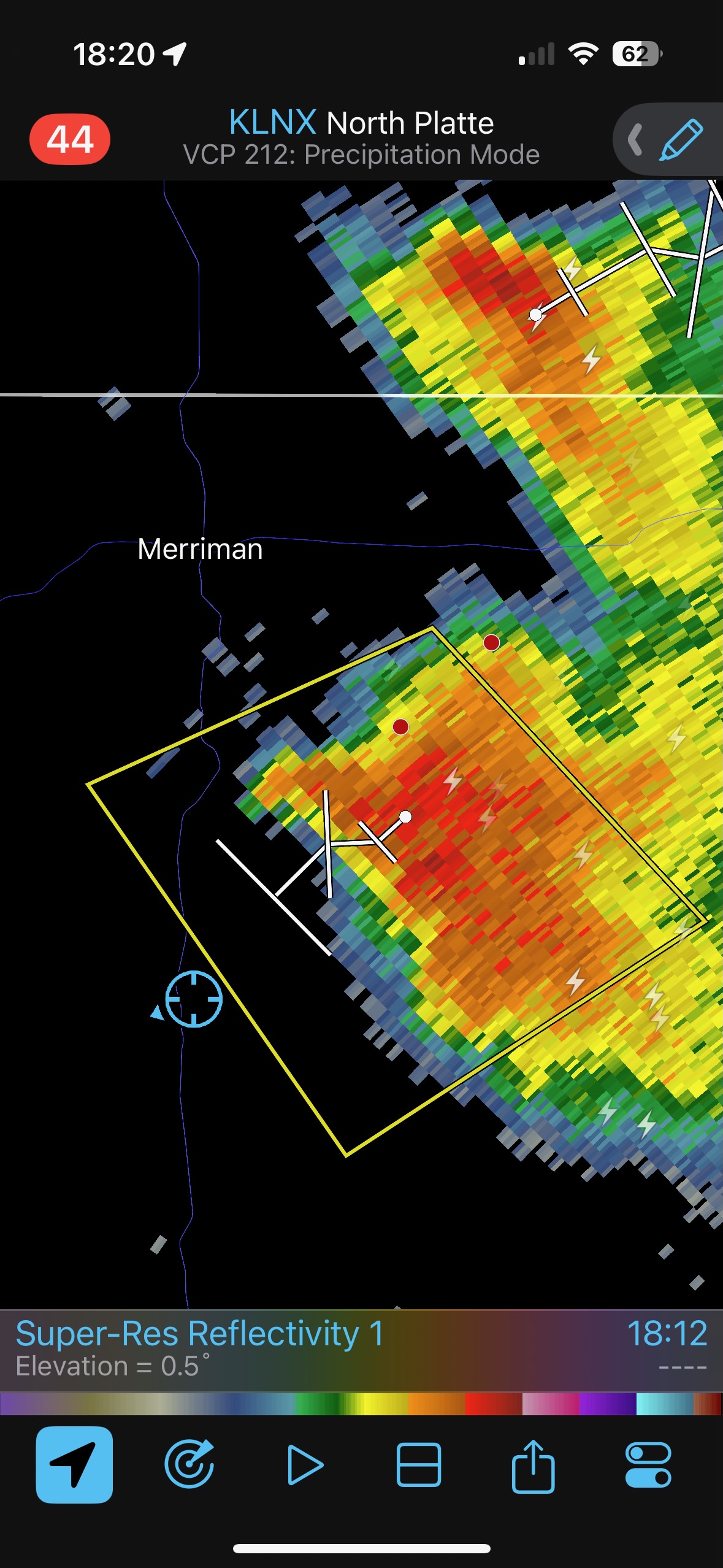
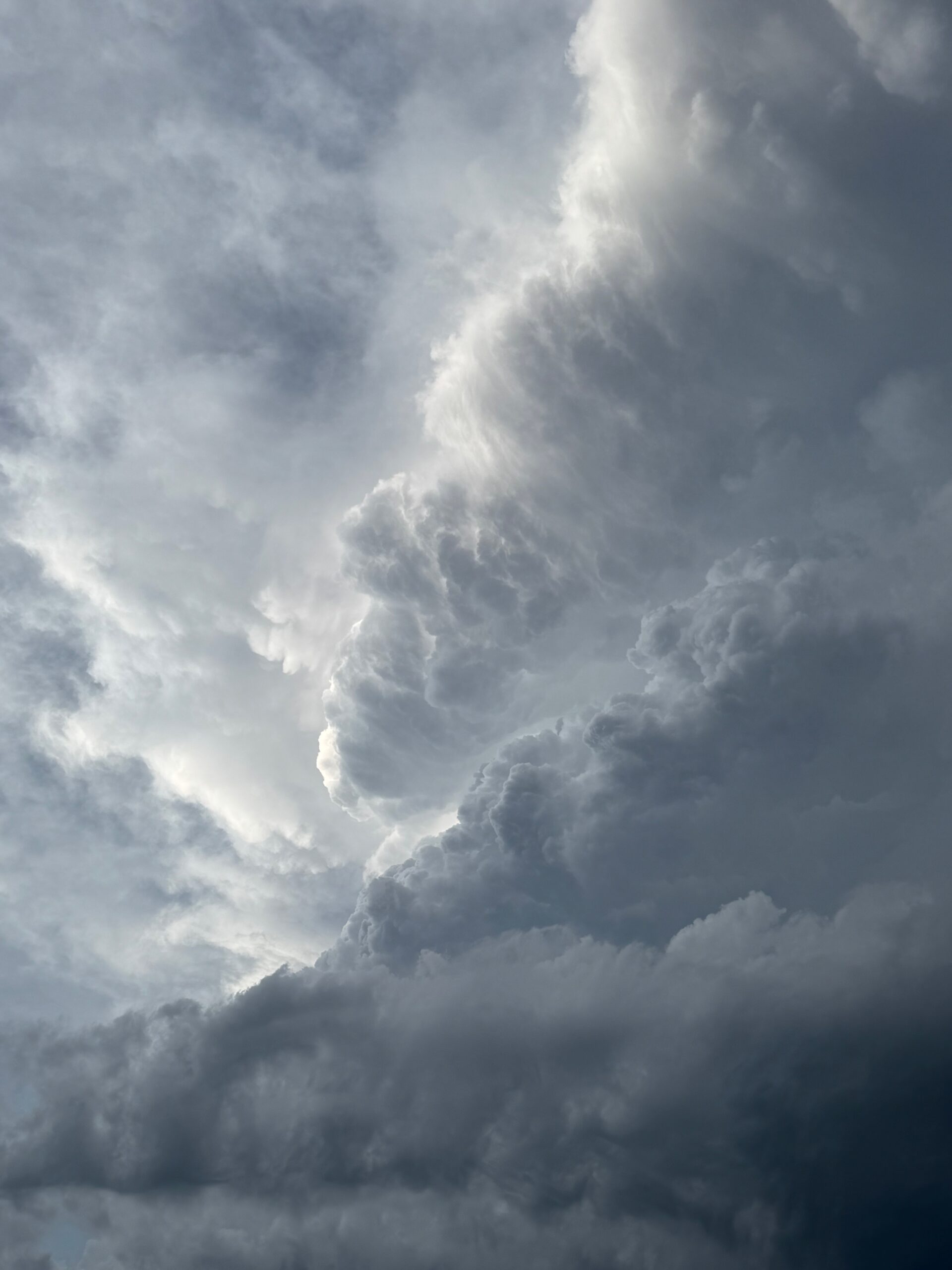
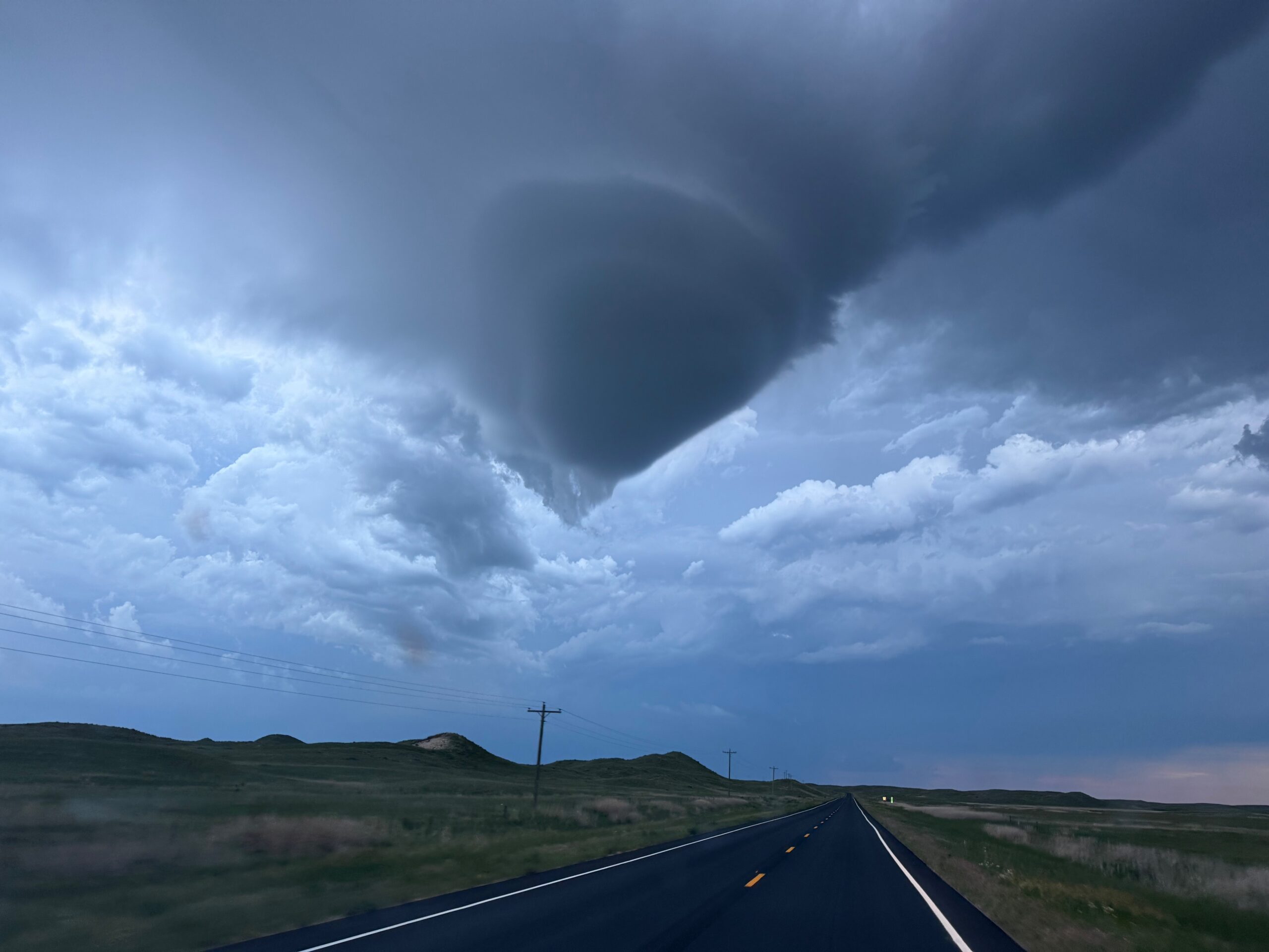
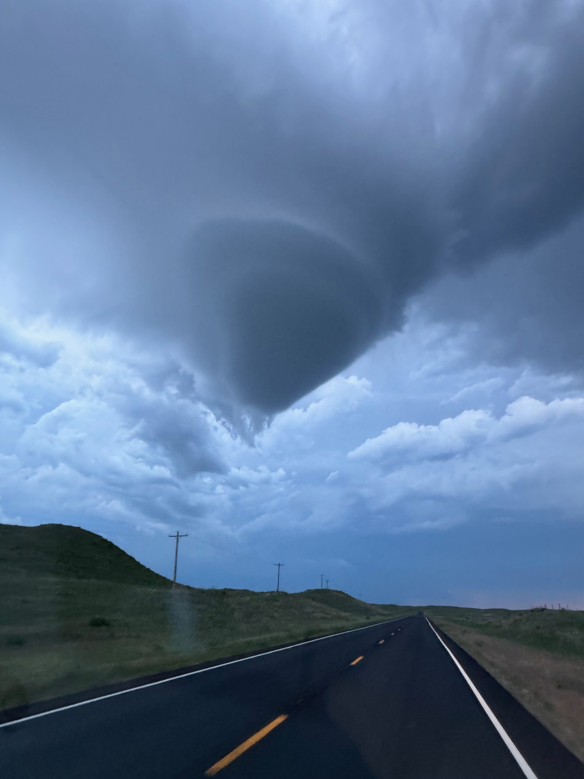
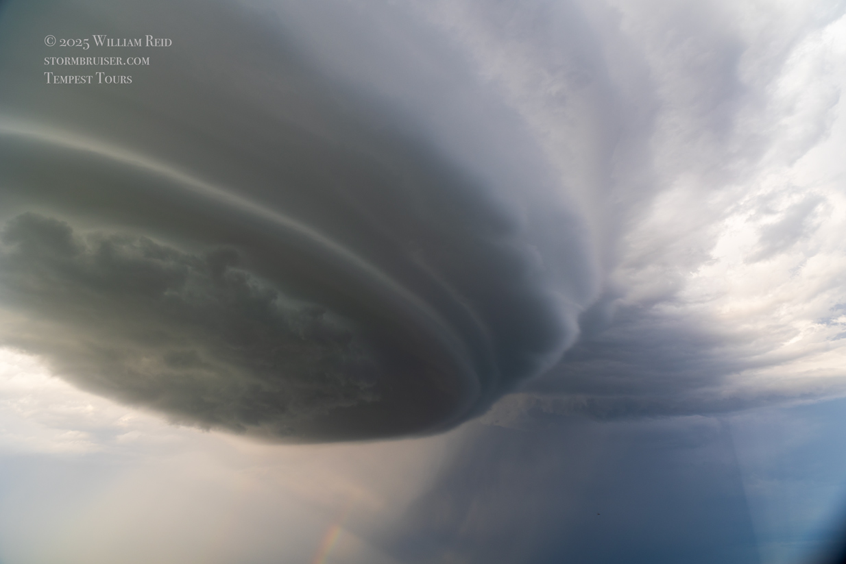
As the updraft base loomed nearly overhead, I figured that we should scoot south some on 61 to get a better perspective once again. From the top of a sand dune perhaps 5 miles farther south of our first stop, we watched the supercell spin and weaken to our due north. New storms were now going up just north of Merriman, so we headed quickly north to check those out. As we headed north beneath the dying updraft base of the Merriman supercell, it showed a weird record-needle shape (see pics below).
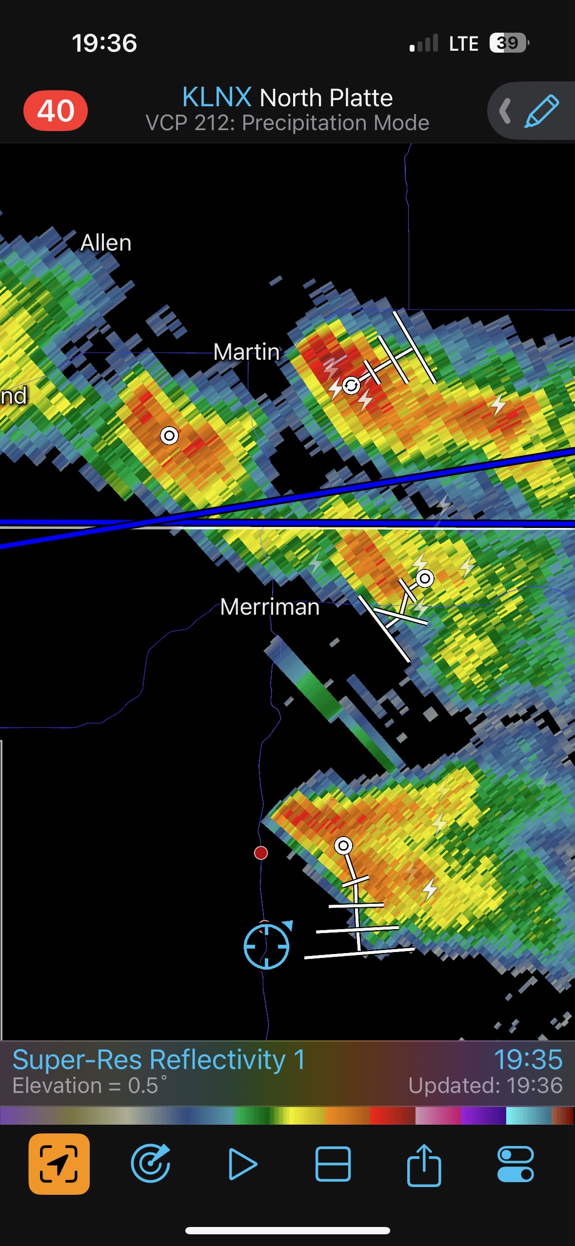


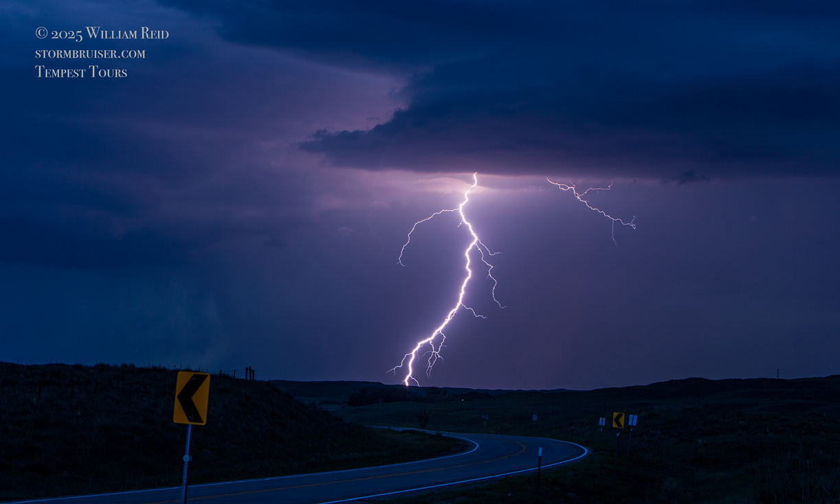
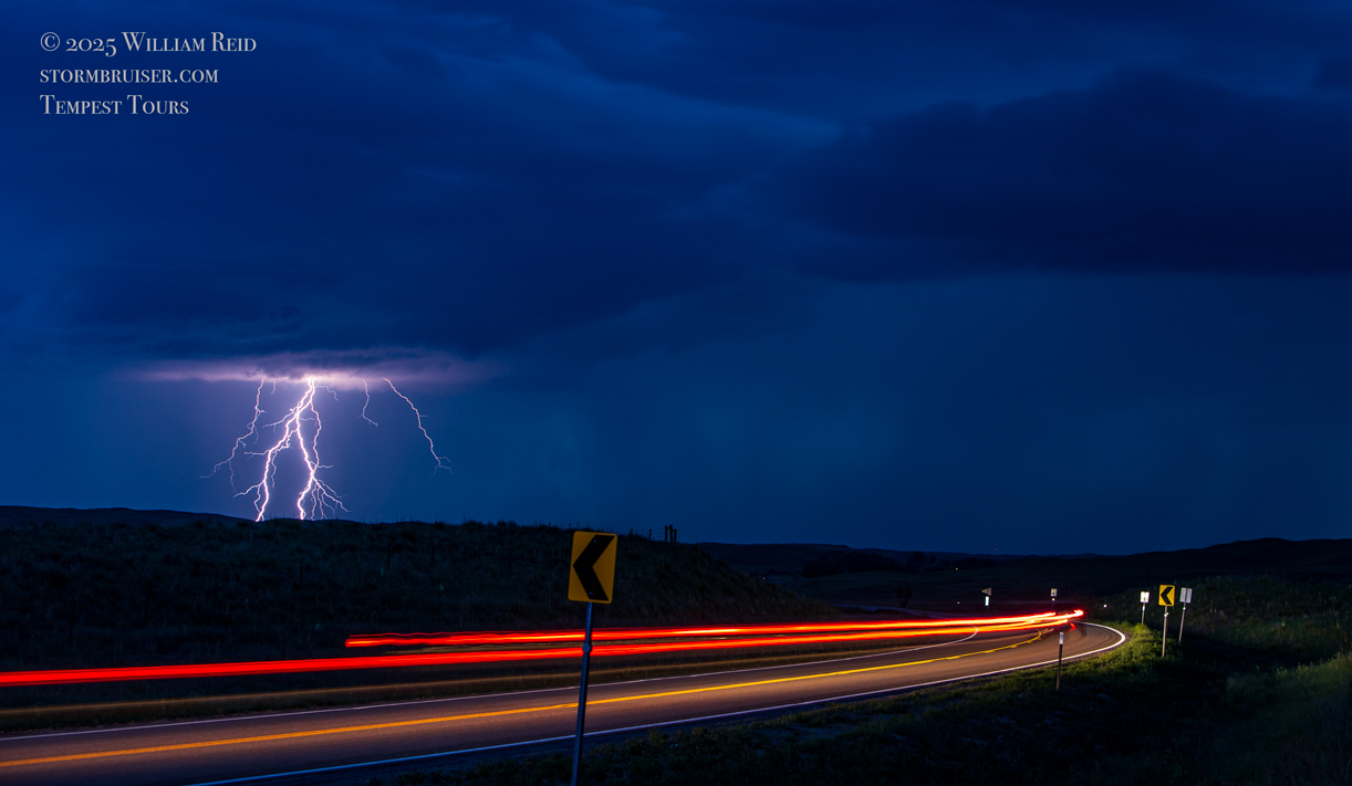
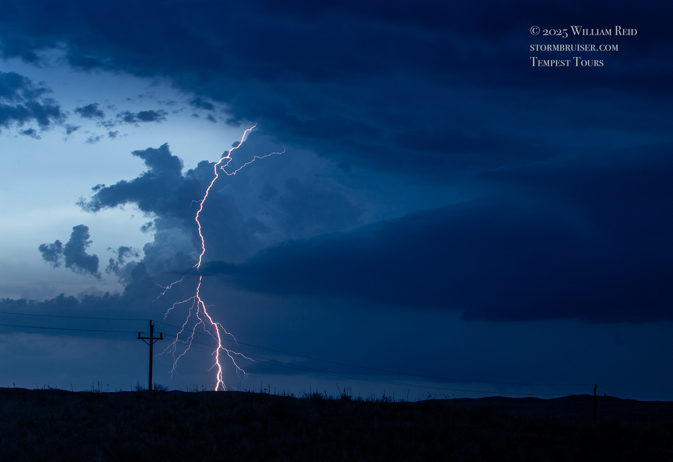
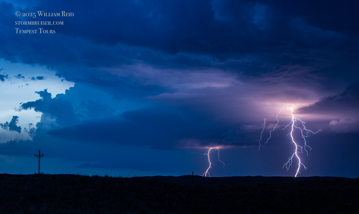
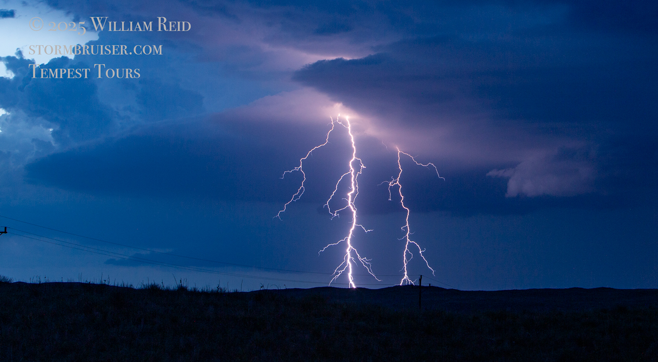
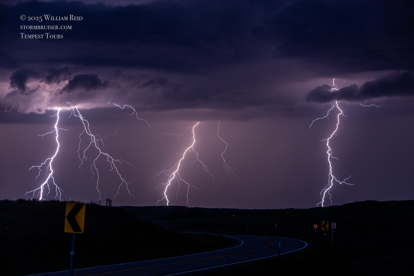
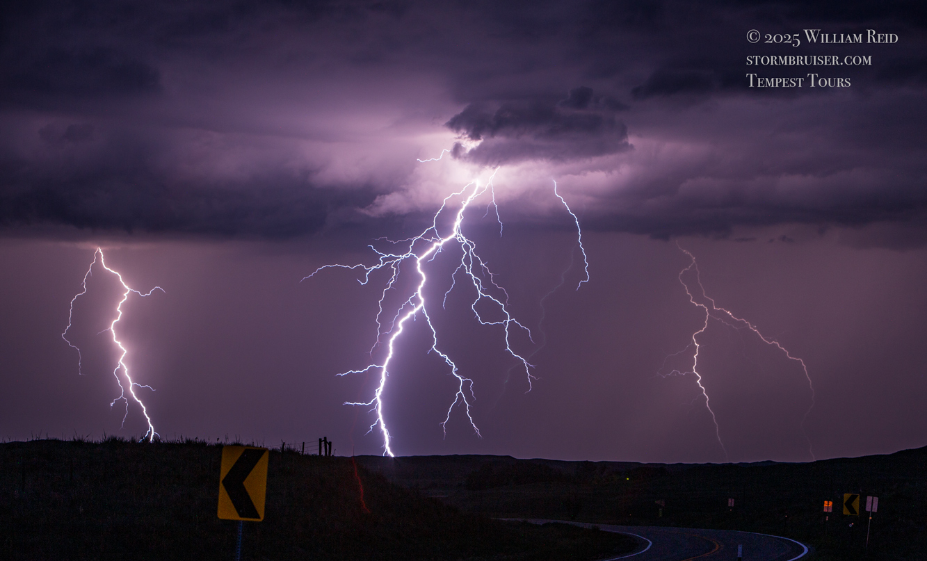
Strong storms began to fill in around us after sunset. We had enough time to stop for a while near Merriman, just south of the border, to photograph the lightning show. Some of my lightning images are in the Canon batch of photos farther down.
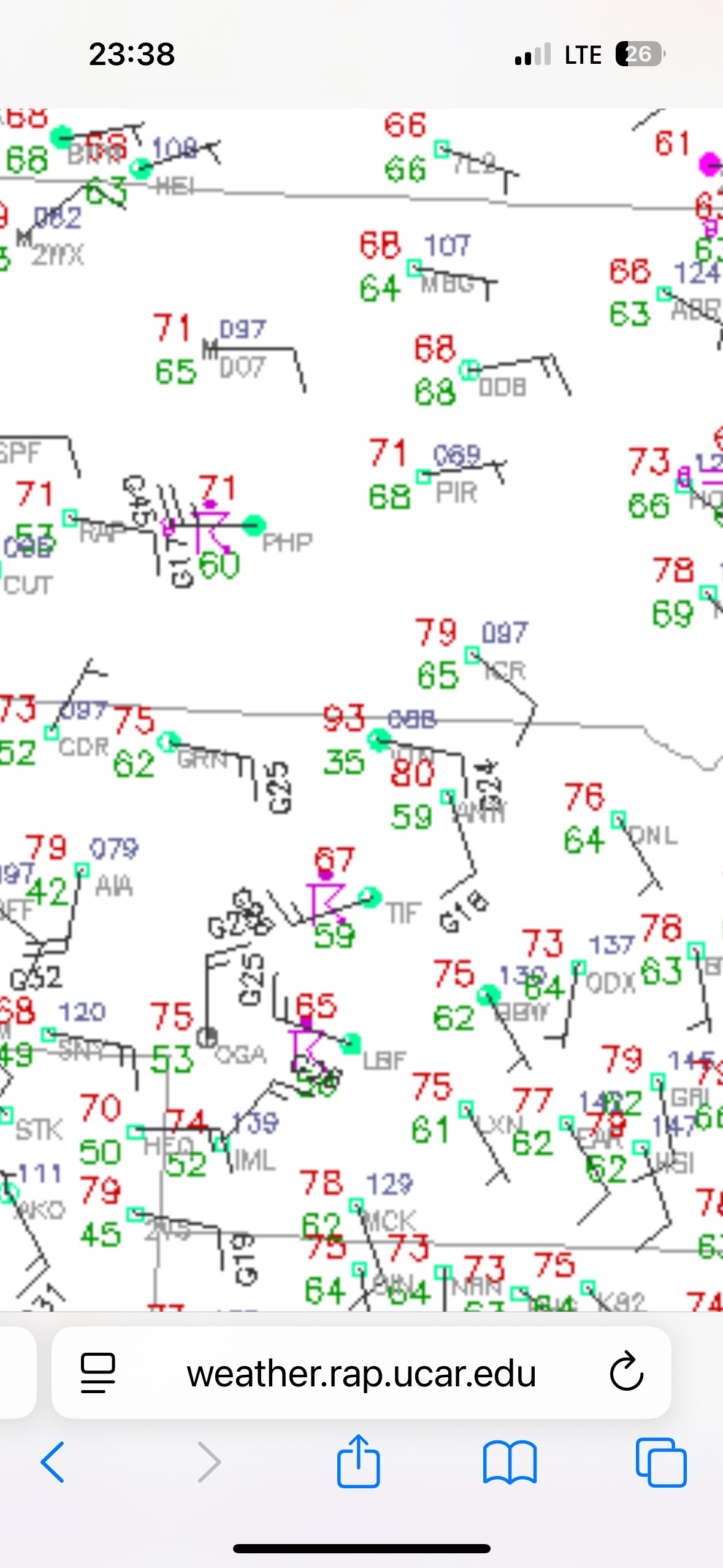
I include the surface weather maps above because they show the heat burst event at Valentine around 11 p.m. CDT. Temperature jumped to 93F and the dew point crashed to 35F!
This was quite the satisfying chase day! And, we didn’t know it at the time, but all we had to do the next day was make a two-and-a-half hour drive south on 83 from Valentine for a long-lived tornado near Wellfleet and Dickens, Nebraska.
Below are the selected stills off of my Canon cameras.
Leave a Reply
You must be logged in to post a comment.