

Start: Clinton, OK Lunch: Plainview, TX End: Childress, TX 600 miles SPC Day One/20Z SPC Mesoscale Discussion 752 SPC Mesoscale Discussion 753 SPC Mesoscale… [Read More]
May 15, 2019 Southwestern Nebraska Storms

Start: Norton, KS Lunch: Idalia, CO (The Grainery) End: McCook, NE 303 miles SPC Day One 20Z SPC Mesoscale Discussion 635 SPC… [Read More]
May 13, 2019 Cherokee, Oklahoma Left-moving Supercell

Start: Oklahoma City, OK Lunch: Seiling, OK (Crooked Arrow Cafe) Dinner: Wellington, KS (Braums) End: Wichita, KS 342 miles SPC Day One (20Z) SPC… [Read More]
May 8, 2019 Southwestern Oklahoma Marginally Severe Storms

Start: Sayre, OK Lunch: Texola, OK (Tumbleweed Cafe) End: Vernon, TX 334 miles SPC Day One (20Z) SPC Mesoscale Discussion 591 SPC Mesoscale… [Read More]
May 7, 2019 Two Tornadic Supercells in the Texas Panhandle
Start: Guymon, OK Lunch: Amarillo (Subway) End: Sayre, OK 447 miles SPC Day One (20Z) SPC Mesoscale Discussion 567 SPC Mesoscale Discussion 569 SPC… [Read More]
May 4, 2019 Oklahoma Panhandle Supercells
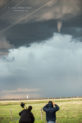
Start: Oklahoma City (Tour 2) Lunch: Woodward (fast food) End: Liberal, KS 488 miles SPC Day One/20Z SPC Mesoscale Discussion 535 SPC Mesoscale Discussion… [Read More]
February 20-24, 2019 More Fun on San Nicolas Island

This entry is a bit of a mishmash of images from San Nicolas Island from late February. First up, a convective storm cell moves… [Read More]
January 14, 2019 San Nicolas Island Airport

November 29, 2018 San Nicolas Island Cumulonimbus

Late on this afternoon on the island, shower activity was drifting west to east over the waters to the north. I set the camera… [Read More]
June 29, 2018 Northwest Nebraska Panhandle Supercell

Begin: Belle Fourche, SD Lunch: Newcastle, WY (Mexican joint) End: Chadron, NE 271 miles SPC Day One 20Z SPC Mesoscale Discussion 942 SPC Mesoscale… [Read More]
June 28, 2018 Capitol, Montana tornadoes
note — this is a long post with many images, and may be slow to fully load. Please allow a little extra time before… [Read More]
June 26, 2018 Western Dakotas supercells
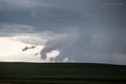
Begin: Fullerton, NE Lunch: Valentine, NE/McDonalds End: Eagle Butte, SD 746 miles SPC Day One 20Z Jun 26, 2018 SPC Mesoscale Discussion 894… [Read More]
June 21, 2018 Hailstorms on the Cheyenne Ridge
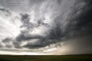
Following our successful tornado day on June 19th, we had a down day on the 20th. The severe risk in central Iowa was too… [Read More]
June 19, 2018 (Part 1 of 2) Prospect Valley, Colorado tornado
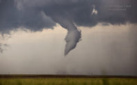
Link to Part 2 of the June 19 chase Begin: Fort Morgan, CO Lunch: Limon, CO/Arbys and Subway and Taco Bell End: Lamar, CO SPC… [Read More]
June 19, 2018 (Part 2 of 2) Agate and Limon supercell and Kanorado severe storm
See June 19/Part One for the weather details and the chase account for the Prospect Valley tornado. Following the spectacular tornado intercept, we headed… [Read More]
- « Previous Page
- 1
- …
- 6
- 7
- 8
- 9
- 10
- …
- 17
- Next Page »