

And “Tornado Fredonia”, too, but we could not see it, despite looking at the supercell on its southeast side as it came up to Fredonia,… [Read More]
April 29, 2008 Web site update: Spencer tornado page ready
In one month, it will have been ten years since the deadly Spencer, South Dakota, tornado of May 30, 1998. I have completed my web… [Read More]
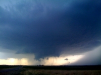
April 26, 2008 San Angelo, TX supercell
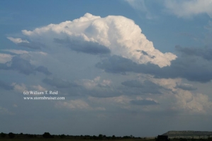
It is chase season again on the Great Plains! I abandoned Los Angeles on Friday, April 25th, and stayed in Las Cruces, NM, on Friday… [Read More]
April 19, 2008 Cottonwood Creek, CA
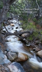
Charlie B. and I took a drive north into the southern Owens Valley, hoping for some wave cloud activity or other interesting weather. It was… [Read More]
Springtime at the Tree of Doom
April 4, 2008 Aircraft at LAX
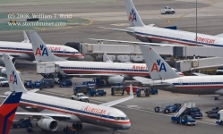
More plane pics on a hazy spring day in L.A…
April 4, 2008 Bird of Prey Now Arriving at Gate 64
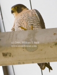
I was on the 16th-floor observation deck at LAX, minding my own business while photographing the jets, when a large bird landed on one of… [Read More]
March 30, 2008 SW OK supercell, photos by Martin Lisius
These photos are courtesy of Martin Lisius. On the left is the “Granite, OK, wall cloud at 6:47 p.m.”, and on the right is the… [Read More]
March 26, 2008 Panamint Valley and Owens Valley, California
Charlie B. and I took a day trip into the deep basins three hours north of L.A. —- the Panamint and Owens valleys. We were… [Read More]
March 10, 2008 Web Site Update Message
Happy March! The time for storm chasing nears—I will be headed to the Plains for the chase season with Tempest Tours in about six weeks…. [Read More]
February 13, 2008 Stormbruiser Update
Just a quick blurb to say that I am scanning slides from 2006. The really nice Red Shirt/Badlands storm of June 13, 2006 is up…… [Read More]
January 27, 2008 Bill Read new NHC director!
Good morning readers! Much to my surprise, I was recently named the new director of the National Hurricane Center! Unfortunately, the media persist in spelling… [Read More]
Welcome To Stormbruiser January 2008 Update!
Happy 2008! Thank you for visiting Stormbruiser. This is the place where I am able to share my passions and storm photography with you. My… [Read More]
January 7, 2008 L.A. Skyline and snow-capped mountains
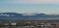
I work at LAX as weather observer once a month, and my shift this January was on a crystal-clear day following a storm which had… [Read More]
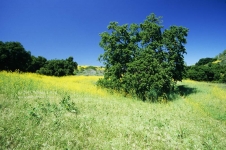
January 11, 2008 Schoolhouse Canyon Oak

Schoolhouse Canyon is a five minute walk west of my residence in Westlake Village. Today was a bright and sunny day, 73F, with some cirrus… [Read More]
- « Previous Page
- 1
- …
- 77
- 78
- 79
- 80
- 81
- …
- 85
- Next Page »