Stormbruiser.com

William T. Reid

  • About
  • Video Links
  • Climate
  • Categories
    • Astronomy
    • Aurora/Northern Lights
    • Artsy
    • Airports (LAX and VNY)
    • Animal Day
    • Beach
    • BEST and MOST POPULAR
    • Chase Season Summary
    • Chasers and friends
    • Cumulonimbus
    • Death Valley
    • Desert
    • Desert/Mountains
    • Elevated photography
    • Eyesores
    • Fire
    • Flooding
    • Hurricane
    • Landscapes
    • Lightning
    • Local: Conejo Valley/San Fernando Valley
    • Mid and High Clouds
    • Nighttime photography
    • Old Stuff
    • Rainbows/Optical Phenomena
    • San Nicolas Island
    • Storm Video Sales
    • Stormy Skies
    • Stupid Bugs
    • Sunsets and Storms
    • Supercells
    • The City
    • Tornadoes
    • Unusual Clouds
    • Vegetation
    • Wind and Dust
    • Winter Weather
  • Contact
You are here: Home / 2017 / May 8, 2017 Supercell Is In The House, New Mexico

May 8, 2017 Supercell Is In The House, New Mexico

May 8, 2017 By Bill Leave a Comment

170508_1167_House


Start:  Raton, NM

Lunch:  Springer, NM (Dairy Delight)

End:  Tucumcari

302 miles

SPC Day One/20Z

SPC Mesoscale Discussion 662

SPC Mesoscale Discussion 663

SPC Mesoscale Discussion 664

SPC Mesoscale Discussion 667

SPC Storm Reports

Sfcmap


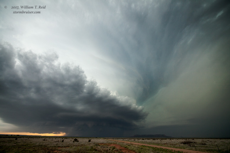
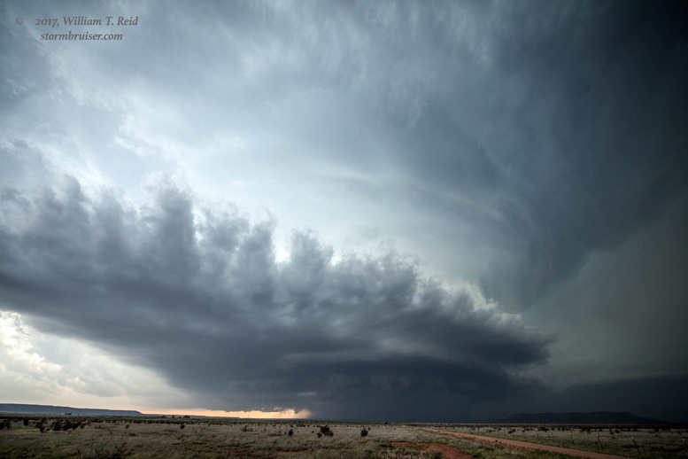
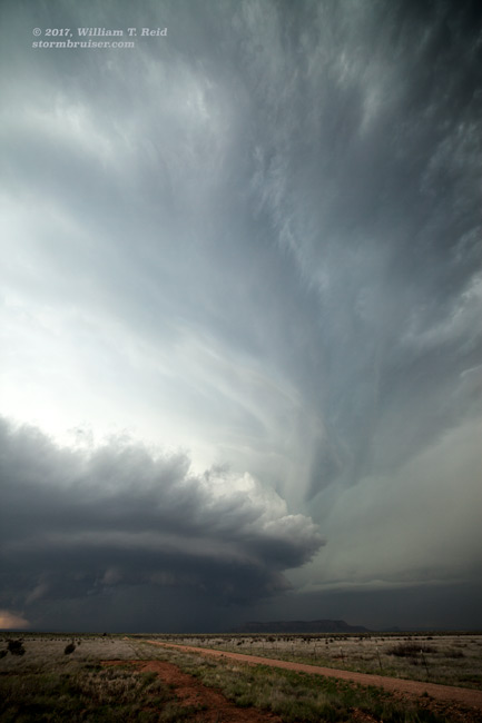
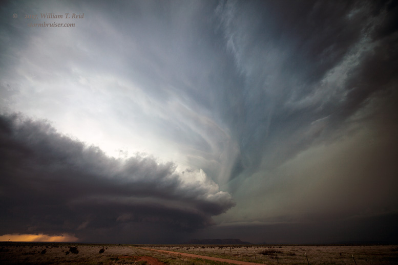
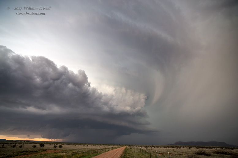
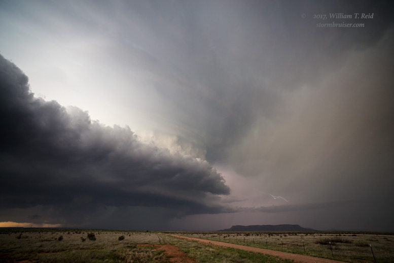
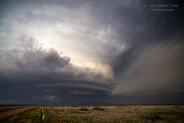
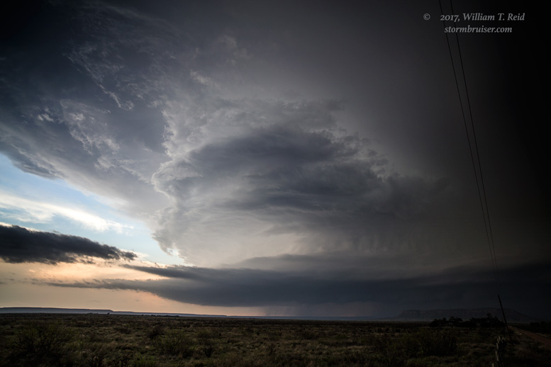
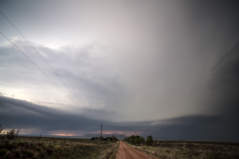
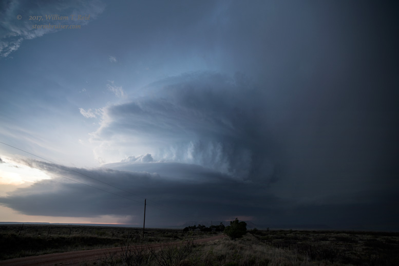
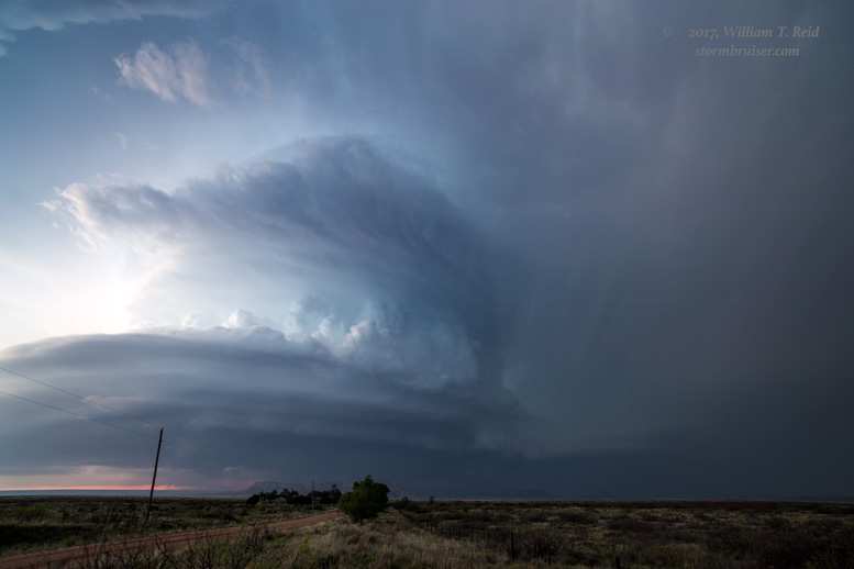
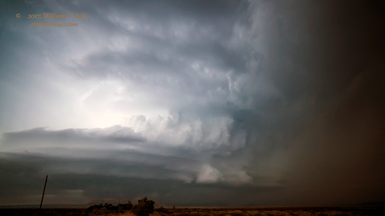
Finally, relatively decent moisture had returned to the High Plains, and shear and instability were looking fabulous for supercells. SPC showed a slight risk for both eastern NM and eastern CO, and a 2 percent tornado area along the Palmer Divide in Colorado.  Moisture appeared to be a bit better along I-40 into eastern NM, so we rolled down to Tucumcari from Raton, via Roy and Logan. We got in front of a rapidly developing severe storm south of Tucumcari, west of the small town of House, NM.  It quickly became an HP supercell, with a ground-scraping wall cloud.


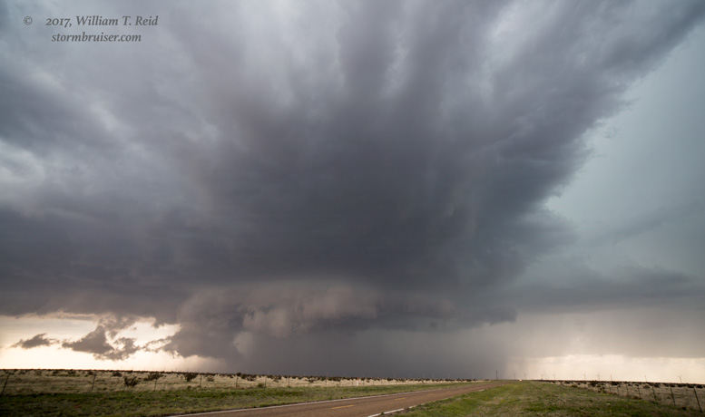
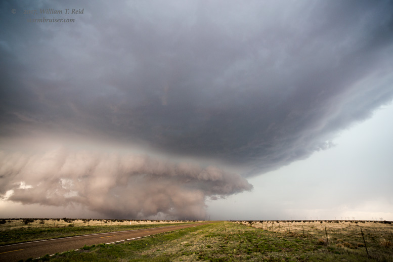
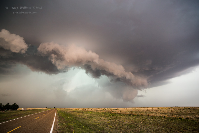
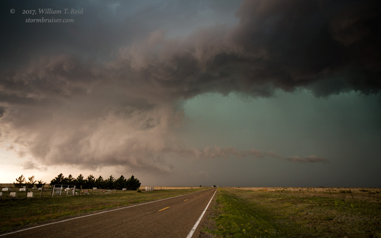
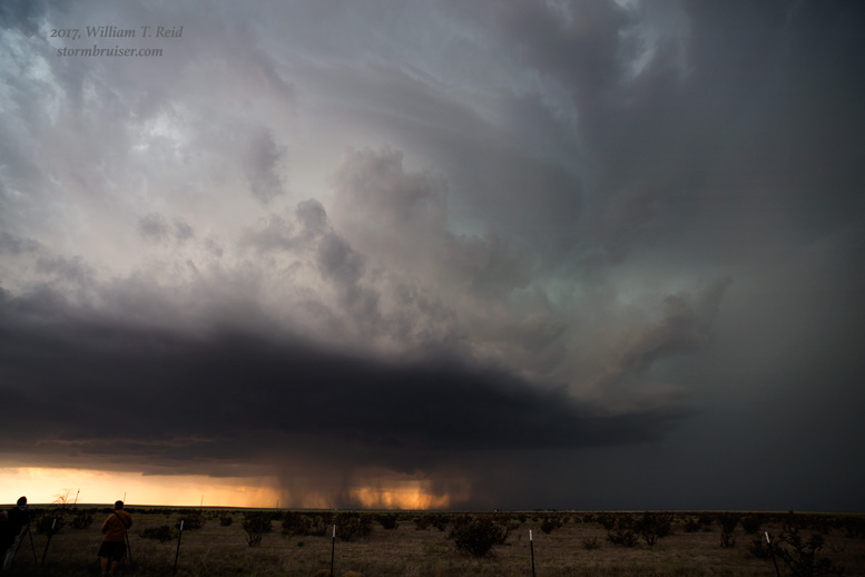
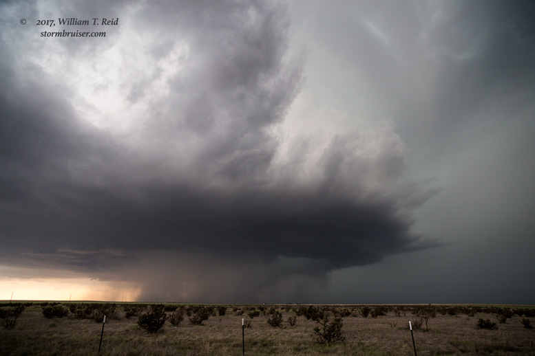
This was quite the beast of a storm, and it was drifting ever so slowly to the north-northeast.  Our road westward out of House worked perfectly for starters, but in order to get north again we had to retreat eastward about ten miles.  Given the HP nature of the storm, and the low likelihood of even seeing a tornado if one should develop, this was not too irritating.  We were afforded fantastic looks at the storm structure, which became more and more impressive into the early evening hours.  The images below are looking to the west from between McAlister and Quay.  Some chasers reported a tornado with the storm at dark.


Filed Under: 2017, Landscapes, Supercells

Leave a Reply

You must be logged in to post a comment.

Search

May 2017
S M T W T F S
 123456
78910111213
14151617181920
21222324252627
28293031  
« Mar   Jun »

Categories

Archives

Copyright © 2025 stormbruiser.com · Log in