
Start: Tucumcari, NM
Lunch: Clovis, NM
End: Lubbock, TX
456 miles
A fairly potent upper-level system was approaching New Mexico and Texas today, and would be providing fast south-to-southwest flow aloft over eastern NM. A surface low near Hobbs was steering Gulf moisture into east-central NM and vicinity on ESE winds. This type of setup is often proficient at tornado production near and north of the surface low when moisture is sufficient. Daytime dew points were mostly in the upper 40s on the western side of the NM/TX border, and in the lower 50s on the eastern side, but would be increasing on a low-level jet towards dusk. For the 20Z outlook, SPC upgraded the area from Hobbs to Clovis to “enhanced” slight risk, and bumped up the tornado risk from 5% to 10%. That was good to see, as we were hanging out near Tatum, NM, mid-afternoon: right between Hobbs and Clovis!
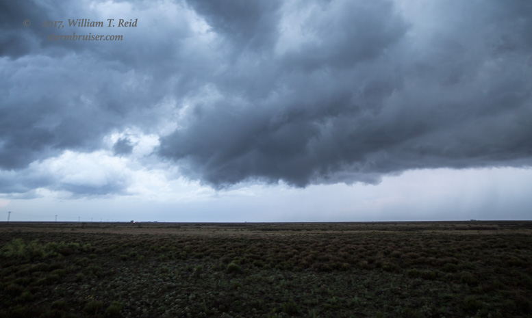
And by mid-afternoon, storm towers were developing near Tatum and moving to the NNE. These were quite high-based, though. As they loaded up with precip and spilled their guts, the cool air helped to bring the storm bases down, and soon there was a menacing HP beast with a very low storm base, where strong inflow was battling cool outflow. A suspicious area appeared close to being tornadic, but I did not see one. The supercell below was near Morton, TX.
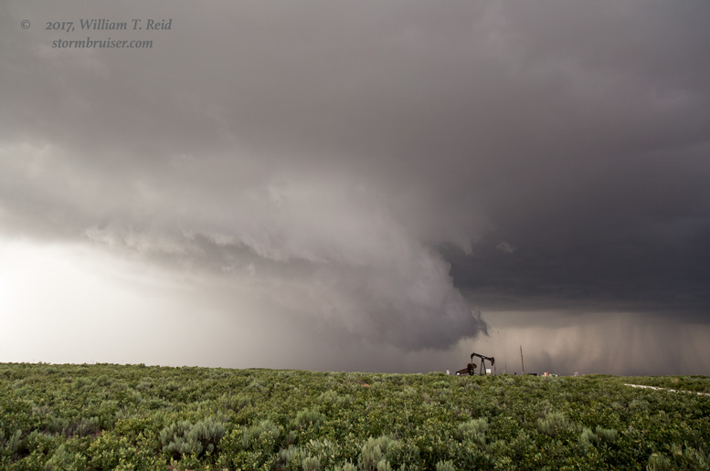
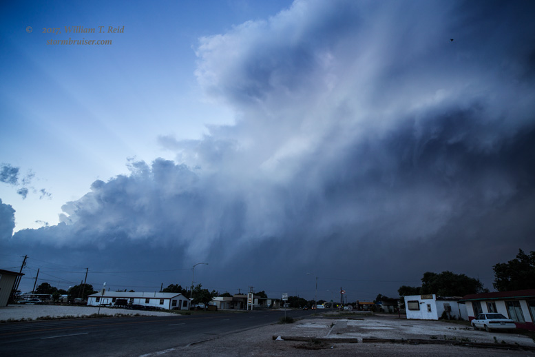
We stayed with this storm for quite a while, but it seemed to be a little outflowish. With a couple of hours of daylight remaining, I decided to abandon this storm and to head towards newer development in southeastern NM, in the Lovington/Tatum area. We blasted south on 214 to Plains, TX, and then west on 380. Between Tatum and Plains was a developing supercell.
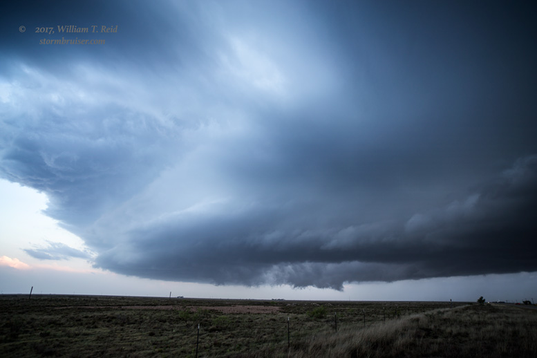
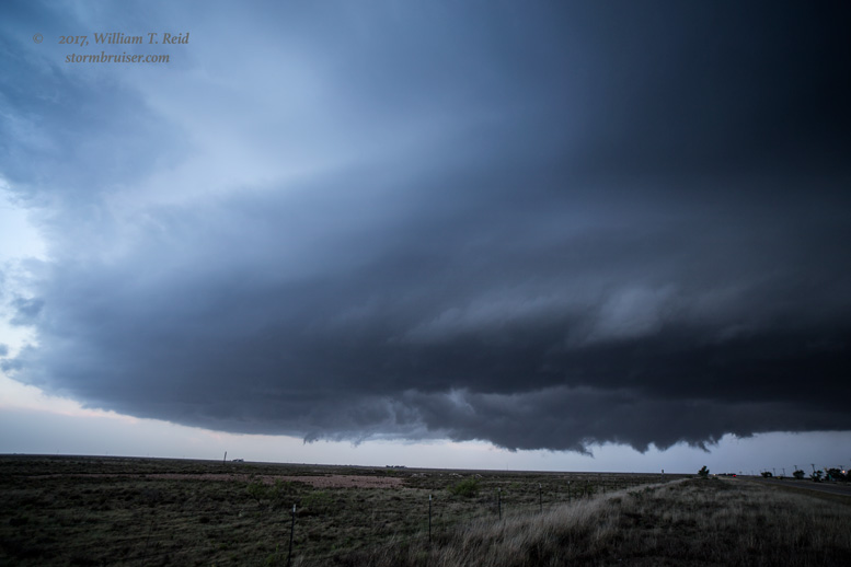
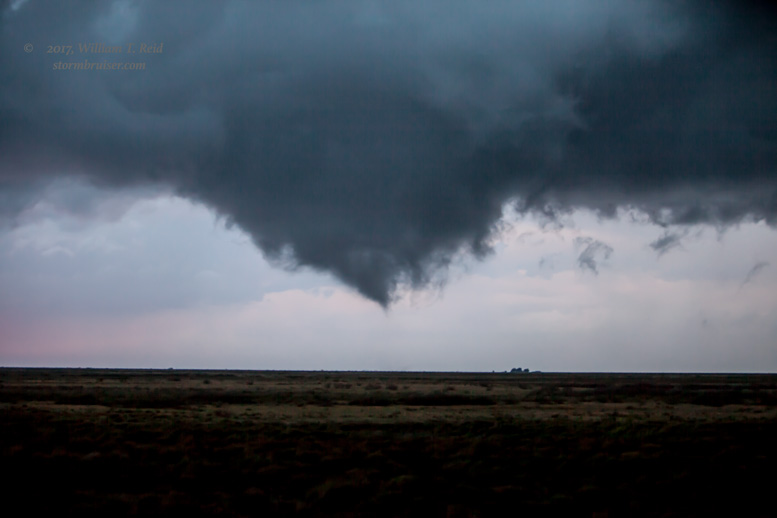
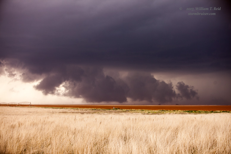
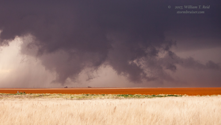
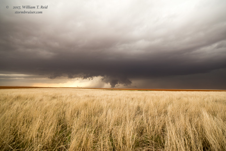
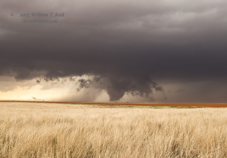
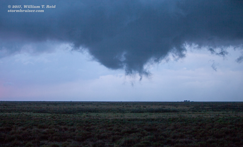
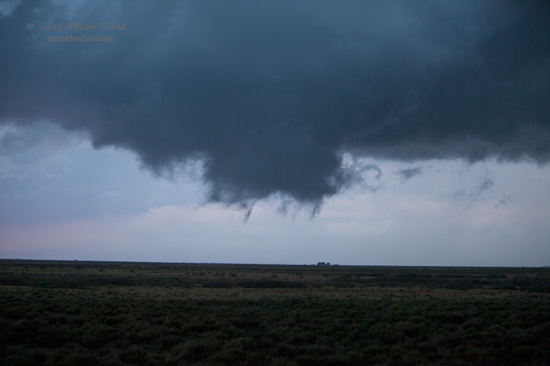
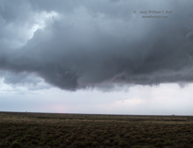
The images above depict a largely rain-free base, a low base without the influence of cold storm outflow, with a decent RFD cut. With a lowered area evident, we needed to get closer! We headed into New Mexico via U.S. 380, and then north a tenth of a mile on 168/Shunts Road. The action area was just to our W to WNW. A wall cloud was spinning hard here, and we stopped to shoot it. A funnel cloud teased the ground for a couple of minutes, and there MUST have been some decent rotation at the surface! The ground was moist, though, and there was no dust getting kicked up. If this was not a tornado, then it was about as close as you could get without having one!

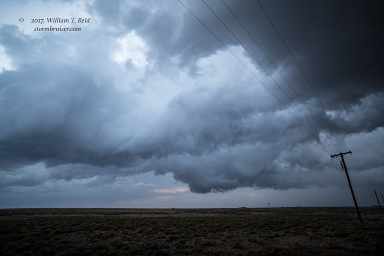
The area moved rather quickly to our NNW and then N, and our north road quickly went unpaved. We had to backtrack to 380 and tried to catch up, but darkness was setting in. We did not observe a clear-cut tornado with the supercell, but the structure was decent as it continued towards Morton. I think we were just a tad low on the surface dew point to permit robust tornado development today.
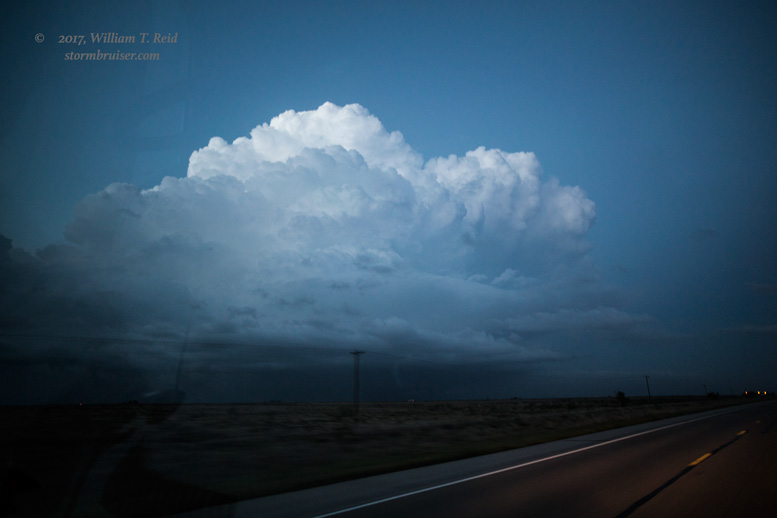
This “tornadic” storm was about ten miles east of Tatum, NM, when we were close to it and observing the strong, tight low-level rotation and the funnel cloud.
Leave a Reply
You must be logged in to post a comment.