

Happy Independence Day!
Start: Murdo, SD
Lunch and 4th of July Parade: Fort Pierre, SD
End: Grand Forks, ND
514 miles
SPC Day One Convective Outlook/20Z
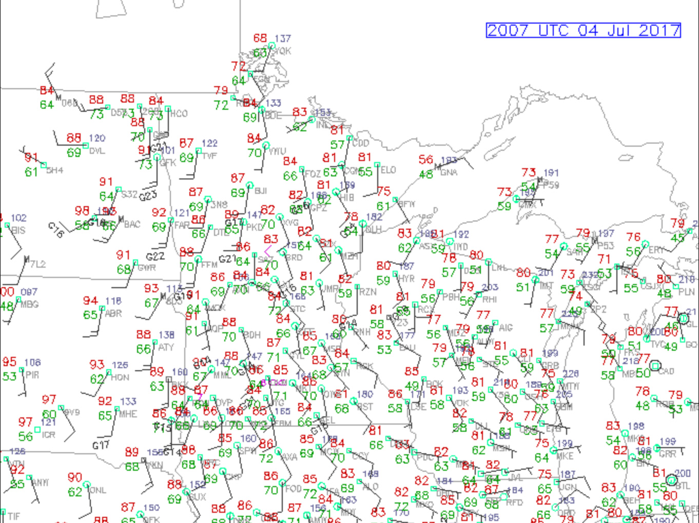
A weak cold front was sagging into eastern North Dakota, and there was ample instability and shear for some severe storms. Though moisture was quite a bit better than recent chases, tornadoes were not expected with today’s activity. Hot temperatures and high storm bases were part of the reason for this.
We spent a nice hour or so in Fort Pierre around noon to watch the Independence Day festivities. Plenty of interesting and old vehicles with the rich and famous from around the Pierre area paraded down the main street beneath hot and sunny skies.
The weather charts drew me to the north to I-94 in North Dakota and then east a few counties to the Valley City area. A storm developed to our northwest, and we watched for a while near Pillsbury. If I recall correctly, this storm split, as did another one later. The left splits dominated while the right splits sputtered.
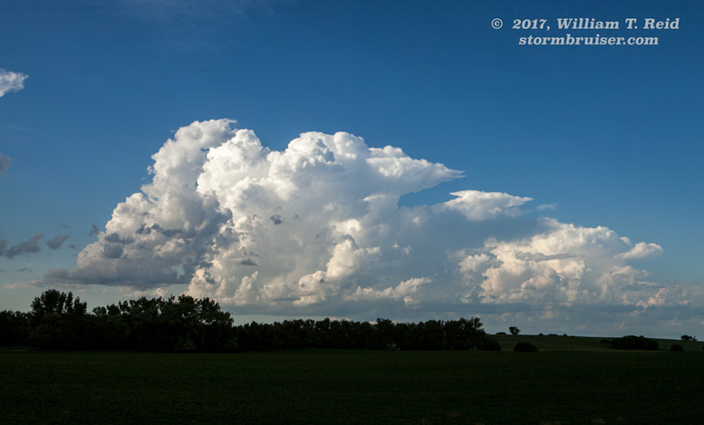


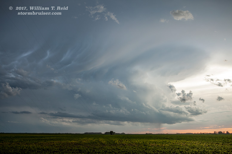
There was some interesting structure for a time, but we fell behind a bit and wound up west of the best storm near Finley. It looked like this one had a funnel cloud for a few minutes to our east.


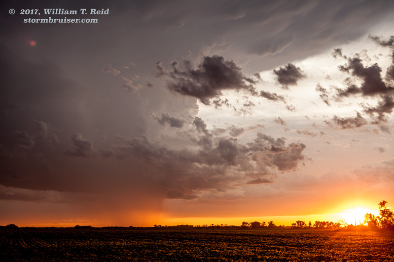
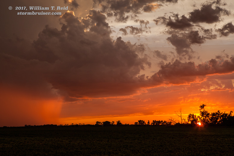
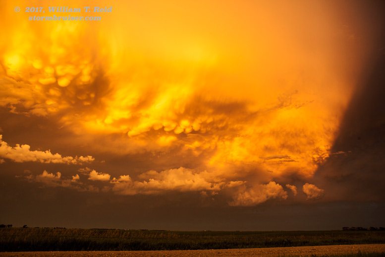
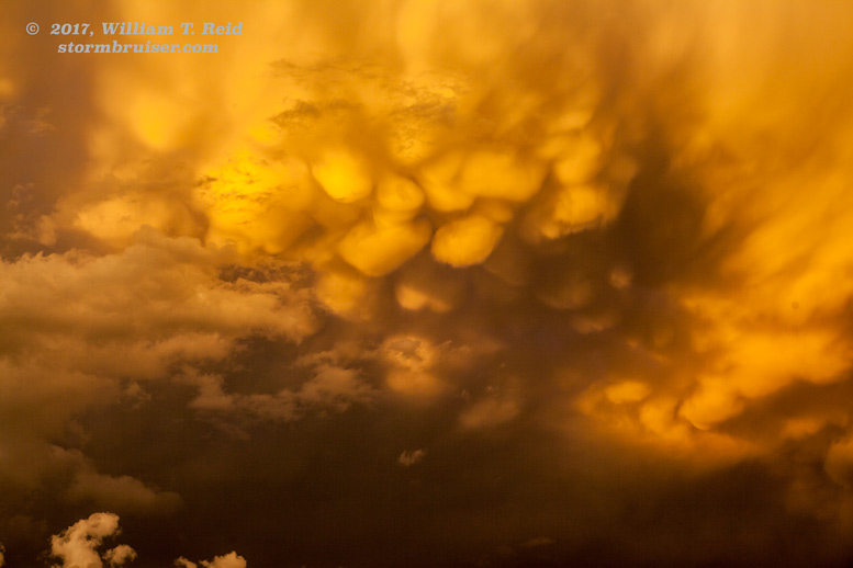
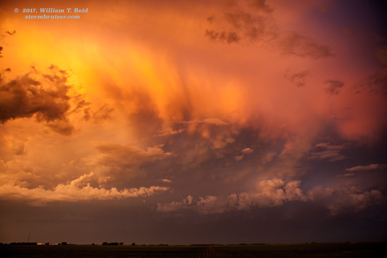
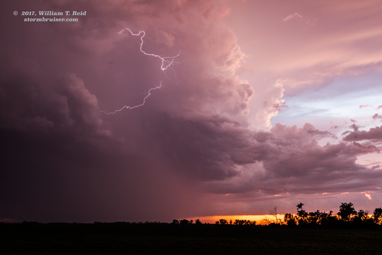
Towards sunset the storms became rather lethargic, and we set up for the stormy sunset shots south of Mayville, near the tallest man-made structure in the Western Hemisphere (a TV transmission tower). As you can see from the images below, the sunset colors were off the charts! Additional storms developed to our east, in Minnesota, on our evening drive to Grand Forks. We watched those from I-29 for a little bit, but they were not worth going after.


Leave a Reply
You must be logged in to post a comment.