
Start: Gillette, WY
Lunch: Broadus, MT/Stockman’s Grill
End: Belle Fourche, SD
466 miles
SPC Mesoscale Discussion 662 SPC Mesoscale Discussion 663
SPC Mesoscale Discussion 664 SPC Mesoscale Discussion 667
Detailed notes and account, with pics and video, by Tempest guest Lesleyanne Ryan
This day’s setup looked to have decent potential for a higher-end supercell and tornadoes. However, the best spot for this sort of activity was not particularly clearcut. It appeared that eastern Montana was the place to be, but I wasn’t sure if the tour needed to be way up near the border with Saskatchewan or down here near Wyoming. After lunch in Broadus, the weather data suggested that Miles City would be a good middle-ground spot. I still wasn’t sure where to target. Some morning and midday storms well to my north or northwest were in progress, but I didn’t want to consider morning storms, even though they were moving into a decent environment. The parameters around Miles City were good, and I was hoping that something could develop there.
We drifted northeast to Terry via I-94. Some weak convection sputtered a little to the west in an area with surface moisture convergence. It was warm and a little humid, without much shade available away from town. I was looking for a nice big shade tree outside of Terry, without any luck. I was becoming concerned that the models, which were persistent and consistent in showing some good-looking storms in this area, were incorrect. The cap was winning big time so far.
My focus shifted from northeastern Montana to southeastern Montana. We needed to get on a storm today, and this eventuality was looking a lot more likely to our south as we meandered north and west and south of Terry. The map showed a gravel road south out of Terry, so we gave that a try. I wanted to be on U.S. 12 east of Miles City, with a quick route to Baker and southward if needed. This was a very pretty drive, and the road was great. We stopped at the old and abandoned schoolhouse at the end of this road at Highway 12, and watched more weak storm towers to the west. The cap was not permitting these to get strong. The environment was pretty good here for supercells and maybe even tornadoes, but this stuff was junky.
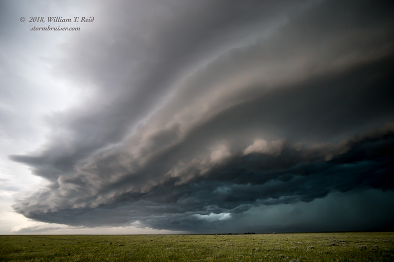
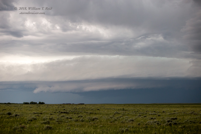
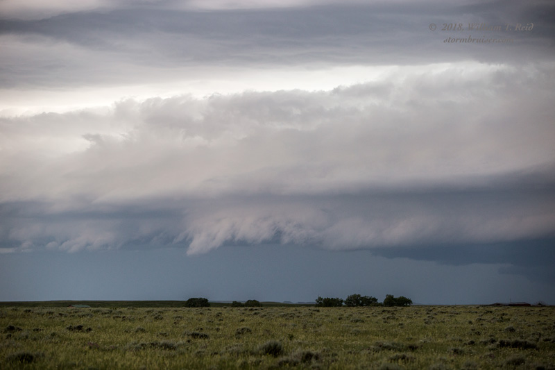
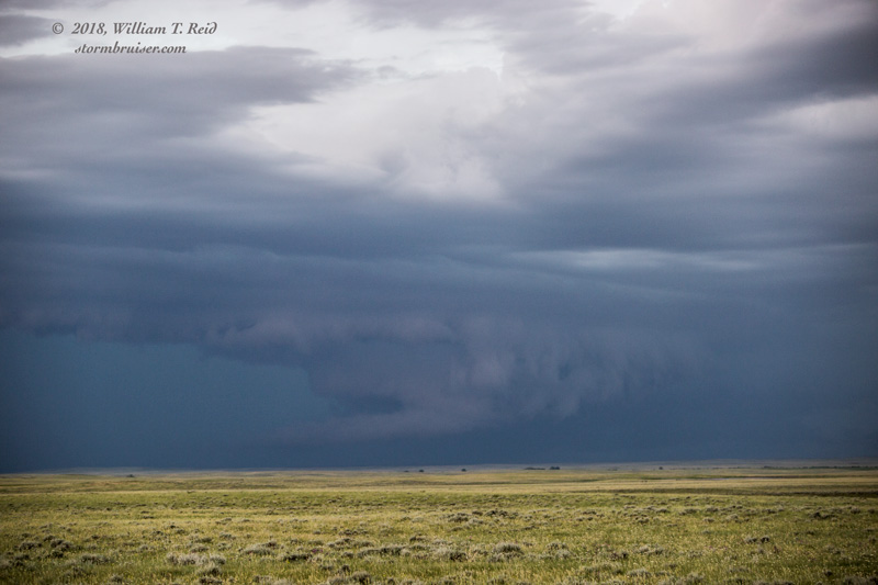
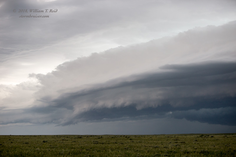
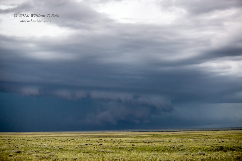
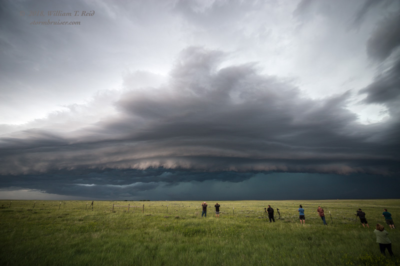
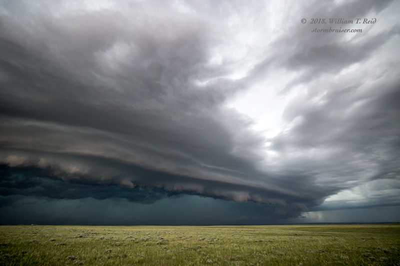
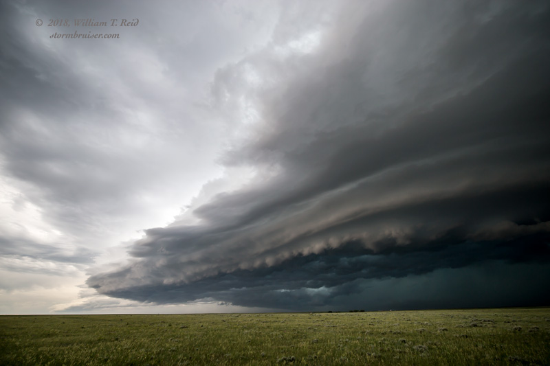
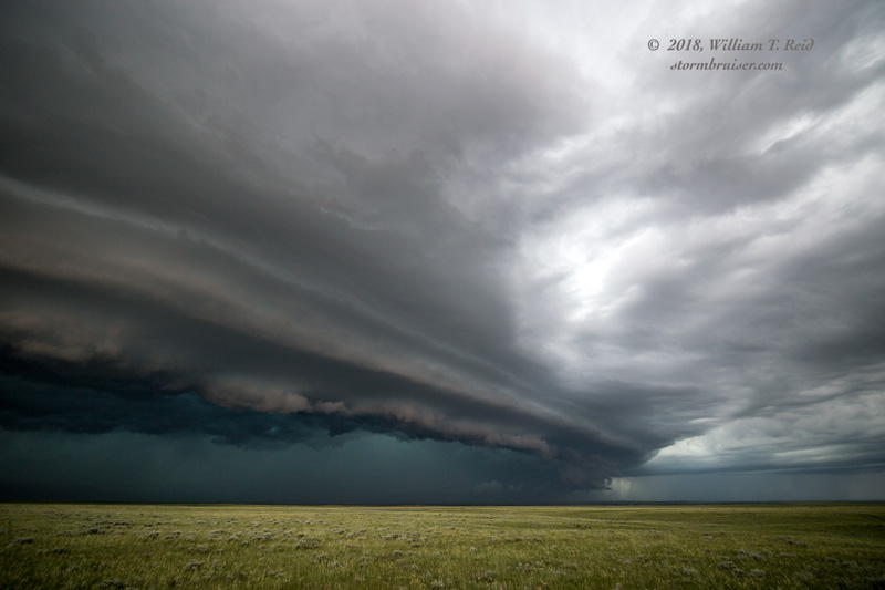
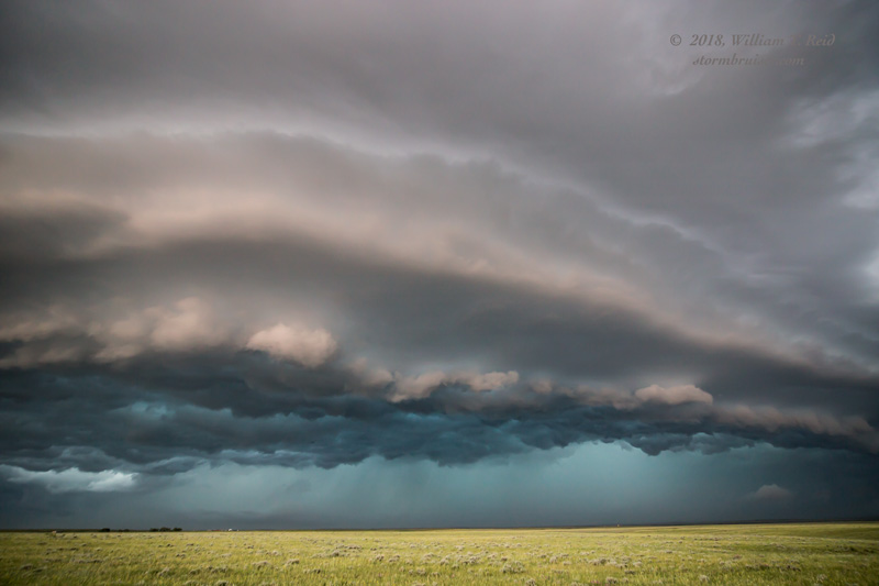
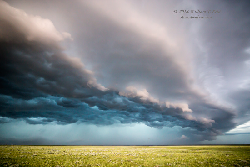
Another storm tower showed itself, well to the south. The latest model runs suggested that the storms down that way might have a better chance at being strong to severe. I committed to this south storm, now not too far from Broadus. It was moving to the east, so we headed to Baker and then south towards Ekalaka. Radar showed that one of three cells was quite good! It took a while, but we finally got ourselves east of this storm, along Highway 323, northwest of Albion. The supercell was so good that it was nearly stationary — out in the middle of a roadless void. Please move east towards us!
Well, the supercell was not very cooperative, and it soon got gobbled up from behind by a linear system surging eastward. There was a wall cloud and wrapped-up area on the supercell just before it got interfered with. Would this be offensive interference and a 15-yard penalty for the squall line? Where is the flag?
At least there was some pretty structure for a while — see my pics below! The storm eventually forced us southeastward to Albion, when a wayward deer decided to end it all in an inglorious fashion by running in front of me and Van One. The van still ran after impact and inspection and duct taping, fortunately. But Van One was without air conditioning for the next couple of chase days. And “thank you” to the lady at the convenience store in Alzada! We needed that pit stop.
Leave a Reply
You must be logged in to post a comment.