
Begin: Fullerton, NE
Lunch: Valentine, NE/McDonalds
End: Eagle Butte, SD
746 miles
On this Tuesday morning, I had two targets to choose from. One was in eastern KS and into western MO, and the other was in far northwestern SD, and perhaps a little north of there into ND. SPC was talking up the southern target a bit more than the northern one, and the tornado potential was perhaps a little better in Kansas versus the western Dakotas. But looming two days ahead of us (Thursday/June 28) was a day with much better tornado potential, and likely would be the best day of Tour 7. If I didn’t mess up, of course. I liked the idea of getting up into the Thursday target area in plenty of time. Since the supercell prospects were excellent today (June 26) in about the same region, I elected to make the long drive from eastern Nebraska on this day instead of the even longer drive from southeastern Kansas (or even farther) on Wednesday and Thursday.
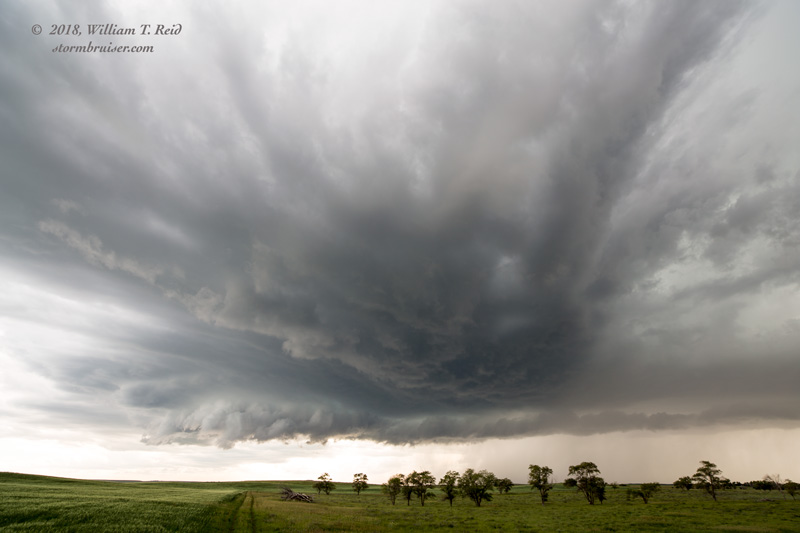
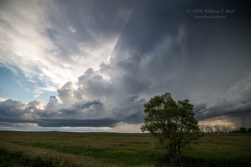
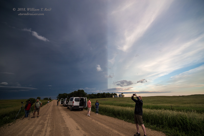
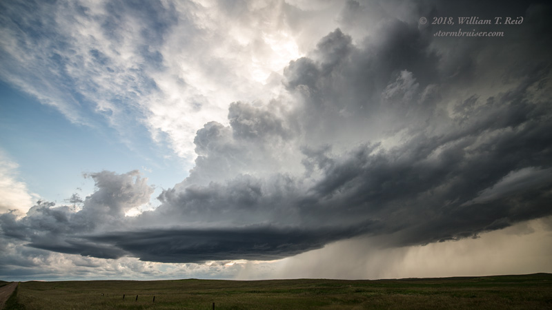
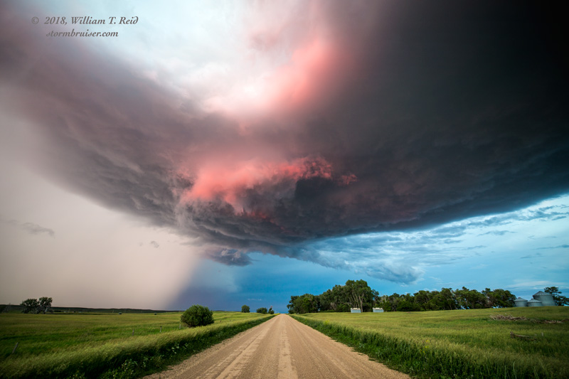
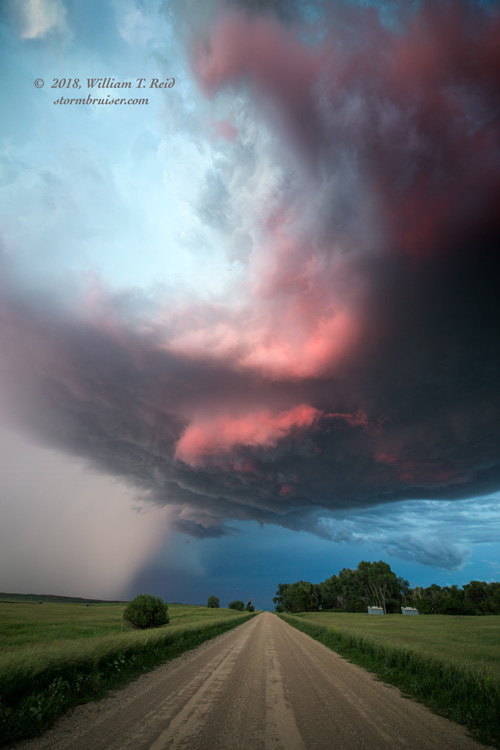
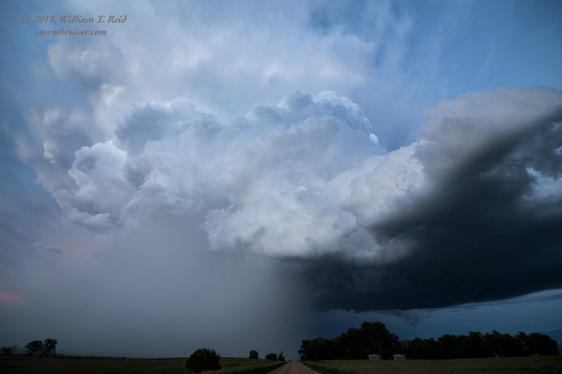
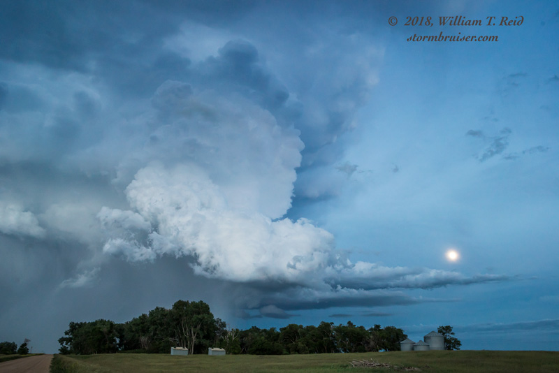
Our breaks and lunch were brief, and we were rolling into Faith and Lemmon as healthy cumulonimbus clouds were developing around Bowman, ND, in the late afternoon. We set up just north of Scranton (east of Bowman) and watched a couple of cells organize. The southern one suddenly looked really good, and it started to head east-southeastward towards South Dakota. It exhibited some very fine structure north and east of Haley, ND (while tornado-warned), and then sputtered a little before sunset near Lodgepole.
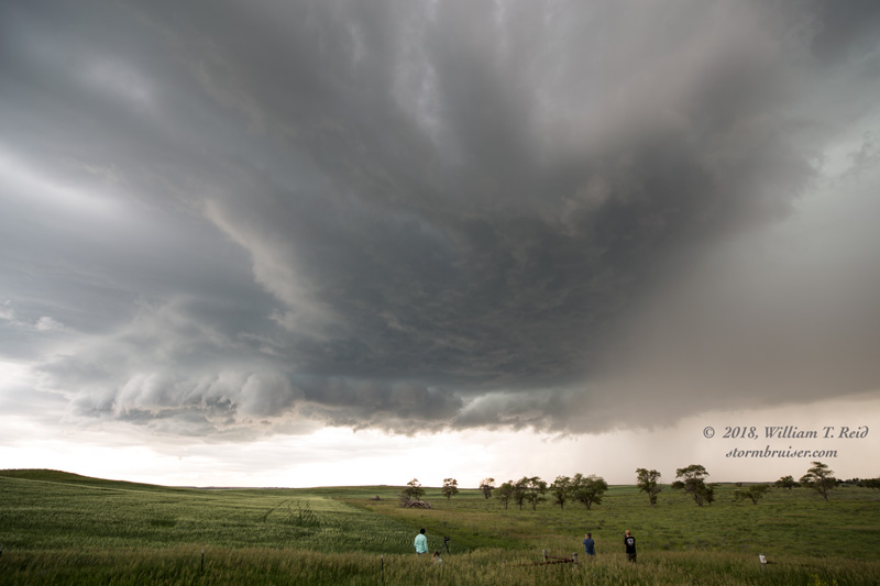
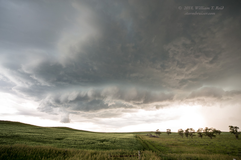
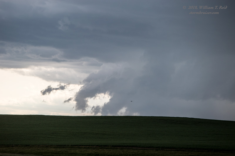
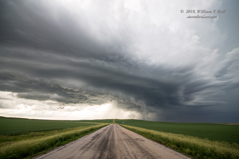
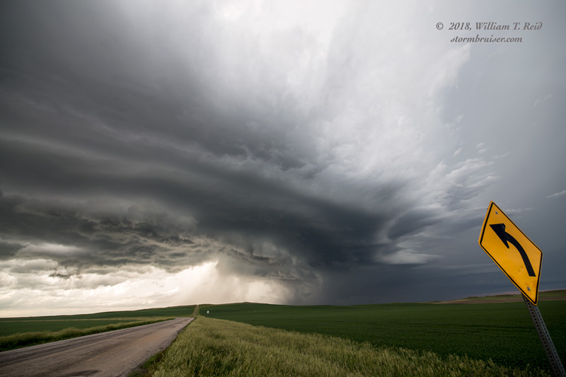
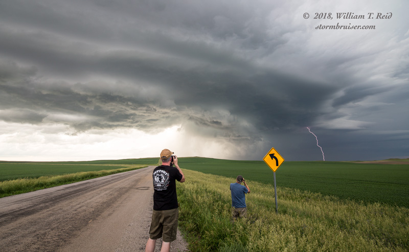
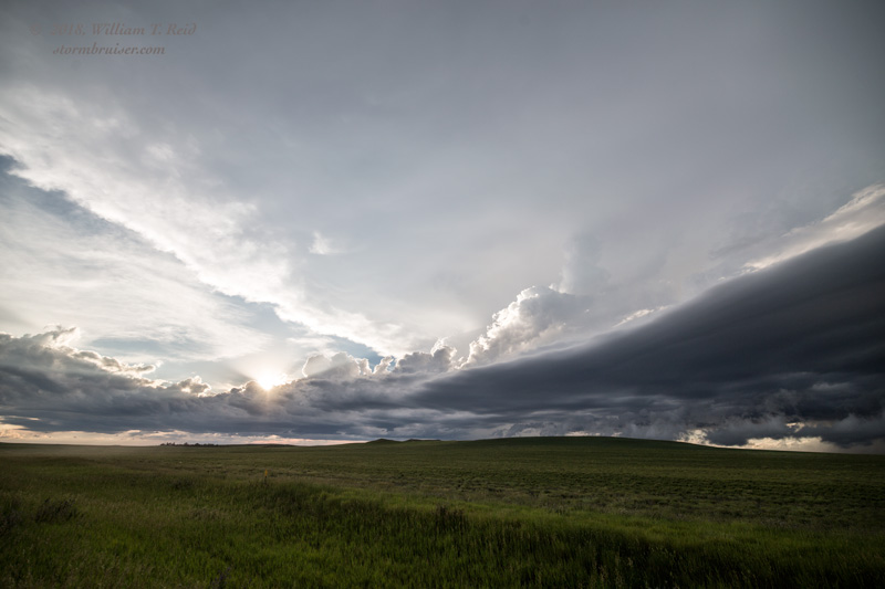

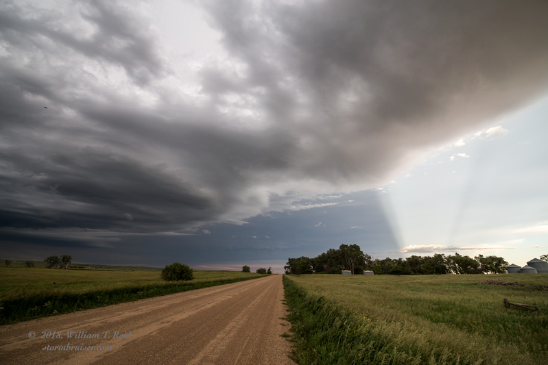
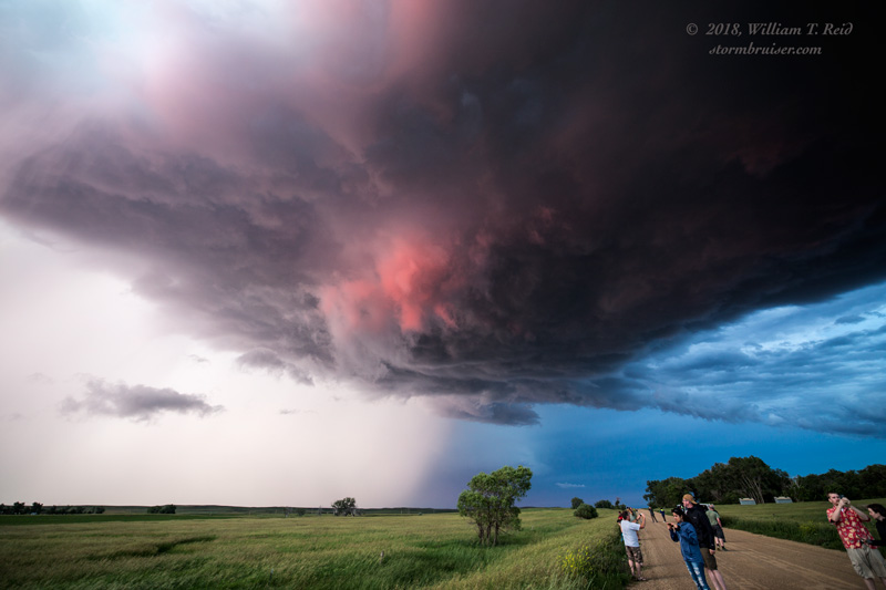
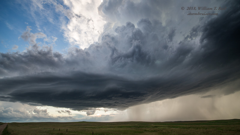
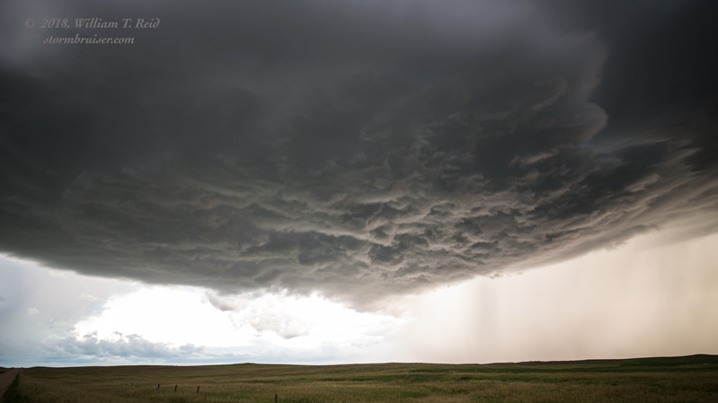
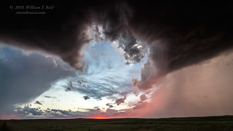
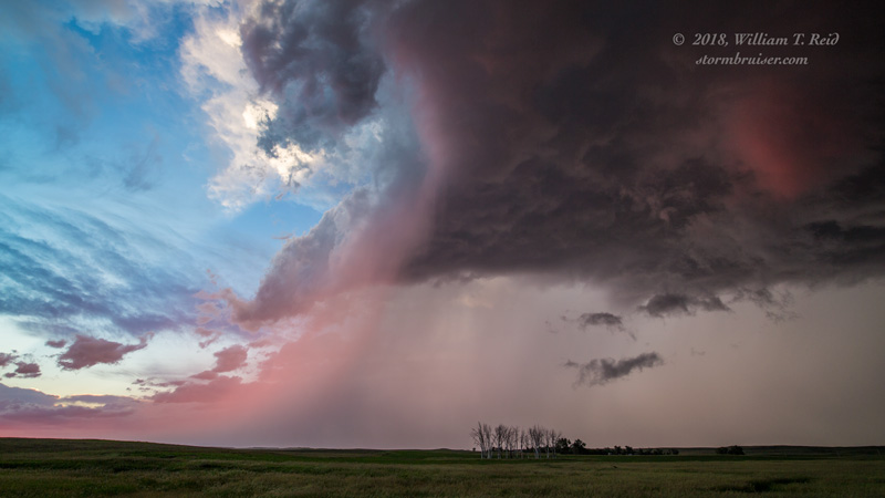
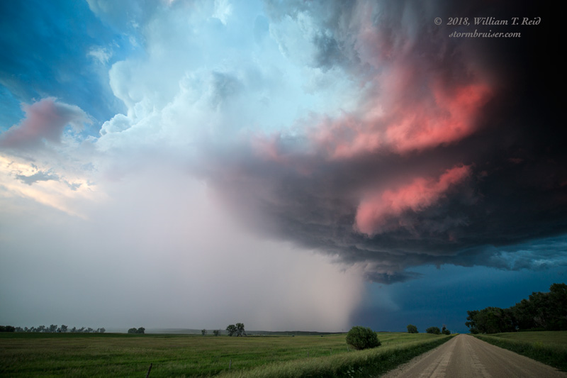
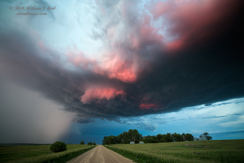
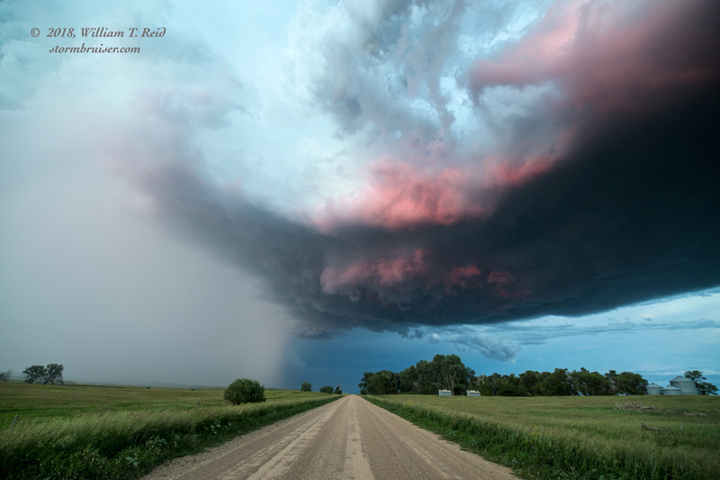
We stopped a couple of miles southwest of Lodgepole, and let this one go. Another rotating updraft approached from the WNW, and its base went directly overhead. Its base caught the last sun rays of the day and turned red, adjacent to a heavy hail core. This was a great and dramatic way to to wind up a very long chase day! Unfortunately, we had another couple of hours of driving to get to our motel at Eagle Butte. UGH.
Leave a Reply
You must be logged in to post a comment.