
Start: Hot Springs, SD
Lunch: Scottsbluff/Taco Bell and Subway
End: Burlington, CO
565 miles
SPC Mesoscale Discussion 1026 SPC Mesoscale Discussion 1027
SPC Mesoscale Discussion 1028 SPC Mesoscale Discussion 1030
SPC Mesoscale Discussion 1032 SPC Mesoscale Discussion 1034
SPC Mesoscale Discussion 1035 SPC Mesoscale Discussion 1036
This Saturday was the final chase day for Tour 5. We began the day in Hot Springs, SD, and I aimed for eastern Colorado, where SPC showed a slight risk. The slight risk extended into much of SW NE and NW KS, but tornado prospects were not high (only a 2% outline by SPC) as the dew points were not that high, and relatively high storm bases were likely. A boundary that stretched from near Limon and into NW KS and SW NE separated southeast winds from northeast winds, and was the most likely focus area for initiation. Upslope flow on the north side of the boundary would likely also help to get storms going from about Denver to the Cheyenne Ridge. I figured that we needed to get down south to I-70 towards Last Chance and Limon. Upper-level winds from the WSW and the shear required for supercells were fabulous. I was not in love with the northeasterly surface winds just north of I-70, as tornadoes are more likely with E or SE winds. CAMs were fairly consistent in showing late afternoon/early evening long-track supercells roughly along I-70, beginning near Denver. That was convenient, as we needed to be back to Denver on Sunday.
As we made our way southward through Kimball and Brush, we could see development to the southeast, near the KS/CO line. Soon, reports of landspout tornadoes were coming in. (There were several landspouts, right on the aforementioned surface boundary, from about 2 to 4 p.m. MDT.) At Last Chance, we headed eastward on U.S. 36 towards these storms near Idalia and St. Francis. The landspout-fest was ending now, though, and the cumulonimbus clouds to the east were looking somewhat feeble. I was concerned that if we continued to the east, away from my primary target area between about Limon and Denver, that we would wind up on junky stuff while the real show was developing well back to our west. So, around Anton, we turned around and headed back to the west. (And as it turned out, the storm-of-the-day was one which drifted southeastward, south of I-70 in NW KS, in the Russell Springs area around sunset and dusk. It had a good-sized tornado or two and fantastic structure. The low-level jet likely helped this storm to go nuts.)
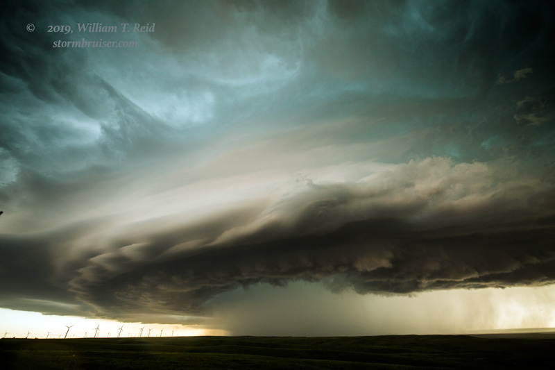
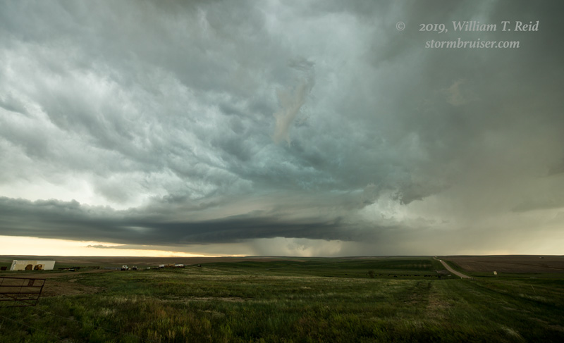
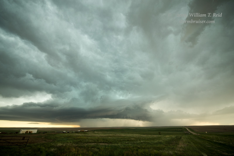
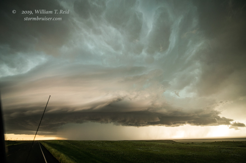
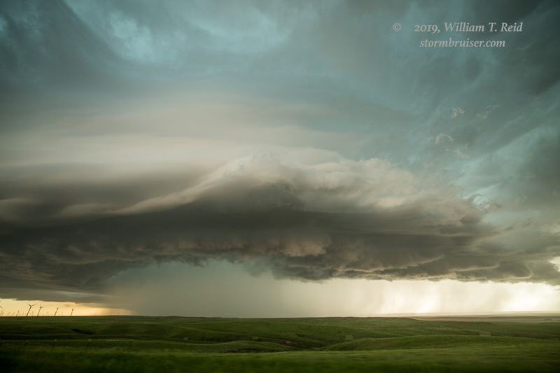
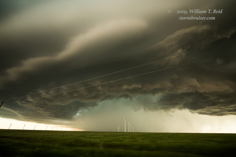
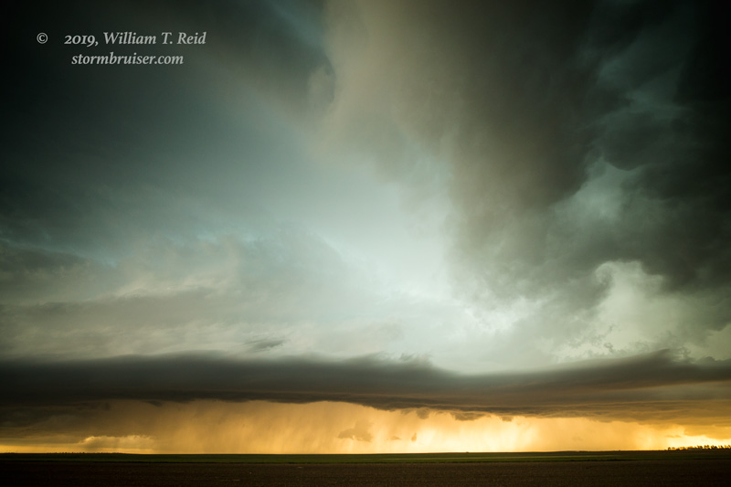
We wound up observing a couple of new storms straddling I-70 near Watkins. The base of the one just to our north quickly assumed a spaceship-like laminar look.
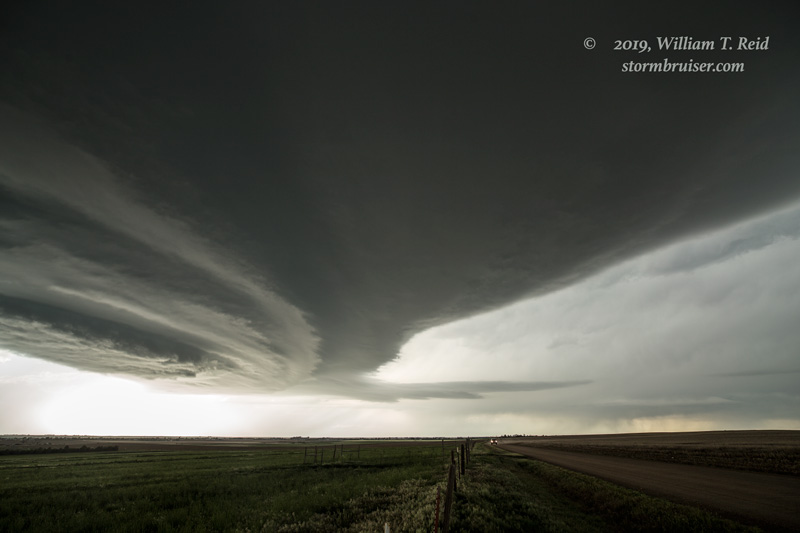
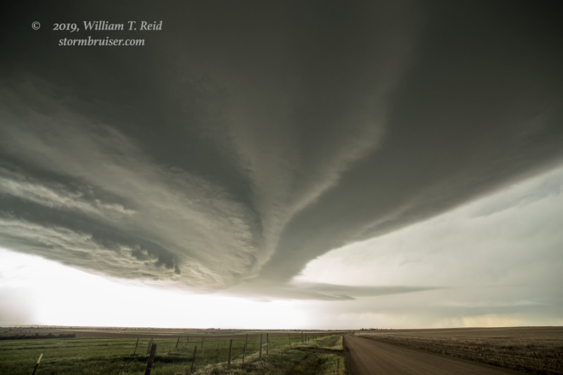
This supercell began to spin hard and to move rather quickly towards the E and ESE. We raced to Byers to stop and look back west.
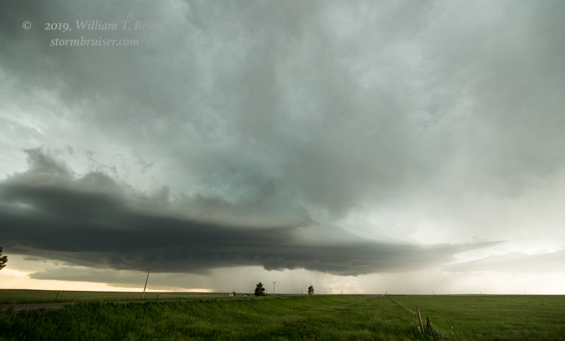
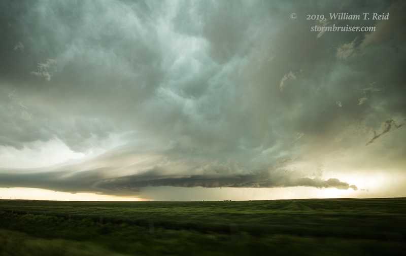
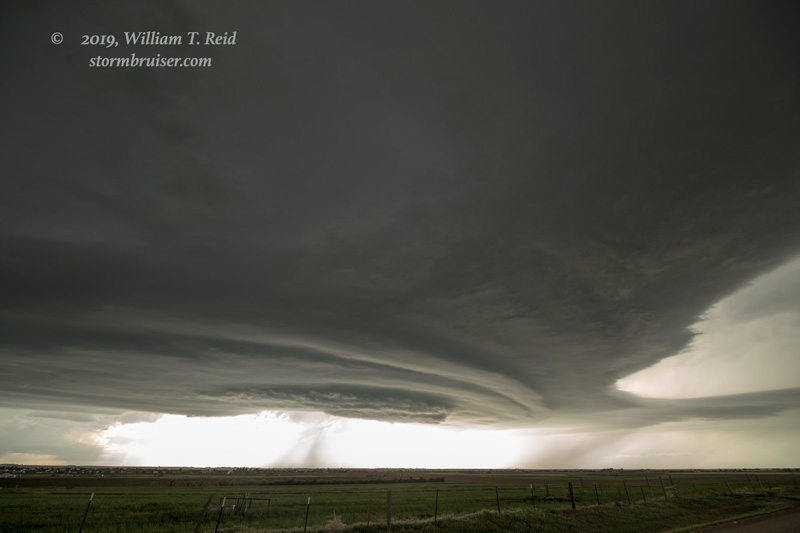
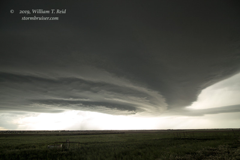
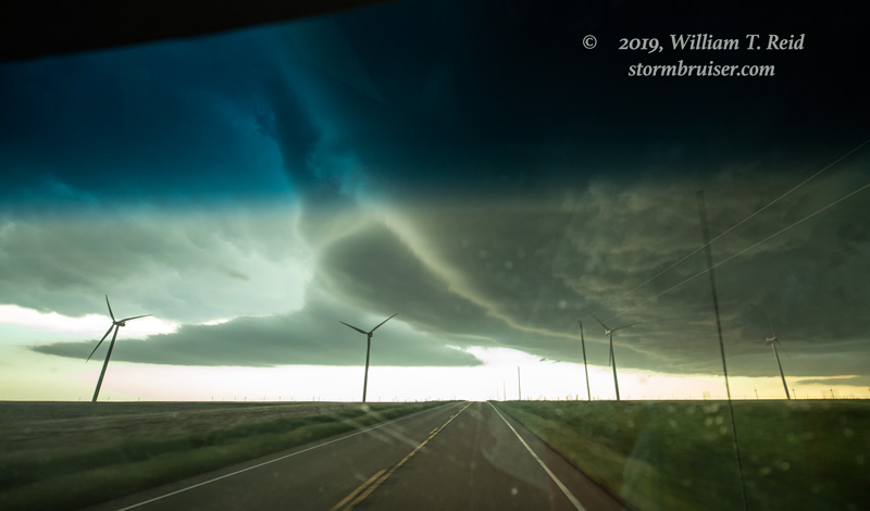
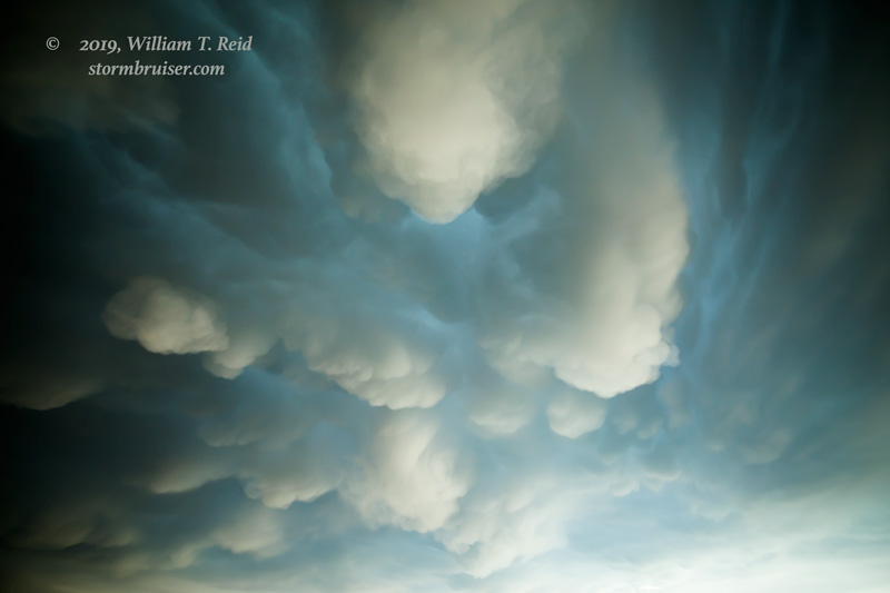
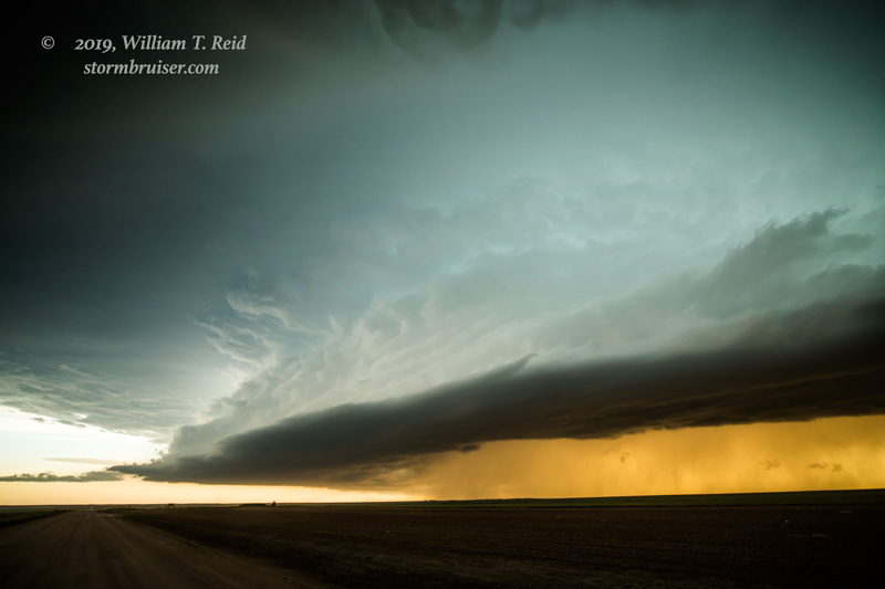
The action area started to get wrapped in precipitation, and a suspicious lowering or two inside of the rain and hail teased us. With the storm heading quickly to the ESE, I decided to quickly head to Last Chance and then south on 71 to stay in decent position. The storm was becoming a big HP beast, and I needed all of my 15mm wide-angle lens to fit all of the storm structure in these shots!
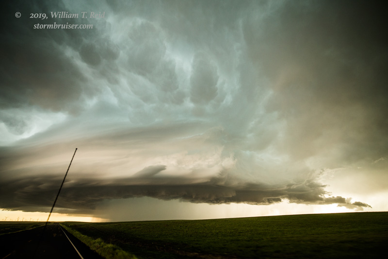
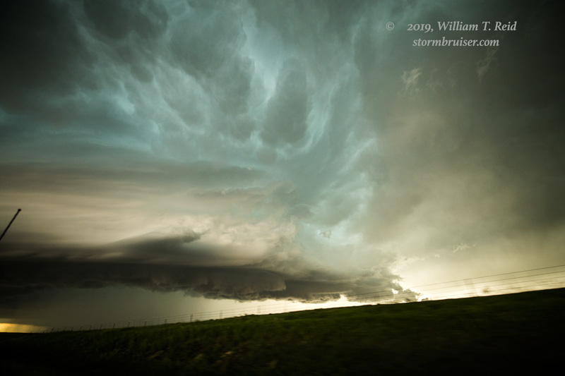
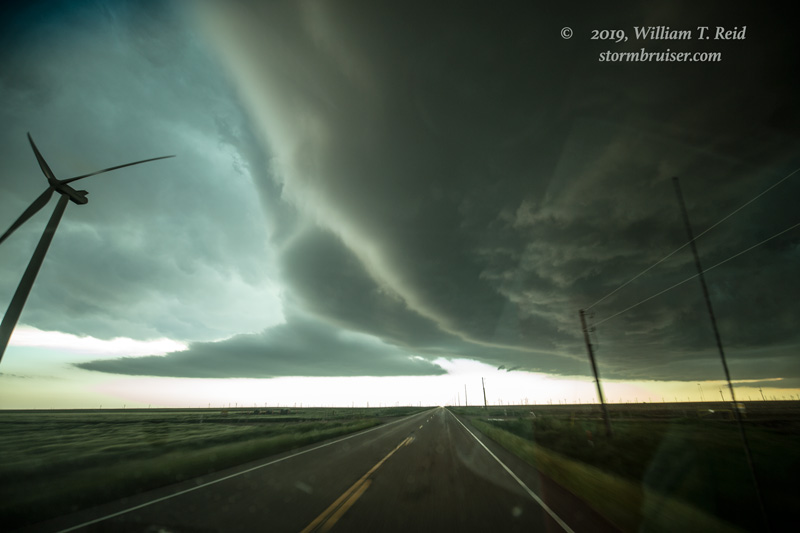
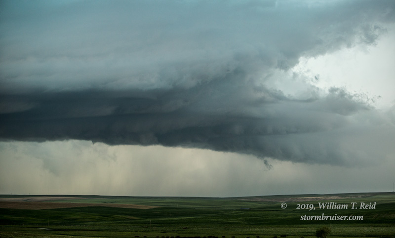
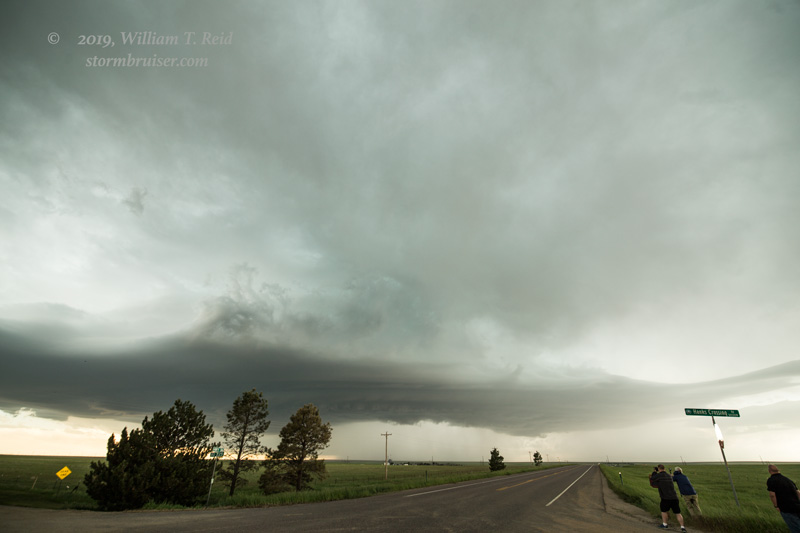
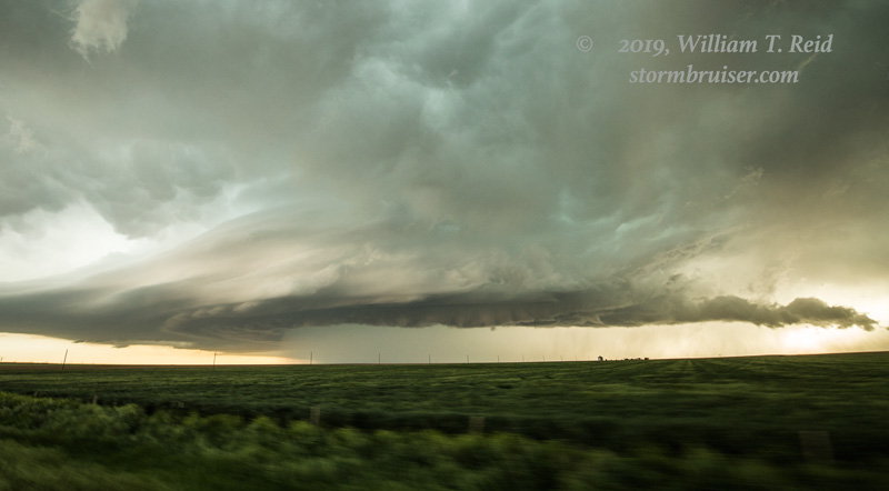
We narrowly cut in front of this tornado-warned storm and came up to it again east of Limon. By now, it was becoming a bit less discrete and supercellular. Another supercell to our southwest (just south of I-70 was tornado-warned briefly. We had a decent look at that one, but did not observe a tornado.
Leave a Reply
You must be logged in to post a comment.