Start: Hugoton, KS
Lunch: Woodward/Chases BBQ
End: Clinton, OK
436 miles
SPC Mesoscale Discussion 1072 SPC Mesoscale Discussion 1073
SPC Mesoscale Discussion 1075 SPC Mesoscale Discussion 1080
SPC Mesoscale Discussion 1081 SPC Mesoscale Discussion 1082
SPC Mesoscale Discussion 1084 SPC Mesoscale Discussion 1086
Chase account by TT guest L. Ryan, with nice time-lapse of the Putnam supercell
—-
SPC showed a large “enhanced slight” risk in western OK and adjacent areas of Texas today. The tornado risk was low, at only 2 percent, but SPC bumped up the large-hail risk in NW OK in their 20Z outlook. By mid-afternoon, low-70 dew point air was heading northwestward towards the Seiling and Enid area. The troposphere was capped rather strongly, though. SPC noted that
"effective shear will only be marginally supportive of organized convection"
…but I was hopeful that the high-end instability (CAPE values above 4000) would make up for the so-so shear.
We drifted eastward from Woodward to Orienta, Meno, and Lahoma (not too far west of Enid). This was an area with some persistent, moderate surface moisture convergence. The CAMs (forecast weather models) were fairly insistent on showing a decent storm in north-central OK before sunset, generally around the Enid area. The location for this predicted cell was bouncing around a bit, and some of the runs showed little to get excited about. It was quite warm and muggy as we drifted around the Lahoma and Goltry area. A few cumulus cloud towers made futile attempts against the cap. Some better-looking towers went up, finally, to our southwest, near Okeene, perhaps. These grew up into small rotating updrafts and failed to impress. It looked like the cap might win today, but then a two big storms exploded a county or two to our west, between Seiling and Clinton. This was less than an hour’s drive west, and the two cells here were in a rather good-looking environment. Let’s go take a look!
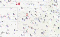
When we reached Canton, we had two strong cells, one to our W and one to our SW. These were moving to the north somewhat slowly, steered by the flow from about 850 to 700 mb, presumably. (The SPC mesoscale discussion maps, linked above, show the flow at 500 mb from the W at around 25 knots.) The paved road network to our west and southwest was not very good. I had to figure out which storm to approach, or to try to play both and see what happens, and then figure out what direction a strong storm might wind up going. With the so-so road network available, it would be easy to wind up out of position. Should I get north of these, north of Seiling?
It looked like the north cell was slowing some and the southern cell was going to crash into it. We edged south and west to Oakwood (on U.S. 270). This road is a NW-SE oriented road, and neither of these directions helped. I wanted to head farther west, to U.S. 183, north of Putnam. This is where the show was organizing. We found a narrow but paved road to get west out of the Oakwood area, and we wound up several miles east of a storm base with a rather decent wall cloud. This storm was looking rather potent, both visually and on radar. In light rain and with some nearby lightning strikes, we were now just west of the Canadian River, Our little-used paved road split here, with one branch zig-zagging WNW-ward to U.S. 183. The other branch headed southwest in a chaotic manner to 183, winding up near Putnam. I asked a local pickup truck driver if both roads could get me to 183. He said “yes,” but the confidence level was not high.
The storm tops were getting WAY up there, near 60,000 feet. And, these cloud tops were right above our heads. We were very vulnerable to large hail here. I wanted a south option to get out of the rain and to a spot less likely to have hail, but there was no south option. If I took that northwest route to 183 (maybe a 15-minute drive to about Taloga), then I probably would get hammered by large hail. No good. I really wanted to utilize that somewhat questionable and zig-zaggy southwest road to Putnam, but there was a bit of storm core in that direction. I envisioned getting caught in giant hail if I went that way. And, this storm was getting tornado-warned just about this time! I don’t like chasing rain-wrapped stuff on unfamiliar backroads. We could stay right here for bit and see what might transpire, but rain and visibility were worsening. We were SO CLOSE to being just south of this beast, in the Putnam area, but I could not risk taking that local county road! The storm was pretty much stationary, and maybe building southward a little. I decided that we had to take the long way around to get into position; to see what was happening. And, if this storm was really going to be worth chasing, if it was going to be a doozy, then it would probably start moving more to the south, into those moist 850 winds.
Back to the east we went, to 270, and then southeastward to Highway 33, between Fay and Watonga. It was excruciating to drive away from the active storm base of a tornado-warned storm, and we were running out of daylight, too. Between Fay and Thomas (about a half hour later) we were getting some good looks again at the storm base and its big wall cloud to our northwest. It was looking great!
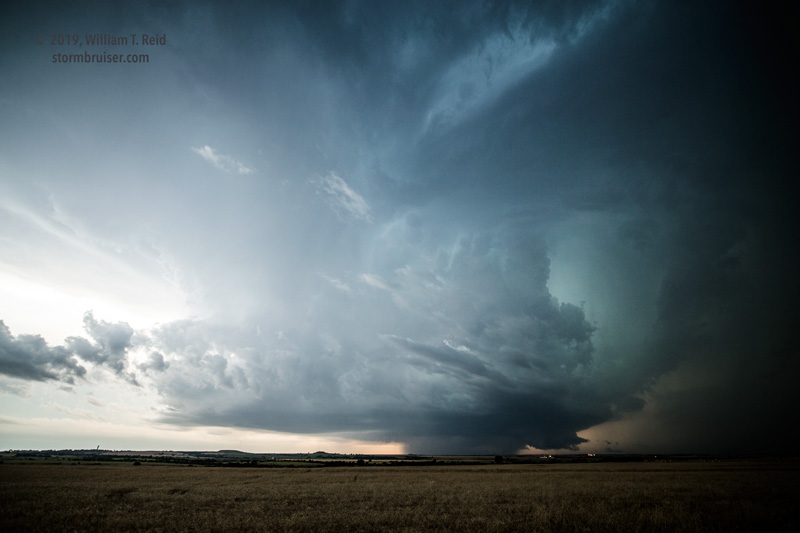
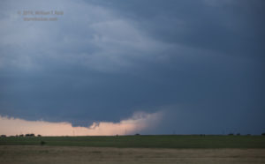
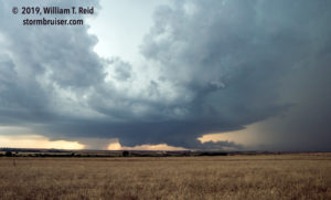
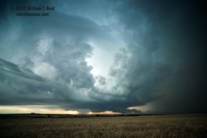
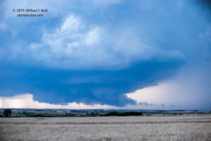
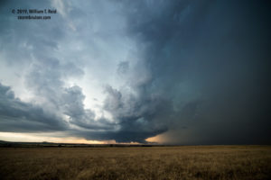
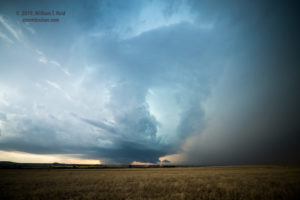
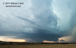
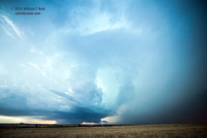
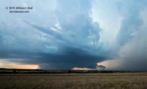
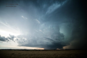
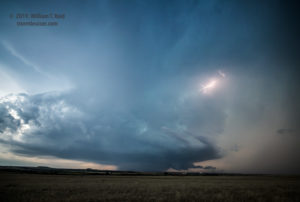
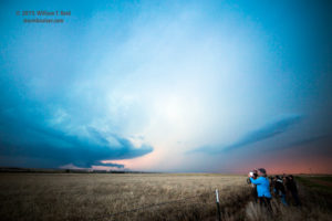
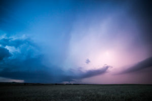
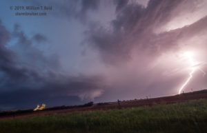
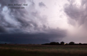
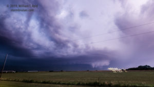
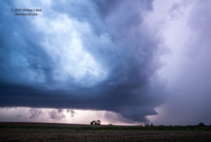
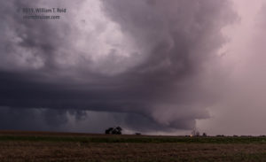
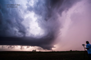
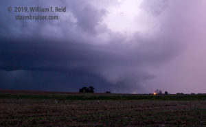
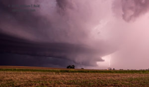
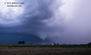
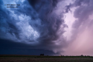
With available daylight minutes winding down and with a good look at the storm and cloud structure, we stopped just northeast of the town of Thomas to photograph the supercell. These views are to the WNW or NW, with the cell pretty close to Putnam, some 10-14 miles distant.
In some of the images above a fairly large wedge-shaped feature is beneath the storm base, just to the right of an area of heavy precipitation. I am not certain if this area was associated with any tornadoes (nor am I certain that it was not a large tornado itself), though a tornado was reported three miles southeast of Putnam about this time. The interesting area became wrapped in more precipitation quickly.
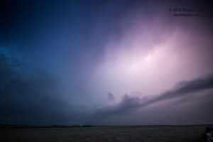
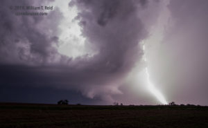
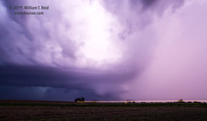
The storm was moving south now (!), and our position was about to get rained or hailed on. We jumped back on 33 and headed to the WSW, stopping just west of Custer City. Along the way, I managed some shots out the window to the northwest. The frequent lightning illuminated the action area nicely.
At our stop, the tripods were out again. We tried to get some structure (and maybe tornado) photos in the lightning flashes. This was pretty easy, and for a little bit at least, it appeared that the storm might have a tornado with it. One was reported 7 miles south of Putnam about this time, about 7 miles to our northwest.
The storm was slowly approaching from the north, and we had to bail. We made it the four miles west to our south option at 183, but that was cutting it a bit close to the action area of the tornadic storm base. South we went towards Clinton, stopping halfway there to look back to see if there was anything to see. The view was poor, and we continued into Clinton. The wind here was getting REALLY strong, and an accident had just occurred at I-40 and 183. Was something new and dangerous developing over us? I wasn’t sure. A very strong squall line was approaching from the southwest. The severe-weather world seemed to be converging on Clinton. No particular direction of travel looked very safe. I elected to go eastbound on I-40 to try to get ahead of the storm. We (i.e., driver Bob Smith!) battled very strong crosswinds, first from the northwest and then from the southeast, on the way to Weatherford. These were some of the strongest straight-line winds that I have experienced, and it was a white-knuckle seven minutes or so in the wind and heavy rain. The airport station at Clinton showed a gust to 92 mph.
The winds let up as we neared Weatherford, but the squall and nastiness were coming at us fast. We exited and hid behind the east wall of a Tractor Supply store, with a view to the north. Wind was soon whipping west-to-east in front of us, carrying a good amount of product that had been previously displayed in the parking lot just in front of the store. Yikes! When the squall and wind diminished, we found some food at the McDonalds in town, and I found rooms at a motel with power in Clinton. What a night!

Leave a Reply
You must be logged in to post a comment.