
Start: Lemmon, SD
Lunch: Newell, SD/Blue Line Diner
End: Valentine, NE
478 miles
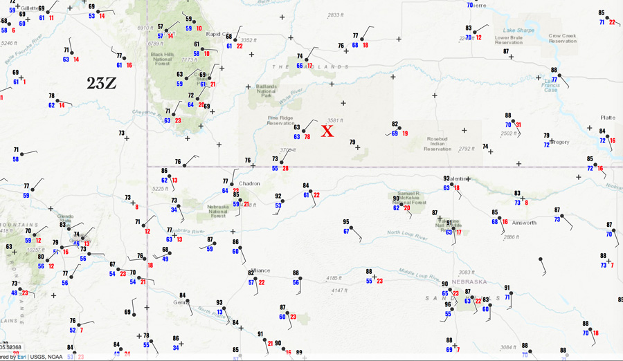
23Z surface map (5 p.m. MDT). Note the wind gust of 78 mph near Porcupine at the RAWS station. The red X marks the approximate location of the target storm when it was strongest.
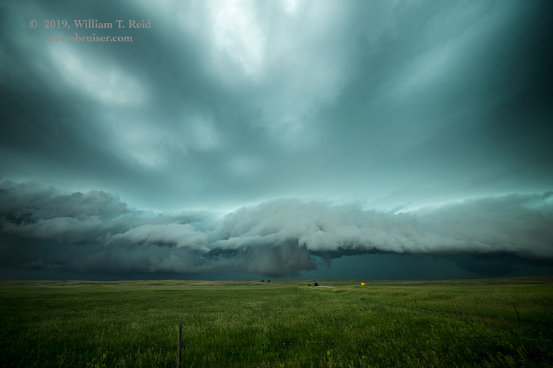
Today was rather frustrating, as we could not get into position in a timely manner on a big-time supercell on the southeastern edge of the Badlands in South Dakota. This storm was tornado-warned and the radar reflectivity looked fantastic for a half hour or so.
SPC was highlighting northern Wyoming today, into the western edge of South Dakota. I thought that the Belle Fourche and Spearfish area would be a good starting point. The Badlands area was not really on the forecast-target radar, in my mind. We headed towards the north side of the Black Hills from Lemmon, SD. So, the first blunder on the chase decision-making making, as it turned out, was to head west on 20 from Meadow to Reva instead of dropping south to Faith first, and then perhaps south from there to I-90. When we finished lunch in Newell and headed south to Sturgis and it became apparent that we needed to be on the new stuff brewing a little ESE of Rapid City (near Red Shirt), we were playing catch up. Playing catch up is the pits.
The instability and low-level shear looked very good for those strong towers going up to our southeast, about 75 miles away. And, we had a great road, I-90, to help us get ESE really quickly from Sturgis and Rapid City. But the place where we needed to be seemed to be slowly shifting to the south and east, due to back-building and deviant motion to the ESE. The storm was a little southwest of Interior when we approached that exit on I-90. I considered darting south there, but that would have put us on those slow NPS roads in the Badlands. We probably would have been unable to get in front due to the hail core. We had to continue to Kadoka and then south.
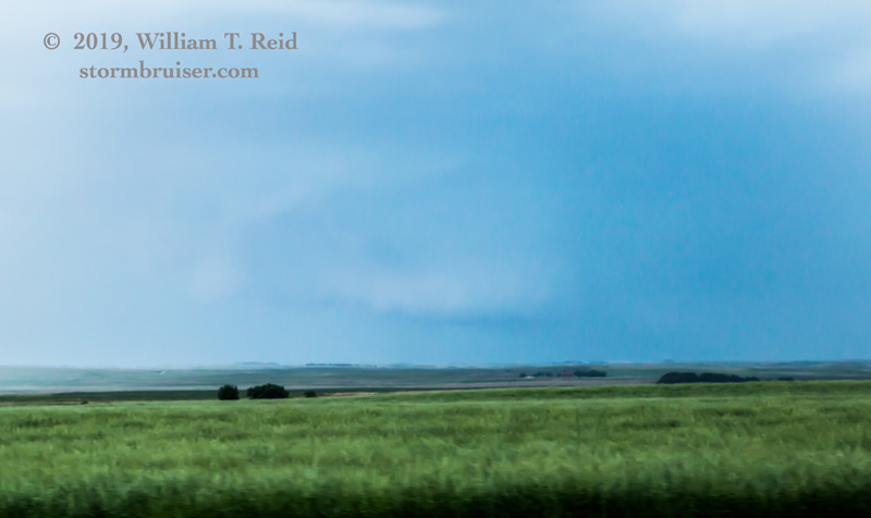
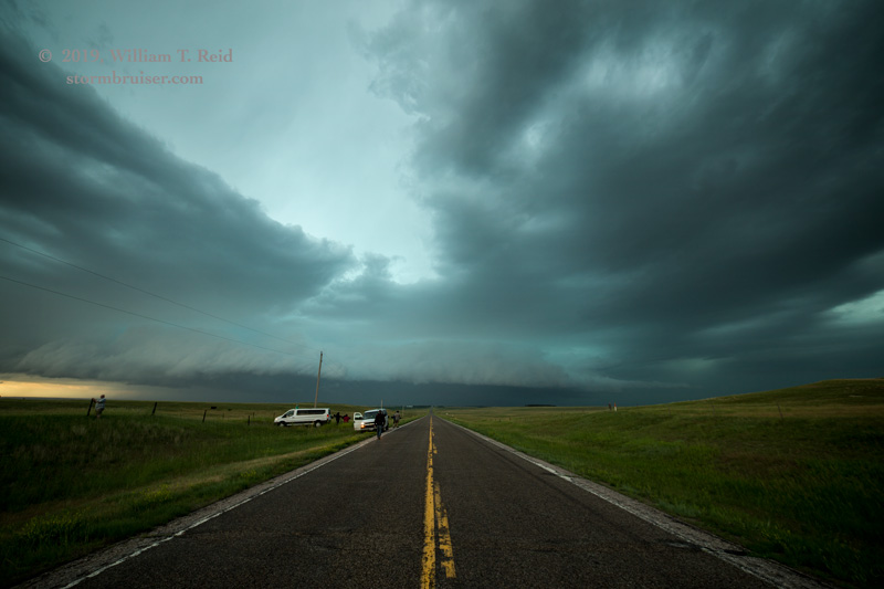
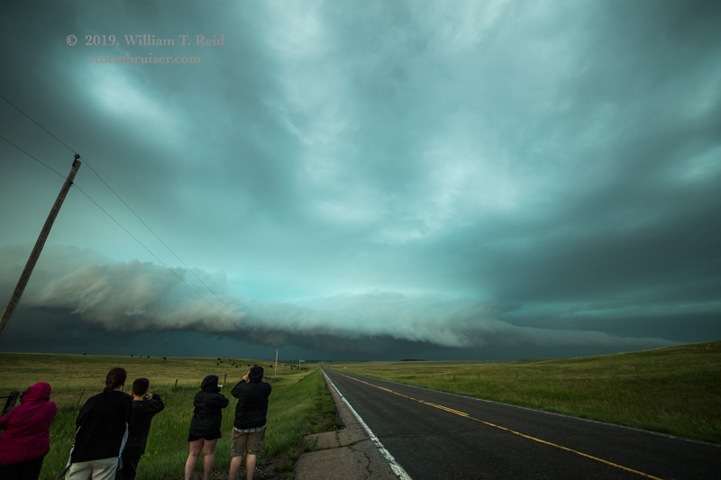
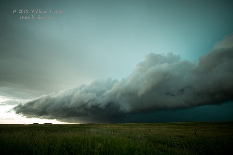
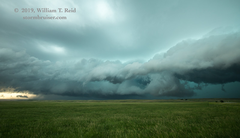
The shots below are zoom shots towards the southwest as we dove south from Kadoka on 73 to 18, and later on 18 approaching Martin.
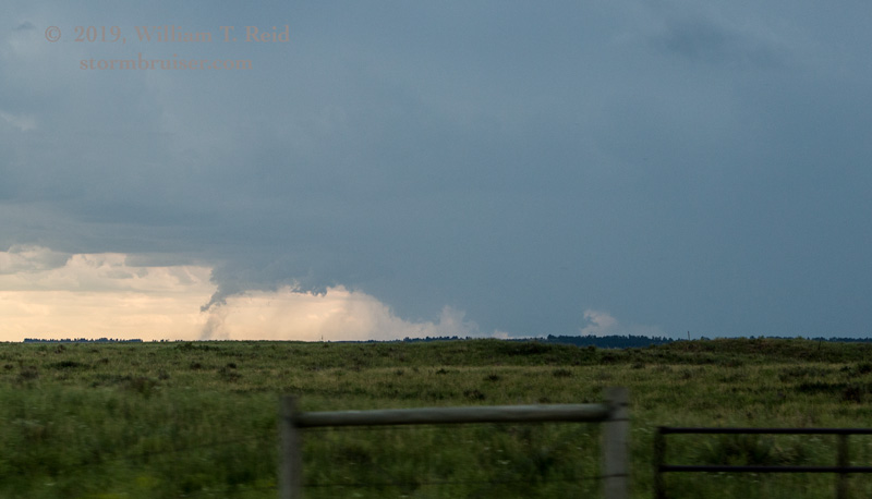
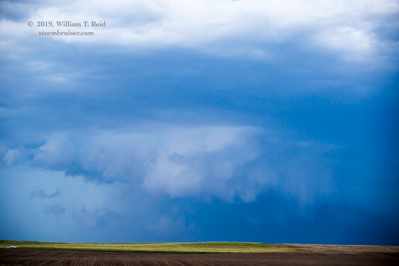
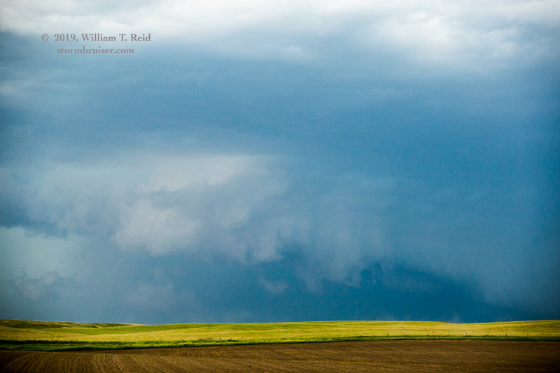
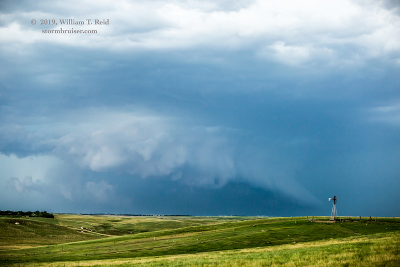
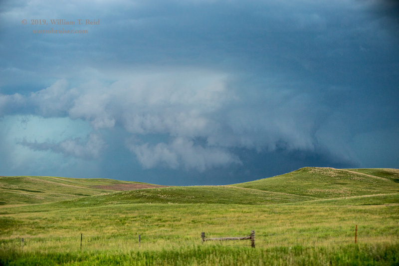
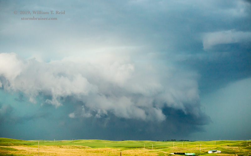

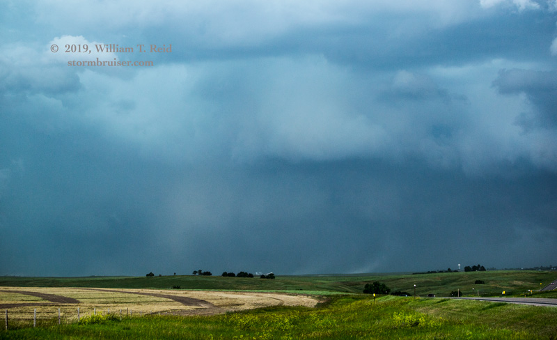
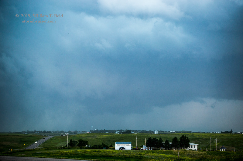
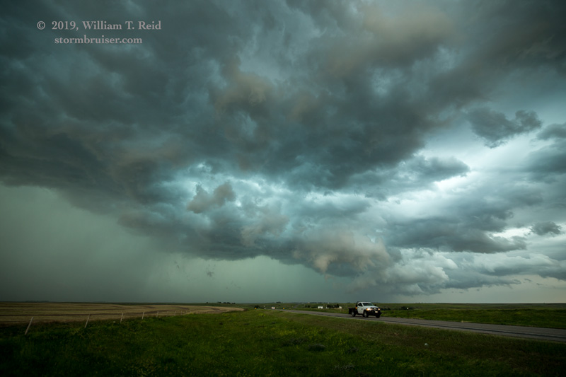
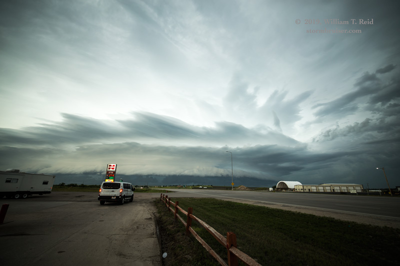
Obviously, there were some menacing lowerings evident and this was when it was tornado-warned and near Porcupine. When we reached Martin, it seemed like a switch was flipped. Another storm quickly went up just southwest of the big one that was bearing down on Martin. It rained on the soon-to-rearrange-Martin storm, and Martin escaped certain doom. Okay, maybe it wasn’t that much of a sure thing, but that dumb new cell turned everything into a fuddy-duddy outflow-fest, though the front end of the severe storm was pretty cool.


This activity pushed us to Mission, where we did a pit stop. From here we descended southward to Valentine and a little west of there to watch additional strong storm activity around sunset. I can’t find my images from this evening jaunt. Help.
Leave a Reply
You must be logged in to post a comment.