

On this Monday Tempest Tours managed to catch a pretty supercell that was trekking eastbound along I-80 in the southern Nebraska Panhandle. During the… [Read More]
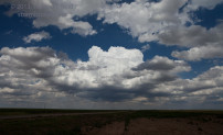
May 18, 2014 Nebraska Panhandle storms

Finally — conditions were becoming more favorable for severe weather on the Plains as low-level flow from the south and southeast developed again in… [Read More]
May 10, 2014 Southeast KS supercells

On Saturday, May 10, we targeted the Emporia, KS, area. Shear and instability looked great for supercells, but surface winds would likely not be… [Read More]
May 7, 2014 Tornadoes near Akron, CO

May 7 was looking like an upper-end chase day as an upper-level disturbance moved out of the Desert Southwest and onto the Plains. SPC… [Read More]
May 6, 2014 Pine Bluffs, WY supercell

With moisture still in short supply on the High Plains, the prospects for a good storm seemed rather slim on May 6. But, there… [Read More]
August 9, 2013 Cuervo, Willard and Vaughn (in that order)

Our chase day on 8/9/13 began in Vega, TX, and my target area was to the west in NM, somewhere around Vaughn. My motto… [Read More]
August 8, 2013 OK-NM-TX Storms

Our Tempest chase group had quite a variety of storms to sample on Thursday, from Boise City to Logan, NM; and from San Jon,… [Read More]
August 7, 2013 Cimarron County, OK supercells
Our chase on August 7 began in Albuquerque, with a target in a SPC slight risk area in the western OK Panhandle. The forecast… [Read More]
June 30, 2013 Northeast NM supercells

The target area for today was the Raton Mesa, or somewhere along the NM/CO border east of Trinidad. Moisture was adequate, and upper flow… [Read More]
June 29, 2013 Haswell, CO supercells

SPC painted a slight risk along the Front Range of the Colorado Rockies today. We started off in Castle Rock, and we moseyed on… [Read More]
June 28, 2013 E CO thunderstorms

From Hutchinson, KS, our group headed west to the High Plains of eastern CO. The flow aloft was adequately strong and from the northwest,… [Read More]
June 27, 2013 Diller and Beverly supercells

This chase day started early and was very active! But, first, here is a brief recap of the previous few days. Tour 9 started… [Read More]
June 22, 2013 Dix, NE, tornado

LINK to Chris Gullikson’s video of the Chugwater meso and Dix tornado This was a very active and interesting chase day, and was… [Read More]
June 21, 2013 Torrington, WY, supercell

On June 2oth (the day prior to this one), we headed back into the U.S. from Swift Current. There was a risk for severe… [Read More]
June 19, 2013 Elkwater, AB supercell

Our group began the day in Medicine Hat, AB, and forecast thinking was to drift west a little —- into moist north or northeasterly… [Read More]
- « Previous Page
- 1
- …
- 22
- 23
- 24
- 25
- 26
- …
- 34
- Next Page »