
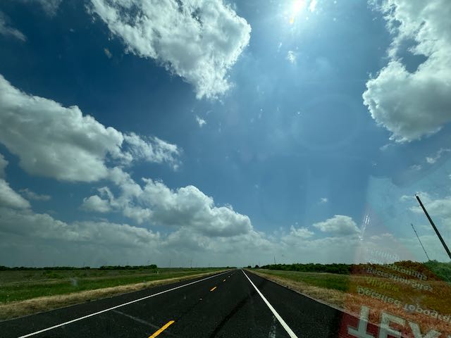
Start: Dodge City, KS
Lunch: Grab and Go/Hutch’s/Sayre OK
End: Abilene. TX 490 miles
SPC Severe Weather Event for May 2
More meteorology for this chase day by Trey G. (Convective Chronicles)

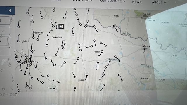
4 p.m. Surface obs above
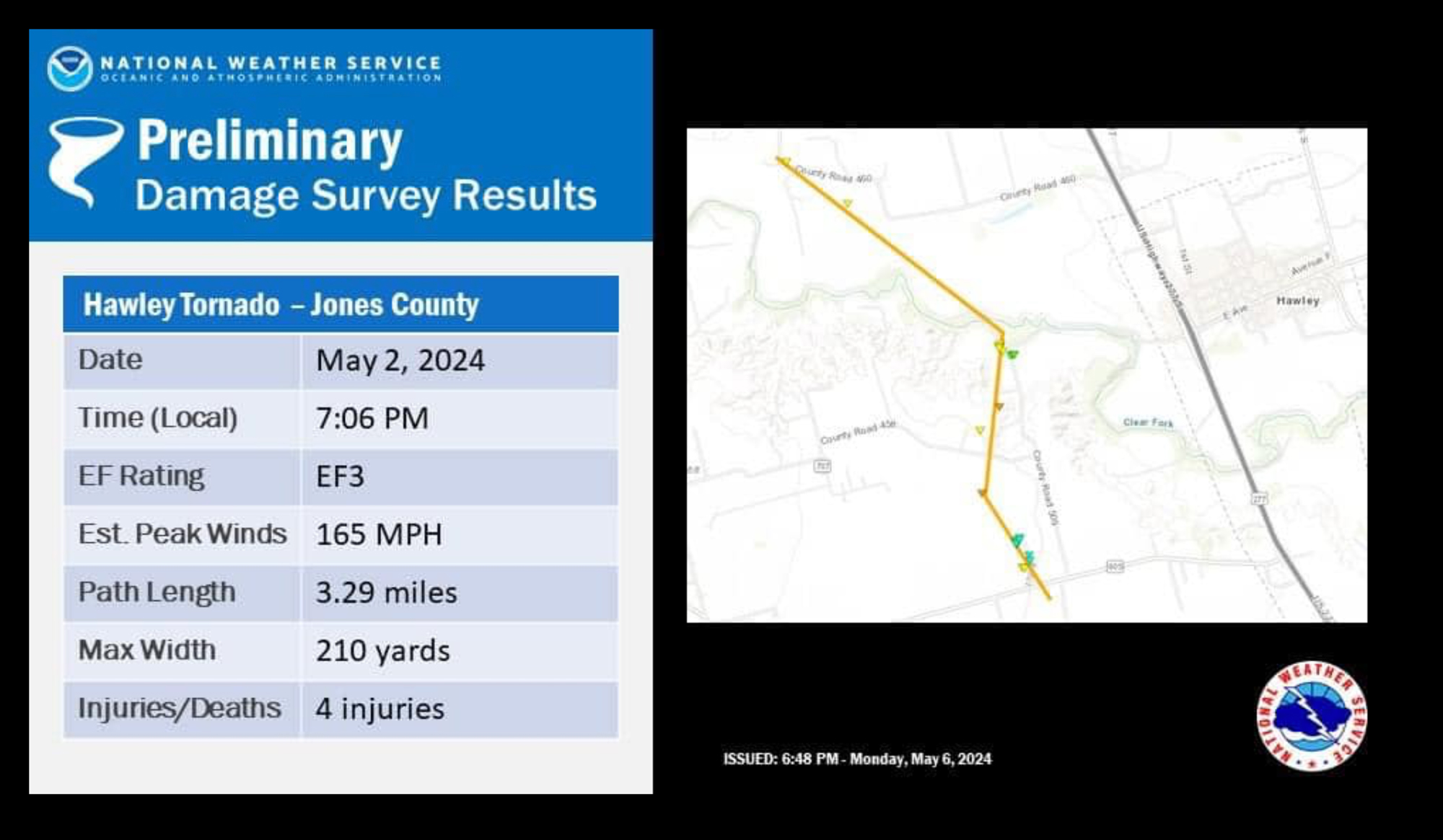
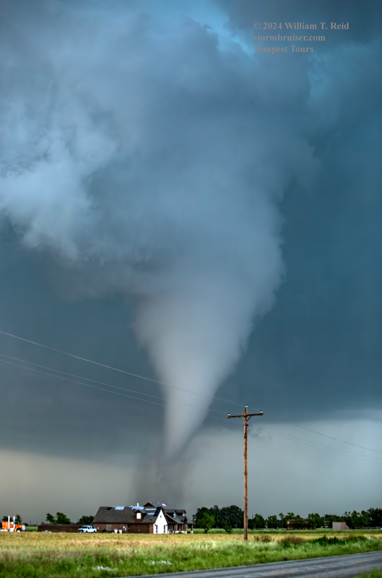
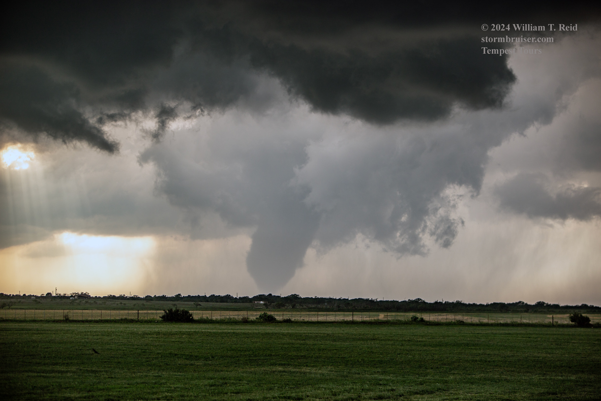
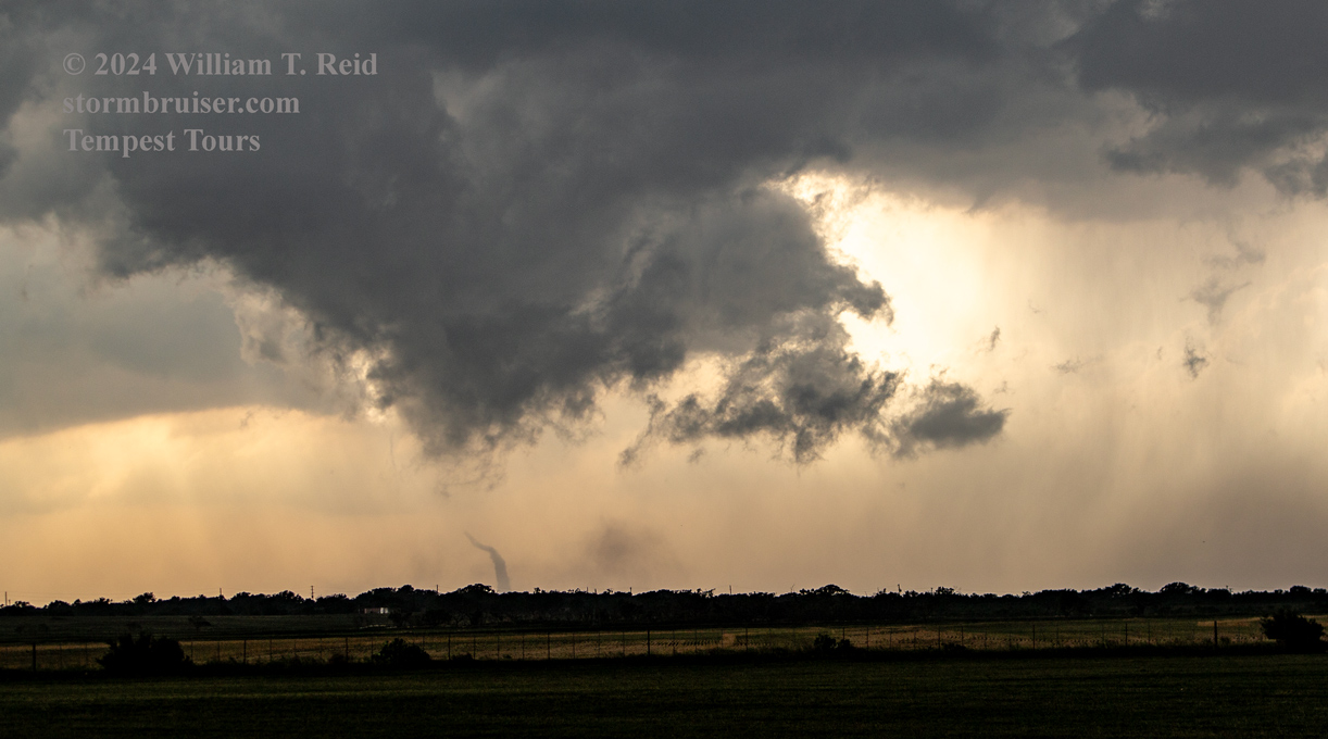
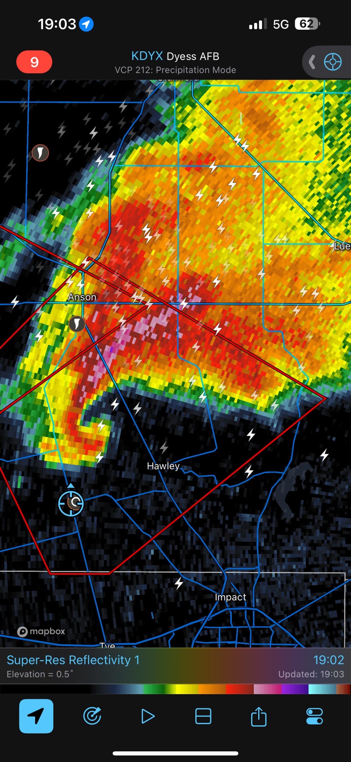
This was a great chase day! A supercell tracked fairly slowly to the SE or SSE through Jones County, Texas. It produced a couple of highly-visible and long-lived tornadoes. Our group had a really good look at the tornado which was SSE of Anson, close to Hodges and Hawley. Chasers have dubbed this one the “Hawley Tornado.”
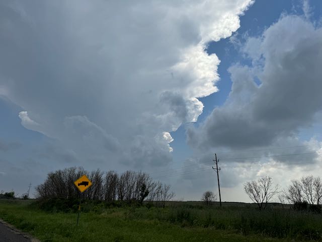
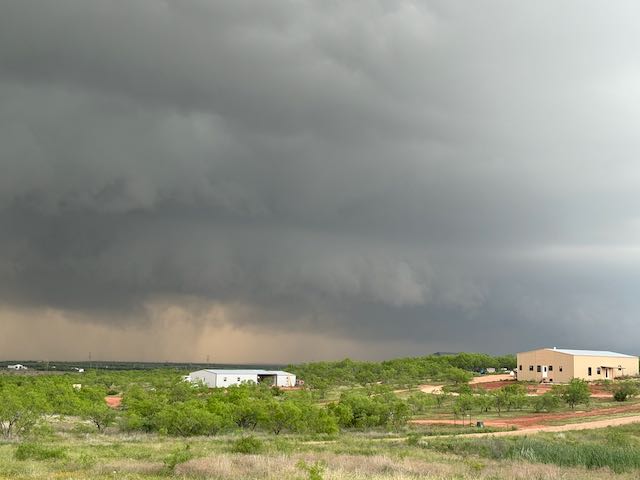
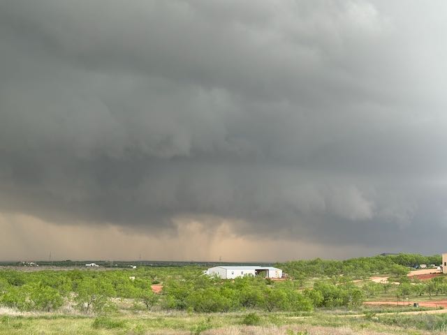
Storms on the previous afternoon and evening were a bit north of Dodge City, and we spent the night in Dodge. We had a bit of a drive to get to the target area on the 2nd. SPC’s 5% tornado outlook suggested that we get ourselves a few counties or so (at least) south of the Red River. Fortunately, we just had to dive due south. After six or seven hours on the road and a quick convenience store lunch, we were near the weak surface low and an area of surface moisture convergence by 4 p.m. near Stamford and Anson. Storm cells were slowly developing on a dry line to our WSW. The tornado threat was not particularly great or clear-cut today, in large part because the low-level shear was rather lackluster. But, instability was very good, big and bad supercells seemed likely, it was a chase day in Texas, and it was May. Tornadoes like such stuff!
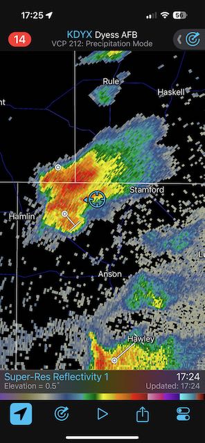
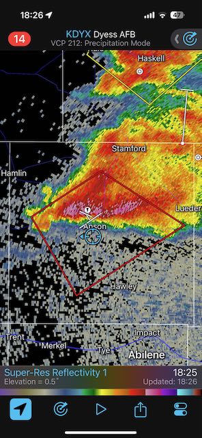
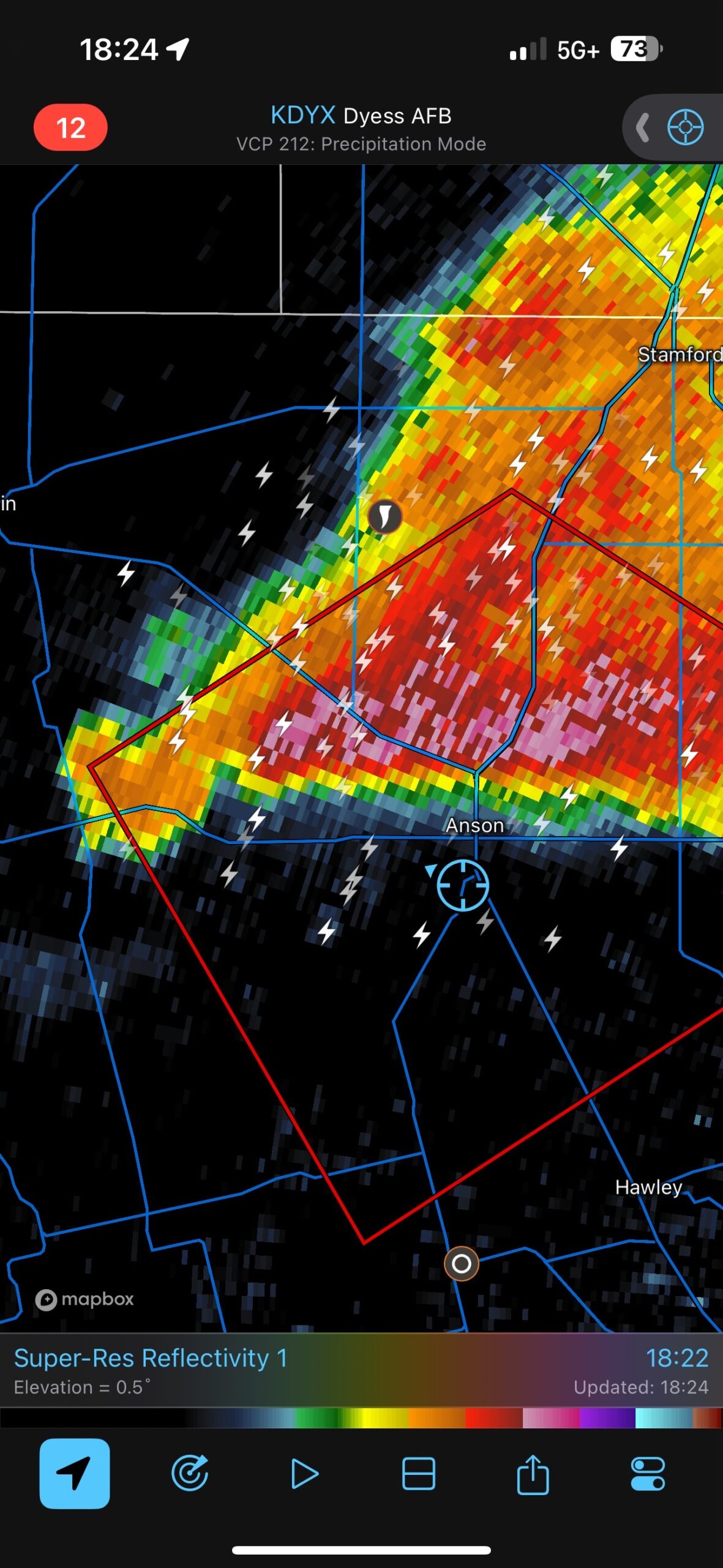
The iPhone shots below show the initial development, the radar grabs and our positions on Planet Earth (the blue circle on the Radarscope).
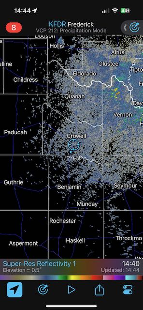
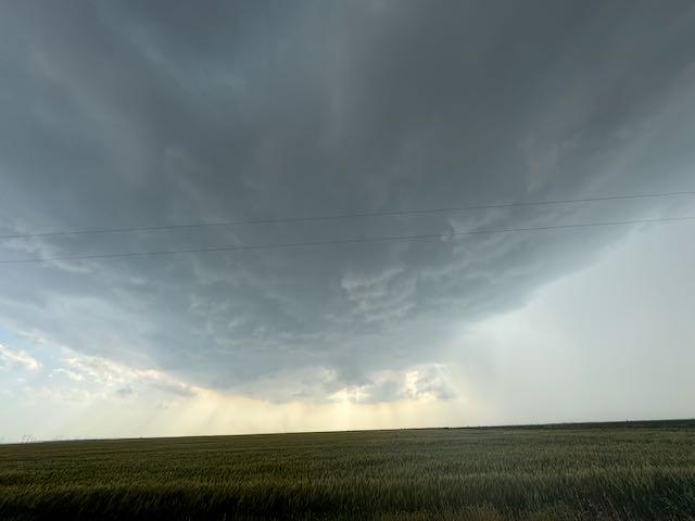
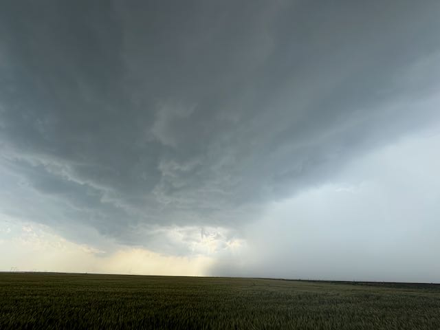
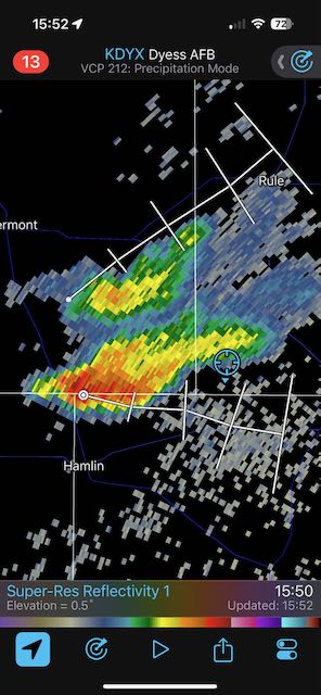
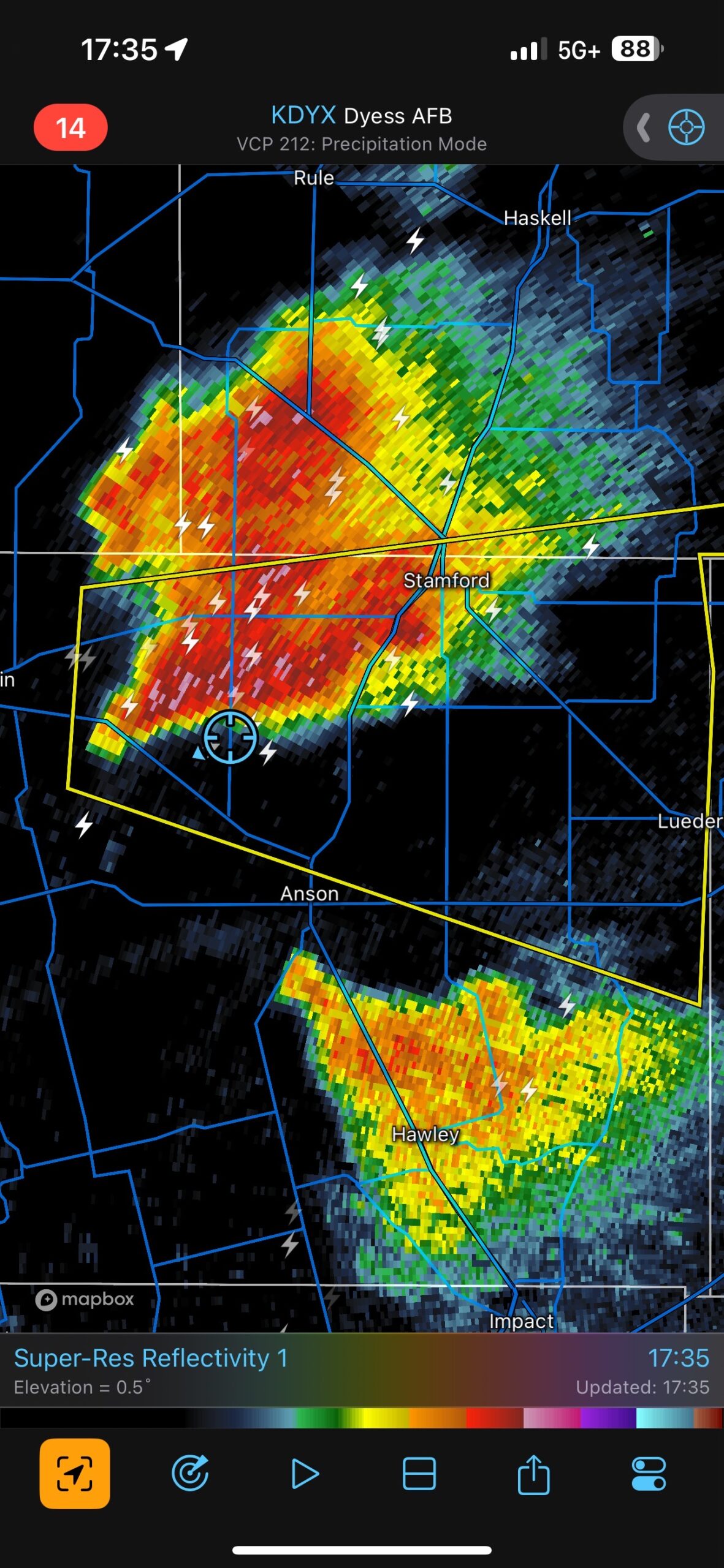
Our group went as far south as Anson and made a pit stop. I then headed back northeastward to Stamford to position east of the new development.
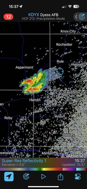
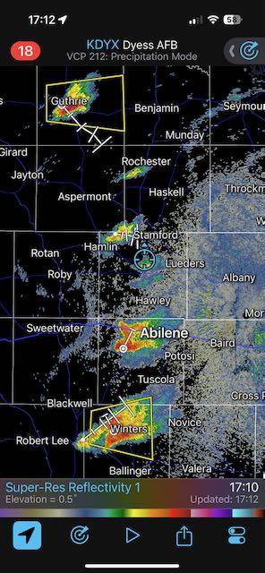
A look at the radar grabs above around 5 p.m. shows a handful of storms from Guthrie to Abilene and Ballinger. The little cell near Hamlin was still young and small at this time, but I was fairly confident that it was the one we wanted (see last radar image above). This was based on its position with respect to the surface low circulation, and its access to the best air/greatest instability. I recall watching that left split off of the storm close to Abilene run northward into the forward flank precipitation area of our developing “Anson” storm. This left split did not have a negative impact on the Anson storm. It may have actually helped to promote tornado development.
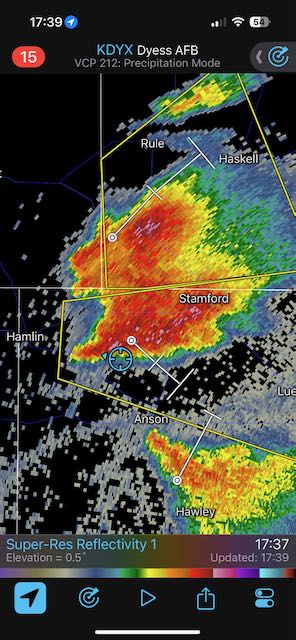

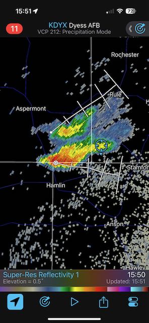
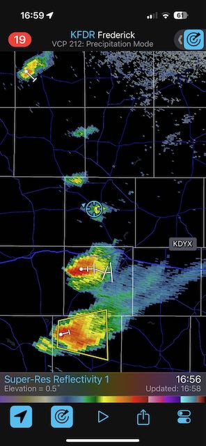
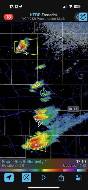
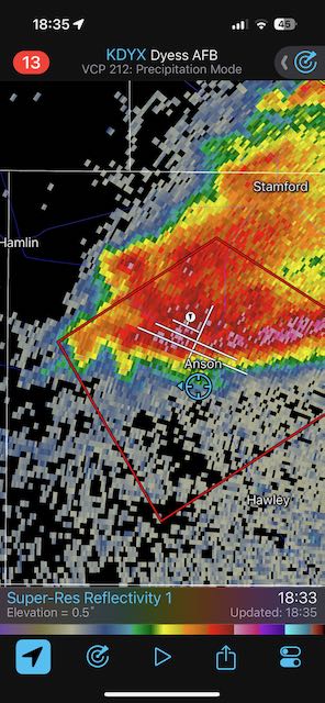
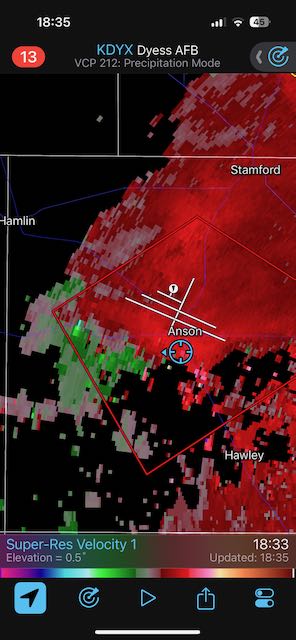
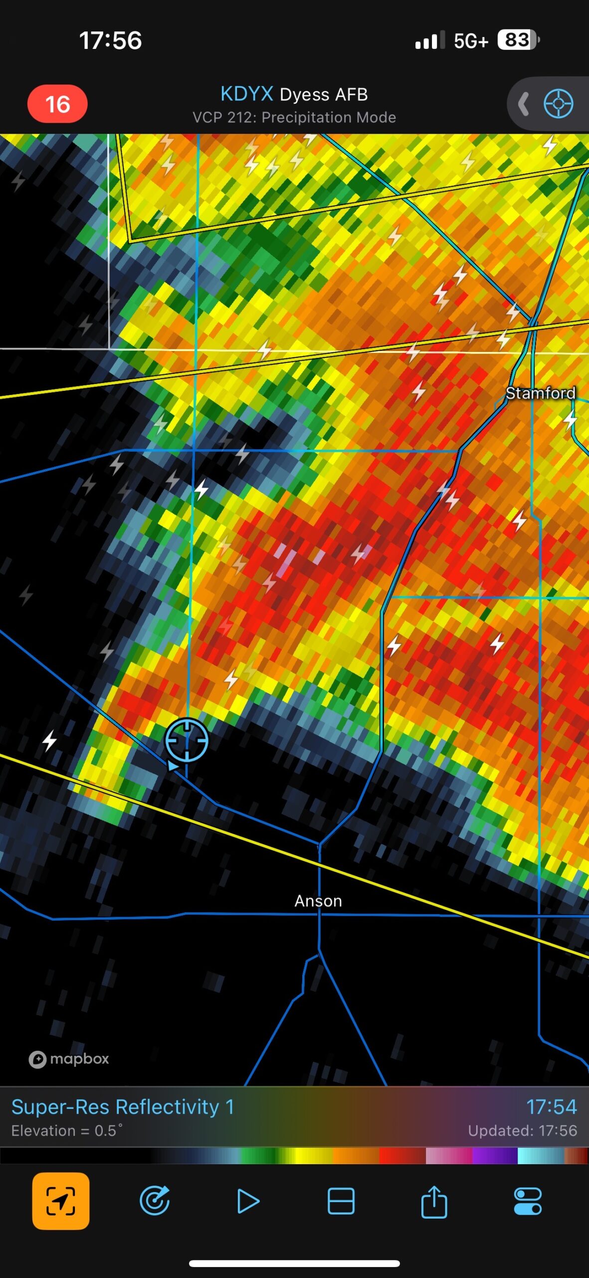
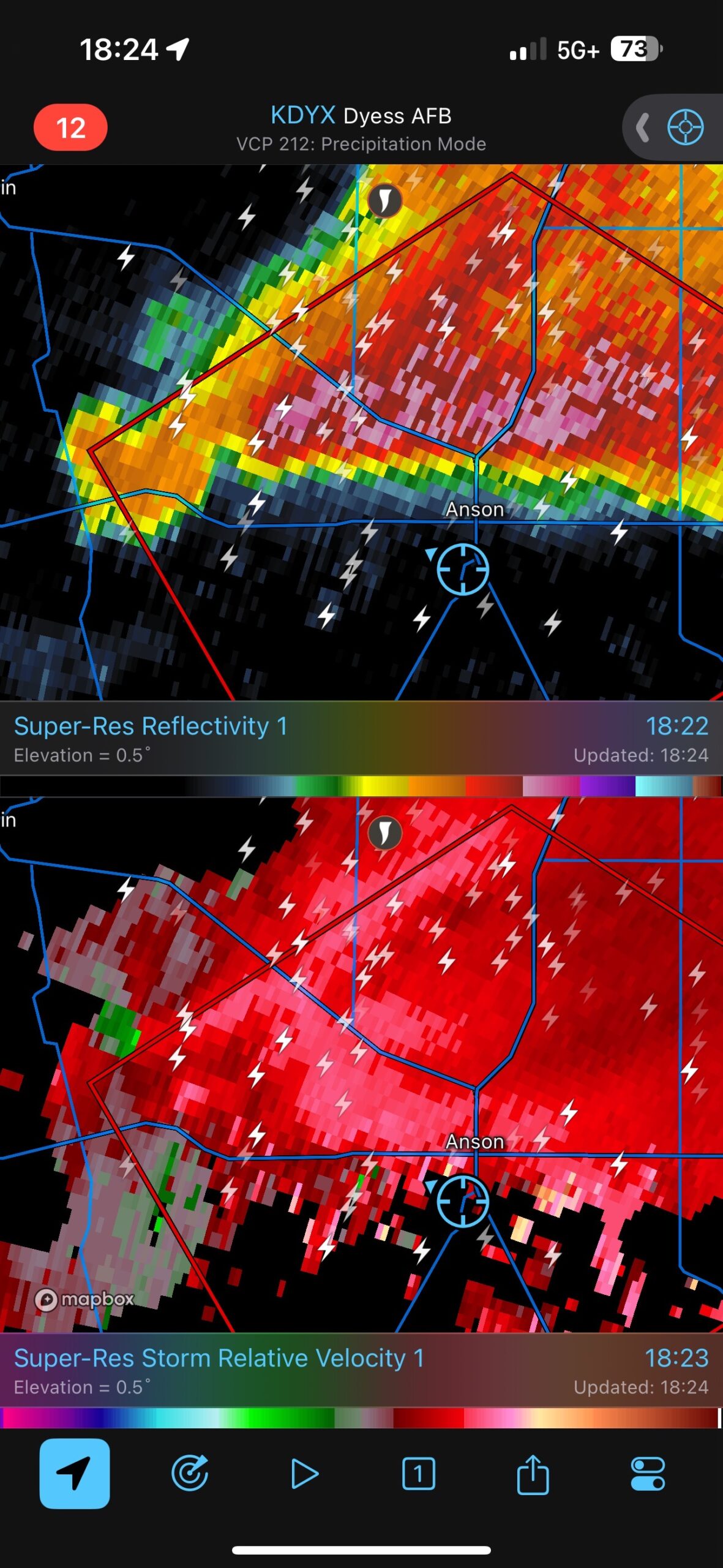
We wound up moving west and then southwest of Stamford some to be just east of the storm base of the soon-to-be-tornadic Hamlin/Anson supercell. The radar image for 5:24 p.m. CDT above shows our location just east of the Hamlin/Anson storm core, the Abilene left-split to the south near Hawley (moving N to NNE), and a pronounced boundary SW and S of Anson. Fifteen to twenty-five minutes later (last two radar images above) the Abilene left split and its outflow boundary are impacting the Hamlin/Anson supercell (which is also splitting).
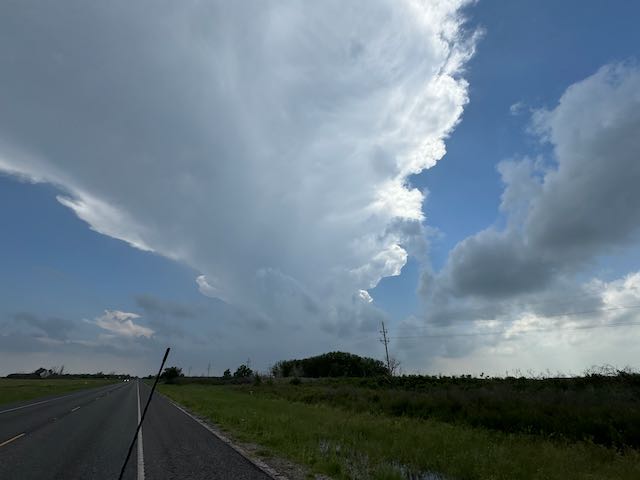
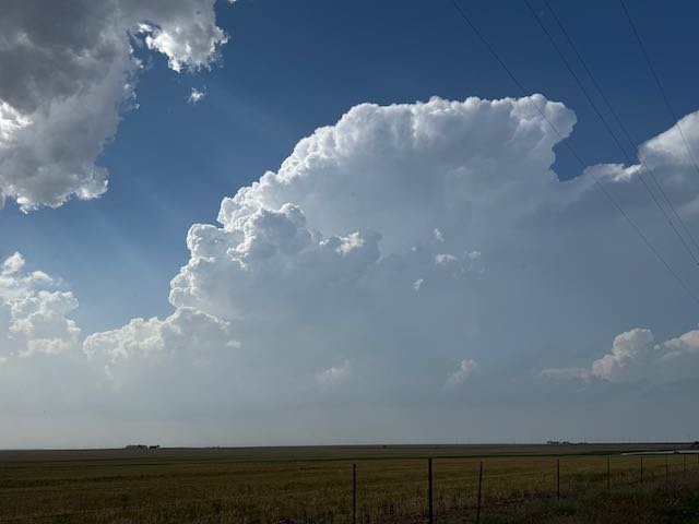
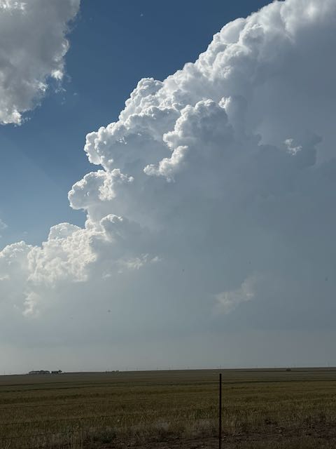
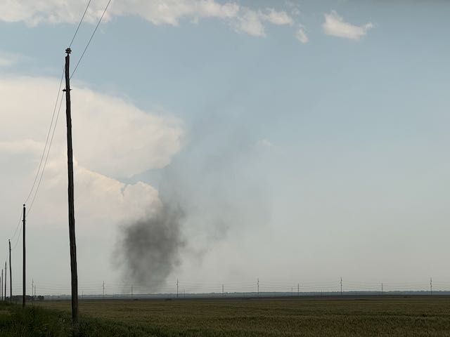
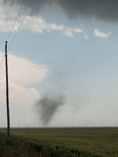
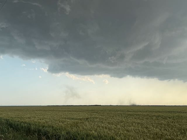
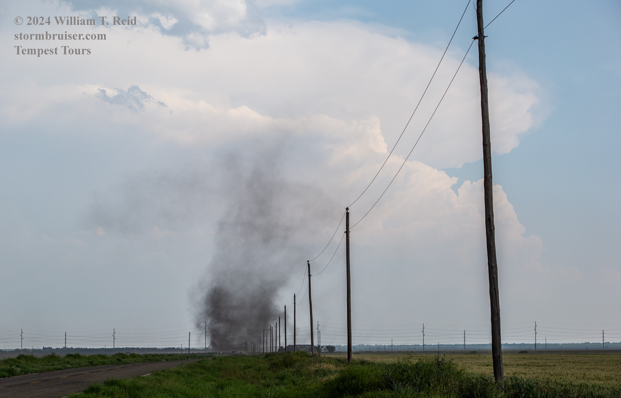
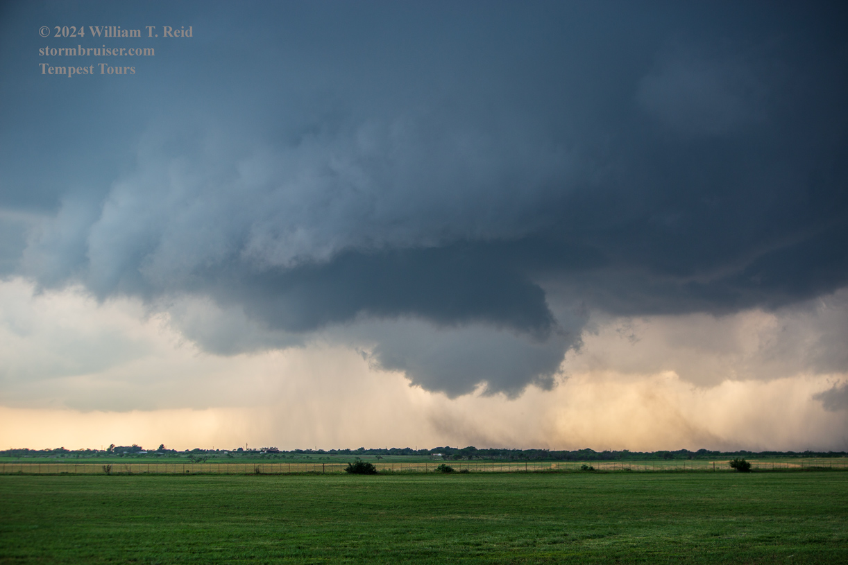
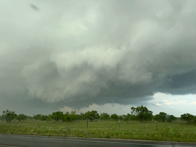
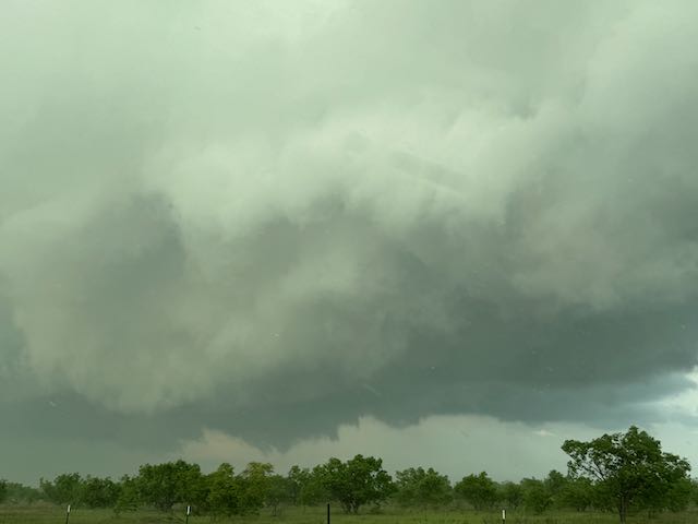
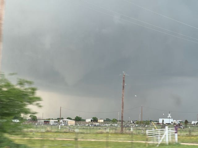
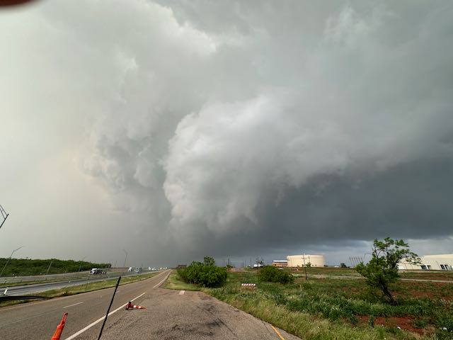
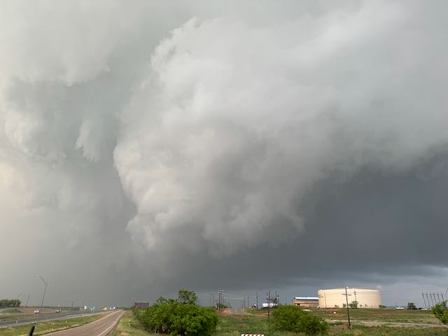
The images below show the uneven and turbulent base of the Hamlin/Anson storm, with some dusty spin-ups. This was along FM 1661, south of the little nothing-berg called “Tuxedo,” around the time of the 17:51 (5:51 p.m.) radar grab above.
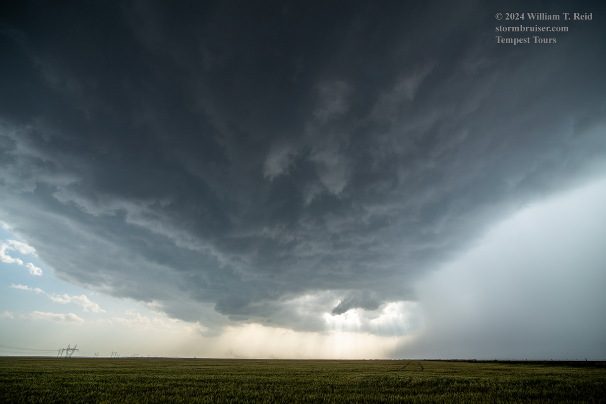
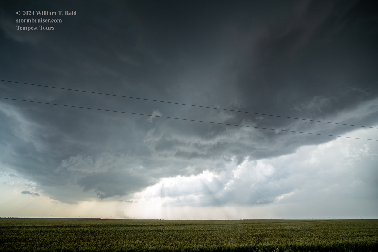
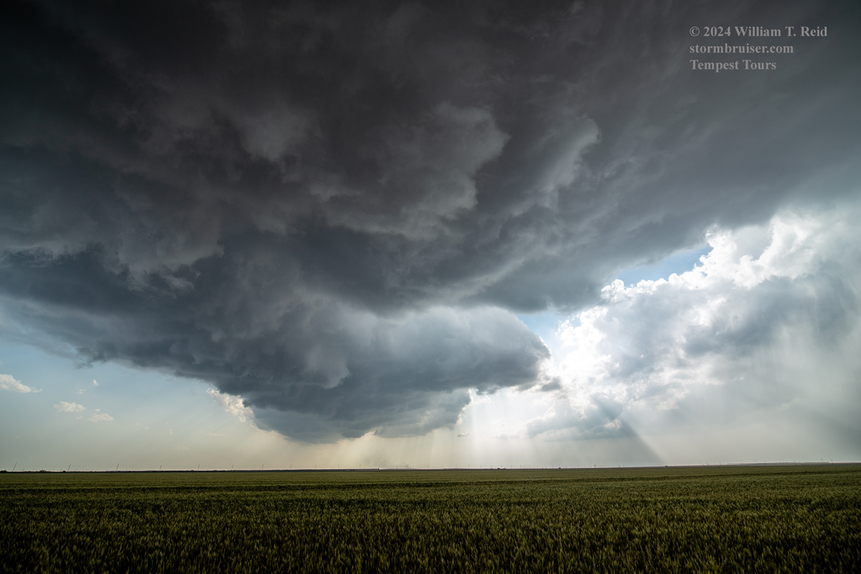
There didn’t appear to be much ground-based rotation at first as dust was sucked up into the base. But eventually this little tornado was passing us by, just to the southeast and south.
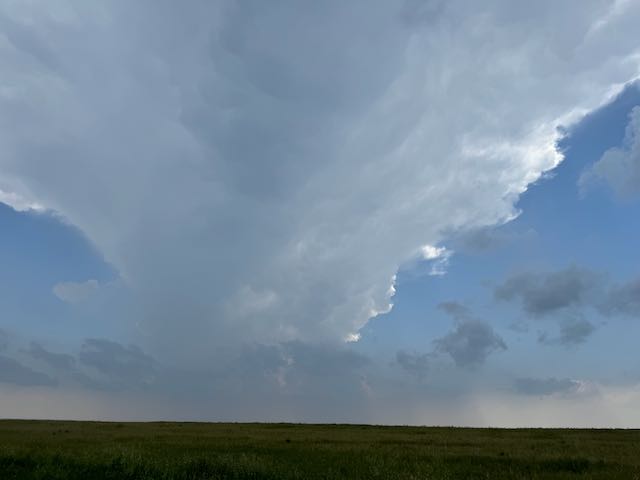
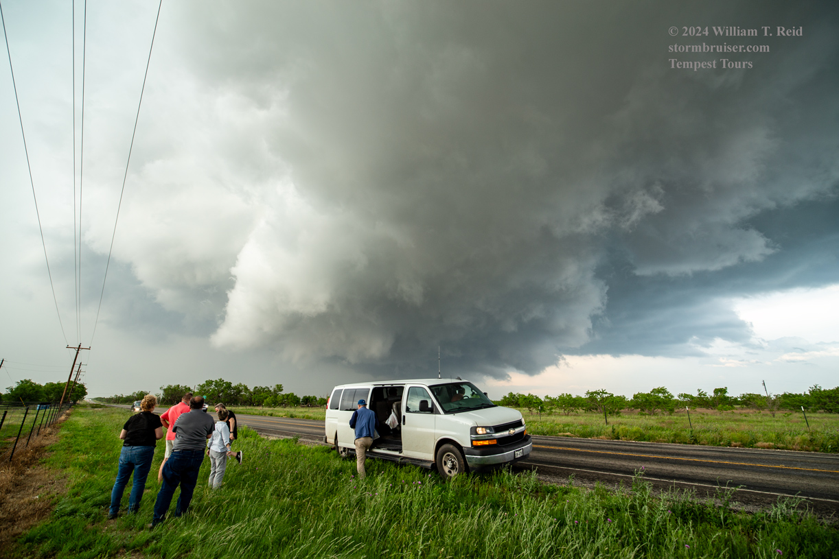
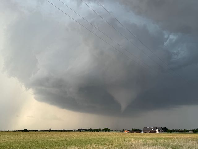
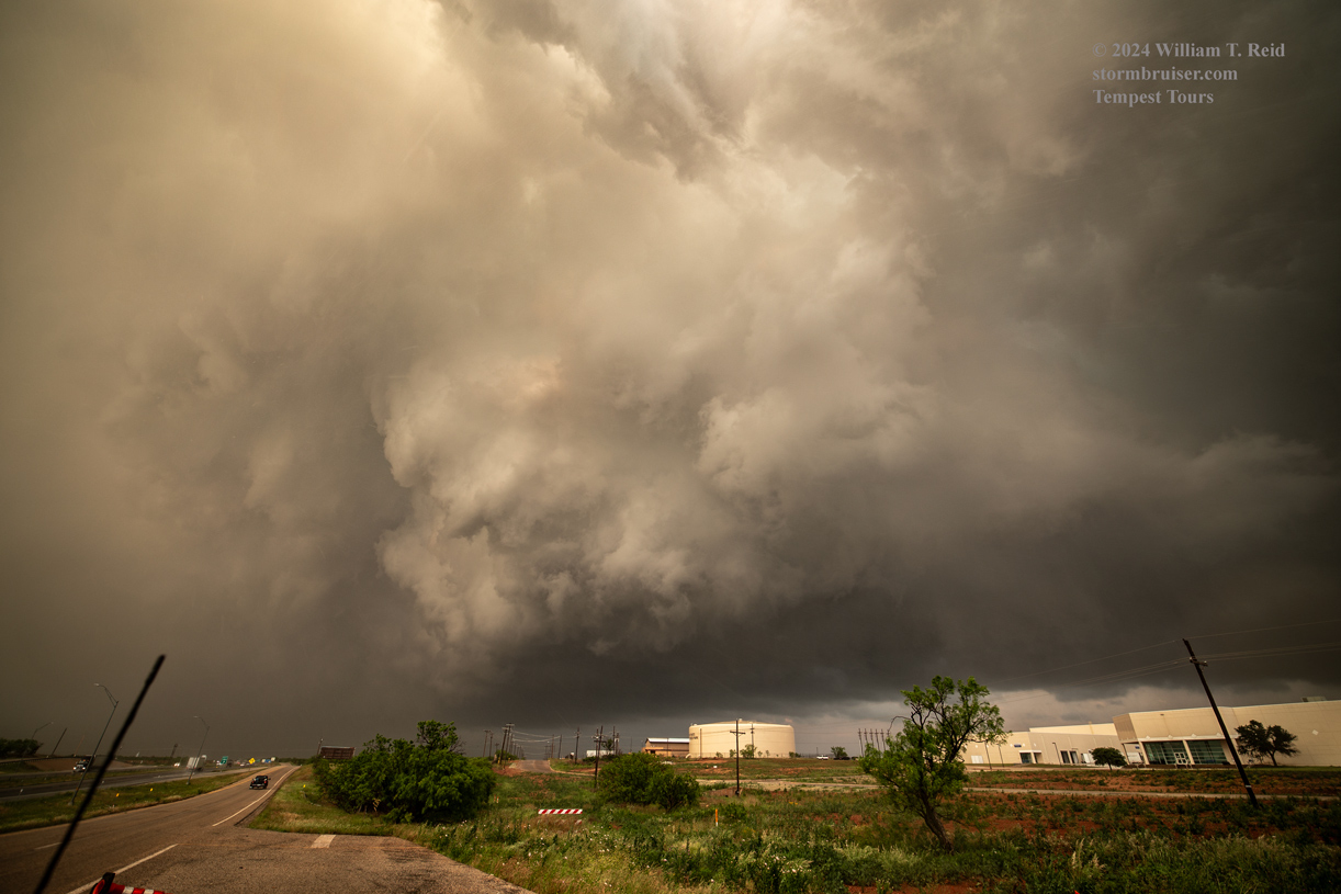
We were rather close to the storm core here, beneath the base. I figured that this supercell updraft would start to make its move to the southeast, towards Anson. And, I was concerned that we might get caught in large hail on the way to Anson unless we made that move right away. I had Matt and Gary take us into Anson via FM 1661 and U.S. 83. We stopped on the southwest side of town on FM 707, with a good view of the storm to our NW. We were now southeast of the supercell, which was good. But the action area was awfully distant now! The supercell was still stuck just north of (east-west) U.S. 180, and the main convergence and updraft area had migrated westward some. And wouldn’t you know, the storm produced a very nice tornado WEST of the spot that we had just vacated (the one south of Tuxedo and northwest of Anson). I got video and stills from several cameras…this first batch below is directly (unedited, unprocessed) from the iPhone. The tornado was to our WNW.


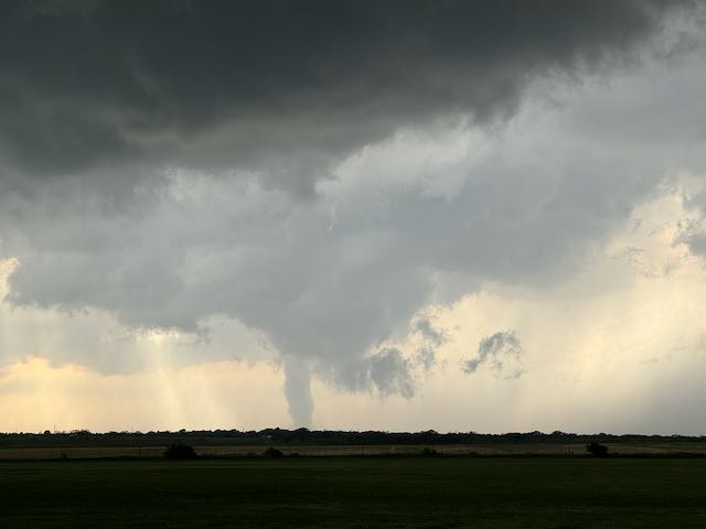
Below are wide-angle shots with the Canon of the tornadic supercell that was just northwest and WNW of Anson.
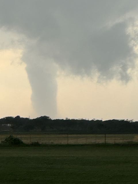
And, below are stills of this same “Anson” tornado in Jones County, from the Canon camera with the long (70-200mm) lens.
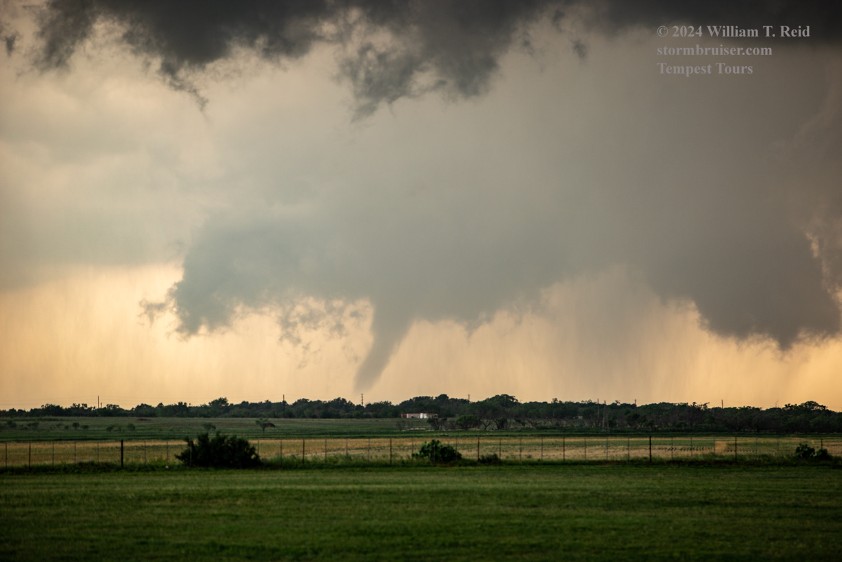
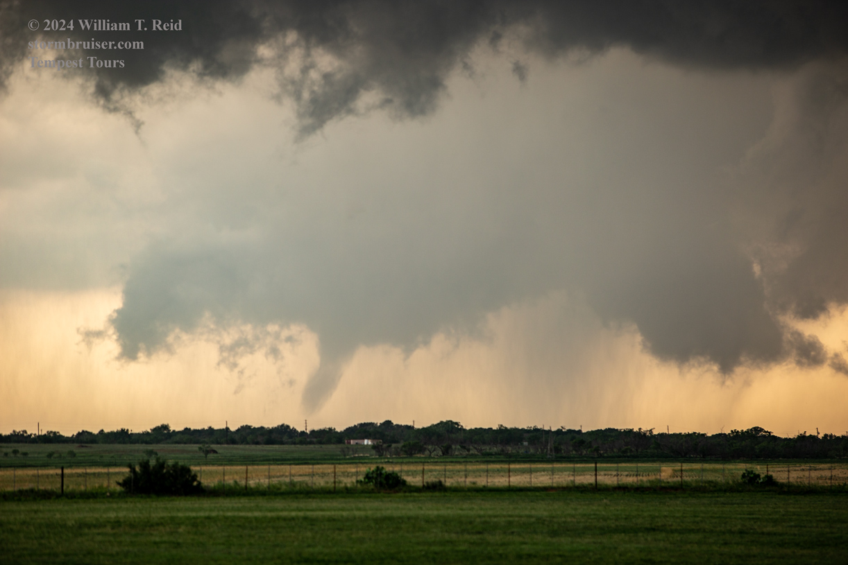
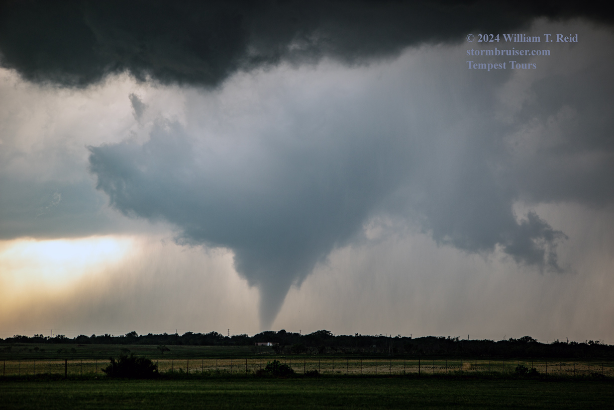
That was a pretty good show, but I was rather miffed that we were kind of far away from the tornado!
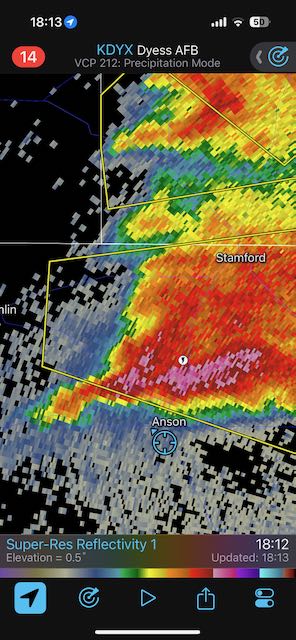
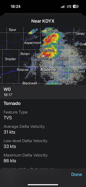
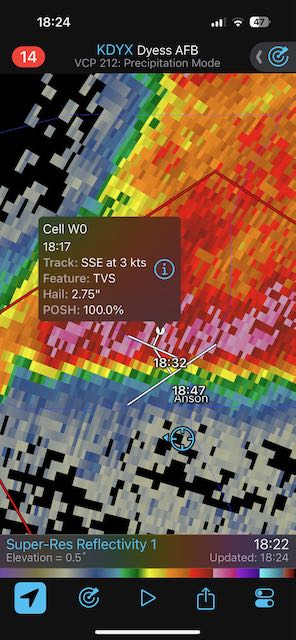
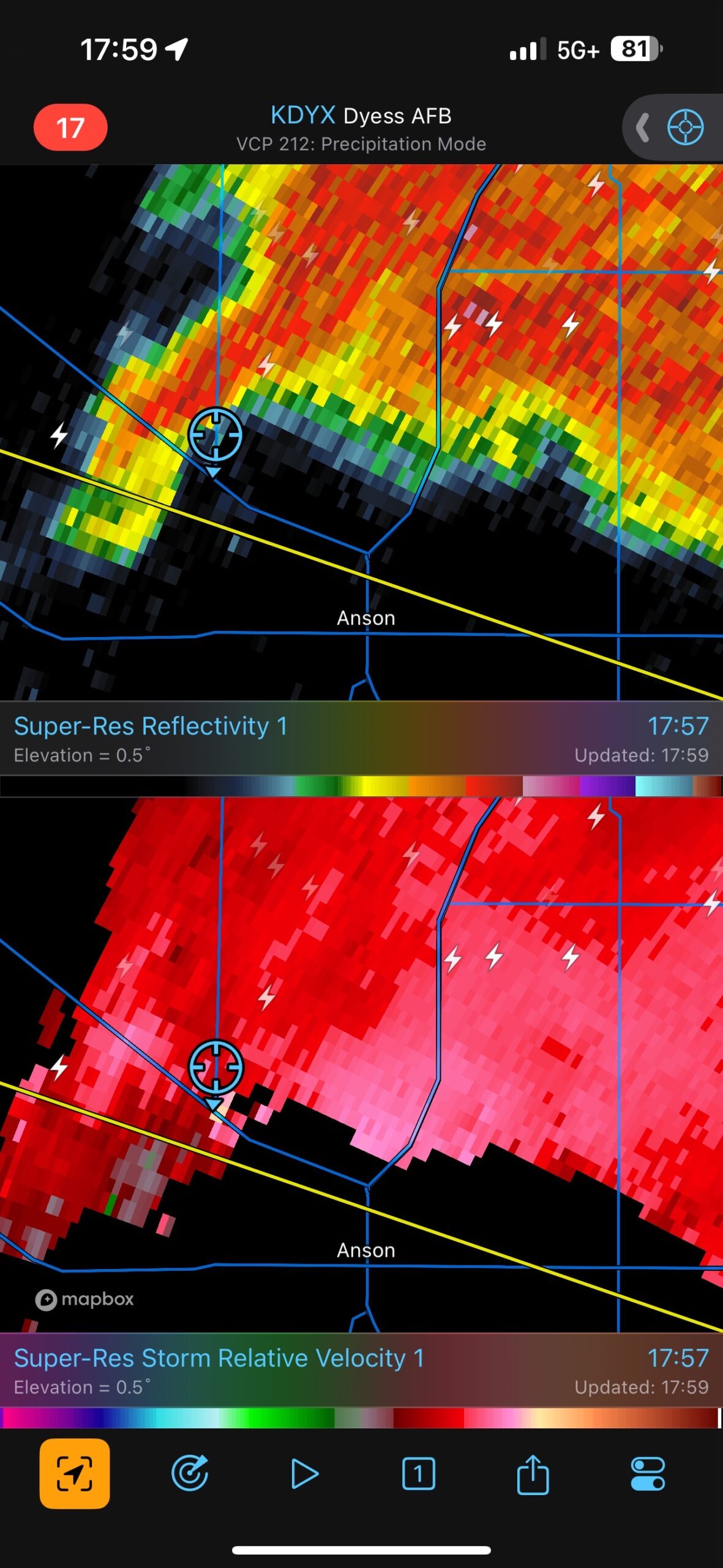
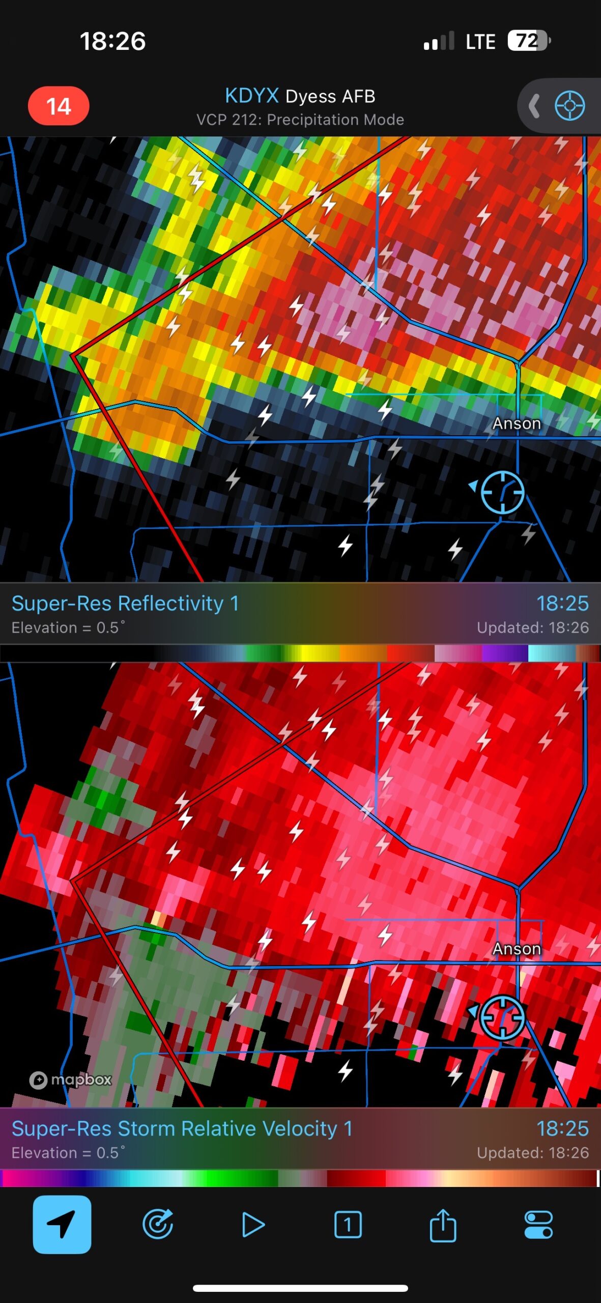
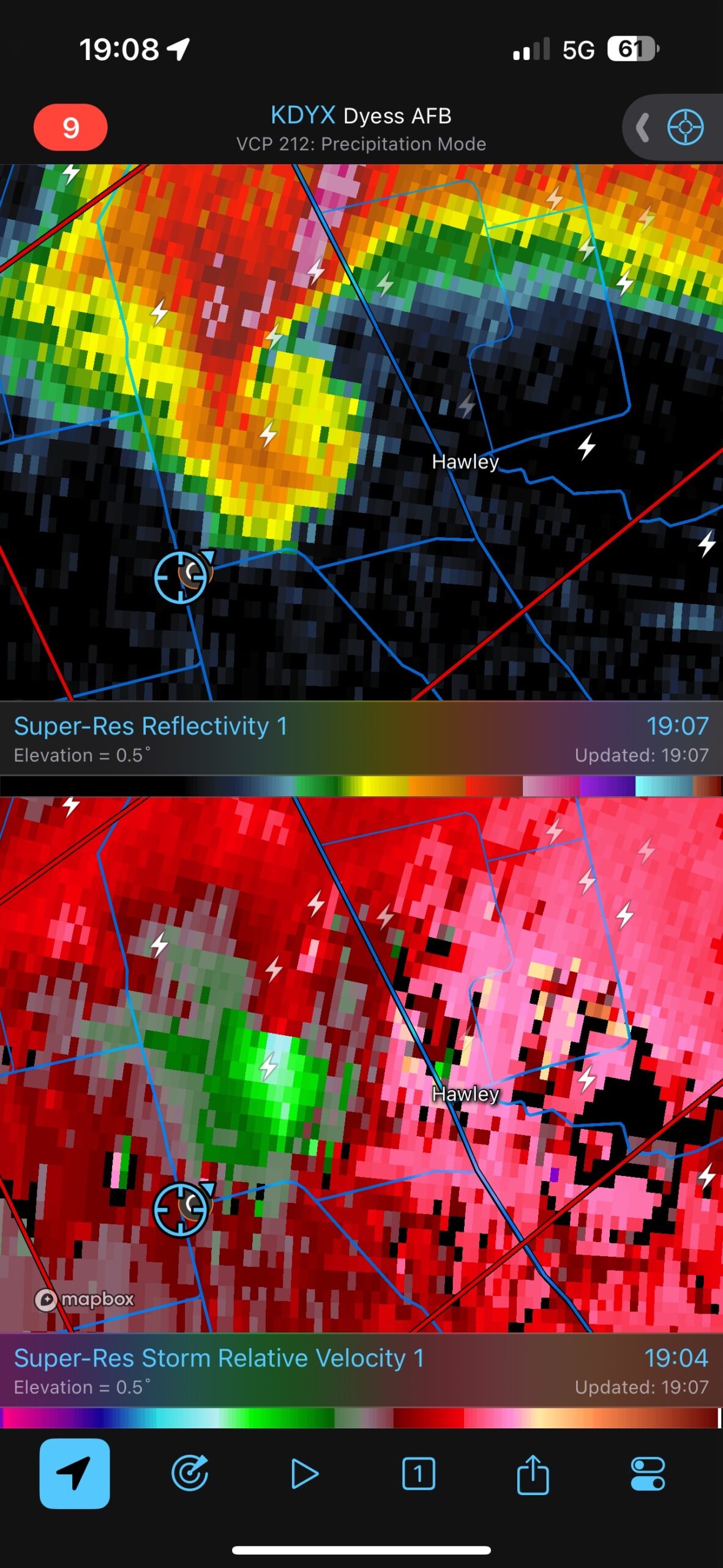
The radar grabs below show our location on the SSW edge of Anson (on FM 707) with respect to the tornadic storm from 1813 to 1835 local time.
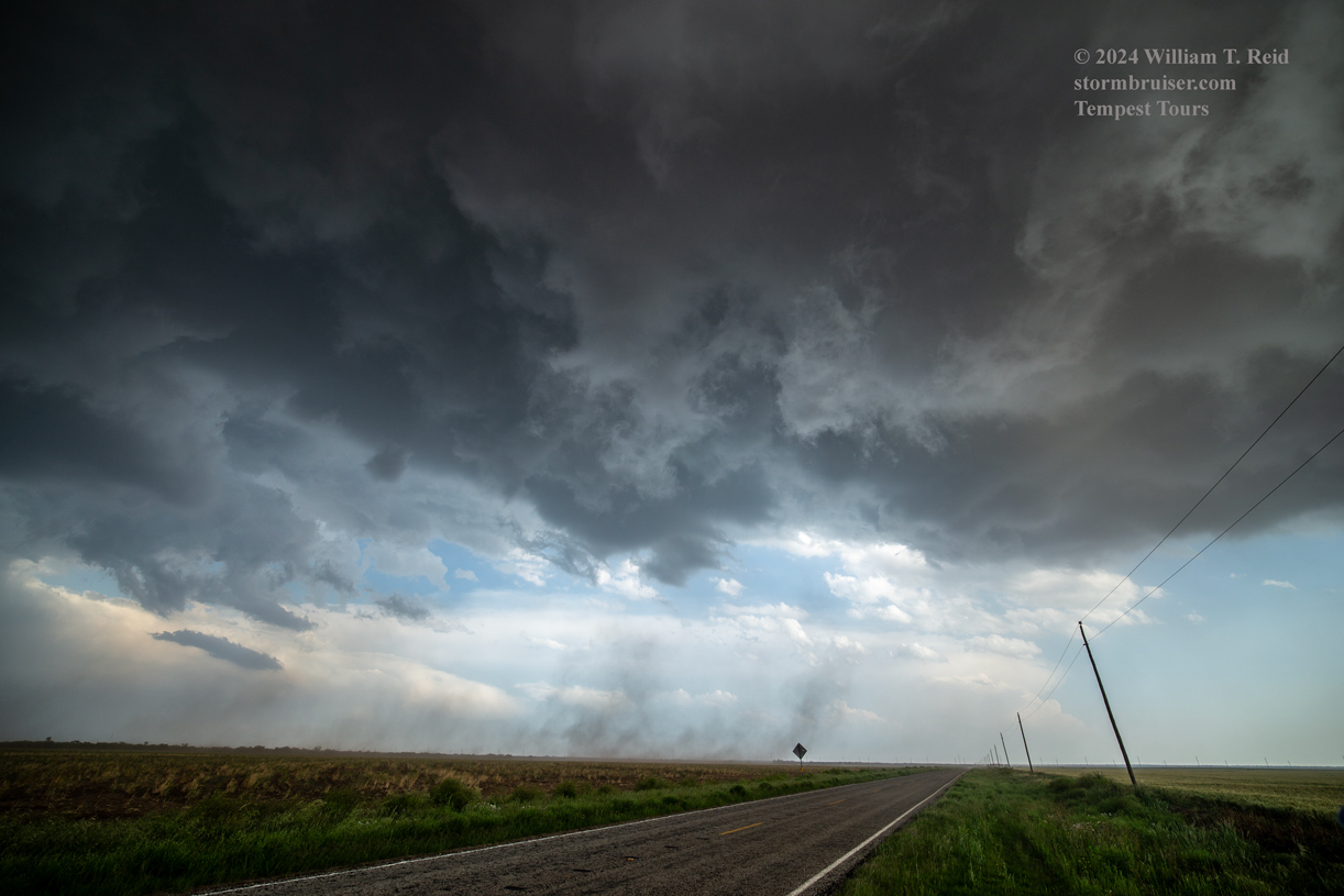
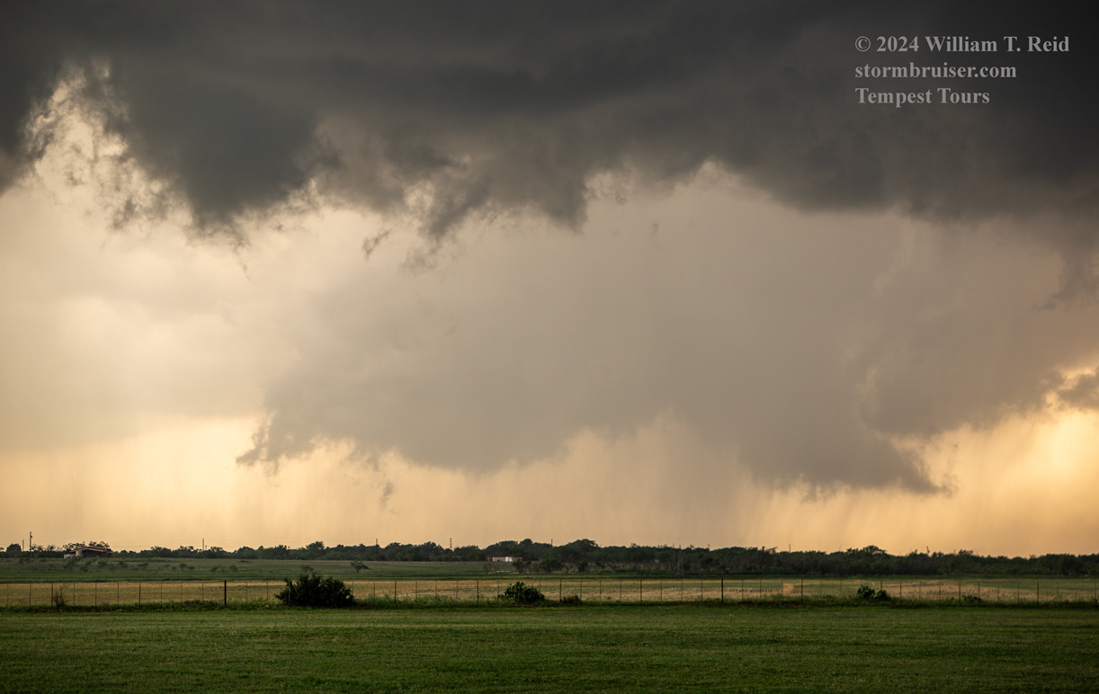
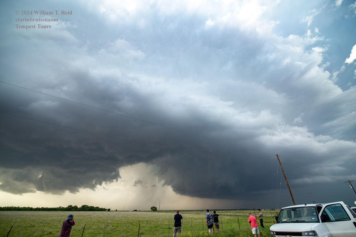
A new active area was developing nearby, really close to Anson…fortunately for us…maybe unfortunately for anyone living near Anson. This was to our northeast. Was another tornado show going to unfold? The photos below are views to the northeast at the new, low and very threatening storm base from our spot on the southwest side of Anson.
I led the tour group SSW and S on FM 707. This route was taking us a bit farther west and south than I was hoping to go. Again, we were well away from the storm base! But I needed to get to an east option. We finally reached an east option after about 11 miles, FM 605 (west of Hodges and Hawley). The Clear Fork River runs between FM 707 and U.S. 83 here, south of Anson, so decent roads east towards U.S. 83 were not available until FM 605.
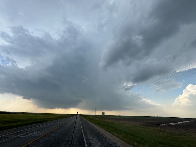
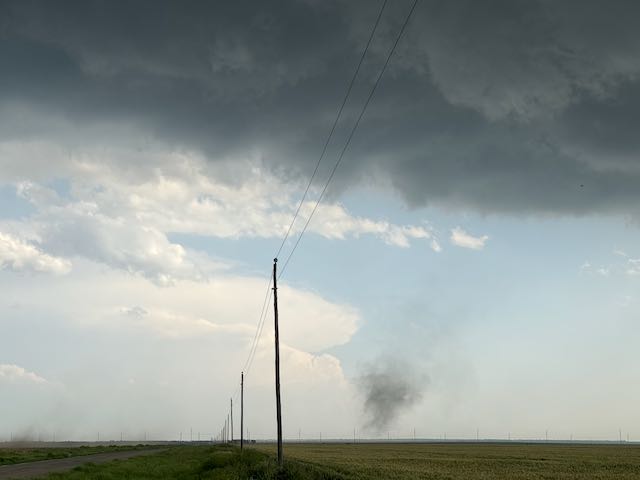
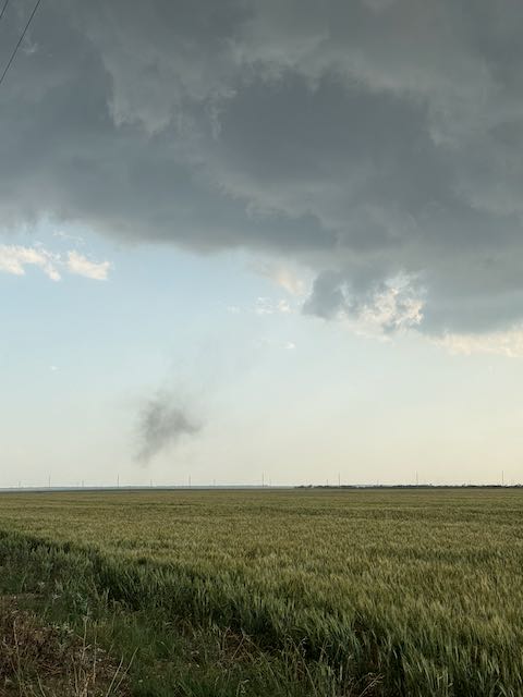
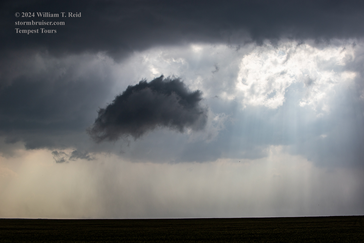
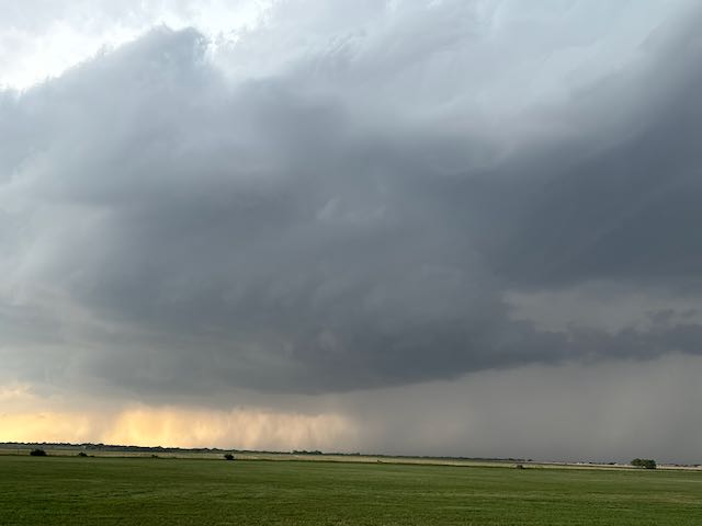
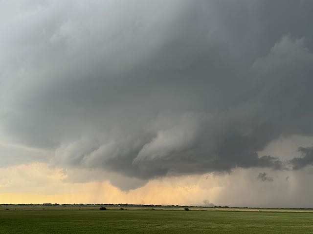
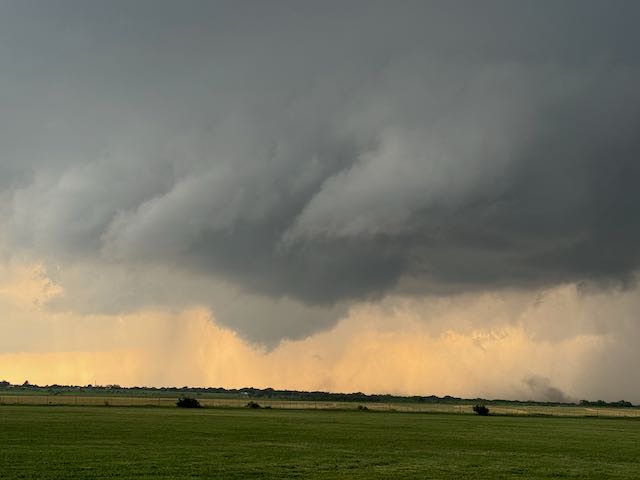
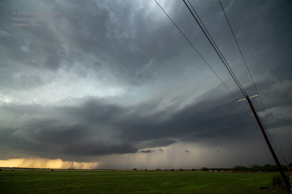
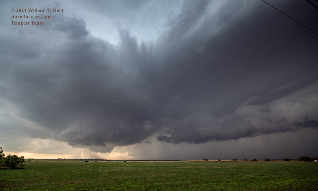
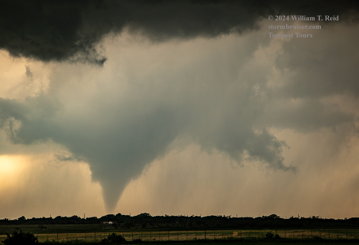
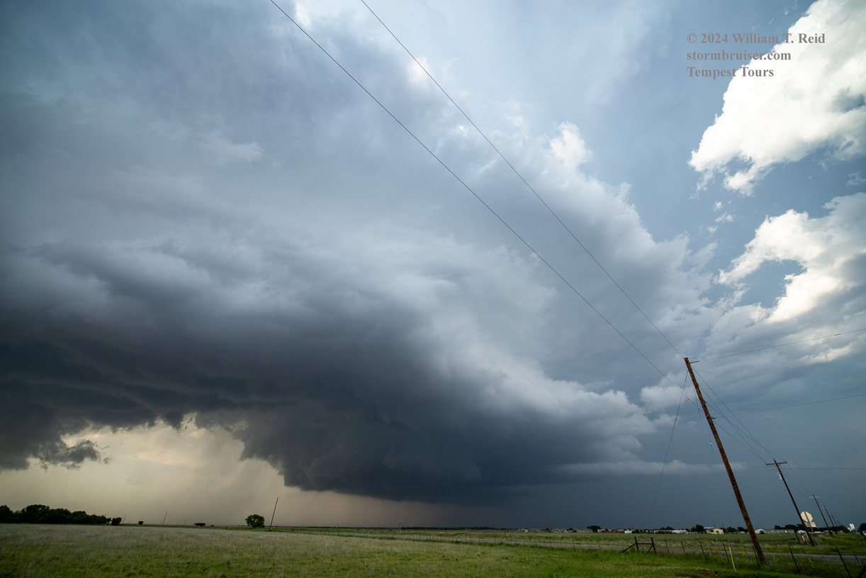
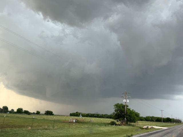
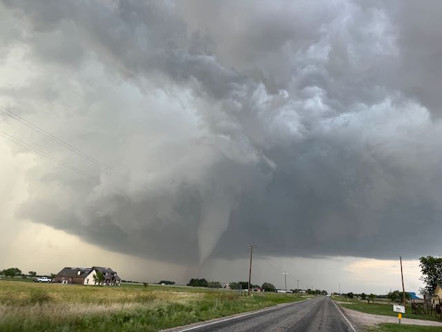
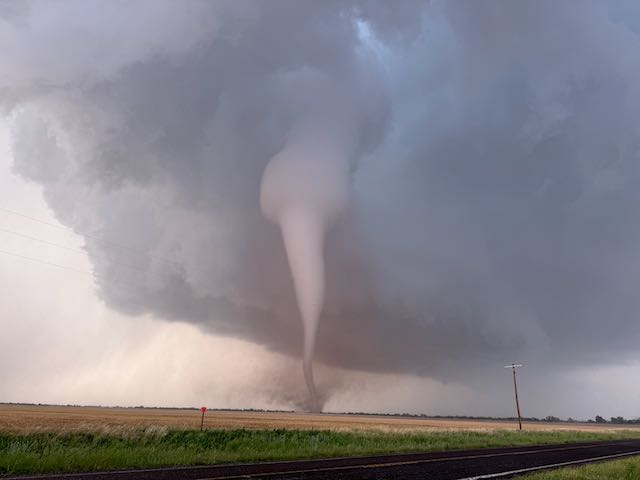
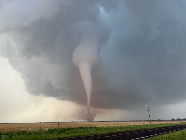
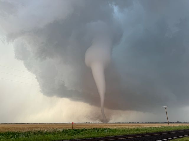
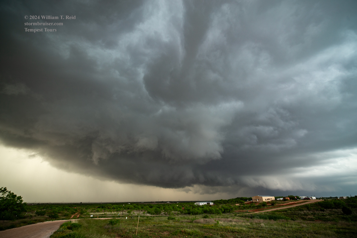
We stopped at the intersection of 707 and 605 in southern Jones County, with a very good look to the northeast of the supercell and storm base. Some structure is apparent in the wide-angle shots below, and then the sharp cut of the RFD/clear slot starts to wrap around nicely! It was going to be tornado time again.
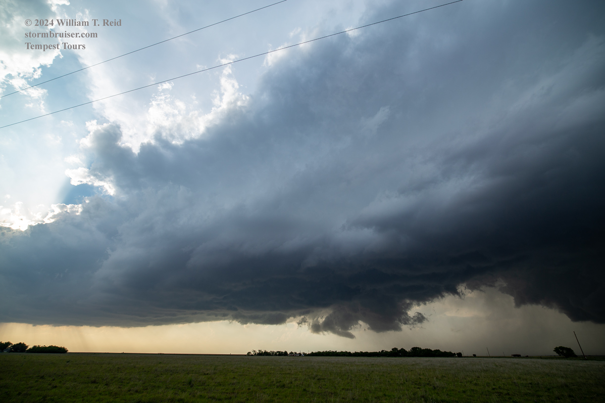
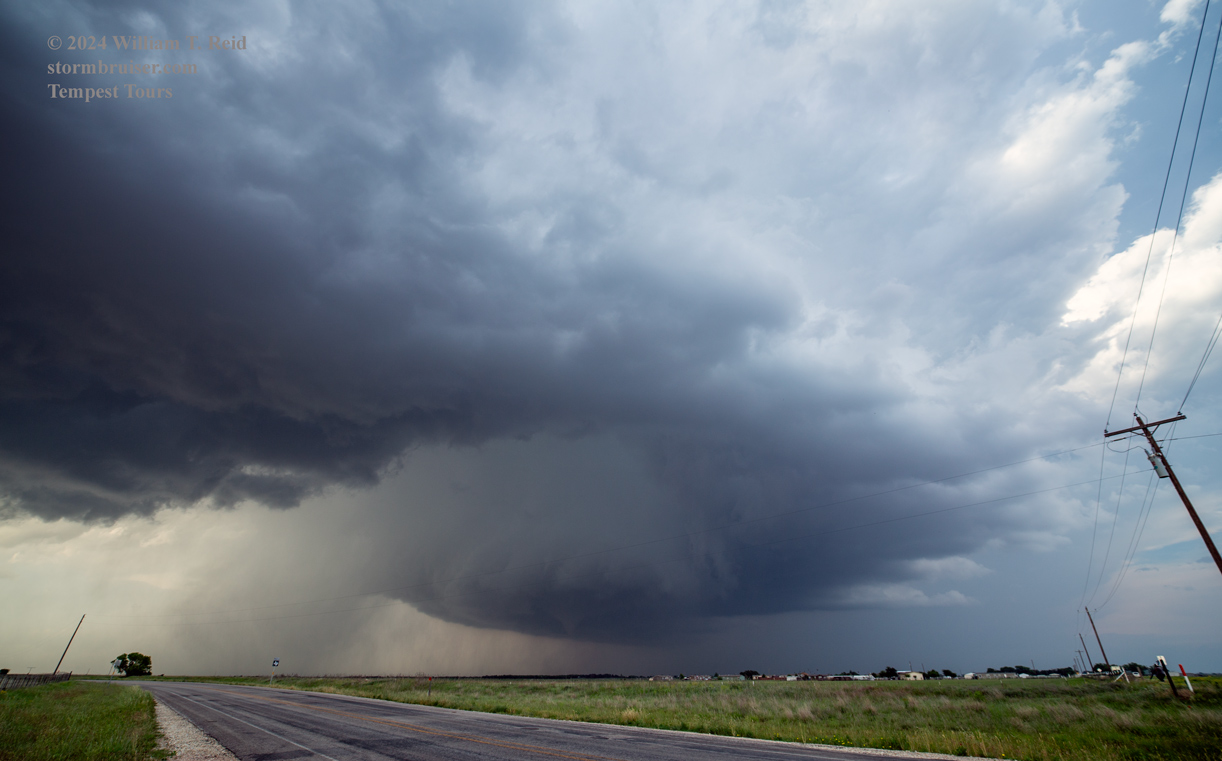
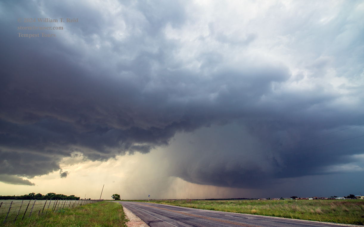
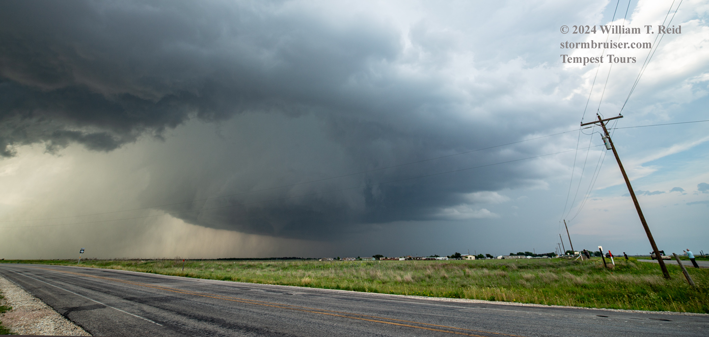
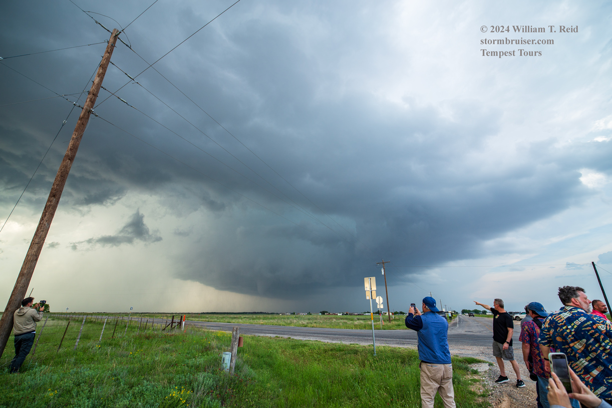
Do you see that precipitation shaft in the middle three images above? It is just behind (to the left of) the roundish base in the RFD region. This is called “the blob,” and severe storm researchers have determined that it is a somewhat common phenomenon which often develops around tornado time.
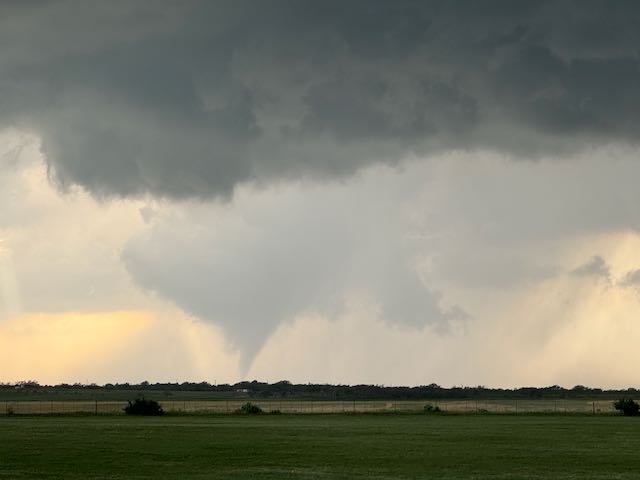
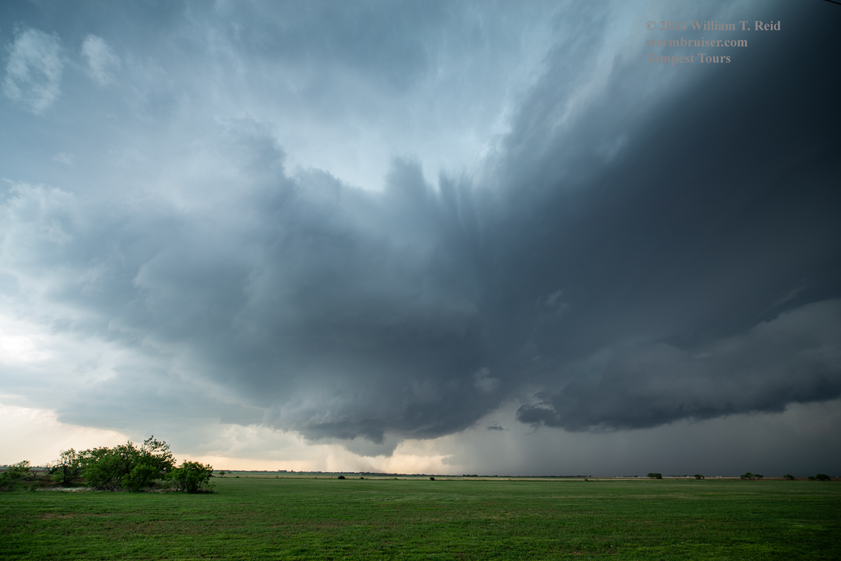
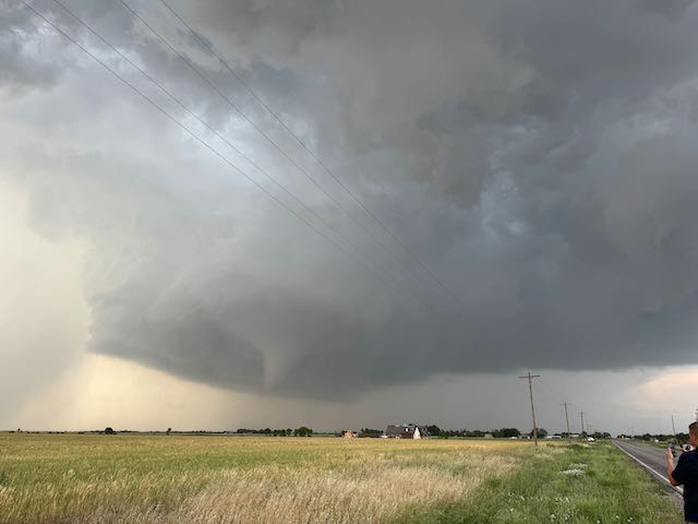
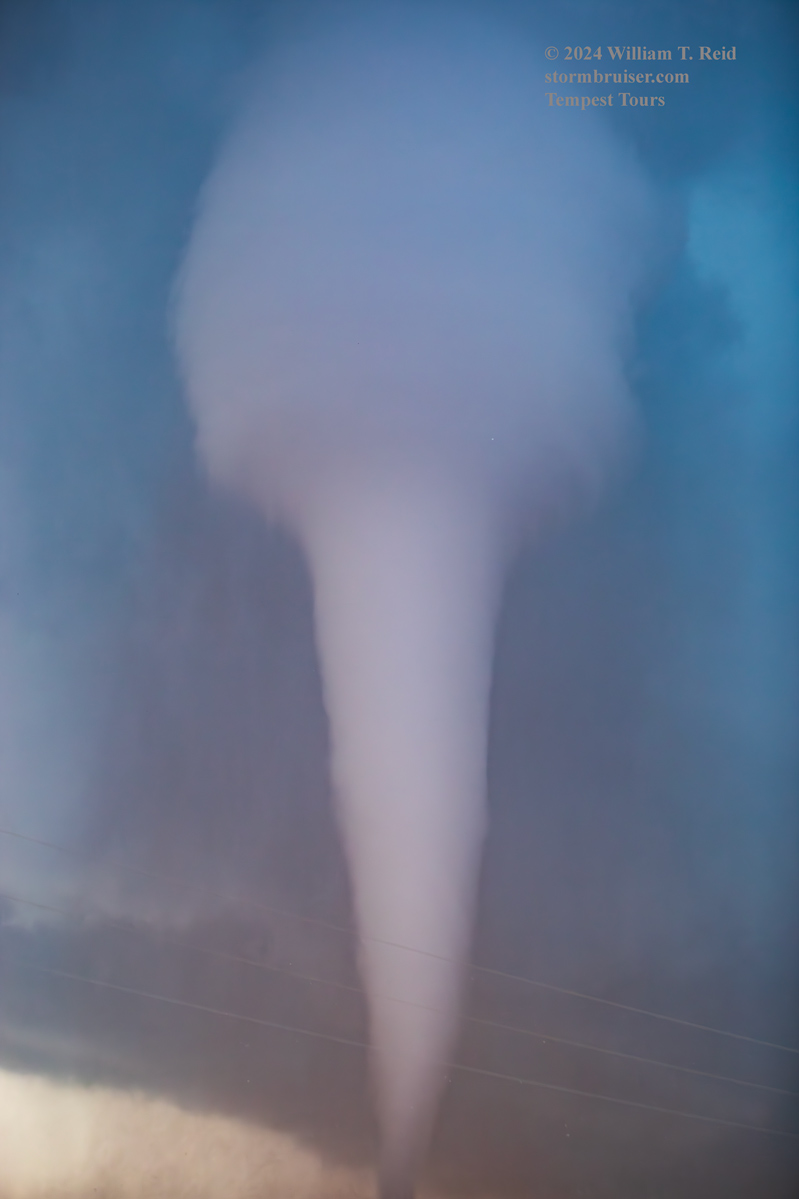
A weak (off-and-on?) tornado was beneath this strongly rotating base. Look at how nice and low the base is to the ground! The storm was likely sucking on air with dew points in the low 70s by now. It was time to get close, and this FM 605 road to the E and ENE would be perfect.
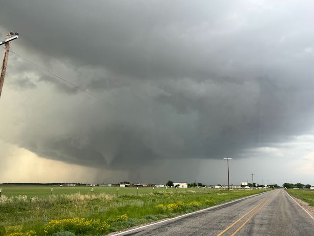
The iPhone shots above were taken during the two-mile reposition eastward. We stopped just short of Hodges, where FM 605 jogs SE briefly before continuing to the east.
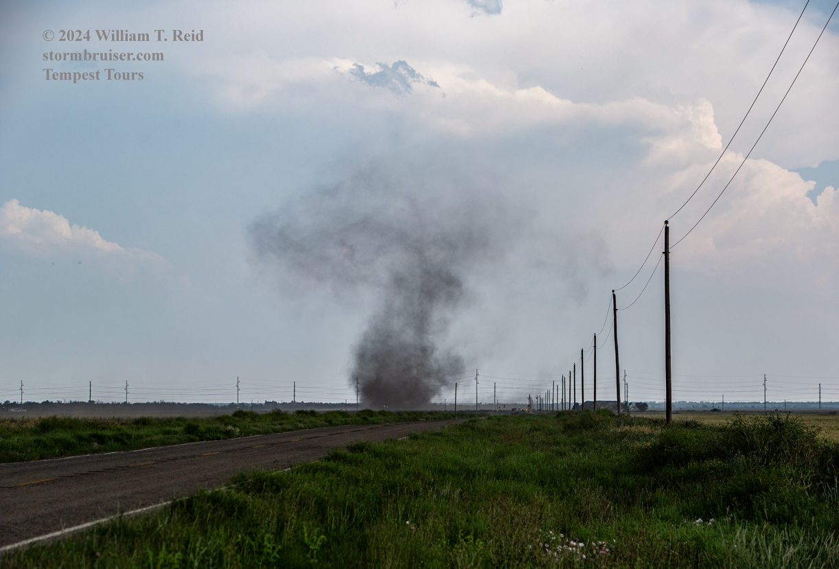
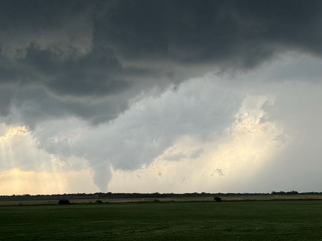
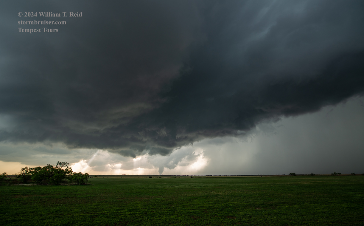
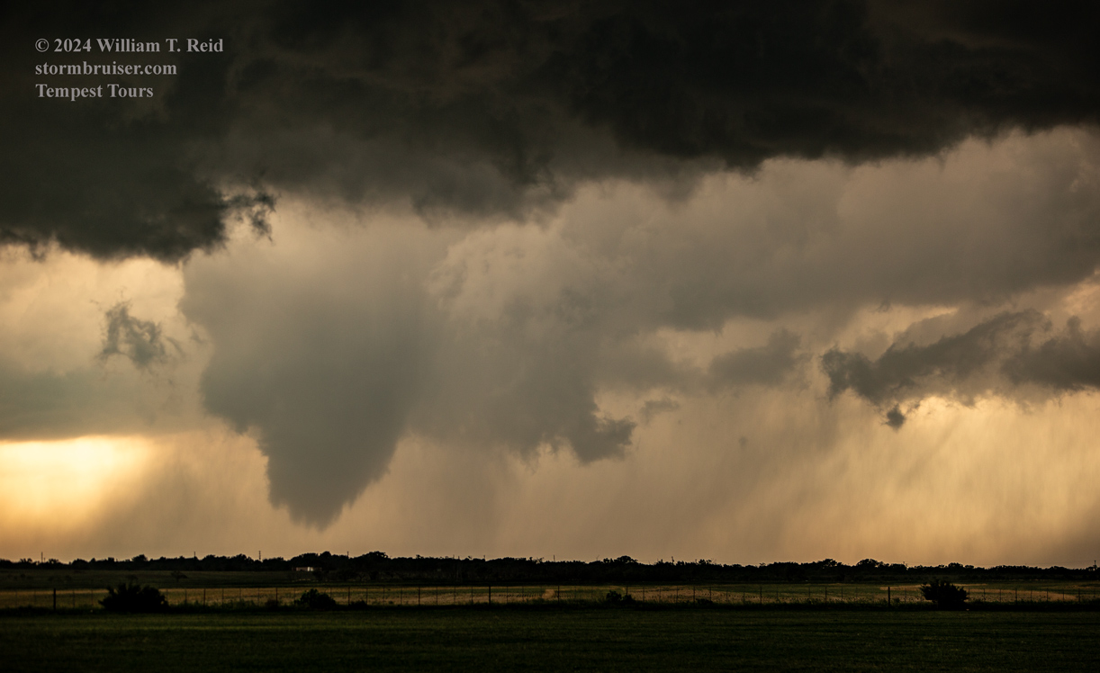
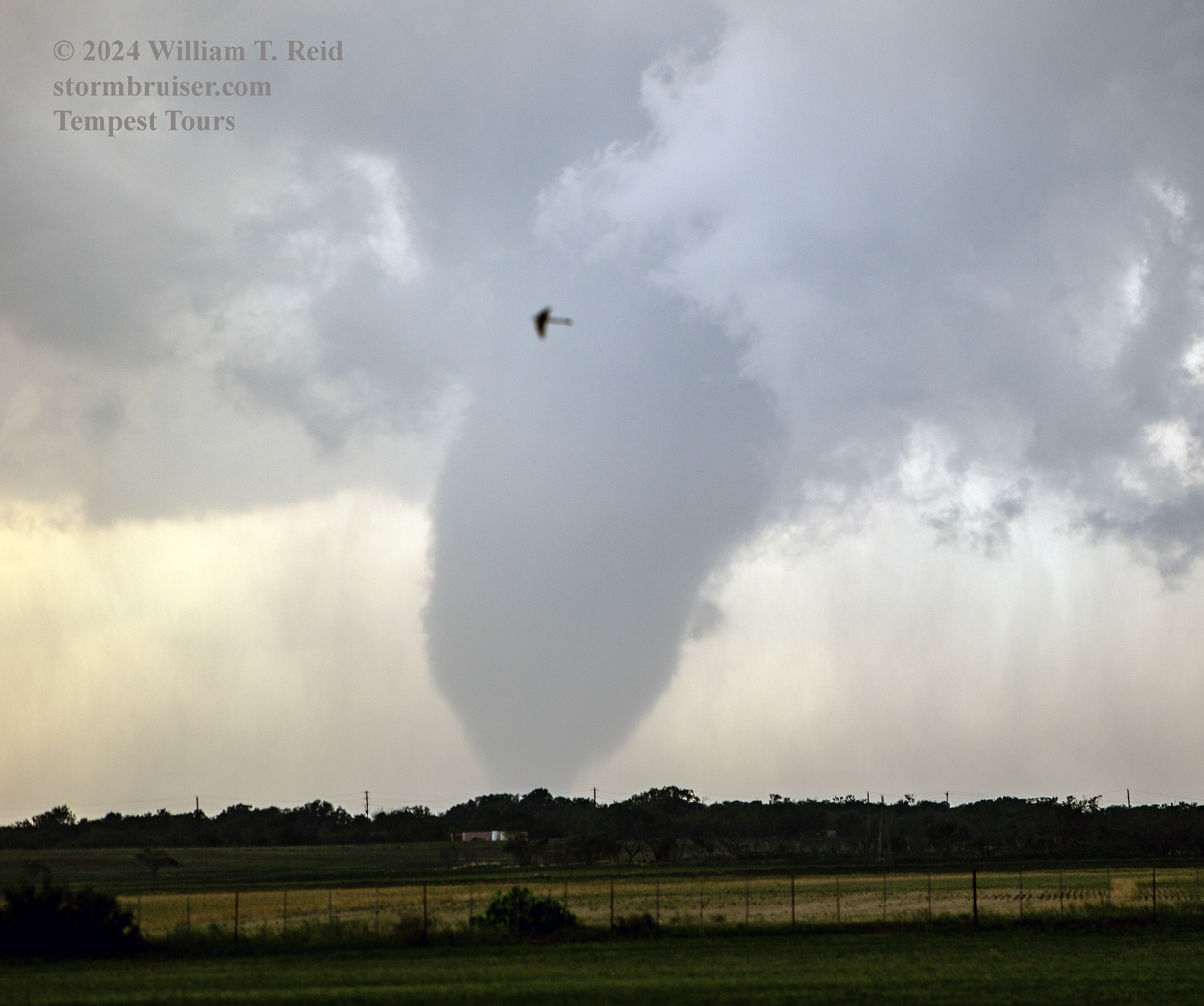
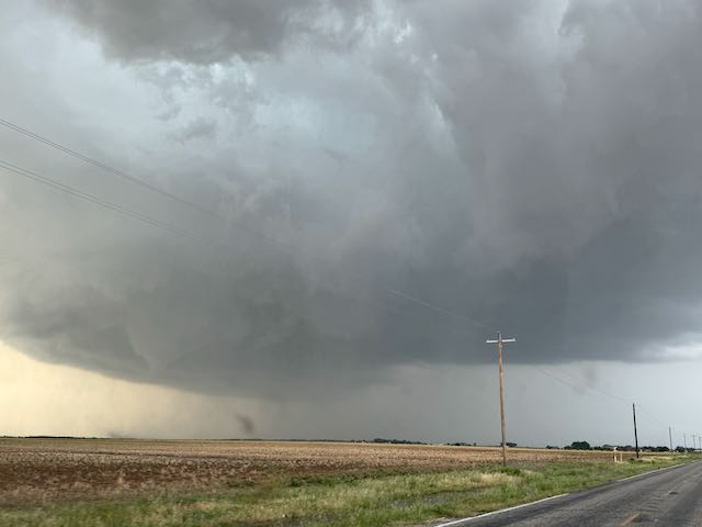
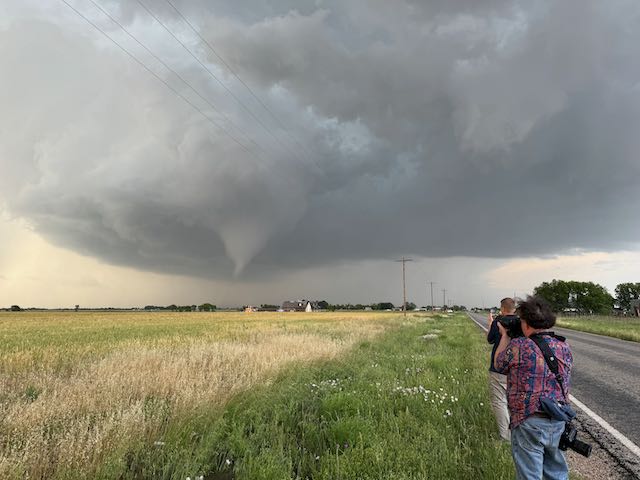
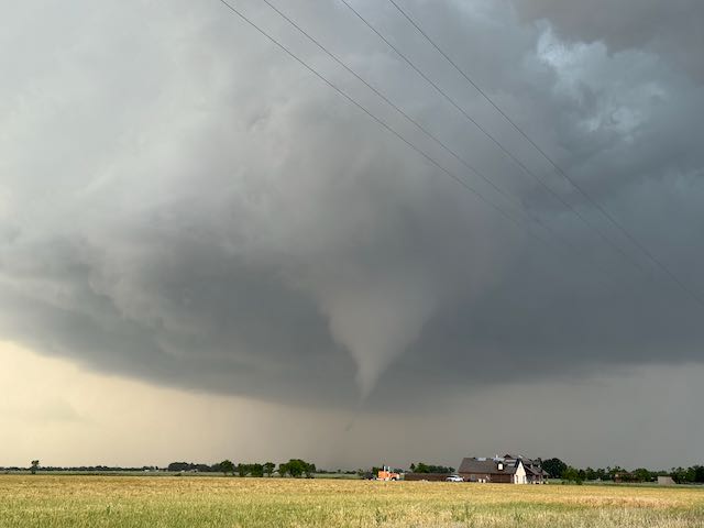
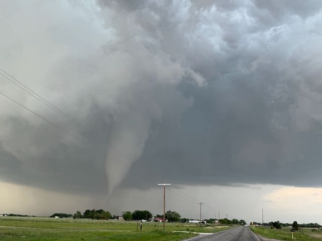
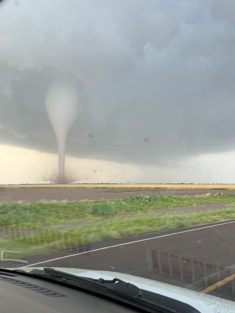
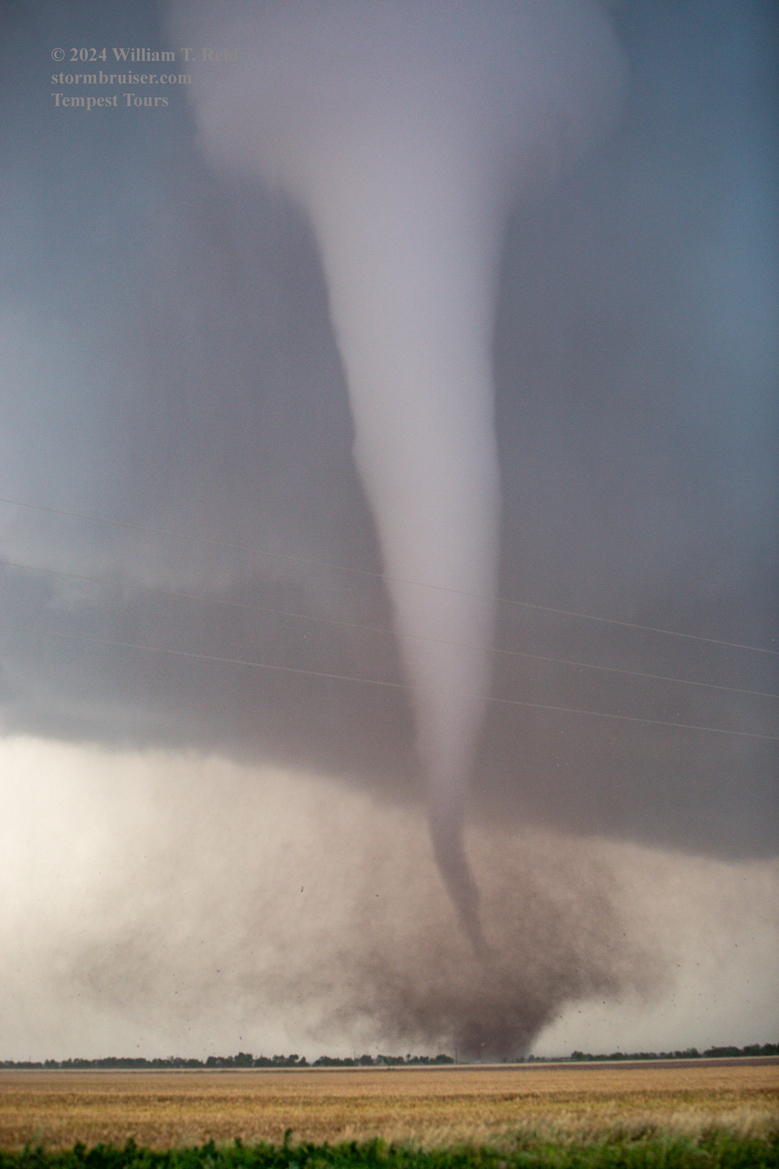
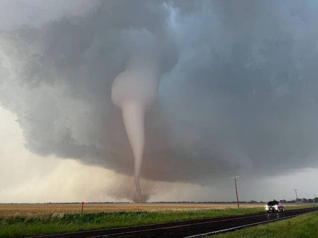
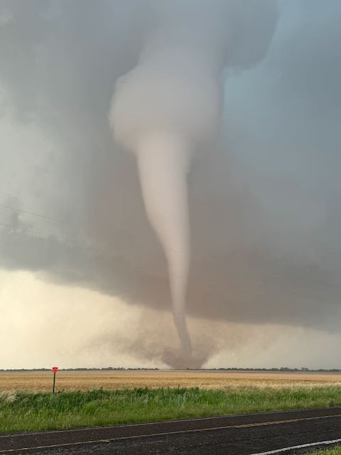
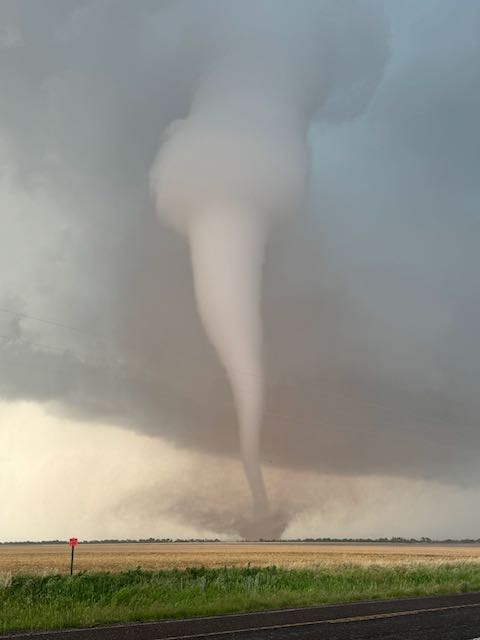
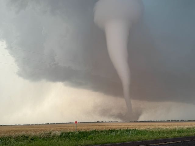
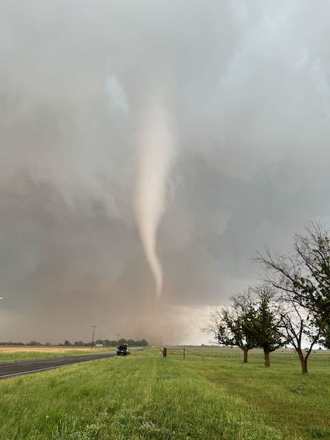
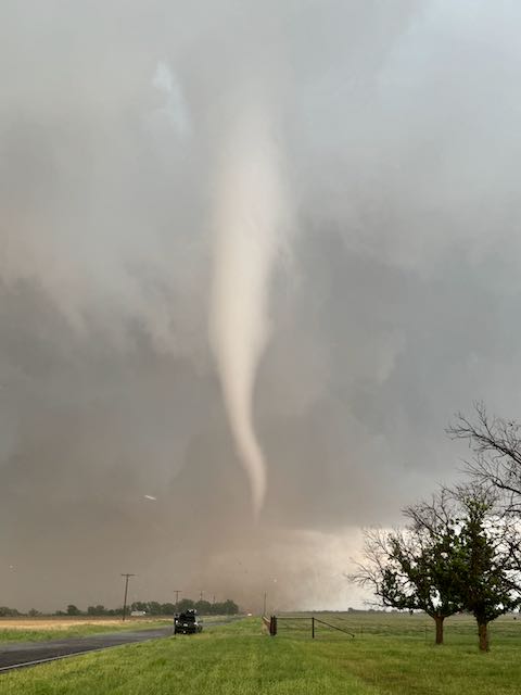
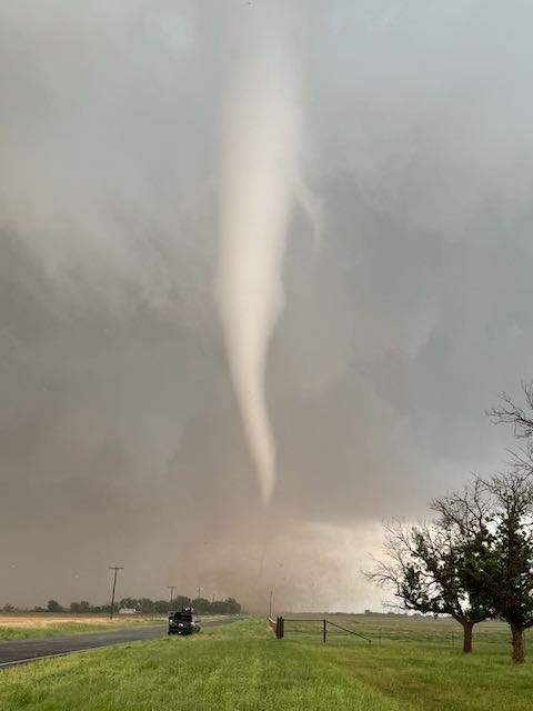
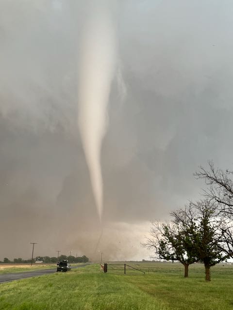
We had a very good view of this new tornado that was maybe a couple of miles NNE of Hodges. There was no rain or hail to contend with here, either. The first group below from this spot is from the iPhone, unprocessed.
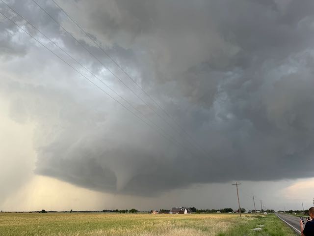
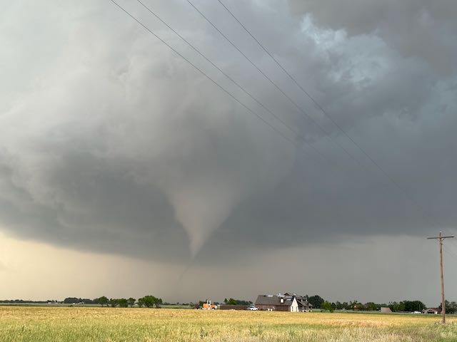
And the two below are wide-angles with the Canon…
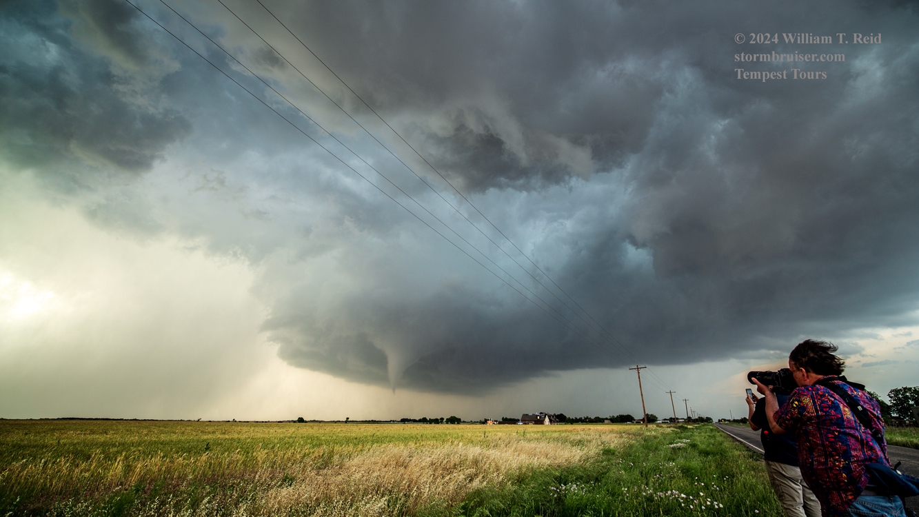
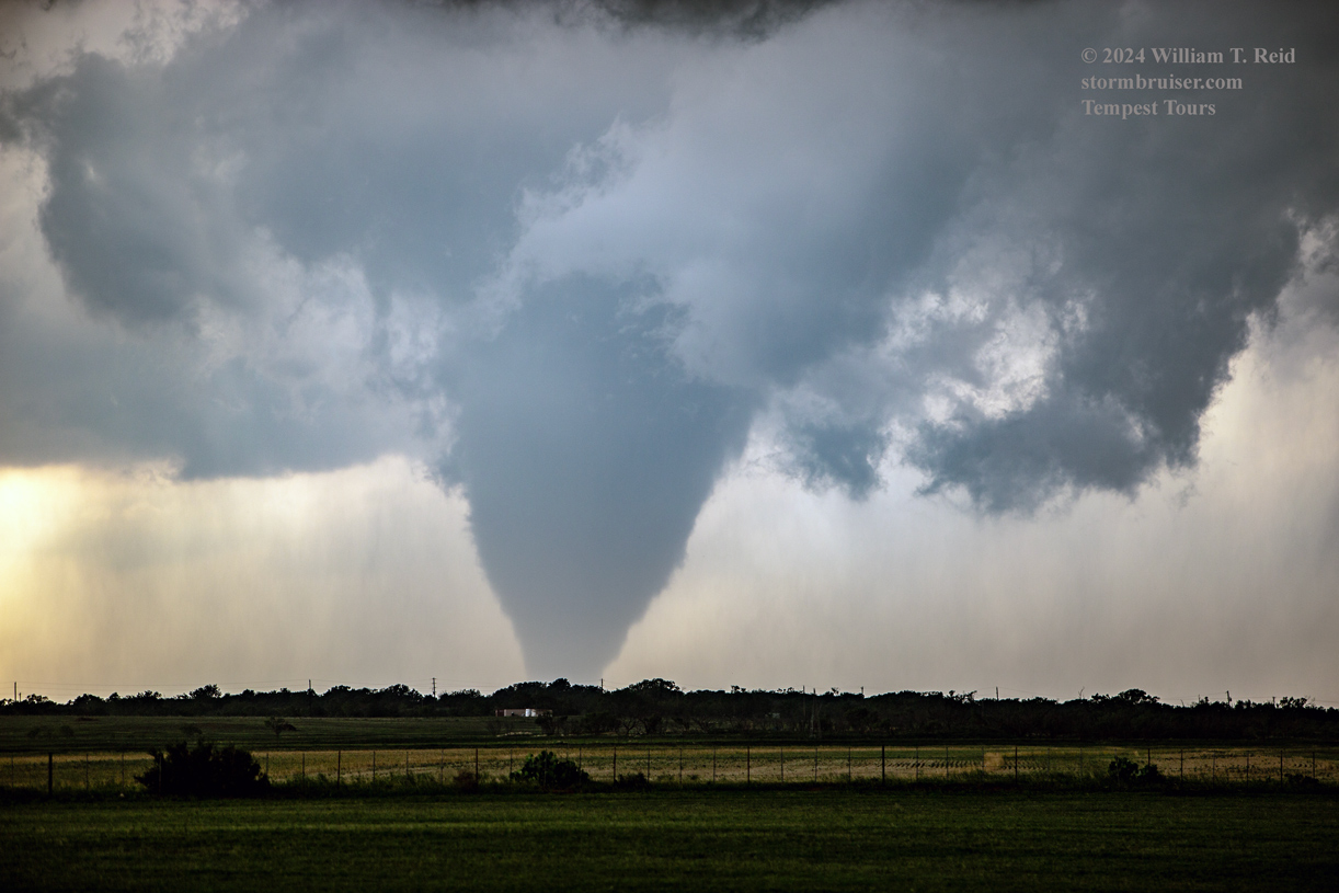
And the batch below from this spot close to Hodges, with the Canon 6D and the long lens.
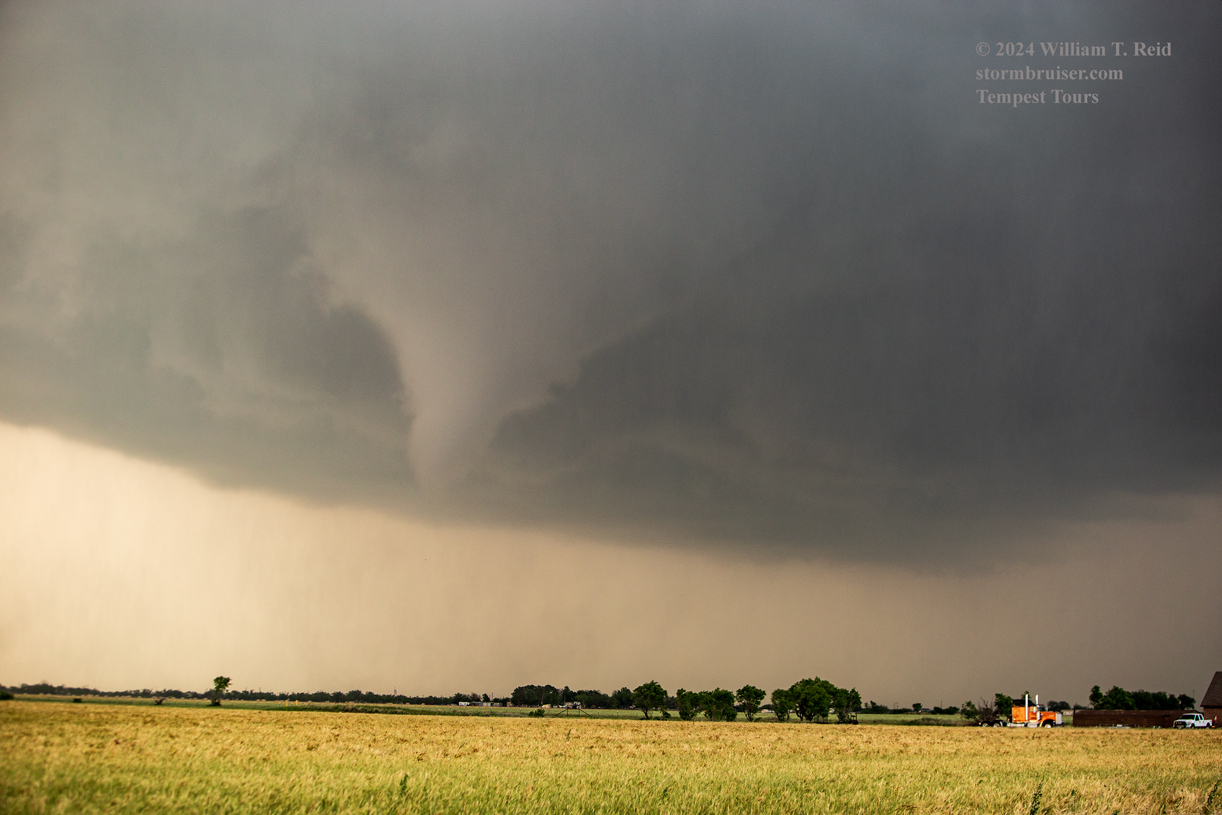
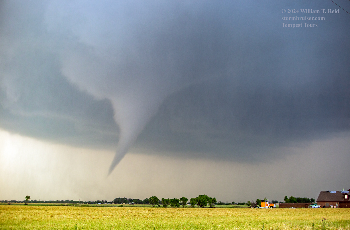
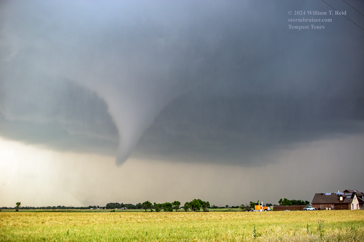
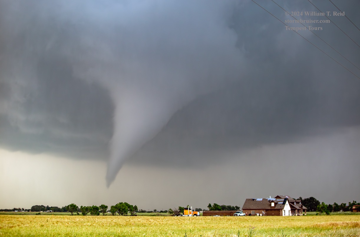
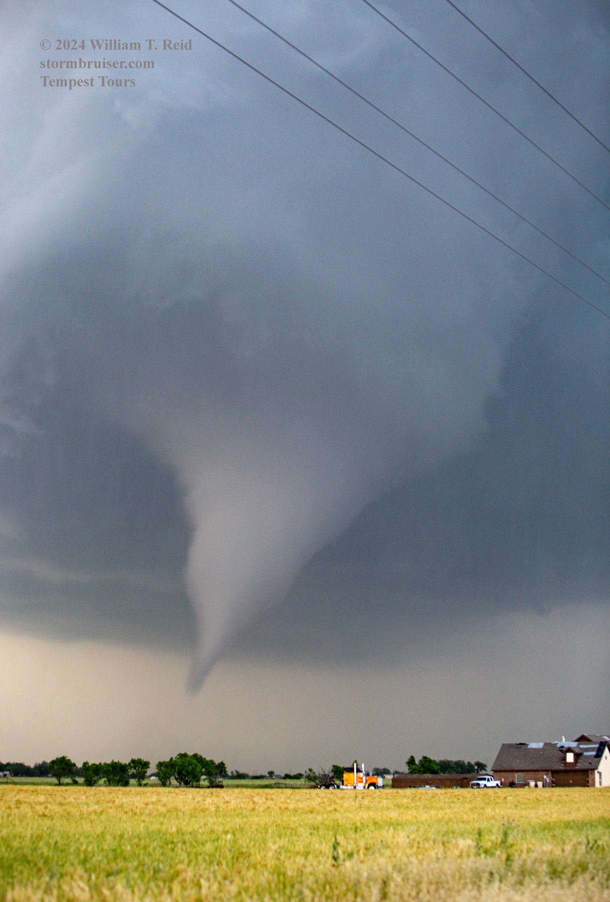

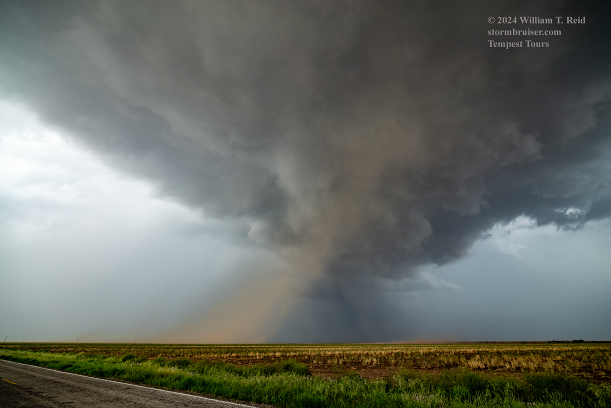
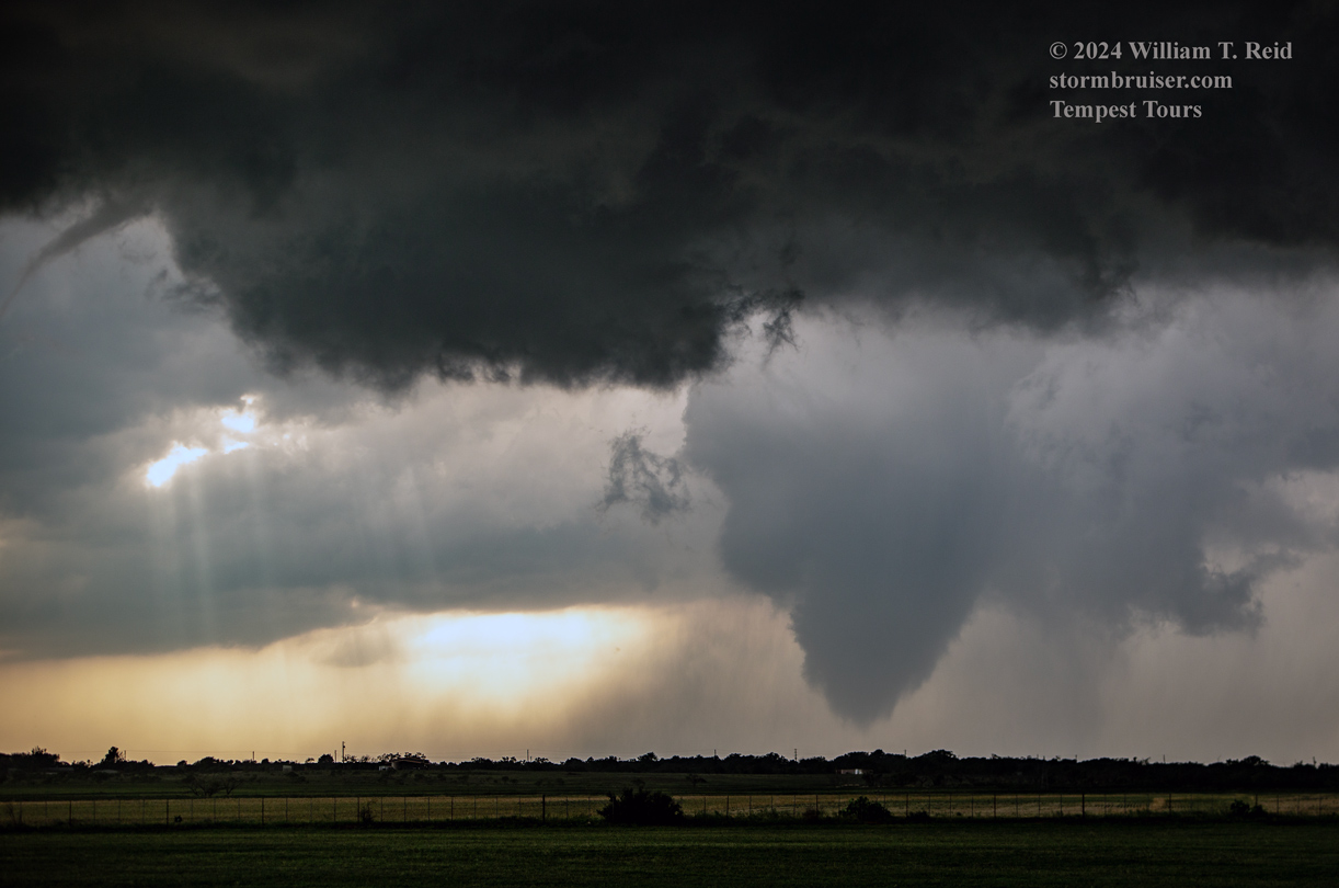
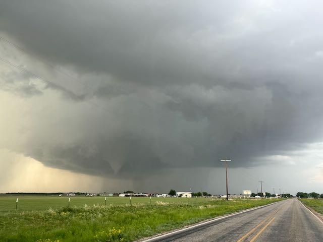
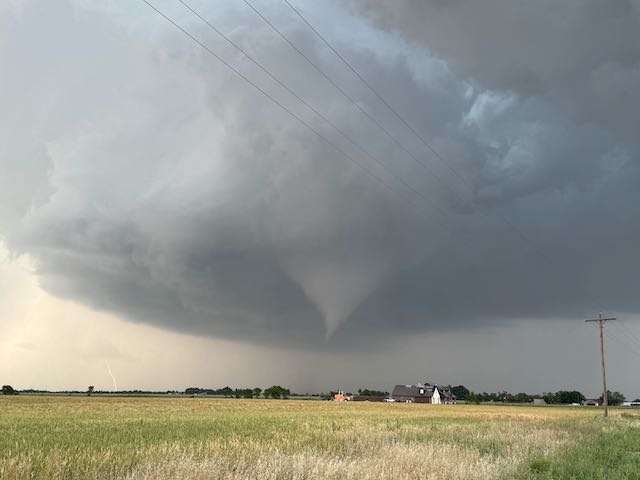
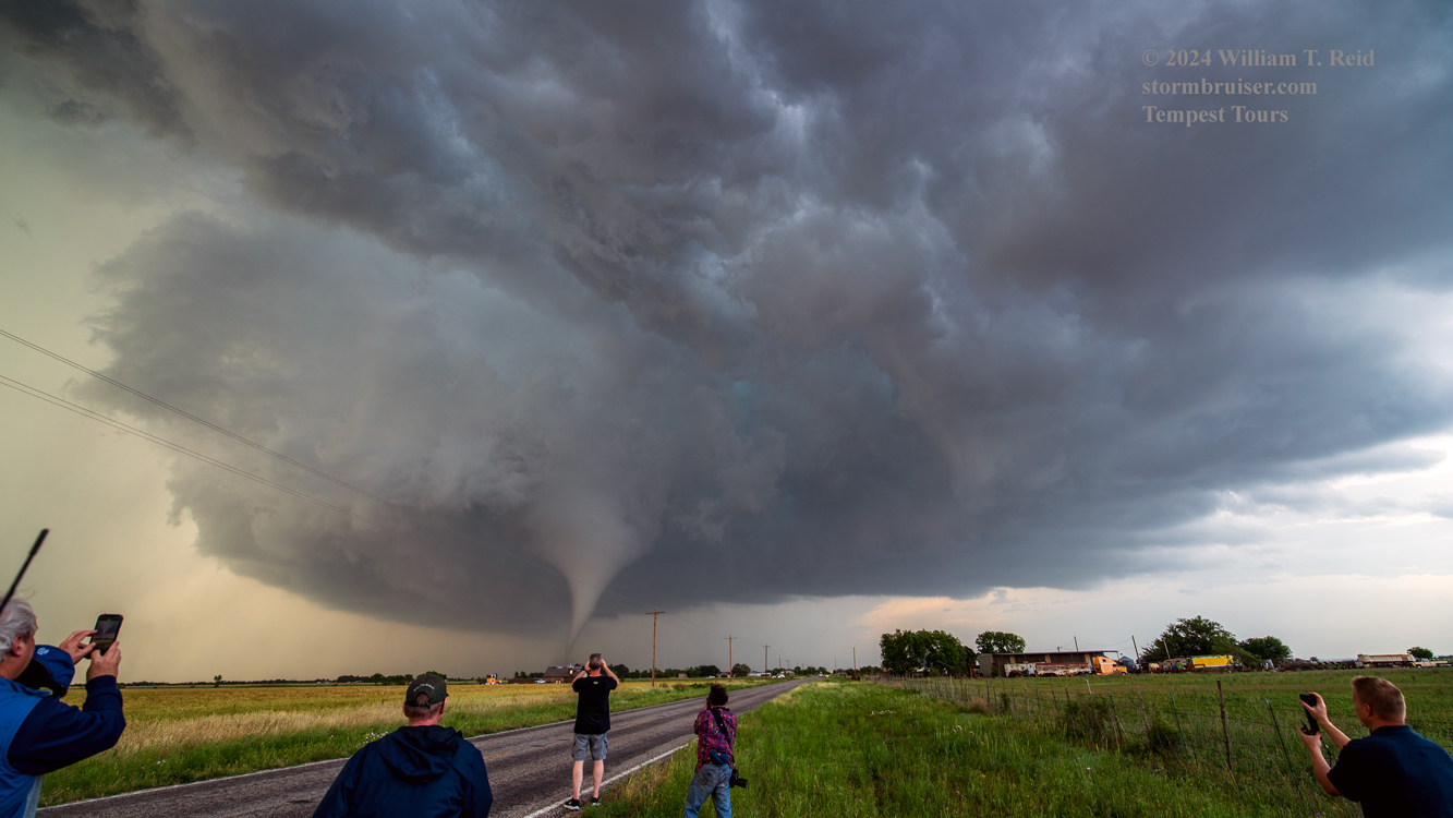
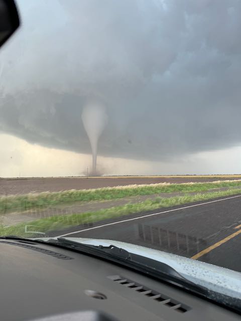
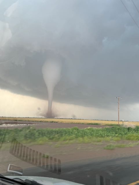
Obviously, the tornado was getting stronger and stronger as it moved from left-to-right. It was moving slowly to south or the SSE. The tornado was approachable, with little or no rain curtains around. Let’s get closer! We were quickly back into the van and headed east on 605. The iPhone shots below were through the windshield as we motored another two miles or so eastward.
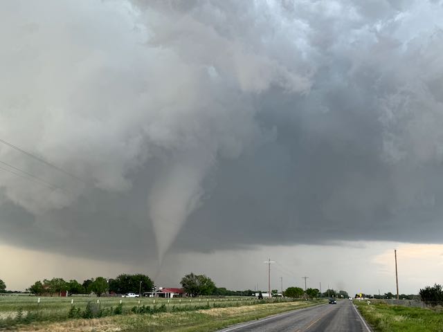
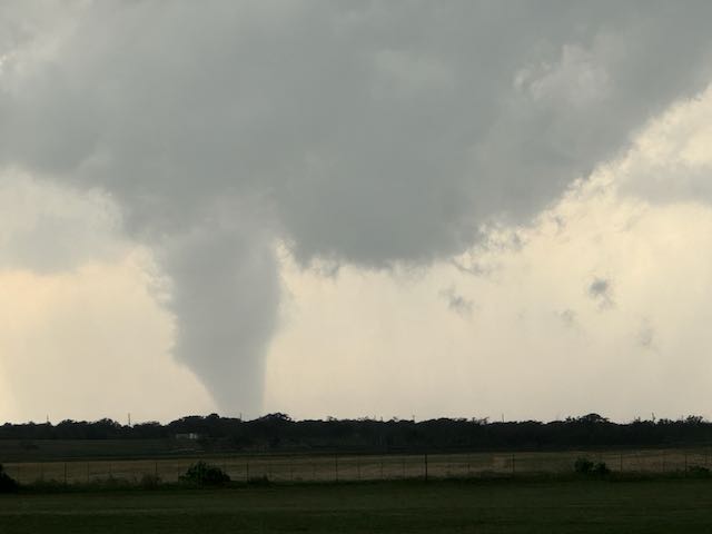
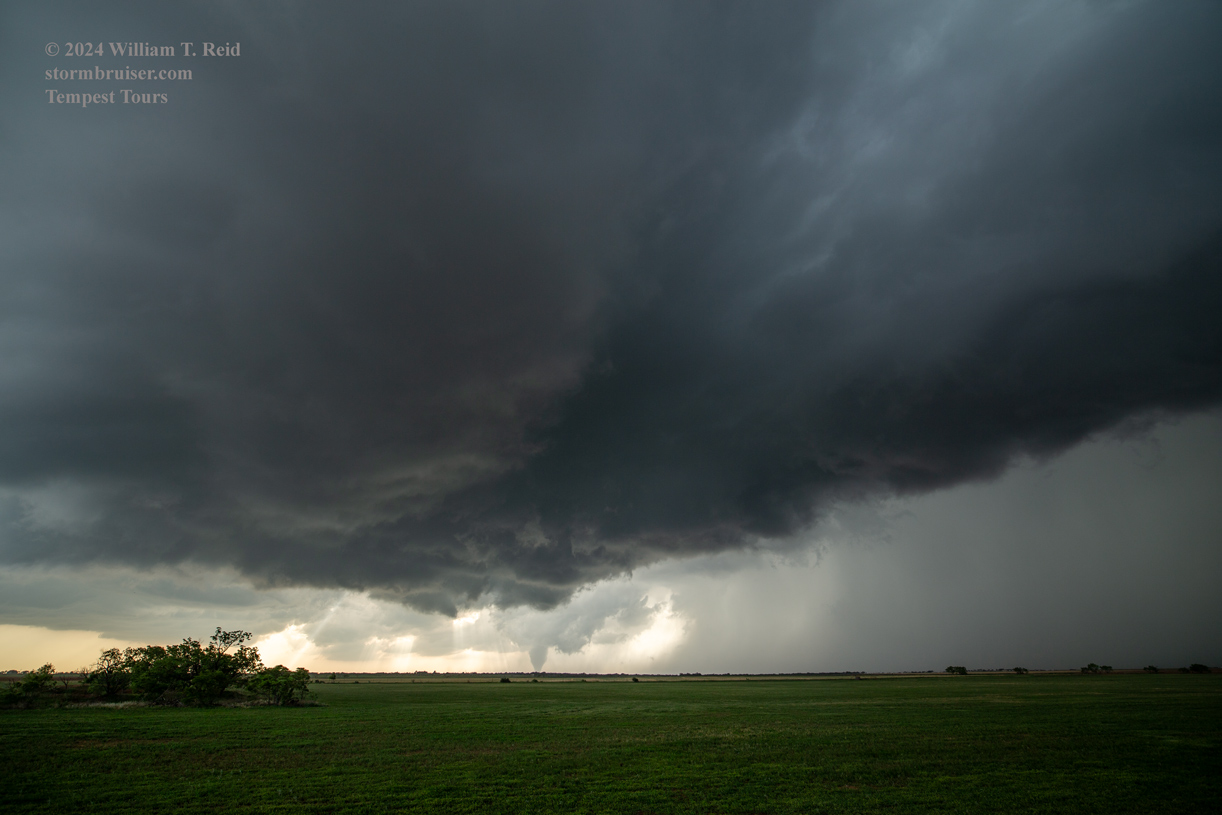
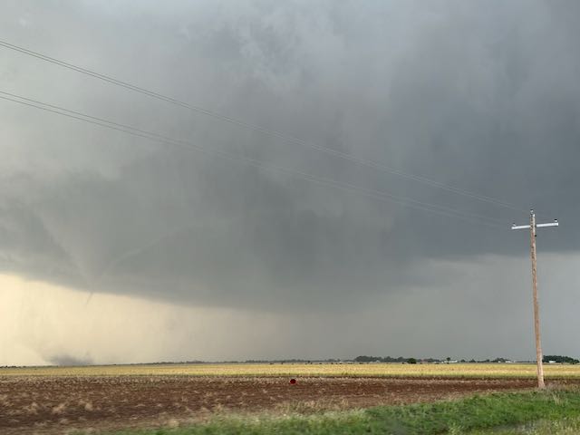
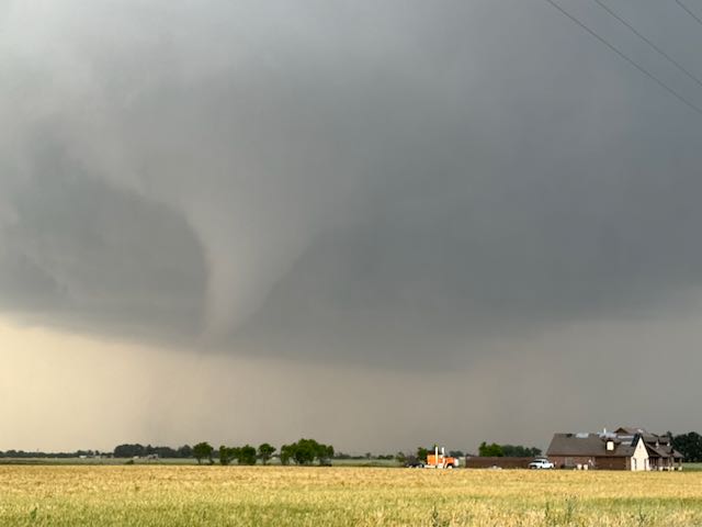
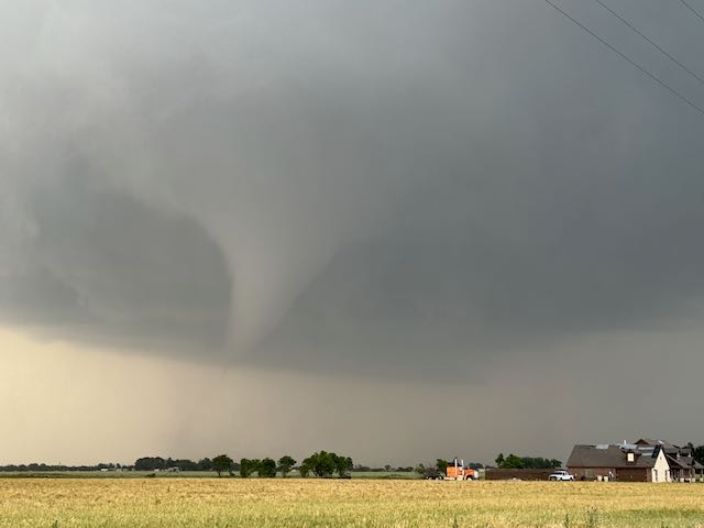
And, once out of the van, I managed to get these wide-angles (15mm!) and zooms…
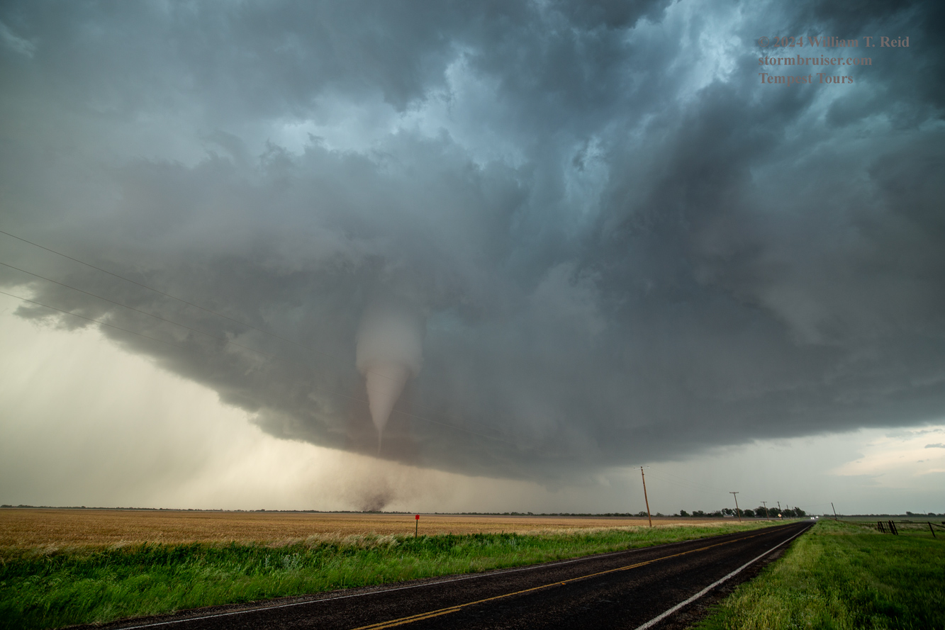
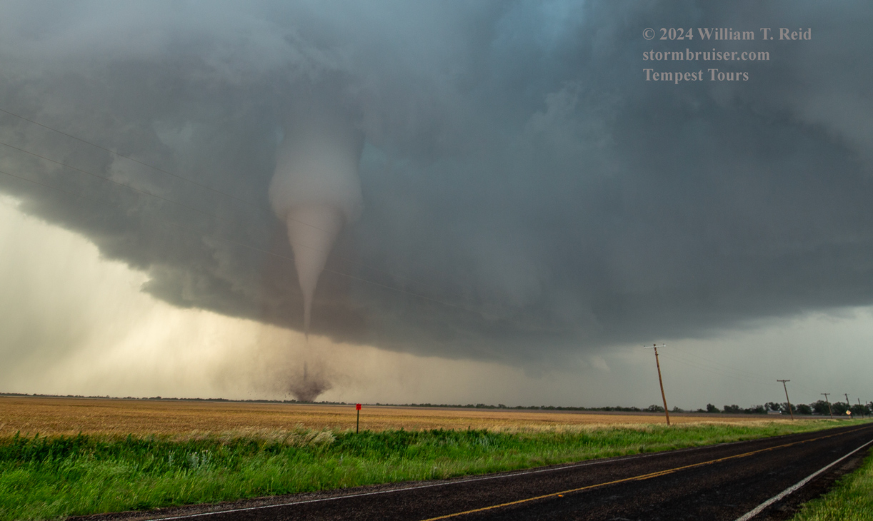
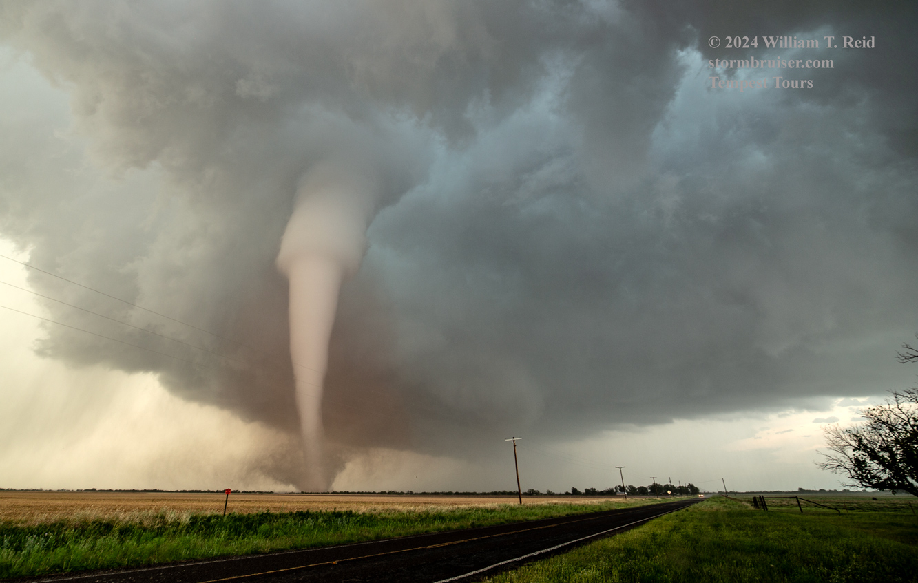
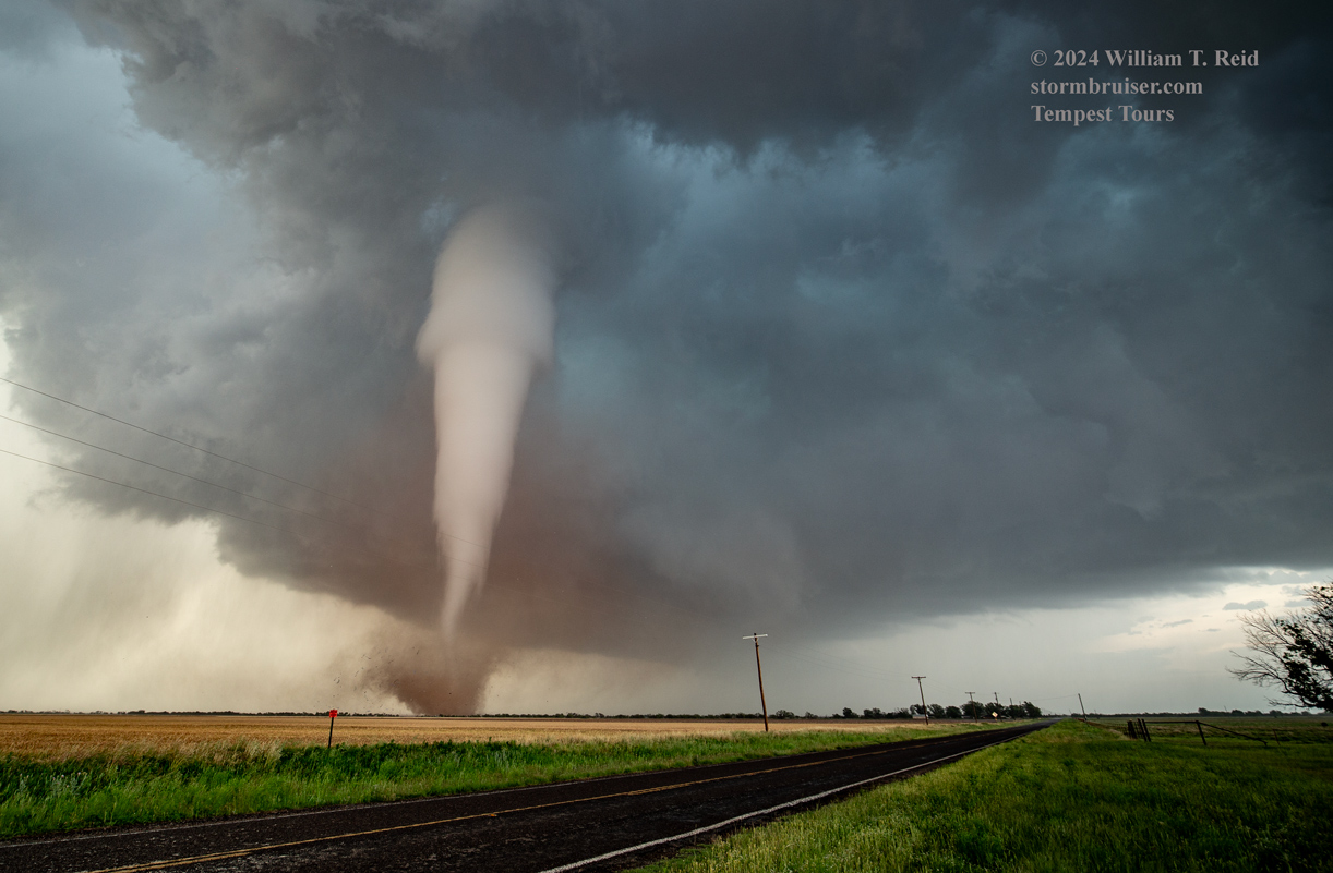
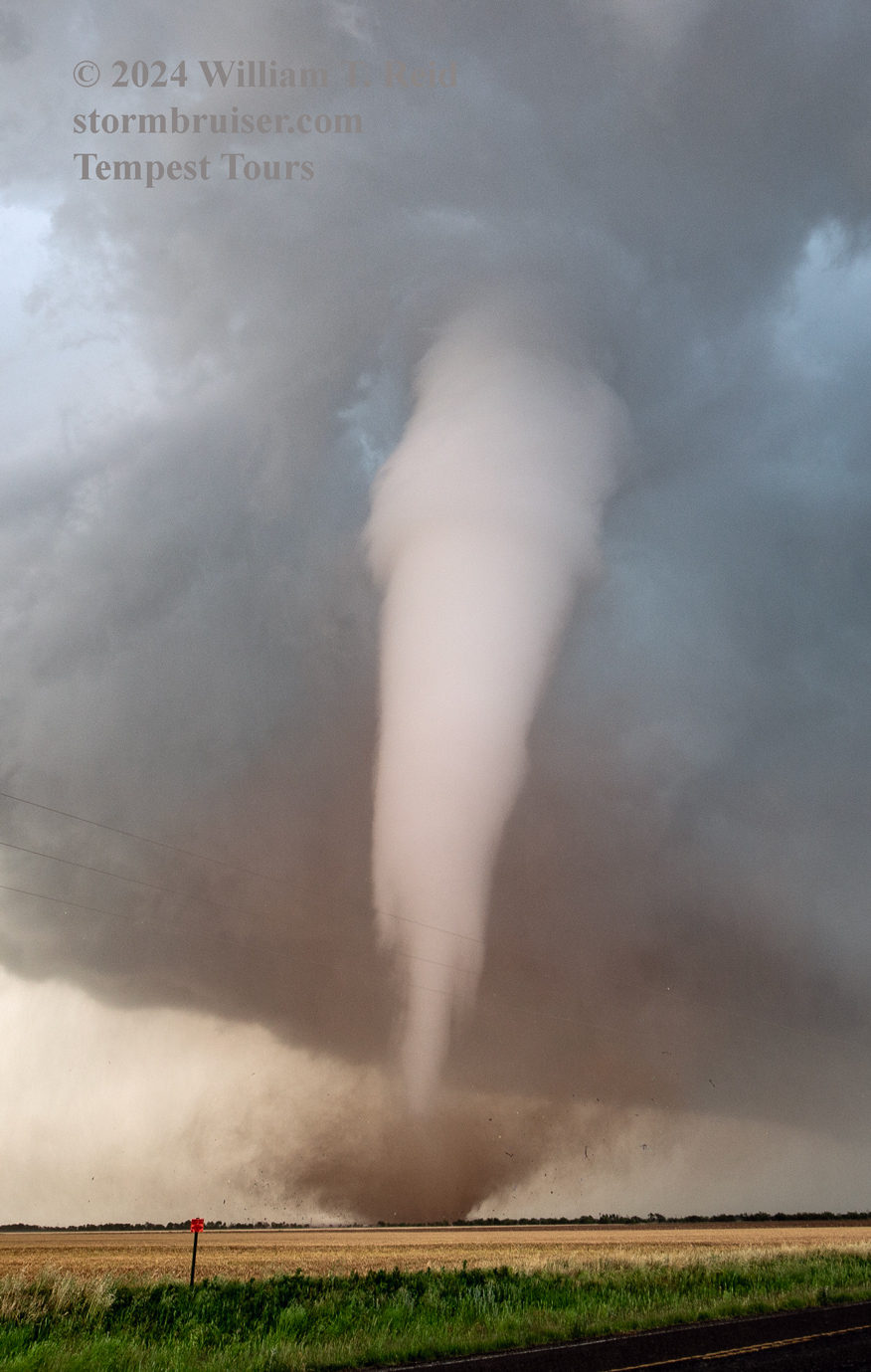
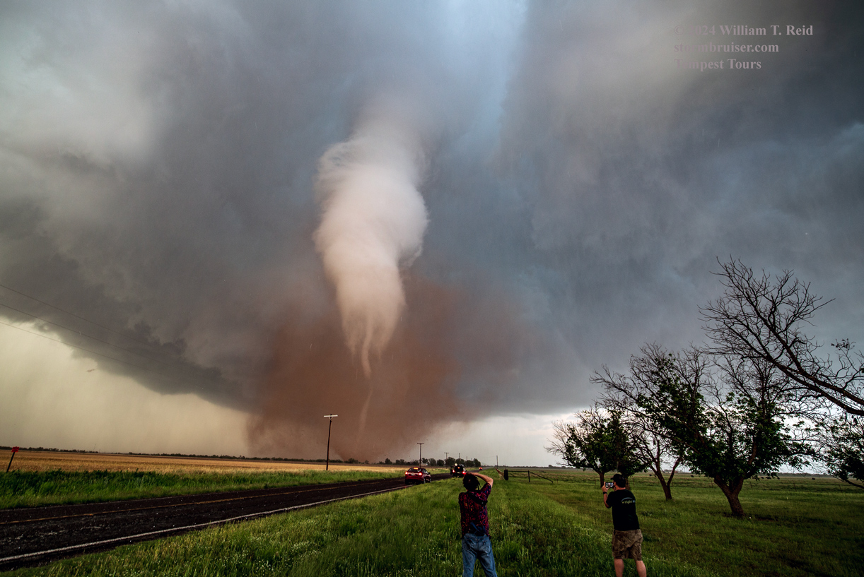
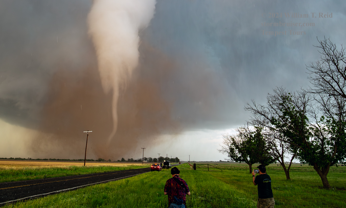
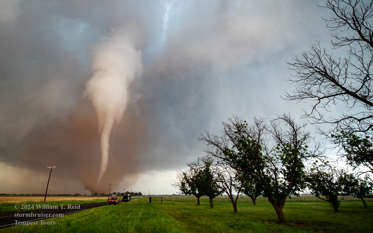
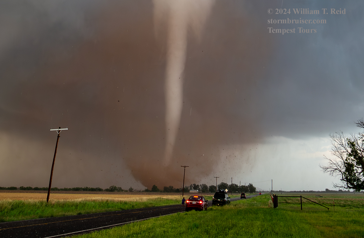
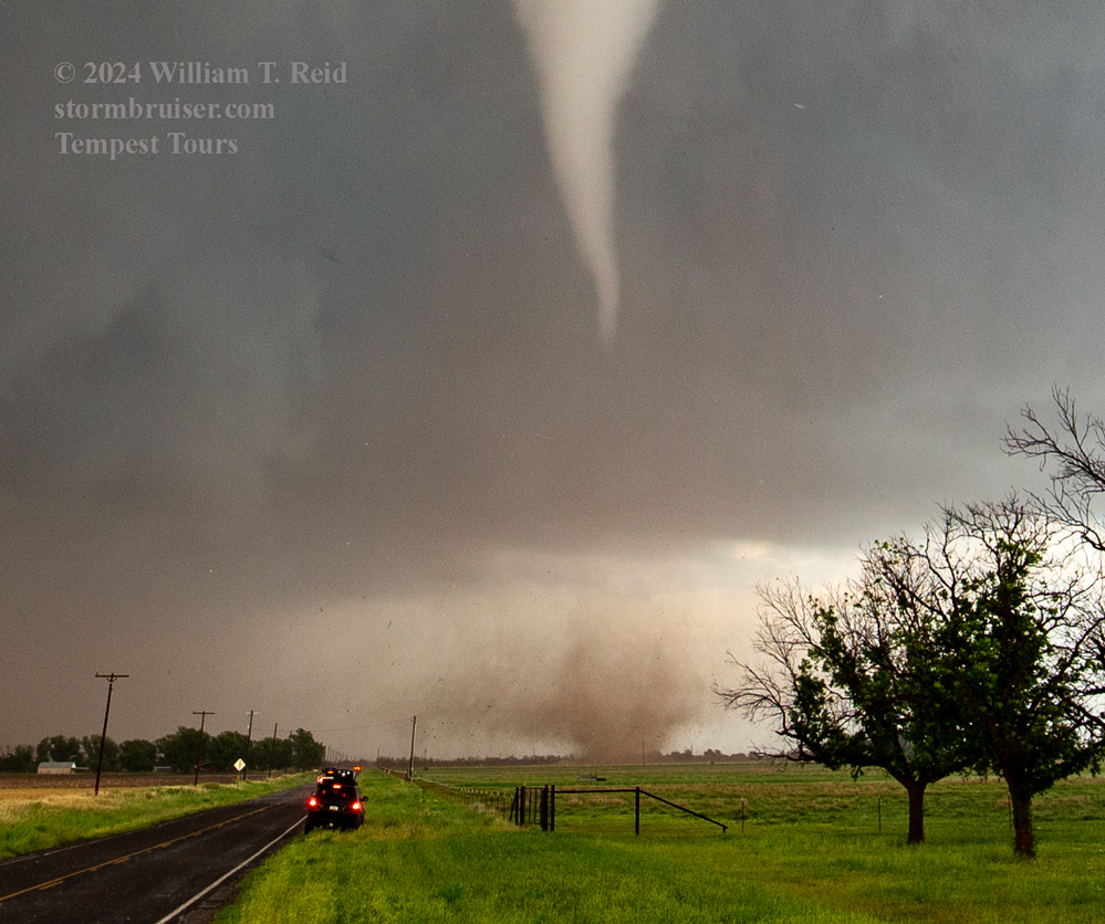
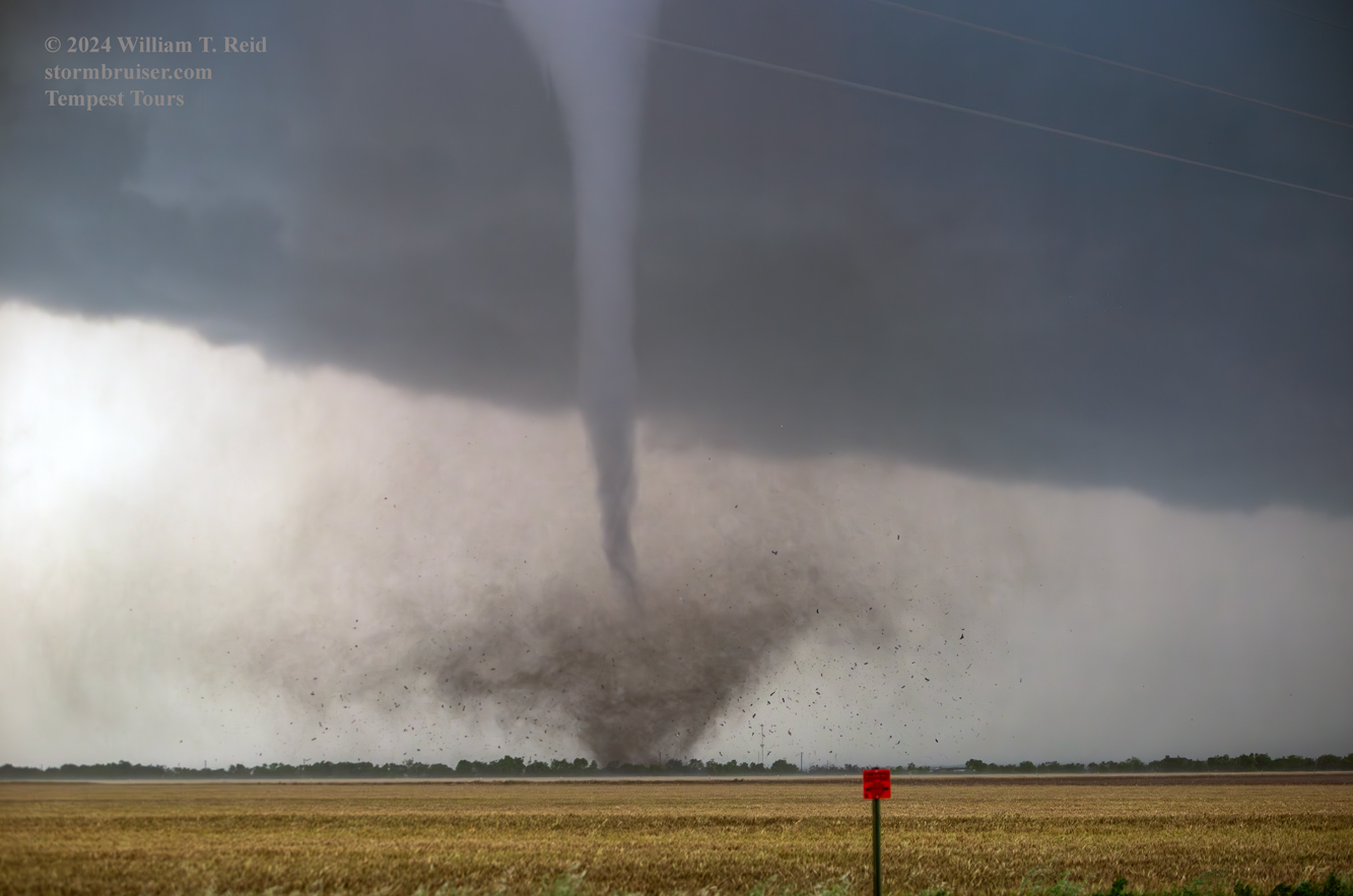
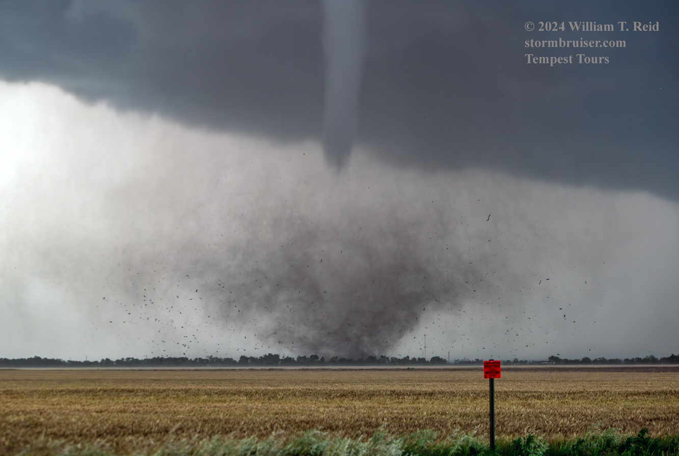

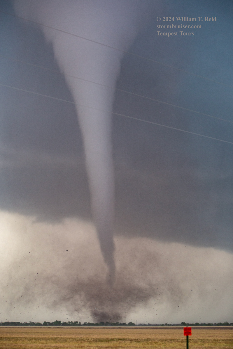
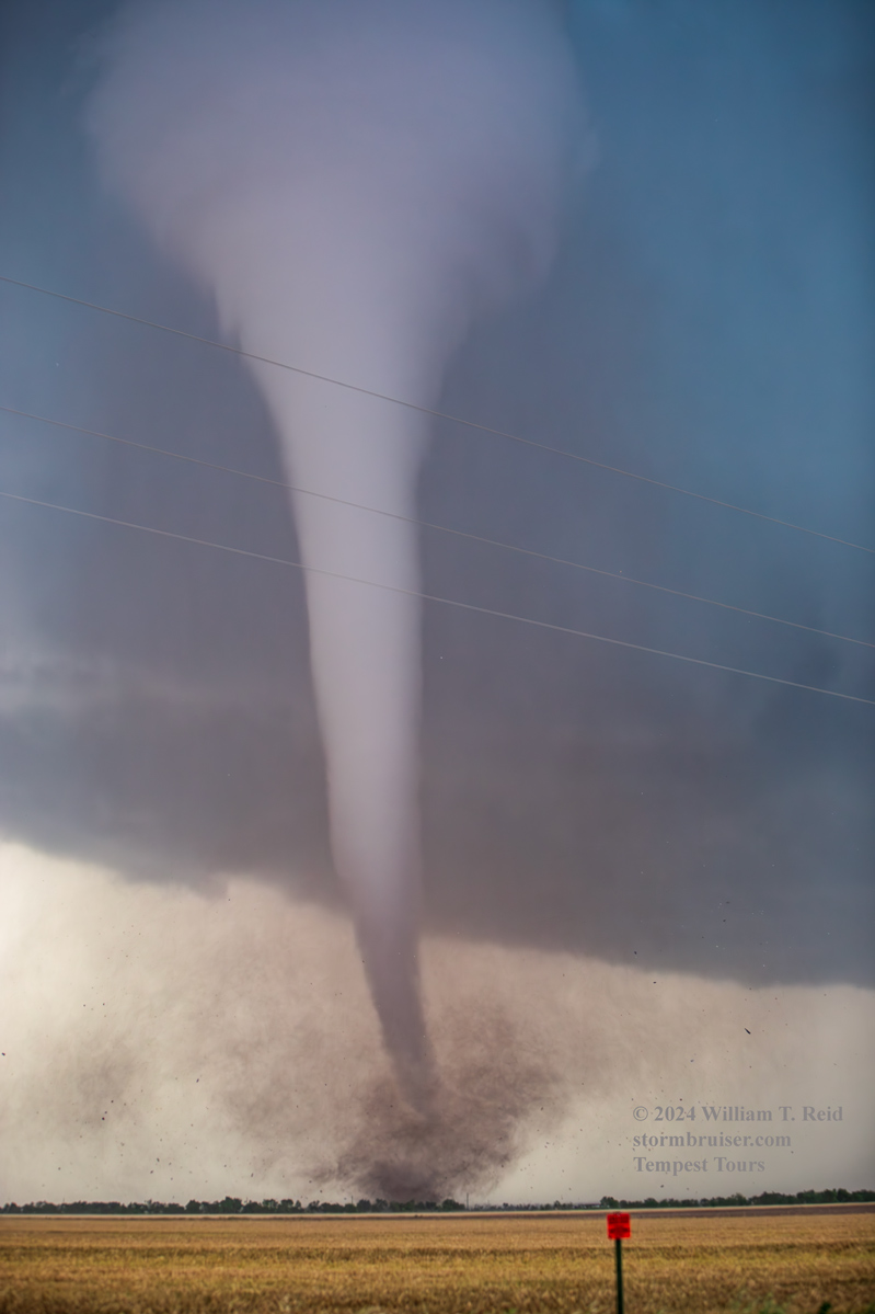
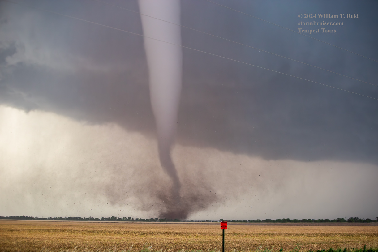
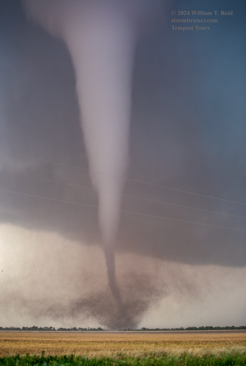
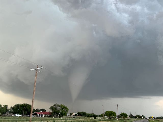
It was during this stage that the tornado was strongest, and we could easily hear it. It was probably a mile or so to our northeast, and then east. It tore through a few homes and sported a large debris fan.
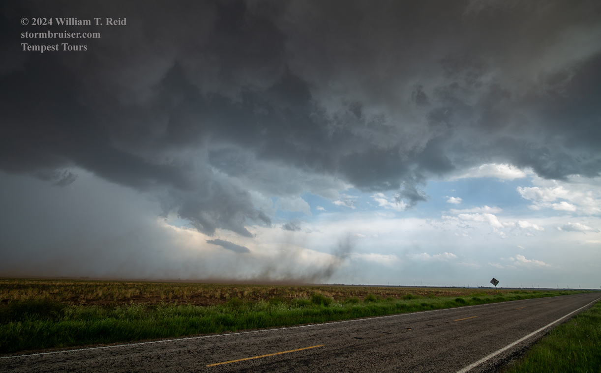
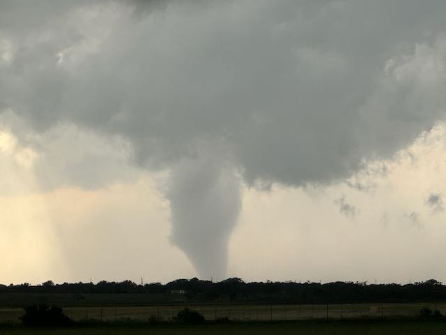
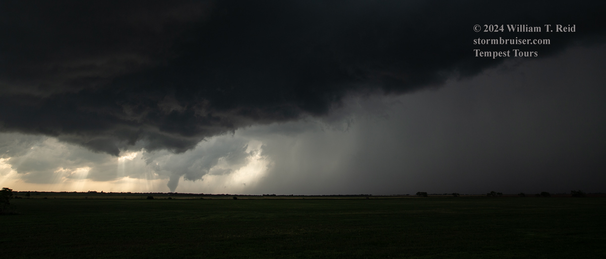
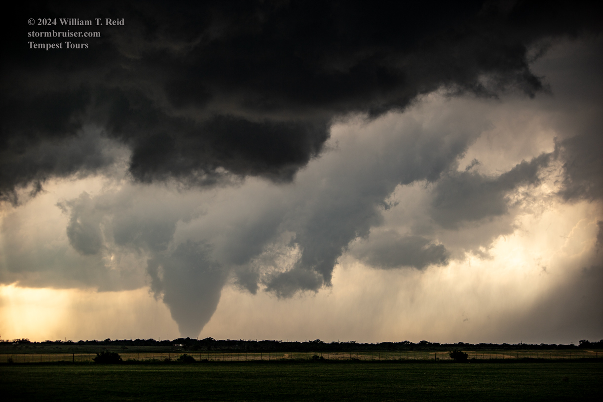
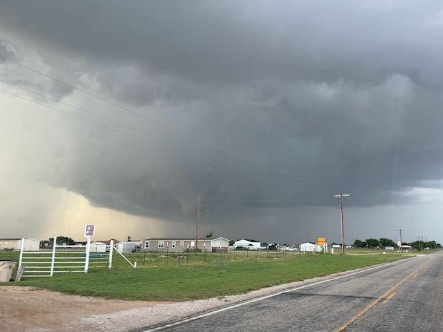
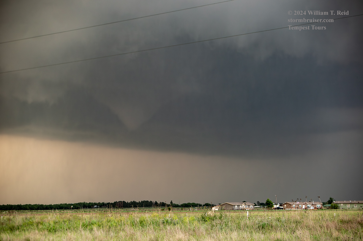
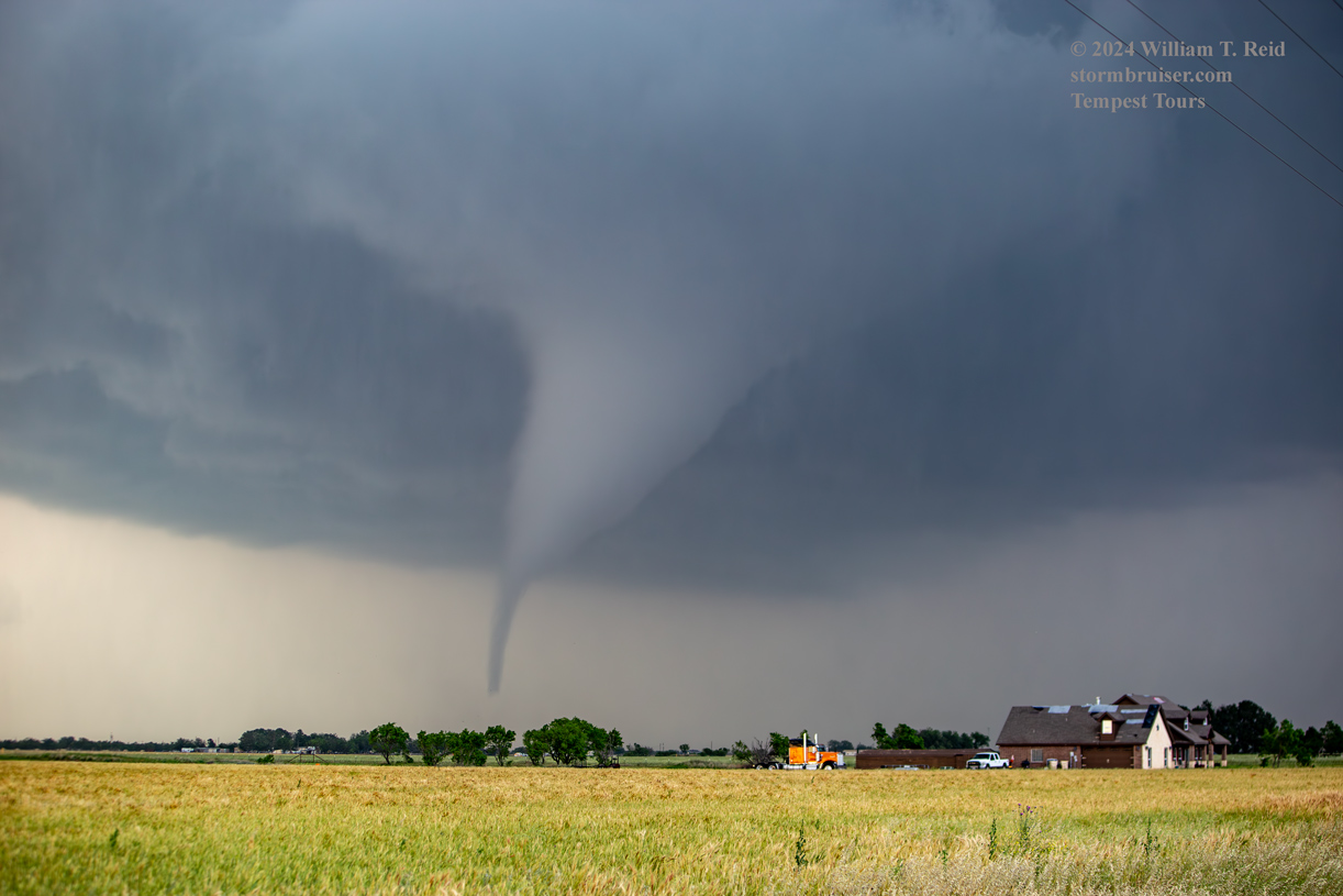
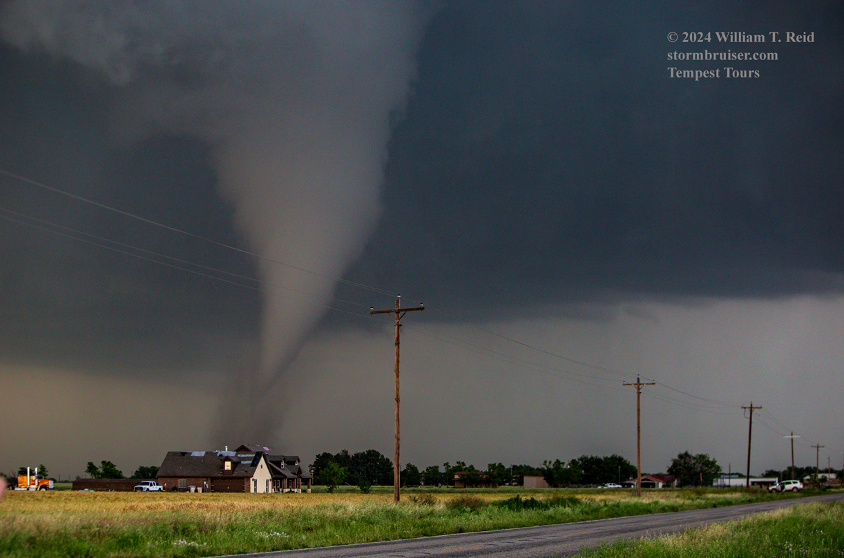
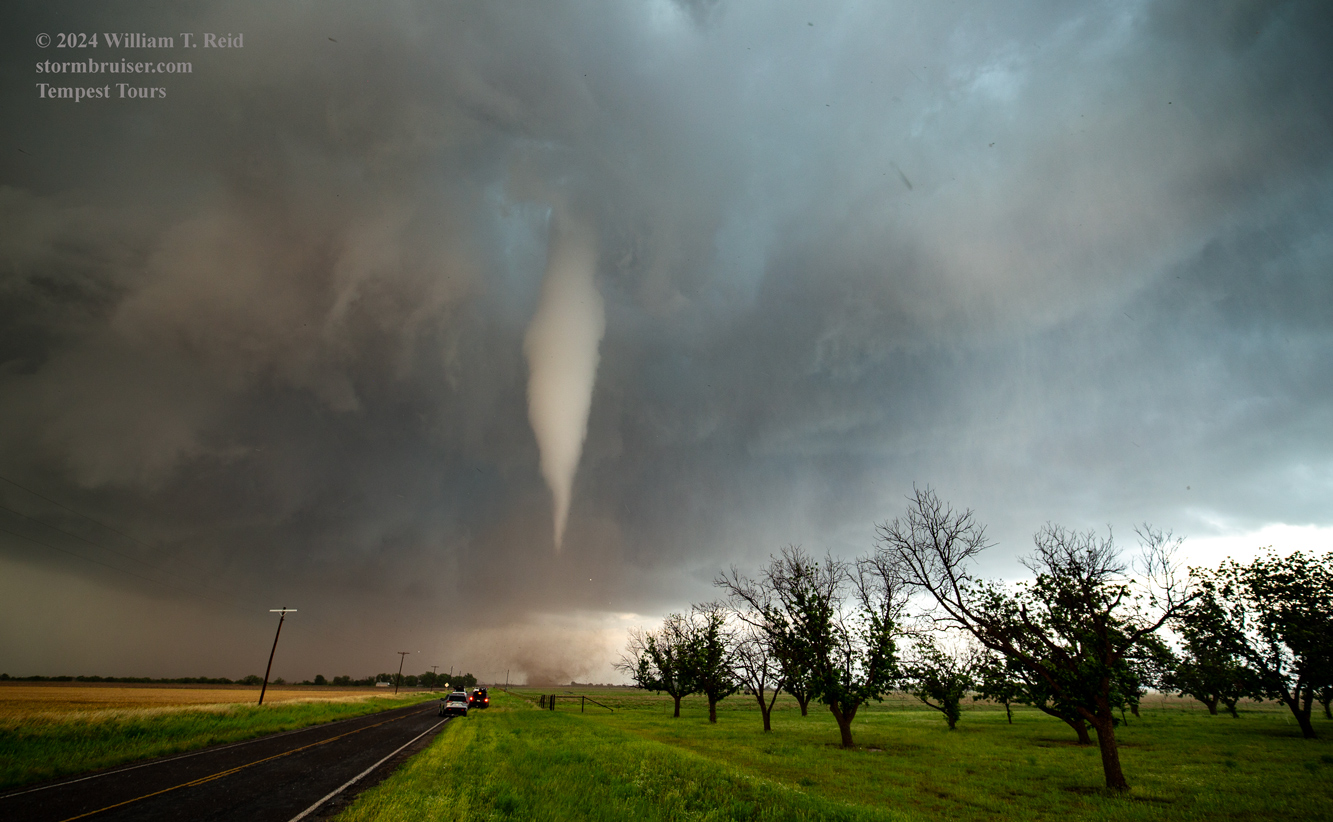
Below are iPhone shots from this same spot, about one-third of the way from Hodges to U.S. 83 along FM 605.
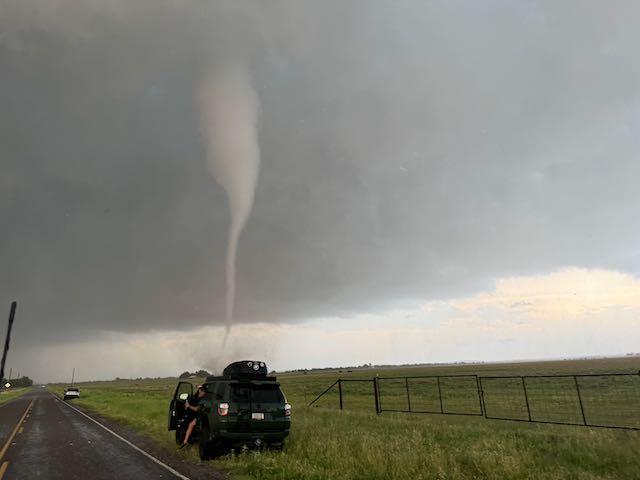
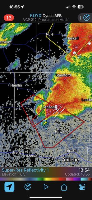
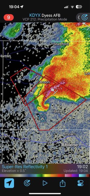
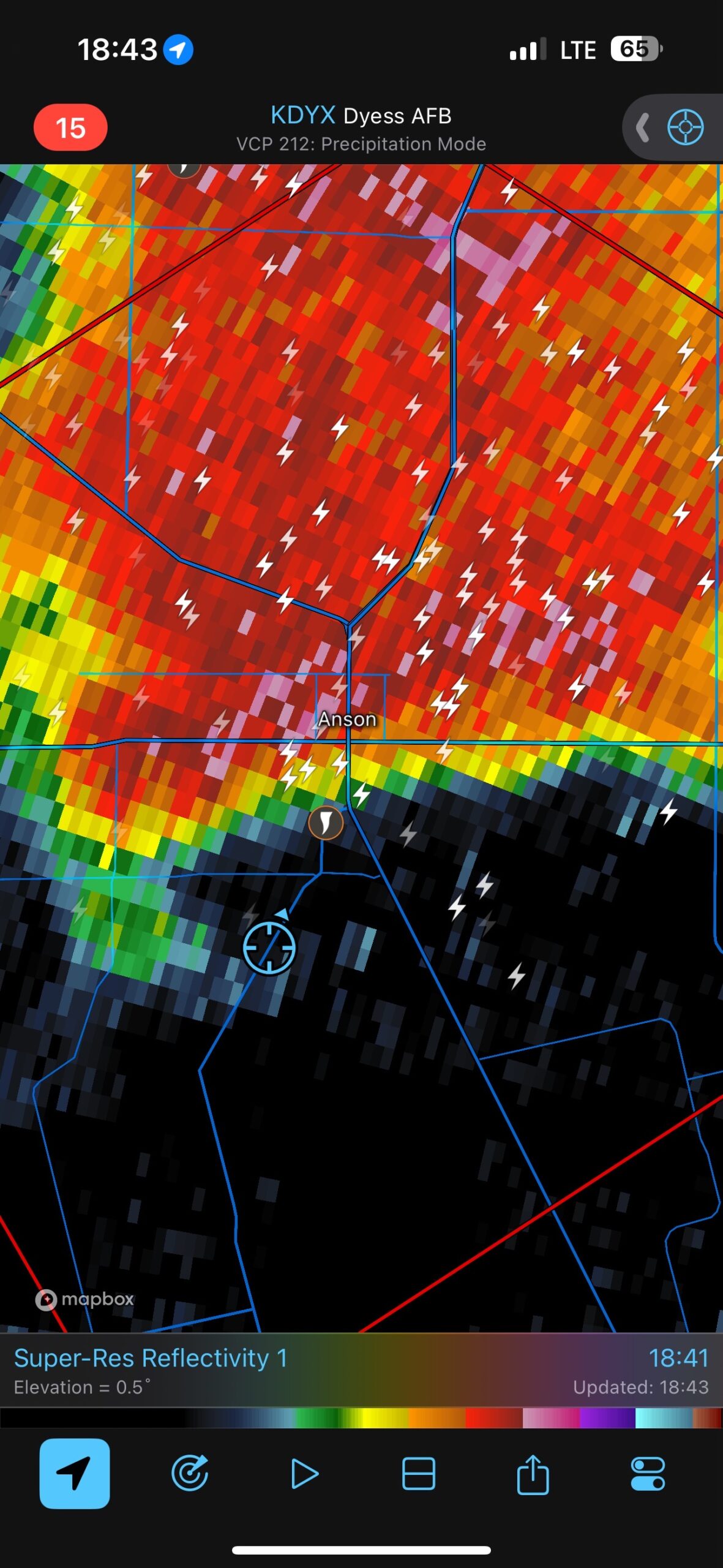
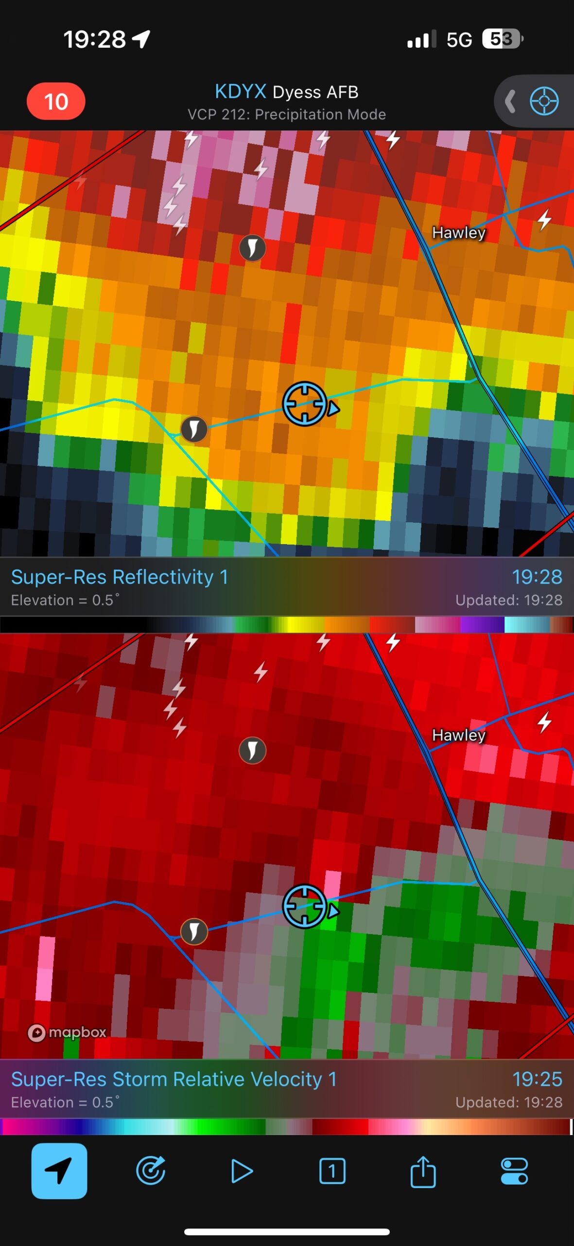
The tornado was looking weaker as it crossed FM 605 to our east. I had the drivers take us east to 83, and we passed through some light damage and debris on the road briefly just before reaching the major highway. Here is a look at my radar grabs at 1854L (a little prior to the development of the Hawley tornado), at 1904L (as the Hawley tornado was in progress), and 40 minutes later, near sunset, as the tornadoes had ended and the storm took aim at Abilene.
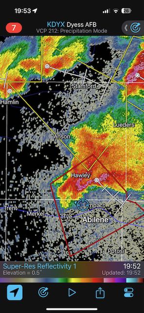
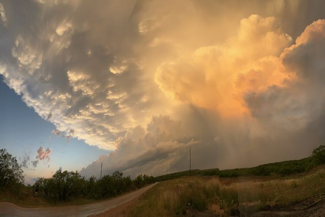
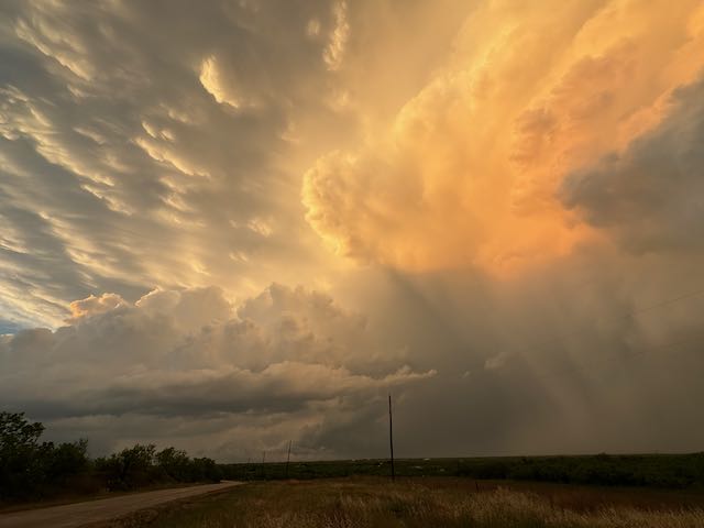
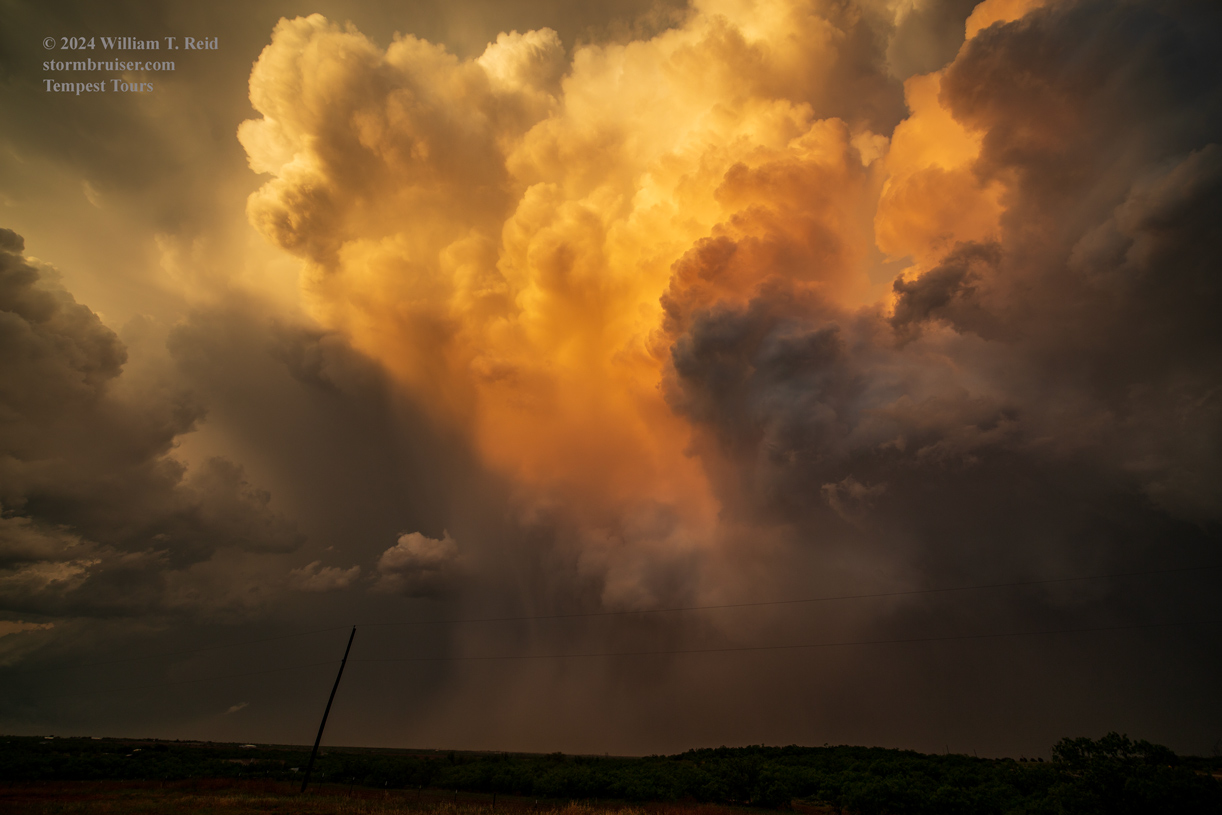
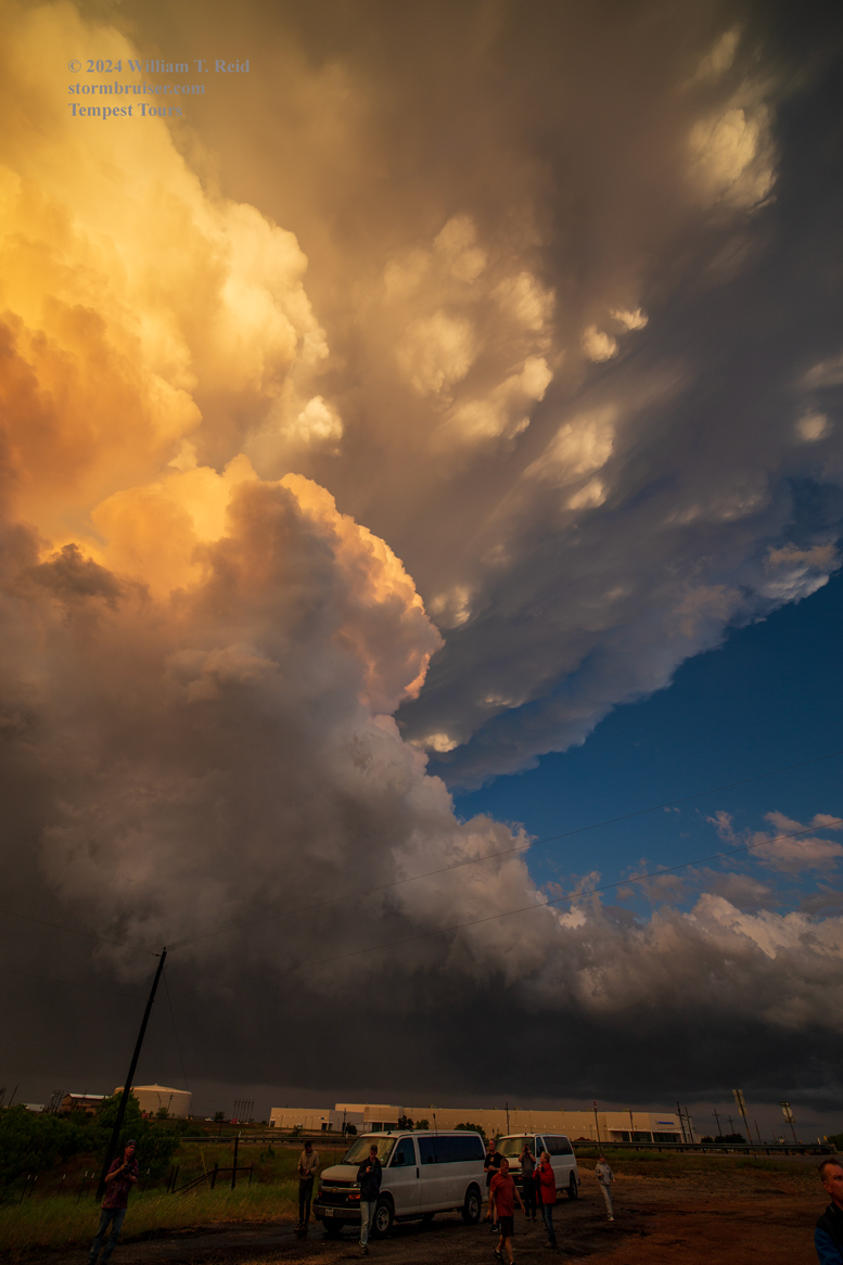
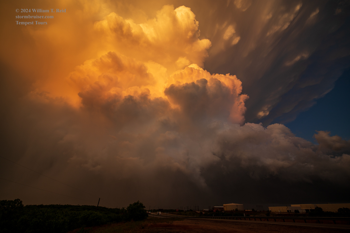
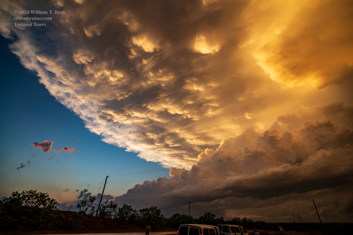
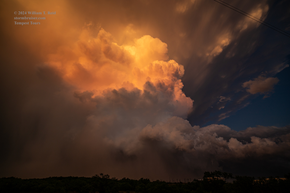
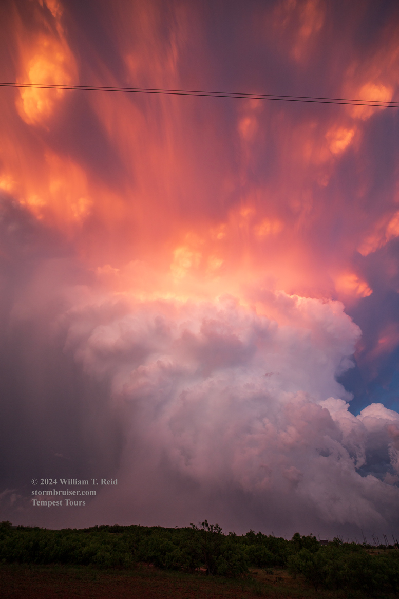
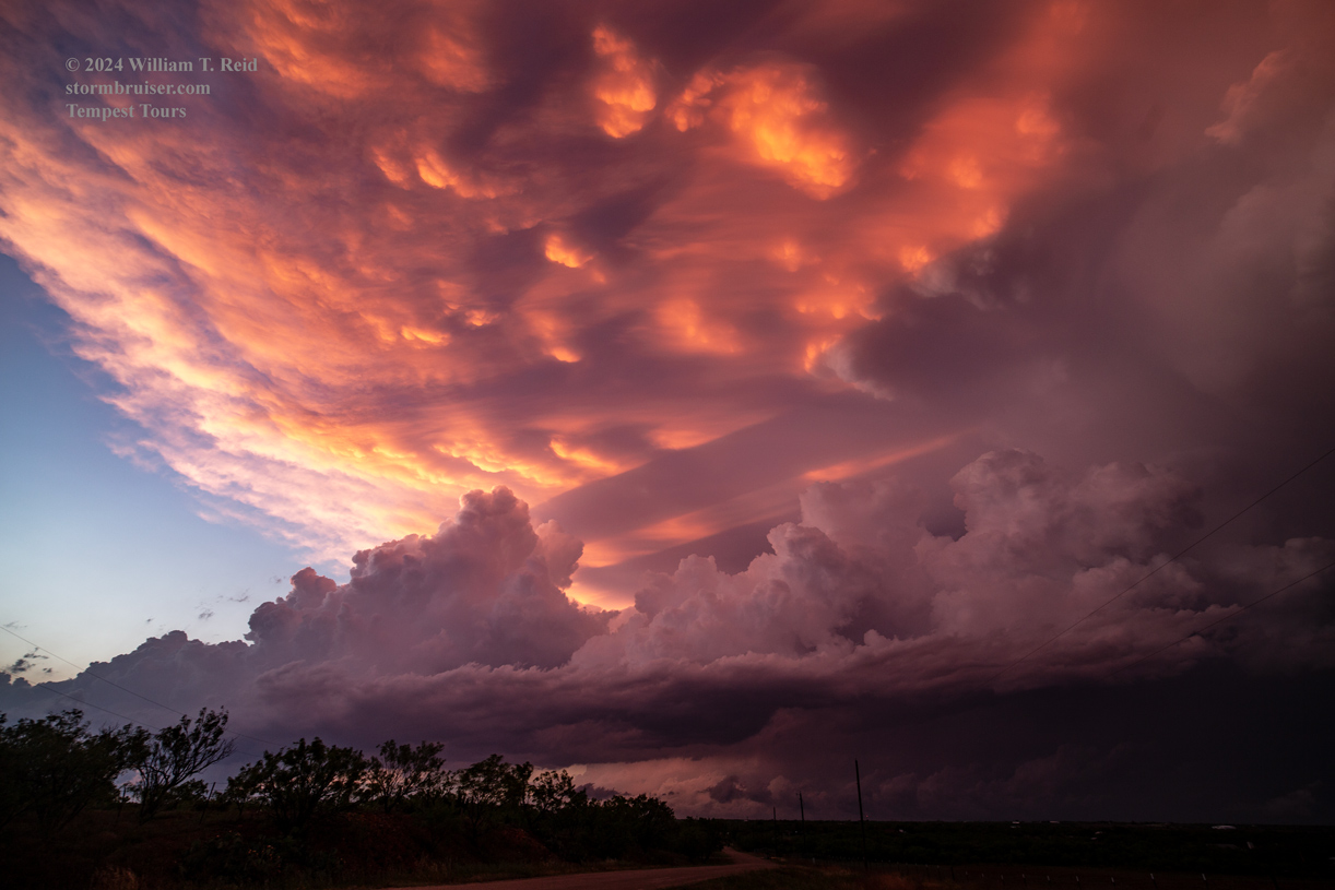
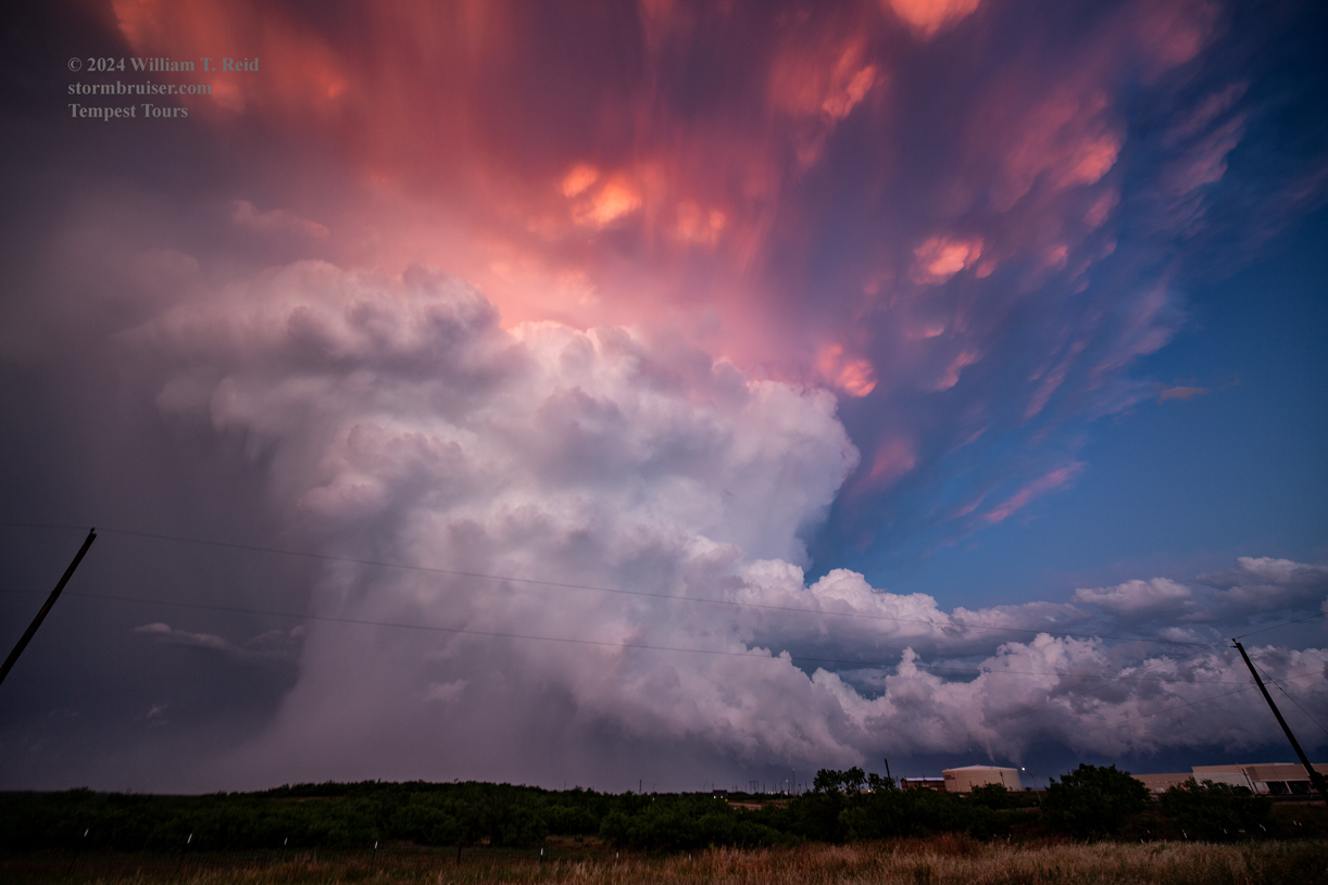
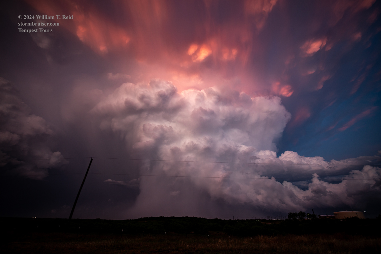
We headed SSE on 83 towards Abilene to try to get into good position again should the storm produce another tornado. It looked serious briefly and might have spawned a weak tornado…but it was done with the tornado-making for the most part. Along I-20 at Abilene we watched the western edge of the storm descend upon the city. Then we set up just north of I-20 on the west side of Abilene to photograph the sunset light on the storm updraft. Wow!

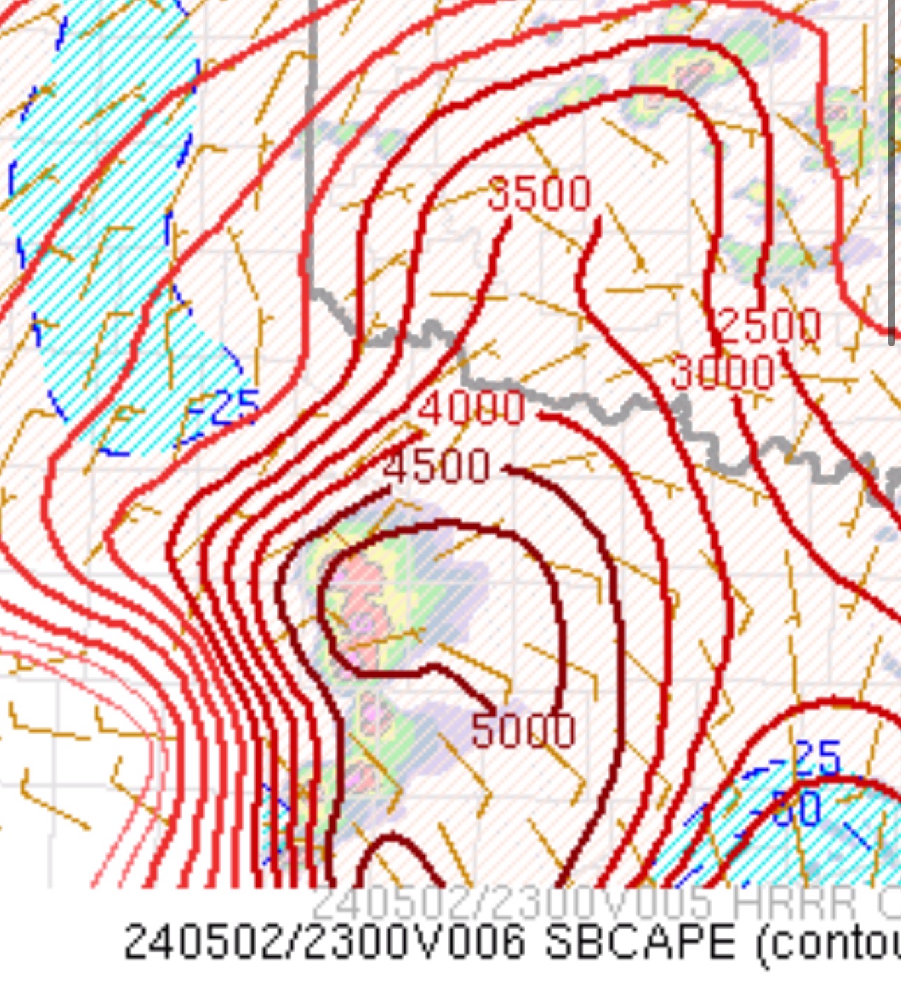
Let’s share some radar grabs from this chase courtesy of TT guide Matt Phelps.
Chris Gullikson (above) and the Tempest Tours Photo group approached the Anson/Hawley tornado from the NNW along U.S. 83. Here is the video by Chris as they battle rain and hail north and northeast of the tornado.
Anson and Hawley Tornado video by TT guide Matt Phelps
Some video clips by me
Leave a Reply
You must be logged in to post a comment.