
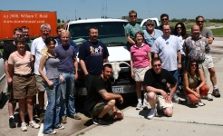
This was the final chase day for the lucky Tour 5 folks. They had observed supercells on eight out of eight of their chase days… [Read More]
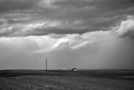
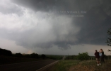
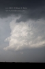
June 17, 2009 York County, NE, CB and Lightning

June 17th was the day of our Aurora, NE, tornado intercept. As the parent supercell continued its trek eastward from Hamilton County to York County,… [Read More]
May 28, 2009 Sutton County, TX storms
The forecast for severe storms in the Del Rio area persisted for May 28. It looked like the initiation area would be a few counties… [Read More]
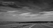
May 27, 2009 Rio Grande Lightning
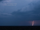
The target area on May 27 was around Fort Stockton, maybe 4-5 hours from Abilene. Well, that is if you don’t get a flat tire…. [Read More]
May 12, 2009 SE TX PH severe cells
May 12 wound up rather disappointing, though we wound up on strong storm cells from about Memphis to Childress to Quanah. Prior to initiation, we… [Read More]
May 5, 2009 Breckenridge, TX Supercell
The only show in Texas on this day began at Breckenridge (a few counties west of Dallas), and we were there from start to finish. … [Read More]
May 1, 2009 Big Country Supercells
On May 1 we targeted northwest TX, and dropped south to Vernon for lunch. Storm towers went up kind of early to our southwest, in… [Read More]
April 25, 2009 Cordell, OK marginal severe
This day began on the NM/AZ border along I-40, at a rest area where a train passes every 15 minutes and blasts its horn for… [Read More]
August 15, 2008 Lightning at Los Angeles International AP (LAX)!!

Wow—the upper low south of L.A. on Thursday had enough ooomph to trigger high-based thunderstorms near the Palos Verdes Peninsula around midnight. These intensified and… [Read More]
June 23, 2008 Mullen, NE supercell
After a Chinese food lunch in Alliance, we needed to drift northeast and east just a little. I was relatively comfortable sticking close to the… [Read More]
June 19, 2008 Potter, NE small supercells
The southern Nebraska Panhandle along I-80 was the hot spot today. A strong updraft or two developed in the vicinity of Kimball, and moved east. … [Read More]
June 14, 2008 SE TX PH CB…
…which, as everyone knows, stands for “southeast Texas Panhandle cumulonimbus”. Our target area on this day was along I-40 between Shamrock and Amarillo. And, the… [Read More]
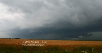
June 13, 2008 SW OK Storms

A boundary ran roughly SW-NE through southwest Oklahoma, and we watched towers struggle against the strong cap for much of the afternoon near Chickasha. A… [Read More]
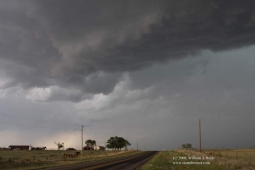
June 12, 2008 Lyon County, KS Severe storms
This was a long day, as I began in Storm Lake, IA, and had to meet Brian and the Tour 5 group in Lincoln, NE…. [Read More]
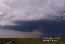
May 30, 2008 Southeast Kansas storms
Back to southeastern Kansas again! This was the final chase day for Tour 3, so it was nice that our target wasn’t too far from… [Read More]