
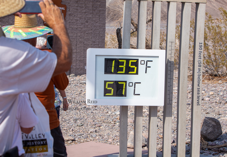
On the weekend of the 108th anniversary of the bogus 134F maximum temperature report in Death Valley, a very high-end heat wave plopped itself on top of the Death Valley region. Numerous all-time record high temperatures were set or tied or threatened. And, I was at Furnace Creek and I was taking a bunch of pictures and temperature readings on Saturday, July 10, when an official max temp of 129.4F was attained! (See my separate entry here for the details and pics from the July 10 visit.) The max temp of July 9th was 130.0F, exceeding last August’s record of 129.9F.
This web site entry is generally your one-stop web site for meteorological data and information with regard to the big desert heat wave of July, 2021. My analysis and a lot more details and comparisons to previous heat waves is in this separate Stormbruiser entry.
Below is a slew of media articles on the event and on the 130F temp on July 9.
Wash Post on SW record. (sorry — this one might ask you to pay up after a few visits)
Wash Post July 10. (sorry — this one might ask you to pay up after a few visits)
Wash Post 130F in DV. (sorry — this one might ask you to pay up after a few visits)
NY Times subject to payment
Weather Maps, Soundings and Charts for the Heat Event July, 2021:
July 8th (i.e., near 00Z July 9th)
08Jul 500 map 08Jul 700 map 08Jul 850 map 08Jul SPC surface map
08Jul VEF sounding graph 08Jul VEF sounding
23Z July 8 regional map Max Temps north July 8 map Max Temps south July 8 map
(Max temps on these maps are based on the observations (e.g. hourly, or every 10 or 20 minutes, etc.), and thus it is possible that a higher temperature that occurred between observations is not indicated on the max temp maps.)
NWS RTP Tables:
PHX RTP July 8 SAN RTP July 8 HNX RTP July 8
RNO RTP Jul 8 VEF RTP July 8. LOX RTP July 8
next morning RTPs:
VEF RTP am July 9 RNO RTP am Jul 9
July 9th (i.e., near 00Z July 10th)
FC July 9 hourlies NWS FC table NWS VEF MxMn list VEF sounding
Sat pic 09 Jul Sat pic 09 Jul B Sat pic 09 Jul C Sat pic 09 Jul D
Wx map obs NWS graphic Max comparisons
SPC 500 map SPC 700 map SPC 850 map SPC sfc map SPC Prec water map
500 map NCAR 700 map NCAR 850 map NCAR
SPC Sounding VEF SPC Sounding VEF data
23Z regional map July 9 Max temps north July 9 Max temps south July 9
NWS RTP Tables:
PHX RTP July 9 LOX RTP July 9 SAN RTP July 9
HNX RTP July 9 RNO RTP July 9 VEF RTP July 9
next morning RTPs:
VEF RTP am July 10 RNO RTP am July 10
July 10th (i.e., near 00Z July 11th)
10Jul 500 map 10Jul 700 map 10Jul 850 map 10Jul VEF sounding
500 map NCAR NCAR 500 zoom 700 map NCAR 850 map NCAR
SPC Sfc 9 p.m.:04Z SPC Prec Wtr 11 p.m.:06Z VEF sounding
SPC Sounding VEF VEF Sounding SPC data
23Z regional map July 10 Max temps north July 10 Max temps south July 10
NWS RTP lists:
LOX RTP July 10 SGX RTP July 10 HNX RTP July 10
RNO RTP July 10 VEF RTP July 10 PHX RTP July 10
next morning’s RTPs:
RNO RTP am July 11 VEF RTP am July 11
July 11th (i.e., near 00Z July 12th)
11Jul 12z 500 map 11Jul 12Z 700 map 11Jul 12Z 850 map
Sat Pic A Sat Pic B 500 map NCAR 700 map NCAR 850 map NCAR
SPC 500 map 23Z SPC 700 map 23Z SPC 850 map 23Z SPC Sfc map 23Z
SPC VEF Sounding SPC VEF Sounding data
23Z regional surface map July 11 Max temps north July 11 Max temps south July 11
NWS RTP lists:
LOX RTP July 11 SAN RTP July 11 HNX RTP July 11
RNO RTP July 11 VEF RTP July 11 PHX RTP July 11
next morning’s RTPs:
VEF RTP am Jul 12 RNO RTP am July 12
July 12th (i.e., near 00Z July 13th)
12Jul 500 map 12Jul 700 map 12Jul 850 map 12Jul VEF sounding
NWS graphic Sat pic A 700 map SPC 00Z Sfc map SPC 00Z
Sfc map SPC 04Z PW map SPC 00Z
23Z regional map July 12 Max temps north July 12 Max temps south July 12
NWS RTP lists:
LOX RTP July 12 SGX RTP July 12 HNX RTP July 12
RNO RTP July 12 VEF RTP July 12 PHX RTP July 12
next morning’s RTPs:
RNO RTP am July 13 VEF RTP am Jul 13
Regional Weather Station Data
Death Valley Stations
FURNACE CREEK DEATH VALLEY NWS/NPS HADS FC hourly temps (same official DV station)
USCRN SITE NEAR STOVEPIPE WELLS 1SW SARATOGA SPRING RAWS
Note: The CARB station temperature data are a bit odd in that the hourly temperature provided is the HIGHEST temperature attained during the previous hour. Thus, a value of 105F at 3 p.m. at a CARB station (including the one near Cow Creek in Death Valley) means that the temperature got as high as 105F from 2 to 3 p.m., and it does not necessarily mean that the temperature was 105F at 3 p.m. However, temperature sensors at the CARB stations are generally well above the ground. This, and because they are generally very-well sited and well-exposed, results in a comparatively small intra-hourly temperature change. In most instances, the temperature indicated by the CARB station at a particular hour is very close to the actual temperature at that time of day (i.e., within a degree or two F). A little more info on this CARB station is in a previous Stormbruiser entry (towards the bottom).
Link to detailed hourly Death Valley/Furnace Creek/NWS/HADS station data. Click on the timeframe desired and then on “Decoded Data.”
Last 72 hours of observations at Death Valley/Furnace Creek
Last 72 hours of data for the Death Valley/Cow Creek CARB station (California Air Resources Board)
and go HERE for a quick look at the latest 72 hours of Stovepipe Wells data (updated every 5 minutes)
Last 72 hours of observations at Saratoga Springs RAWS station in southern Death Valley
For info on the Stovepipe Wells station, see this link,
go HERE for the historic and recent Stovepipe Wells data
This link outlines the type of station and measurements for the USCRN station at Stovepipe Wells. Maximum and minimum temperatures are based on 5-minute averages which are updated every 10 seconds. The five-minute averages themselves are derived from temperature readings taken every two seconds by three thermometers! This is a very conservative methodology to determining the daily max and min temperatures, but is basically the same as at the NWS/FAA ASOS stations at airports. Both use 5-minute averages to determine the air temperature.
Someone in the government does the same thing that I do: they compare maximums between Stovepipe Wells and Furnace Creek!
Note: I have found that many, if not most of the RAWS stations are rather poor on daytime temperature measurement during sunny conditions and light winds. With such conditions, the temperature is often several degrees too high at RAWS stations. I figure that this is likely due to generally lousy radiation shields for the temperature sensor. However, I have not found the Saratoga Springs RAWS station to have such inflated daytime temperatures.
More info on the exposure of the official Death Valley station.
Inyo County Stations
HUNTER MOUNTAIN RAWS Tecopa:Shoshone CEMP DEATH VALLEY JCT Scan
OWENS VALLEY RAWS SOUTH LAKE CABIN NEAR BISHOP 16SSW (SLK)
Bishop Paiute Tribe-CA AIRNOW Bishop AP KBIH Bishop Airnow Deep Springs SCAN
EW4197 Bishop SCE Big Pine FW6556 Big Pine OAK CREEK RAWS
CRABTREE MEADOWS METEOROLOGICAL STATION NEAR LONEPINE 16WSW (CBT)
FW5911 Darwin SCE Lake Canyon Dr FIVE MILE RAWS SAWMILL NEAR BIG PINE 15W (SWM)
EUREKA VALLEY RAWS Lone Pine-PermMS CARB Lizard Tail-NE Shoreline Owens Lake CARB
Keeler-Cerro Gordo Road CARB Shell Cut-Highway 190 CARB Owens Lake-Ash Point CARB
Dirty Sox Owens Lake CARB Olancha
Mono County Stations
Mammoth Summit 11053 feet BENTON RAWS SCE Benton Valley SCE Benton Hot Springs
DEXTER RAWS SCE Walker Creek SCE Crestview Radio Mammoth Yosemite Airport KMMH
Valentine Eastern Sierra Reserve (UCNRS)
Esmeralda County Stations
Mineral County Stations
Hawthorne Industrial Airport KHTH SR-359 Anchorite
Kern County Stations
SCE Grapevine Canyon INDIAN WELLS CANYON RAWS INYOKERN NCAWOS
CW9763 Inyokern China Lake, Naval Air Facility KNID EW8927 Ridgecrest
CW9067 Ridgecrest LAURAL MOUNTAIN RAWS DW9138 Red Rock Cyn SP
WX6HNX-13 Jawbone Cyn SCE Jawbone Canyon Rd WX6HNX-8 California City
Mojave AP KMHV SCE Tehachapi Pass Edwards Air Force Auxiliary North Base
Edwards Air Force Base KEDW WX6HNX-15 Boron
Los Angeles County Stations
General Wm J Fox Airfield KWJF Palmdale AP KPMD
SADDLEBACK BUTTE RAWS Gray Butte Field Airport KGXA
San Bernardino County Stations
FW3178 Victorville Southwest EW0436 Helendale OPAL MOUNTAIN RAWS
I-40 – Barstow Maintenance Yard Daggett, Barstow-Daggett Airport KDAG
Bicycle Lake Army KBYS MEANS LAKE RAWS. SQUAW SPRINGS RAWS
Twentynine Palms KNXP Old Woman Mountain Essex SCAN RICE VALLEY RAWS
Baker Caltrans MID HILLS RAWS OX RANCH RAWS
Needles AP KEED Victorville Airport KVCV Barstow CARB
MANIX UPR DUNN UPR BALCH UPR KELSO UPR
CIMA UPR MOORE UPR BORAX. Trona-Athol & Telegraph CARB
Riverside County Stations
Palm Springs Regional Airport KPSP EW7734 Desert Center Blythe, Blythe Airport KBLH
Thermal KTRM Jacqueline Cochran Regional Airport
Joshua Tree National Park – Pinto Wells
La Paz County Stations
DW6614 Quartzsite AHAKHAV PRESERVE RAWS FWS R2 PORT #2 RAWS east of Parker Dam
Mohave County Stations
DW8519 Lake Havasu City DW1372 Lake Havasu City CW2796 Lake Havasu City
Havasu City Airport HAVASU RAWS FW5796 Yucca Bullhead City Airport KIFP
CW4367 Bullhead City KATHERINES LANDING NEAR BULLHEAD CITY 9N
Kingman, Kingman Airport KIGM UNION PASS RAWS EW5448 Fort Mohave
Clark County Stations
Laughlin Henderson Executive Airport KHND US-95 MM 53
COTTONWOOD COVE NEAR SEARCHLIGHT 13E Las Vegas AP KLAS
Boulder City Municipal Airport KBVU Las Vegas CEMP Nellis Air Force Base KLSV
CALLVILLE BAY RANGER STATION NEAR BOULDER CITY 13NE North Las Vegas Airport KVGT
Desert Shrub – Sheep Range Overton CEMP Moapa Valley DRI Mesquite CEMP
KYLE CANYON RAWS Angel Peak EW9999 Las Vegas Indian Springs CEMP
Indian Springs Auxiliary Airfield KINS. Jean Airnow Casino Center
Lincoln County Stations
Alamo CEMP Pahranagat NWR DRI Rachel CEMP
Nye County Stations
Sand Spring Valley DRI Kawich Peak Meadow DRI Nyala CEMP
FW2720 Pahrump FW4776 Pahrump Pahrump CEMP FW9488 Pahrump
CW9143 Pahrump ASH MEADOWS Raws Rogers Spring DRI Amargosa Valley CEMP
Mercury, Desert Rock Airport KDRA Mercury ARL SORD Amargosa Vly Gate 510
Yucca Mountain BUDDY ADAMS Raws Beatty CEMP Sarcobatus Flats CEMP
Tonopah Airport KTPH Tonopah CEMP US95 Tonopah Summit Warm Springs Summit CEMP
Leave a Reply
You must be logged in to post a comment.